|
|
|
The
Kibbey Butte Route: Saturday-Sunday, May 17-18, 1997 by Dennis Foster |
|
|
|
|
|
|
|
The
Kibbey Butte Route: Saturday-Sunday, May 17-18, 1997 by Dennis Foster |
|
|
|
|
|
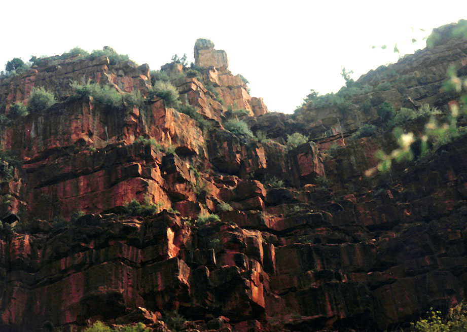
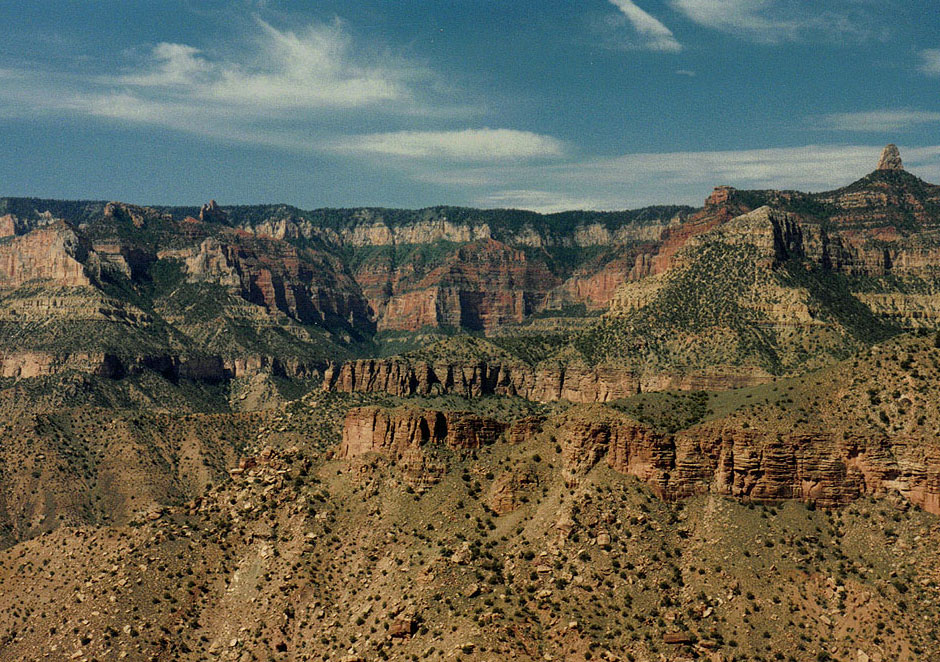
I have always been drawn to the Nankoweap region of the Grand Canyon, perhaps in large part due to the difficulty I had in getting to this area. I first hiked here in 1983, and have done a number of interesting trips into this canyon. This trip was prompted by my desire to search out a rather obscure route into, and out of, Nankoweap called the “Kibbey Butte Route.” It is an access from the North Rim. On the face of it, the description defies common sense - a ropeless route (save for lowering/raising packs a couple of times) that has an elevation change of approximately 2500 feet over a horizontal distance of less than a half mile. Seemingly quite mad, and the allure is obvious. There are precious few places in the Grand Canyon where this is possible. Our common perception of the canyon being comprised of sheer barrier cliffs is not without reason. However, this route takes one through, from top to bottom, the Kaibab limestone, the Coconino sandstone, the Supai group of sandstones and limestones and the Redwall limestone cliff layers. The namesake of this route is Kibbey Butte, a very unassuming formation in the Hermit shale level, peaking below the Coconino sandstone cliffs. Easily visible from the popular Point Imperial viewpoint, on the North Rim, it would likely be the last thing any visitor there would notice. Indeed, from this vantage point, a route from rim to canyon floor looks quite impossible. But, the route is blessed with two huge advantages. One is an easy bushwhack through the forested rim to the bottom of the Coconino level. The other is an utterly easy and narrow chute through the Redwall. The heart stopper is the upper 100-150 feet of Supai. Two of the canyon’s best known hikers/explorers spent much time and energy piecing together this route, over a number of forays into this area, although they were separated in time by some two decades. Harvey Butchart, the celebrated master of Grand Canyon hiking, in the company of sometime hiking companion George Beck, actually made an aerial survey of this route in the 1960s. Butchart’s original bypass of the tricky Supai led him to a miserable contour above the Redwall in order to get to the appropriate “fault ravine.” It took him a number of climbs through here before finding a suitably direct way through the Supai. Although his description of this route is included in the voluminous trail logs he has bestowed upon the Cline Library at Northern Arizona University, it didn’t make it into any of his three hiking books. George Steck, whose hikes in the canyon were legendary before he wrote two books describing fabulously attractive loop hikes here, independently sought and found this same route through the Supai. Like Butchart, Steck also conducted an aerial survey, although this time in the mid-1980s. With a number of false tries, both from the top and the bottom, he also finally succeeded in identifying the proper route through the Supai. The description is well-written up in Steck’s second book, Grand Canyon Loop Hikes II. |
|
|
||
|
Click on any picture to see a larger image. |
||
|
|
||
 |
 |
 |
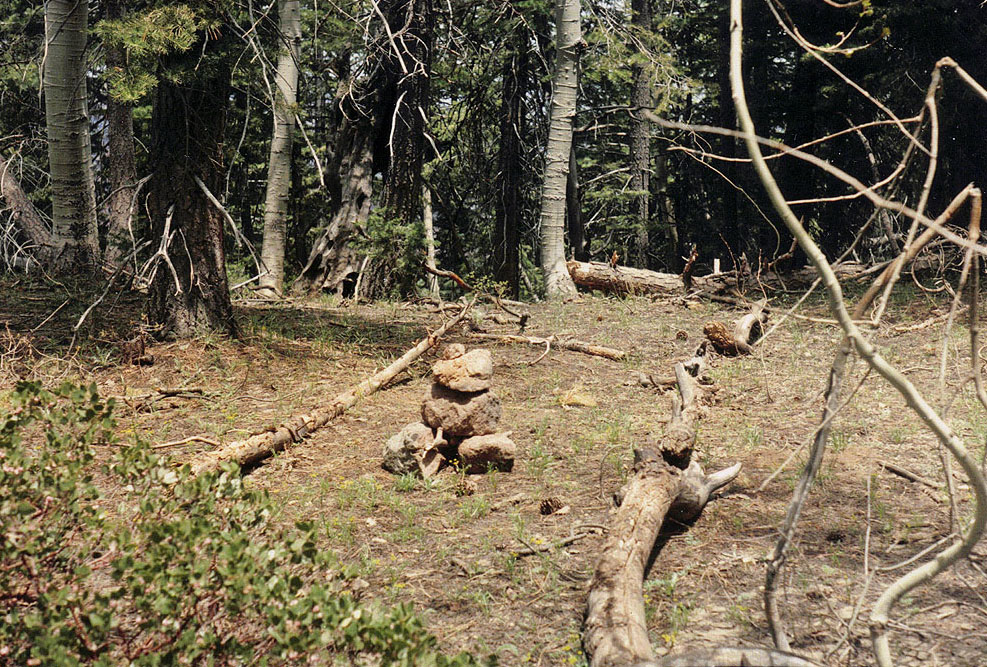
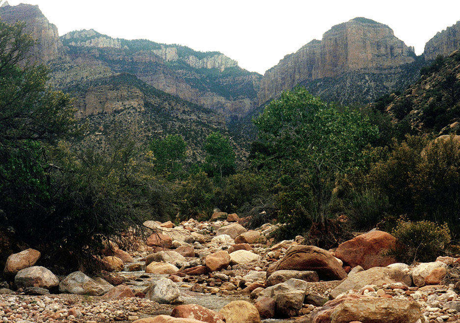
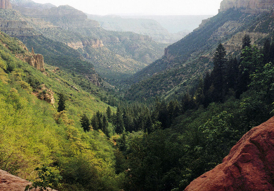
| View up Nankoweap canyon to Kibbey Butte. Mt. Hayden on the right. | The top of the Nankoweap trail was getting bare and I put in these rocks. | The view of Kibbey (in the red) from the Ken Patrick trail. |
|
From my home in Flagstaff, Arizona, it is about four hours to the Grand Canyon Lodge, on the North Rim of the canyon. I left in the mid-afternoon on the day after the rim opened up in May. Once in the park I found a spot to cache some water. My plan was to park in the Kaibab National Forest, at the Nankoweap trailhead. The Kibbey route would dump me on the rim some six miles from where I had parked. I would follow alongside the paved Cape Royal road until I was able to follow a trail the rest of the way. I left two quarts of water where this trail crosses the road. Following a brief stop at the lodge, and a quick bite to eat, I was off to the trailhead, where I camped for the night.
The next
morning, I was up at 4:30 a.m. and ready to hike by 5:30 a.m. This
hike was to serve another purpose--as an exercise in “doing without.”
Far too often I find myself carrying 55 pounds, or more, when I backpack.
There are The Nankoweap trail runs some nine to ten miles from this trailhead to the creek. During the summer this can be brutally hot, and it is not a desirable place to hike. When loaded down with weight, leaving at less than an ideal time in the morning and if inexperienced, a dry overnight camp may be necessary along the trail before reaching the creek (and it is still some three miles from there to the Colorado River). I was in good shape, and the conditions were nearly perfect, and I reached the creek by 10:15 a.m., less than five hours after starting down. Although a bit early, I decided that a longish lunch break was in order. When I hike, I find it very difficult to munch along the way. Unlike the chaos of my eating habits at home, on the trail I pretty much stick to three square meals a day, and do little in-between meal snacking. Despite knowing this, I invariably will end up a hike with mostly filled plastic baggies of corn nuts, peanuts, raisins and chocolates. I wonder if they appreciate my showing them around the Grand Canyon?
By a quarter to
noon, I was on my way up the creek. My target was the furthest
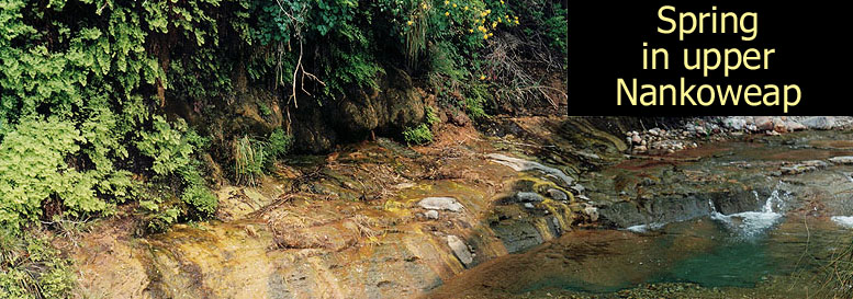
spring that feeds Nankoweap Creek. It would be the last sure water
until I reached the water cache I left on the rim. So, the afternoon
was mostly spent rock hopping and crisscrossing the creek. One of the characteristics I have noted while engaged in an intense hike is that background noises fade away. I hardly ever notice the airplanes and helicopters that fly overhead. At least, while I am hiking. During the day, when I am resting, I am usually too damn tired to be annoyed by the noise of these overflights. On the other hand, in the morning and the evening, when I am in a more reflective mood, all is quiet. It makes me wonder who the people are that complain about the overflight noise. Probably some bureaucrat, or lobbyist, ensconced away in a Washington, DC office. Or, some spoiled river rat, who is soaking up the sun on a sandy beach, putting away a cold one and wondering whether it will be steak or trout for dinner. Although it was relatively early in the day, and I dearly wanted to push on, I had to stop here. I knew I would need to rehydrate, and build up some extra reserves for the next day. On the map I looked to be just a little over two miles from, and some 3500 feet below the rim. I felt confident that my planning was paying off. |
|
|
||
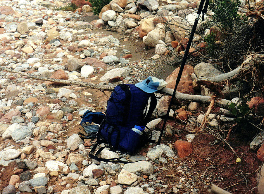
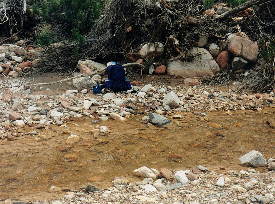 My pack along the creek. |
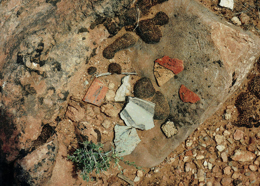 Pottery sherds at some ruins. |
 Looking up the creek. |
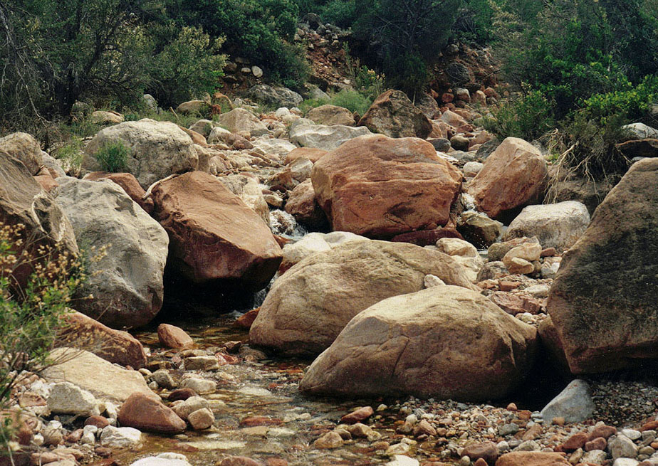 Upper creek bed. |
 The view to Swilling Butte. |
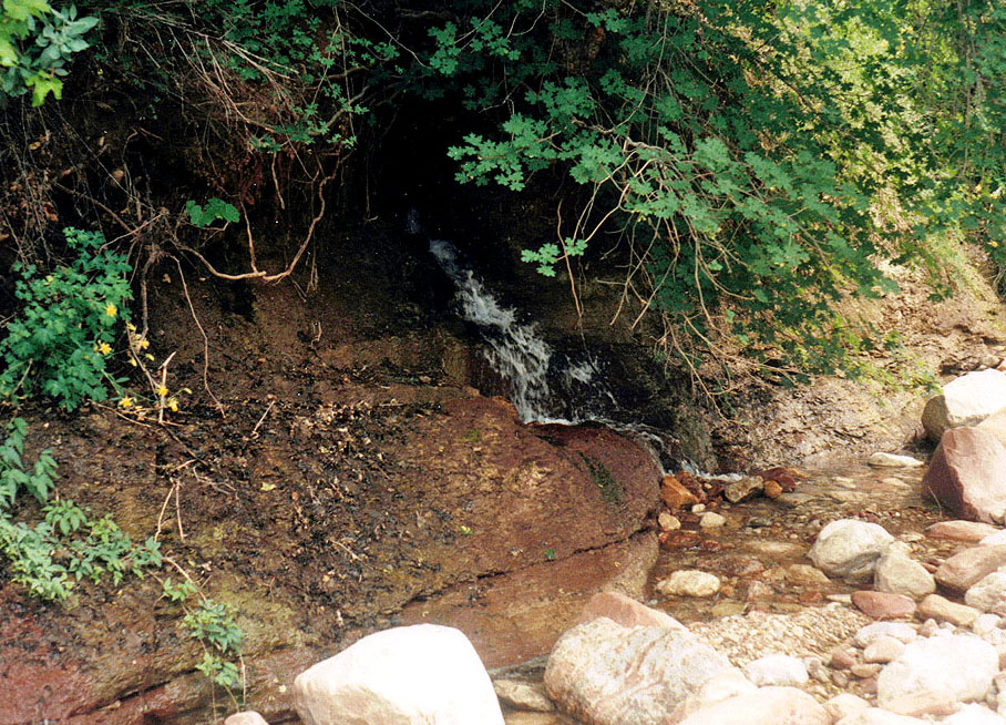 The upper spring; no water past this. |
|
I did face one serious concern. I am no madman, and am easily turned away from climbing through spots that present any exposure. Especially when hiking alone. But, for this hike, that place would come some 2000 feet above me, high in the Supai. It would be there that I would be faced with the potential of having to turn around and backtrack my way out of the canyon. The fact that Butchart and Steck had come through this route wasn’t enough for me. I have lots of Grand Canyon experience, but I am no Butchart. And, I am no Steck. I knew that I would use up much of the day getting to this spot, and if I had to turn around, I figured that it would be imperative that I be able to get back to the spring before dark, and out the day after that. I didn’t really pack a whole extra day’s worth of food, but had enough to nurse me through another 24 hours. I didn’t want to have to turn around, but the probability of that happening seemed greater as I looked up this boxy canyon, with its sheer cliffs. The spring was actually very noisy. The water gushed out of the side of the ravine in two places, probably flowing at a gallon a second, although my estimate is likely to have a huge margin of error. I suppose that one may call this “natural noise,” and worthy of some particular respect. However, I find it extremely difficult to sleep near this kind of water source, so I spent a long while finding a suitable spot to camp, far enough away so that it was not distracting, but close enough so that filling up my water bottles wasn’t a burdensome chore. The area was quite brushy, and I barely found a place to lay out my air mattress. A tent would have been out of the question. For the rest of the day, I did very little, but drink water, rest and eat. For those that think a hiking story must include a favorite recipe, here is mine for that evening’s dinner: Get two slices of bread from the plastic container. Open one of the individual packages of mayonnaise (courtesy of Chic-Fil-A) and a package of horseradish sauce (from Arby’s). Spread generously. Open a 5 ounce can of chuck chicken (chunk ham may be substituted instead, although then I will likely use mustard instead of the horseradish). Scoop and spread on the bread. Put both pieces of bread together and eat. Hold the lid of the plastic bread container underneath the sandwich so as to catch any that should fall. For dessert, open up an 8 oz. can of sliced pineapples and eat directly from the can. The evening was cool, and I wore some polys to go along with my sheet, and I ended up putting my poncho over me, to further retain heat. My air mattress turned out to be a big disappointment, as it leaked. Once I laid down, hardly ten minutes would elapse before it would go flat. As a consequence, I tossed and turned most of the night, unable to find a comfortable position for very long. And, as to be expected, I finally seemed to fall into a deep sleep about an hour before I had wanted to get up in the morning. |
|
|
||
 |
 |
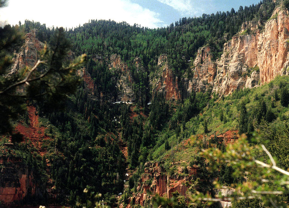 |
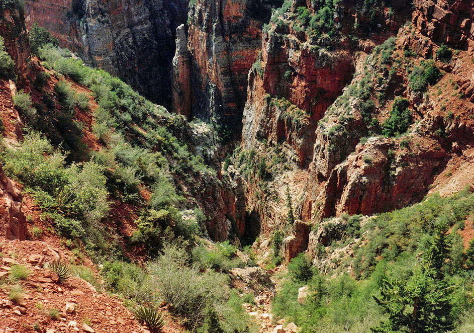
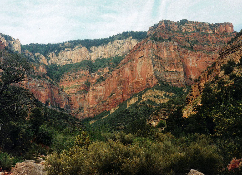
| Looking up Nankoweap. Kibbey is above the Supai on the right. | Looking
back down the canyon from the Redwall chute. |
The
head of the drainage from above the Redwall. |
|
I slept through my alarm, although my watch was nearby. Still, I woke up at 4:30 a.m. and realized that I had to get going. My breakfast of an instant breakfast drink, peanut butter and honey on a bagel and an avocado just hit the spot. By 6 o’clock I was on my way up the canyon.
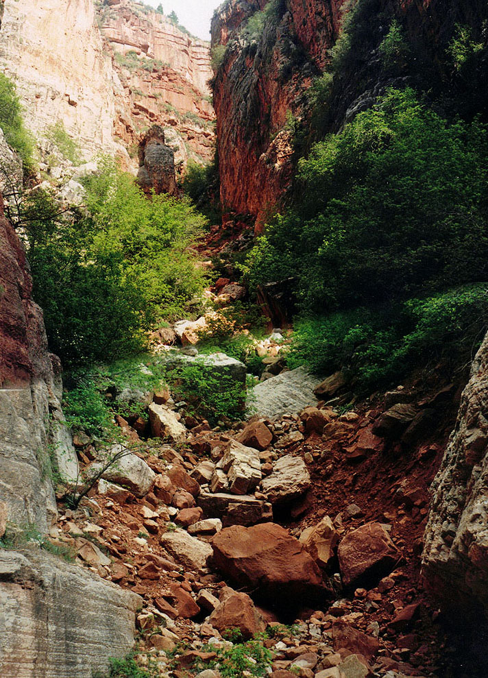
Without flowing
water, it was easier to hike up the bed. At a major junction, I
momentarily missed my way. I followed the main bed for a bit, as my
view was quite obscured by the trees and bushes growing all around.
I regained my course, and the going got slower. There were lots of
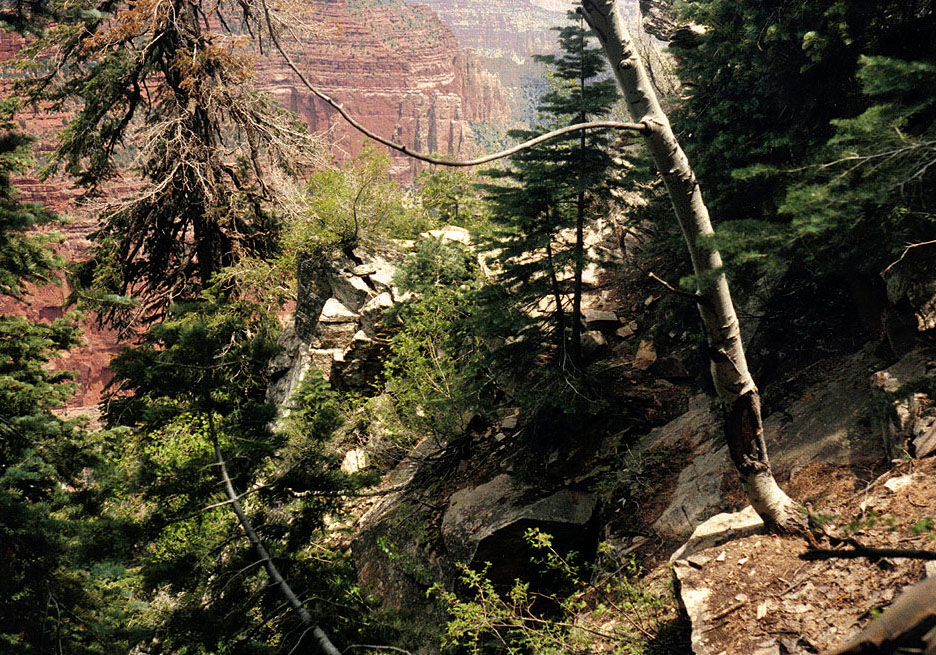
fallen trees across the bed that had to be As I neared the end of this box canyon I could start to detect the wonder of the Redwall chute (pictured to the left). By 8 a.m. I had reached the end of the bed and could look 90 degrees to my right up this compressed passage. It was the narrowest of cracks and yet it safely gets one through some 600 feet of this cliff layer. While steep in some spots, and rocky all the way through, it was as close to ideal as one can come in the canyon. I easily climbed up through the Redwall, and had started through part of the Supai. It took barely a half an hour. I carry a micro-cassette recorder to get an accurate account of the time, as well as to record other thoughts I have. It was easy to see, from up here, what was going on ahead of me. My recorded comments paint the picture pretty well, “From here the Supai looks just absolutely horrible, so, I guess that’s the story.” The fault that generated this route didn’t break apart the upper 150 feet of Supai, hence the difficulty of making this route work.
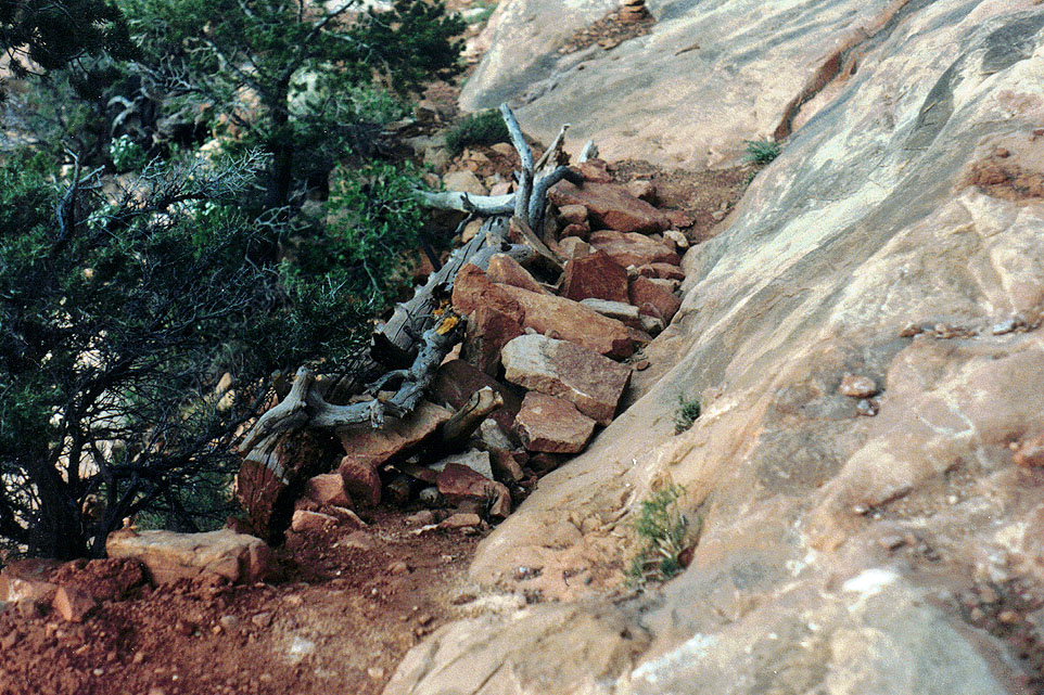
I had taken the
time to literally draw a map of Steck’s route description through this
section of Supai. I drew in the right descent ravine, the ponderosa
that is supposed to line up with Brady Peak, the large overhang, the
detached white tower, the critical chimneys to climb, along with the
spacing between them, the curious Steck had taken some two and a half hours to come down through this section, although it was hot, there were four in the group, and they had heavy packs. I was traveling solo, had a light pack, the temperatures were perfect and I anticipated that I could climb up through spots with the pack on my back. It took me some 45 minutes to contour over to the first landmark here--a grove of ponderosa trees and a bit of a seep spring. The contour was quite miserable, although I was following the hint of a deer trail. On more than a few occasions I found myself holding onto the limbs of trees and bushes while dancing my way across especially steep and unstable ground. A bigger pack would have made this much worse. From the ponderosa grove, the route unfolded before me just as shown on my map. It seems a rare thing for events to develop just as planned! I easily found all of the right spots, including the crucial crack that has a fir branch growing down through it, used to assist along the way (pictured to the right). This was the only place I had to take my pack off, and raise it up after me. I’m sure that I didn’t win any style points through here, but was happy to find the going as easy as it was. |
| Now near the
base of Kibbey, I was on familiar ground. I had been down here, from
the rim, a couple of years ago. Although tedious, and sometimes very
steep through the forested pines, from here I was on the rim in less than
an hour. Some three hours after that I arrived back at my truck,
having picked up my water cache along the way. It was a simply
fabulous hike. |
|
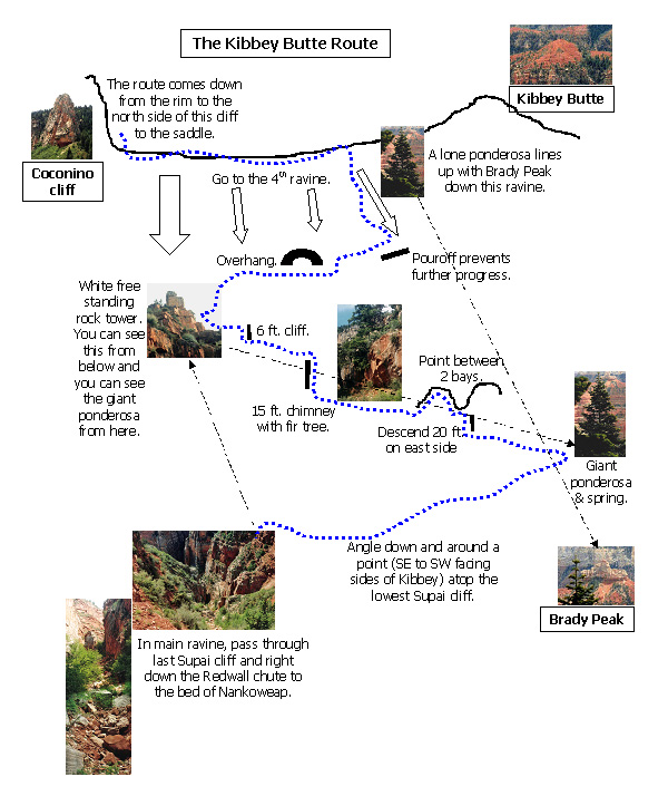
Appendix 1 - The Kibbey Butte Route Map I had drawn a map on a piece of paper which I still have. But, I know I copied it onto a 3x5 note card for the hike and I can't find that. The roughed out sketches are not especially great, so I decided to put it together again, below, using some photos I took during the hike to highlight certain features. All of these photos appear in the text, above. The map is based on George Steck's description given on pages 130-131 of Grand Canyon Loop Hikes II.
|
|
Appendix
2 - Micro-cassette
Transcript Friday,
May 16th, 1997 and am beginning to leave from Flagstaff for the hike up
the Kibbey Butte route. It
is 2:46 and I’m just leaving the gas station at Flagstaff.
The mileage is 39,648.1. The
weight of my pack is 25 pounds exactly. It’s
4:38. The mileage is 120.8,
from Flagstaff, and I’m right now crossing Navaho Bridge, arriving
here at Marble Canyon. It’s
5:27, and I’m just leaving Jacob Lake.
Stopped here to get some gas and reset the odometer.
It is sunny and partly cloudy--got some rain down around Cliff
Dwellers and in that area. And,
now, on to the North Rim. The
forest road that goes off to the east and the west, leading to all kinds
of points, including Nankoweap trailhead, [is] 27.1 miles past Jacob
Lake. It’s
6:01--I’ve just entered the park. It’s
6:21. The miles are
39,859.6 and I’m right at the rim where the Ken Patrick trail is, to
check it out. Saw some snow
on the way in, and I’m hoping it’s not going to be a big problem
here, off the side. [This
is the water cache spot.] It is 8:17. The miles are 39,906.5--have come 95.1 miles from Jacob Lake and I’m now at the Nankoweap trailhead. There’s a couple of vehicles parked over nearby--don’t know that I saw a tent anywhere. It seems like it may rain a little bit tonight, so looks like I may be setting up the tent. [I did set up the tent, but it did not rain. When I arrived here, after first going to the lodge and eating a quick dinner out on the balcony--pizza slice and a salad--it was dark.]
It
is Saturday, May 17th. The
time is 5:34 and I’m just getting ready to go here.
All ready to head down. The
sun has been up for as bit. I
did get up at 4:30, but it takes about an hour to get ready to get
going. There are a couple
of vehicles here and it looks now like there isn’t anybody camped, so
they must be down the trail. It
is 6:35 and I am at the trailhead on the saddle.
The route down was pretty nice.
At the top the trail has been cleared away a lot, so it’s real
easy going. Once you get
past the big plateau the brush is still a little bit intrusive. Had to cross a snowpack over one little stretch too, so it
was kind of an odd little outcome.
Real nice day--clear, breezy, but very pleasant up here, which
makes me think it’s going to be very hot down there.
So, on to Marion Point. It
is 7:30 and I have stopped in the shade of a tree, somewhat past Marion
Point. I thought I might
catch an overhang here with some nice shade, but it’s catching some of
the early morning sun. But,
still, it’s a pretty nice spot right here.
I’m going to take a little break, have some water, put some
sunscreen on my arms and get this long sleeved shirt off.
It’s still pretty nice. Of
course, we’re still pretty high here in this section.
But, time is going real well.
There are about six, or seven, hikers ahead of me, on the other
side of this bay. I suppose I may be meeting up with them, or passing them,
somewhere by Breezy Point, it would seem.
So, anyway, take a little break here.
It is still very clear, and quite calm, right here anyway. It’s
7:55 and I’m ready to leave this little spot and continue on my way. It’s
8:51 and I’m at the top of Breezy Point, to stop, have a drink of
water, and keep on. At
9:27, I’m passing camp-on-a-ledge. It
is 9:55 and I have just passed the little sit-down rocks in the Tapeats
and am ...on my way I stopped to have a little bit of water there. When I get down to the terrace I intend to cut across and hit
the creek upstream, as best I can, before stopping for a bit. [Water
sounds] That is the sound
of Nankoweap Creek. It is
10:19 and I have just arrived here just a moment ago.
My traverse of the terraces turned out pretty well, and I came
down right at the petroglyph rock.
So, one could never have planned that any better.
I’m going to take a pretty long break here--probably a lunch
break, really. And, head up
the creek here in quite a bit. It
shouldn’t be such a big deal getting up there to the higher spring.
Some clouds have rolled in, so that probably means it’s going
to be cool and shady this afternoon.
The breeze has been blowing cool, so that’s felt pretty nice. The sun is warm, but not unbearable, so far.
So, take a break here. --Some
miscellaneous trail notes: First,
the rocks that I placed on the very upper part of the trail, near the
saddle, bridging a spot that had washed away, are still there, and it
looks to be in excellent shape. It
is 11:45 and I am all set to head up the creek here for the spring by
Ehrenberg Point. The clouds
have gotten a little bit heavier--I can still see plenty of blue
sky--but, it has been shading things down and cooling things off, so it
feels pretty pleasant. Onwards. It
is 12:44 and I climbed up to the top of a terrace, where Walcott Spring
is, and have followed along it, and intend to follow along it until I
reach the branch here, heading up where I need to go.
But, not too far up here, on the higher part, a little pottery
sherd area that I took a picture of, and a number of rooms here--it
seems to me at least four, or five, or maybe even six good sized rooms
on the edge, overlooking the creek. It
is 1:00 and I am right near the major fork here, in Nankoweap.
I’ll be heading off to the north and the right hand side, to
get where I want to go. But,
it doesn’t seem like I’m going to have too much further to go to
reach that upper spring. The
sun is feeling a little bit warm--the rocks are feeling a little bit
warm. So, I’m going to
stop here, at the creek, for a little bit--recoup a bit. It
is 1:34 and time to continue on, up Nankoweap, here, to find the spring
by Ehrenberg Point. [water
sounds.] It is 3:14 and I
have come to a spring coming right out of the side of the wall, and this
certainly seems to be the one that Steck refers to, and that Butchart
refers to. So, take a
little look around before deciding on a place to camp. It
is 3:54, and I have gone up and down here a ways and really can’t find
much that looks to be a very good camping site.
But, I’ve picked a spot that’s not too far from the
spring--far enough away so that I hope that the noise doesn’t keep me
awake, but, close enough so that I don’t have to make too big a trip
to get to it. And, so, now
I’m just going to relax, kick back, fix water, maybe even dunk myself
down here a little bit if the water feels good.
Sunday,
May 18th. It is 5:57, and
I’m all set to leave my little campsite here.
My little [air] mattress doesn’t work very well, as apparently
there’s a leak, and the thing went flat very quickly every time I blew
it up, which made my night less than comfortable.
Or, at least, perfectly so.
And, in fact, the ground was a little bit cold, and that was a
little bit uncomfortable, too. But,
I still slept pretty well through most of the evening.
I didn’t hear my alarm go off at four, but I did wake up at
about 4:30 and get going in here. Had
a good breakfast--a bunch of water.
I got my four liters. And,
I can see Kibbey Butte from here--it looks mighty, mighty close,
although apparently it’s going to take six to eight hours to get to
it. But, that’s the way
it goes. So, now to go up
and look for that route through the Redwall. It
is 8:07 and I am at the bottom of the Redwall break, and it looks pretty
good, just as everybody says. Climbing
up the ravine here was straightforward, but once I passed the branch
that goes off between Hancock and Kibbey the going got a lot
slower--(narrower) the ravine was narrower, fallen trees across it and
bushy. [I fell down in here
a couple of times.] In fact, I missed the turnoff and started heading up the
wrong canyon for just a couple of minutes before I realized my mistake.
And, I don’t know how well marked that junction is, as I cut
across a little area to get back into this ravine.
It is a beautifully cool day--light cloudiness around.
I’ve been in the shade most of the morning.
And, the sun doesn’t look like it’s going to rise on me too
much until I’m up above the Redwall.
From here the Supai looks just absolutely horrible, so, I guess
that’s the story--see what’s on when I get up there. It
is 8:40 and I’ve reached the top of the Redwall.
It was pretty straightforward--a couple of places that were a
little steep, and I actually (put my pole) strapped my pole to the pack
and put my camera inside, so that I could better climb up through some
of that. From here, I have
to consider what I’m going to do.
The fault ravine continues on through a big chunk of Supai, and I
believe that’s what Steck was talking about, in terms of contouring
west from that lower break into the fault ravine.
Otherwise, right here, it looks like you could continue along the
Redwall for a piece. There
is an upper ledge in the Supai that is possible as well.
To my northeast I can see a solitary little tower, which I think
is what Steck, and Butchart [?], refers to, in terms of marking the top
part of the route here. So,
it seems that things are working well. It
is 9:00. Time to continue
on. I’ve decided to
follow through this fault ravine to what looks to be a big chunk of the
Supai, and then try and take a little higher contour over to the
ponderosa tree that Steck talks about.
The next couple of hours will be quite crucial for the success of
this trip. It
is 9:47 and I’ve reached the ponderosa grove, where there’s a little
seep spring and I’m right next to it.
So, I’m going to grab a place to sit and read my stuff again,
maybe even scout out what it is I’m trying to do here, before I put
the pack back on. WooHoo!
It is 10:36 and I am up around the base of Kibbey--going to work
my way around to the isthmus, I guess, that leads to the mainland here
[Well, the ridge that connects Kibbey to the rim.] and then take a break
for lunch. What a route.
I decided not to stop and reread things, but instead just take
whatever looked good, since I remembered pretty well what the
description was about. It’s
10:40 and I haven’t quite reached the isthmus, but I found a good spot
to sit and take my lunch. So,
I’m going to do that. On
the way up, I caught all those spots, pretty much right on.
The first one, by the tree, I went a little bit to my right,
around the point, as Steck had mentioned, and climbed right up through
there without any trouble. I
saw a rock cairn that was on the other side of the point [at the top of
this spot], which would have been the sort of main way, I suppose. It
is 11:43 and I’m all set to leave my little nice lunch spot. Very enjoyable, just sitting around and eating something,
resting for a bit. I feel
very good, so there must be something to say for that.
Still some high, light cloudiness, keeping the sun a little bit
dampened, although it seems a little bit bright right where I am here.
So, on up to the rim, hopefully [to] encounter some of the old
trail along the way. It
is 12:24 and I’ve just reached the top of the tower, in the
Coconino--the back side. I
lost the trail a couple of times, but seemed to always manage to get
back on one. Very steep,
very poor footing, kind of a chore that way, but at least a trail, and,
man, the flies are really a buzzin’ around me.
Well, now up through the Toroweap and Kaibab.
It should be a little easier going, but still some climbing to
do. It
is 12:39 and I’ve reached the top.
I’ve come out where there’s a burnt tree stump, exactly
(where I’ve gone down...) where I went down before.
And, there’s a rock cairn here, and a couple of logs pointing
the way, down at this particular spot.
So, how about that. Well,
I’m going to try and wander through the woods here, towards my water
point, and hopefully stay away from the road.
We’ll see how it goes. It
is (1:36, excuse me...) 1:14 and I am right now at my water cache.
I tried to follow through the woods, but the going was really
tough and it forced me back to the road.
The road was nearby, and it turns out to have been the spot where
it’s close to the rim, right before Greenland Lake, and the walk back
along the road wasn’t too bad. The traffic is light, so, and speed was pretty decent [for
me]. So, I’m going to
fetch my water, take a little drink, and then continue on to Point
Imperial. It’s
1:18 and I’m about ready to go. I
was down only two liters from leaving my campsite this morning, so that
seems like a little bit too little water to have consumed, but I don’t
feel like I was really saving any at all.
So, I’m now back up to almost four, having had about a half a
liter here. Onward. It
is 2:29 and I’m just passing through Point Imperial, just about to get
on the road headed to Saddle Mountain.
I followed the trail all the way here, except that it cut off the
end. [That is, I left it
once I knew I was at Pt. Imperial.] It
is 3:27 and as I’m walking along here I see a big grove of aspens and
there is the gate. So,
I’m on the Forest Road 610 and all I have to do is hop down to get the
truck. At
3:31 I’m back at the truck. It
is 4:07 and I’m all set to leave and drive home, maybe all the time in
the light [daylight]. The
miles is [are] 39,906.5 and the trip odometer is 95.1, which would have
been from Jacob Lake to the water cache to the North Rim and back here,
seemingly quite a long ways. It
was .2 of a mile from the truck back to the gate, that leads along the
road to Point Imperial. It’s
4:34 and I’ve reached the highway. |
|
|
||
|
|
Return to Hiking Grand Canyon home page |
|