 |
|
|
Day Hike to "East" Plateau Point Great views of Phantom Ranch, the river, the Devil's Corkscrew and the Old Miner's Trail. Saturday, April 19, 2003 by Dennis Foster |
|
|
|
|
|
|
|
Day Hike to "East" Plateau Point Great views of Phantom Ranch, the river, the Devil's Corkscrew and the Old Miner's Trail. Saturday, April 19, 2003 by Dennis Foster |
|
|
|
|
|
One of the coolest day hikes from the popular South Rim Village area is
what I call "East Plateau Point." Well, sometimes I call
it "Plateau Point East," so there is some flexibility
here. Some years ago I thought it would be nice to go out to the
end of the Tonto (which is usually great anywhere in the canyon) just
opposite of Pipe Creek from the oft-visited Plateau Point. When I
first did this trip I was just blown away. It is light years
better than Plateau Point. But, it has a drawback - you pretty
much have to bring along all the water you'll need for the day, since
the easiest approach is via the South Kaibab trail. So, if you
pick a cool time of the year, and consider caching water on the way
down, you can manage this neat hike.
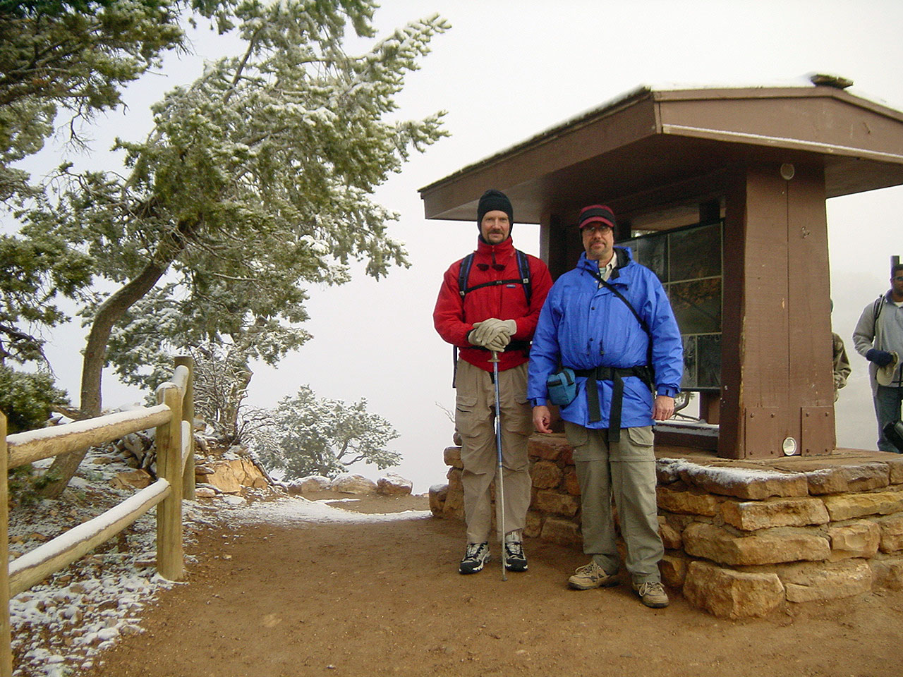
So, with hiking buddy John Eastwood, we got an early start from Flagstaff and were on the trail at about 7:30 a.m. It was a chilly start, despite being in the latter part of April, and there was snow on the ground at the rim. It didn't affect us for long, and in fact the weather down in the canyon was about as perfect as you could ever hope for. The clouds that prevailed in the morning lifted and the afternoon was absolutely glorious. |
|
|
||
 |
 |
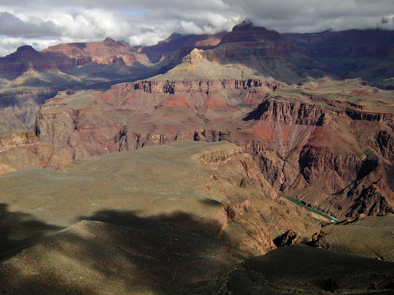 |
| John & Dennis at the trailhead. | Stately O'Neill Butte. | Our objective at the Tonto's edge. |
|
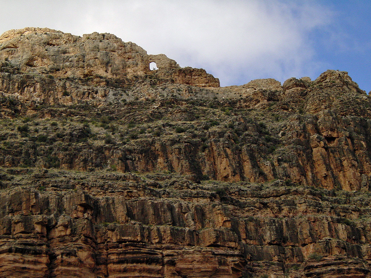
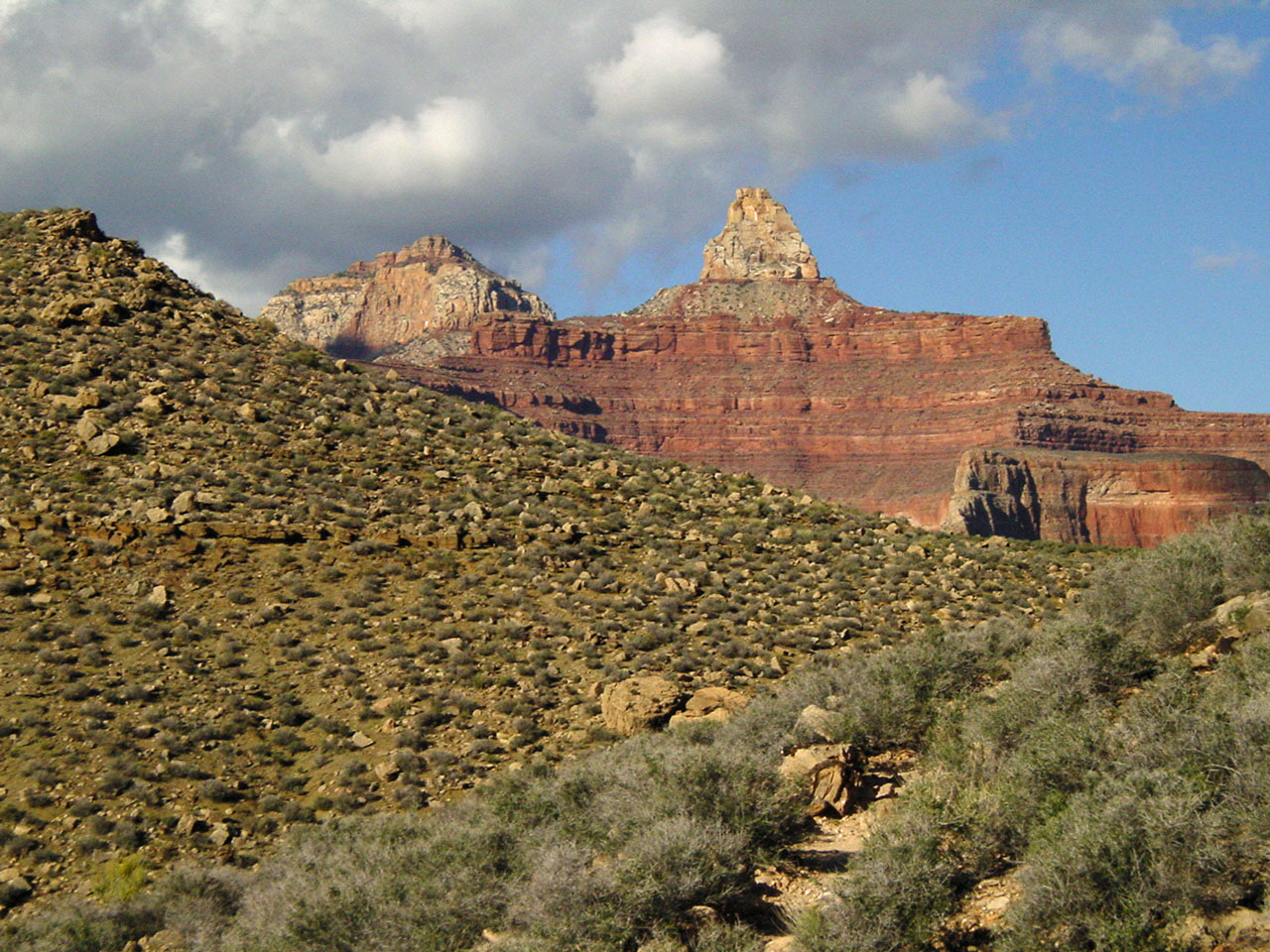
Among the usual sights along the South Kaibab trail is the hike past the
impressive O'Neill Butte and, lower down, if you look up along a short
stretch of trail you'll see a window in the upper Redwall. At the
Tonto level, you leave the South Kaibab and take the Tonto trail west,
toward Indian Garden. A favorite hike of mine is to come down the
Kaibab, cross on the Tonto and take the Bright Angel back up to the
rim. But, today, we are coming in and going back on the Kaibab . .
. at least, that was our plan.
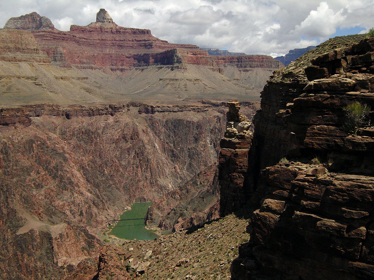
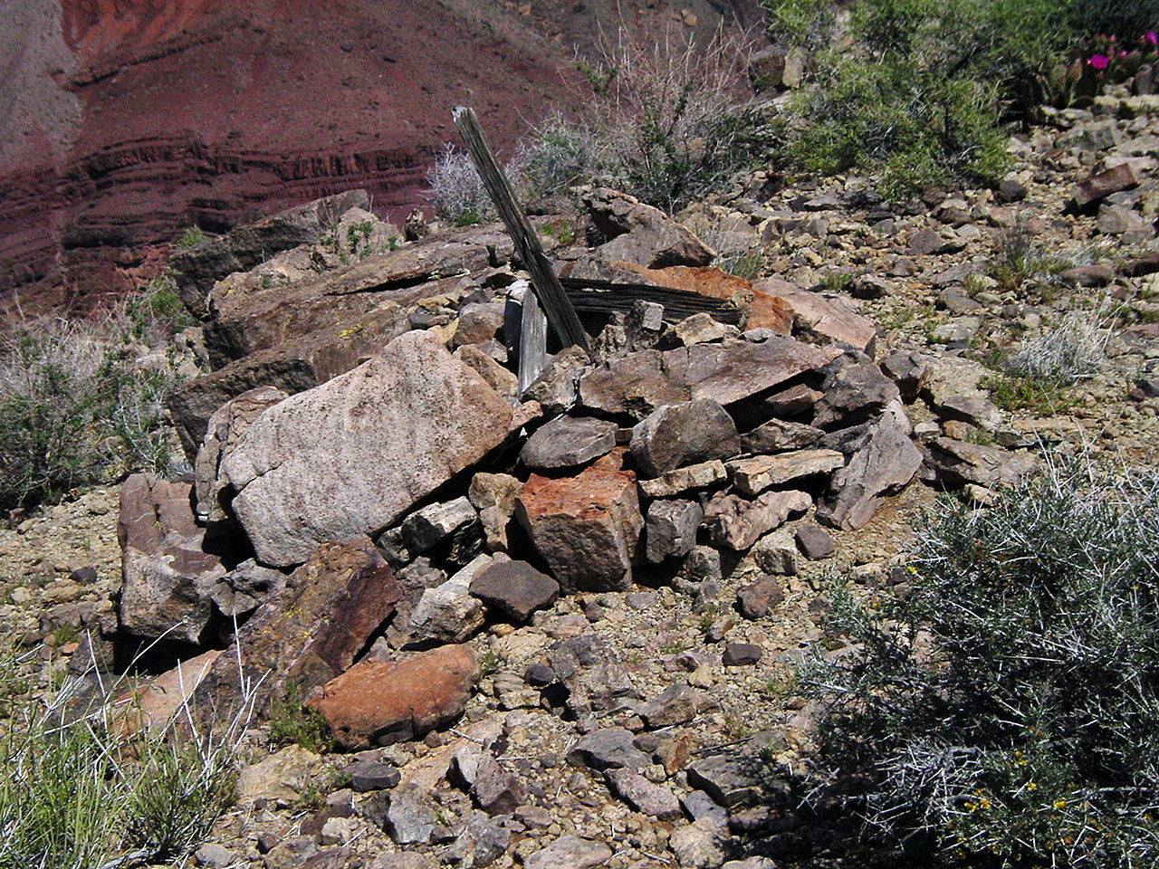
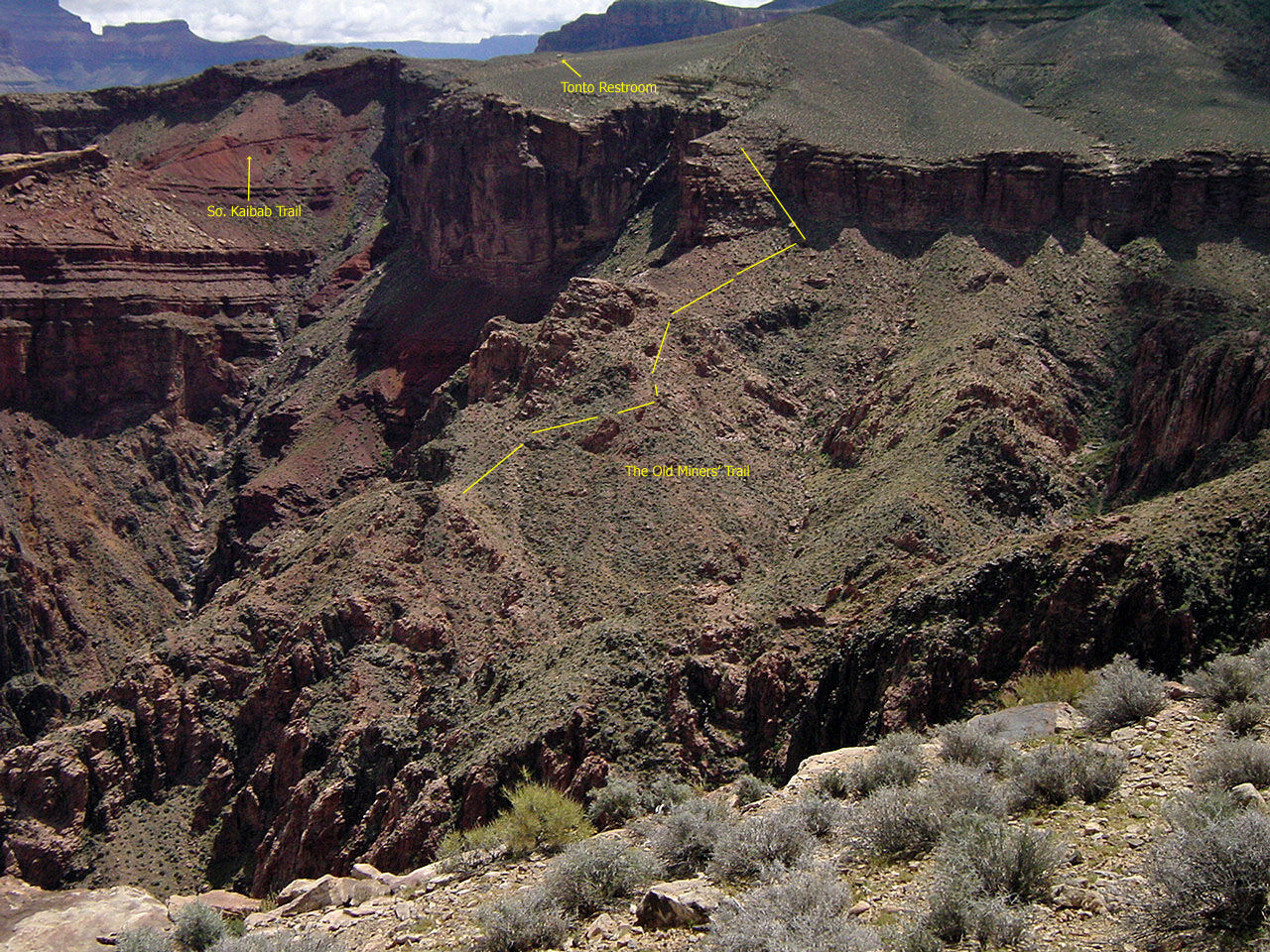
After passing a major ravine, you leave the trail and just hoof it across the Tonto Plateau to the end. It is pretty easy going and you can see where you're headed. A few years ago when I did this, we passed some empty crates that may have been left over from the old days of the wild burro roundup in the early 1980s. Out at this
viewpoint, there is an awful lot to take in, from east to west . . . |
|
|
||
 |
 |
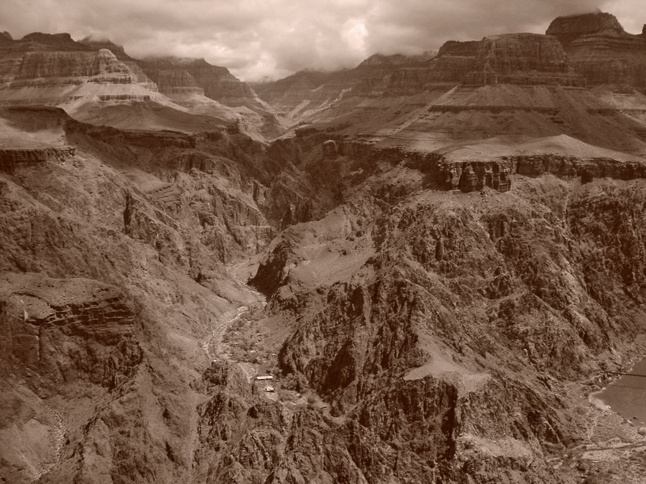 |
| A window in the upper Redwall. | The Old Miners' Trail (see annotated) | Phantom Ranch - sepia tone. |
 |
 |
 |
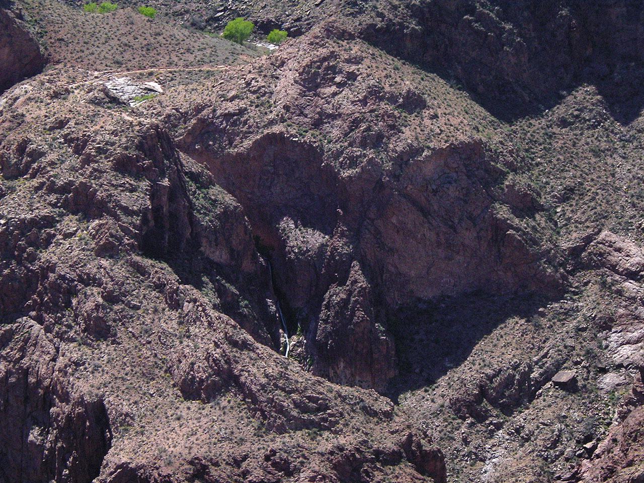
| The black bridge & Zoroaster. | Garden Creek Falls. | Old Devil's Corkscrew (annotated) |
 |
 |
 |
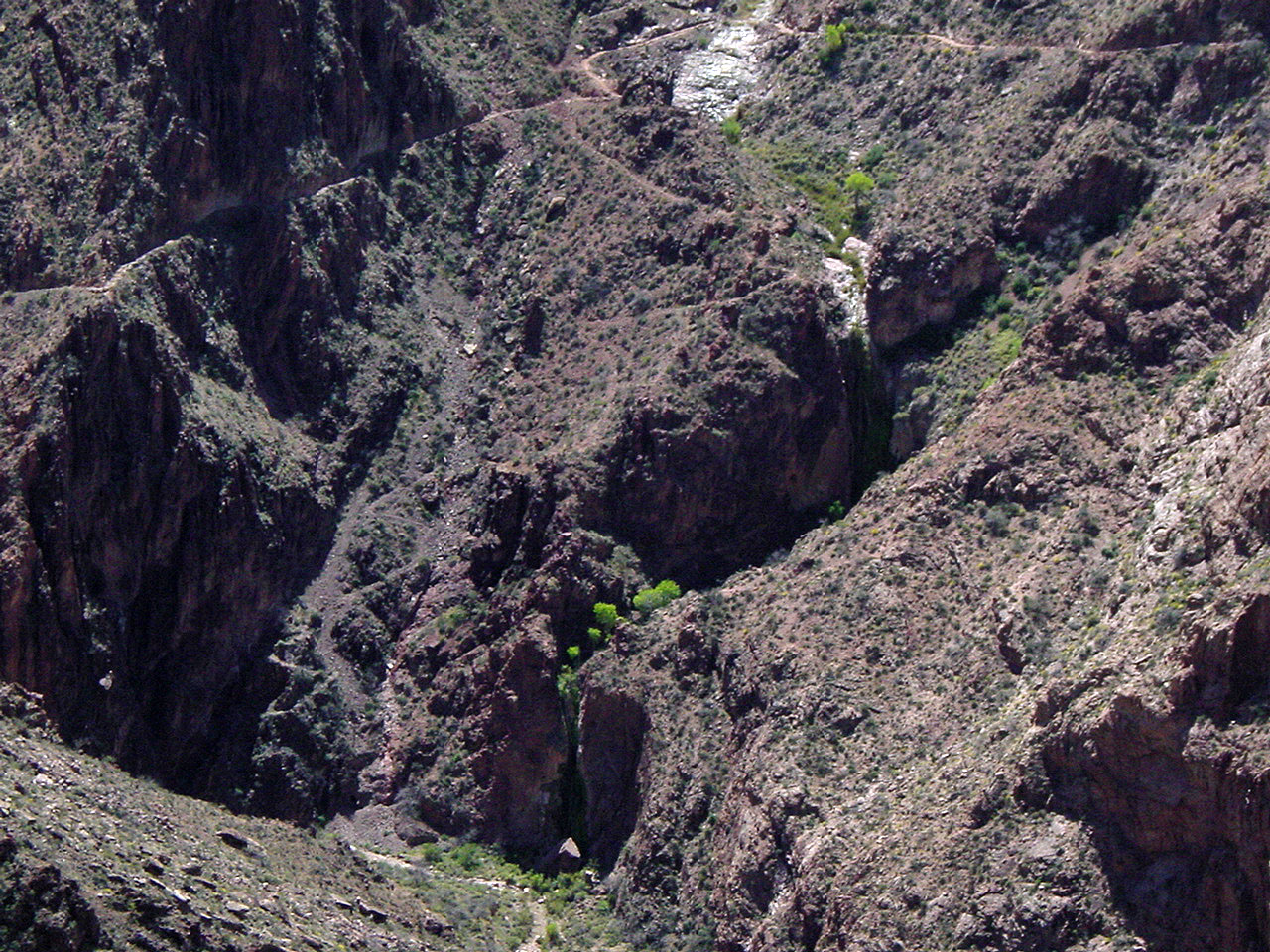
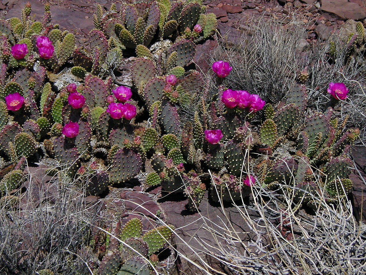
| Looking up Bright Angel Wash. | Blooming cactus. | Old miner's claim? |
|
While we were out here, we could see that there was an easy route
through the Tapeats, heading west and, apparently, down to the bed of
Pipe Creek. In the back of my mind I had the notion that there was
a route here, but now don't know the source. It sure looked good,
and there was a big cairn at the top that looked like it might be a
marker of some sort - a miner's claim perhaps. So, off we
headed. We got into a very large ravine and slowly worked our way
down toward the creek. I took the photo of John climbing down,
below, but must admit that it is a bit disingenuous. There is a
big flat spot just inches below the bottom of the picture. But, I
told John to pose like it was quite precarious so we could show his
wife. Hmm . . . she wasn't all that amused!
Well, we cliffed out with the Bright Angel trail practically within spitting distance. We gave some thought to angling off to our left where there was a possible way down, but it just seemed too risky. So, we hiked all the way back up to the Tonto and then back to the trail. In January of 2004 we would try the same route from below, but got stymied again. Then, on a hike to Plateau Point in April of 2004, I got a chance to really look this area over and figured out how to do this route. A month later, I returned and did this route, from the Bright Angel trail up to the Tonto and out the South Kaibab. |
|
|
||
 |
 |
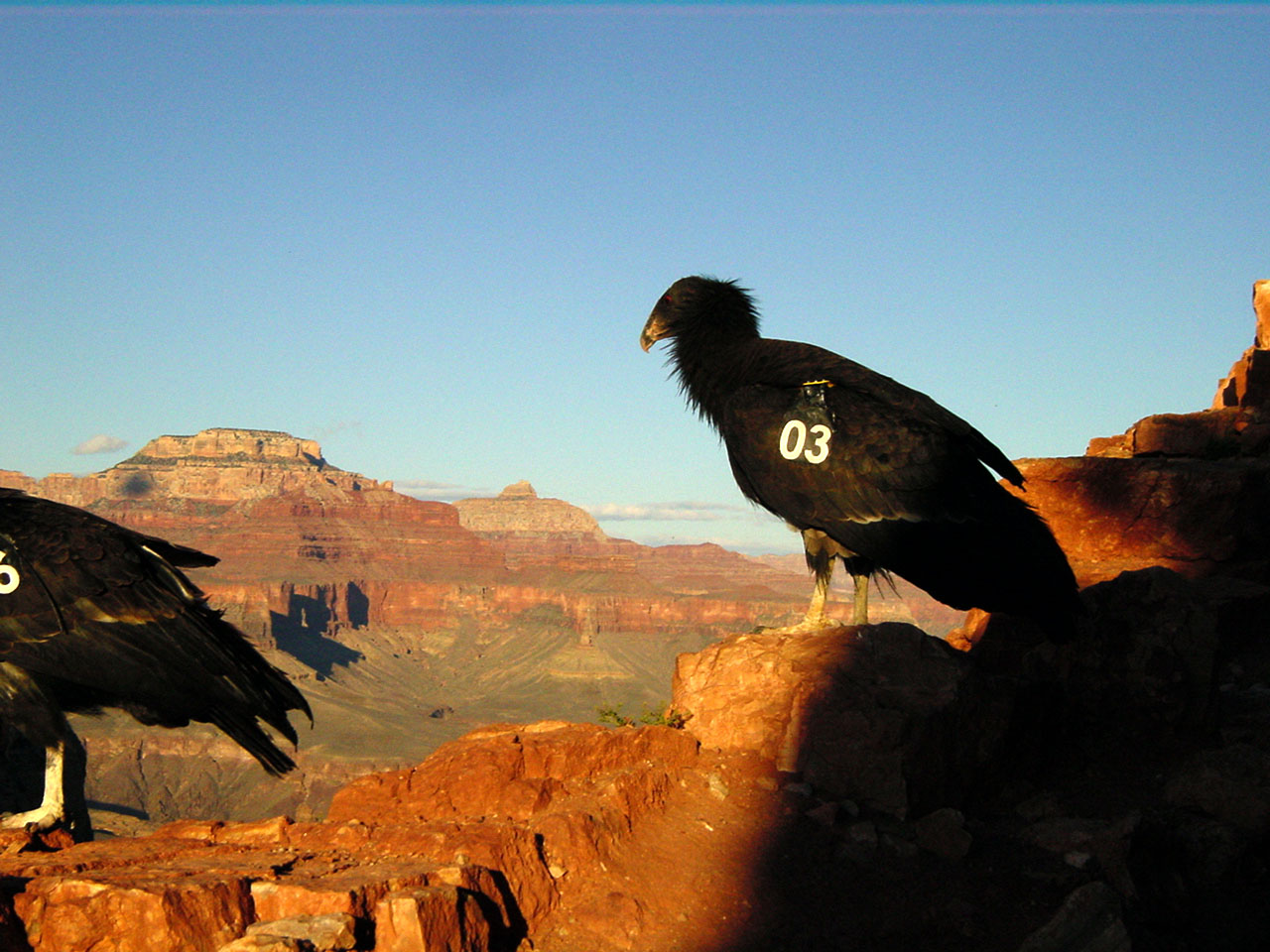 |
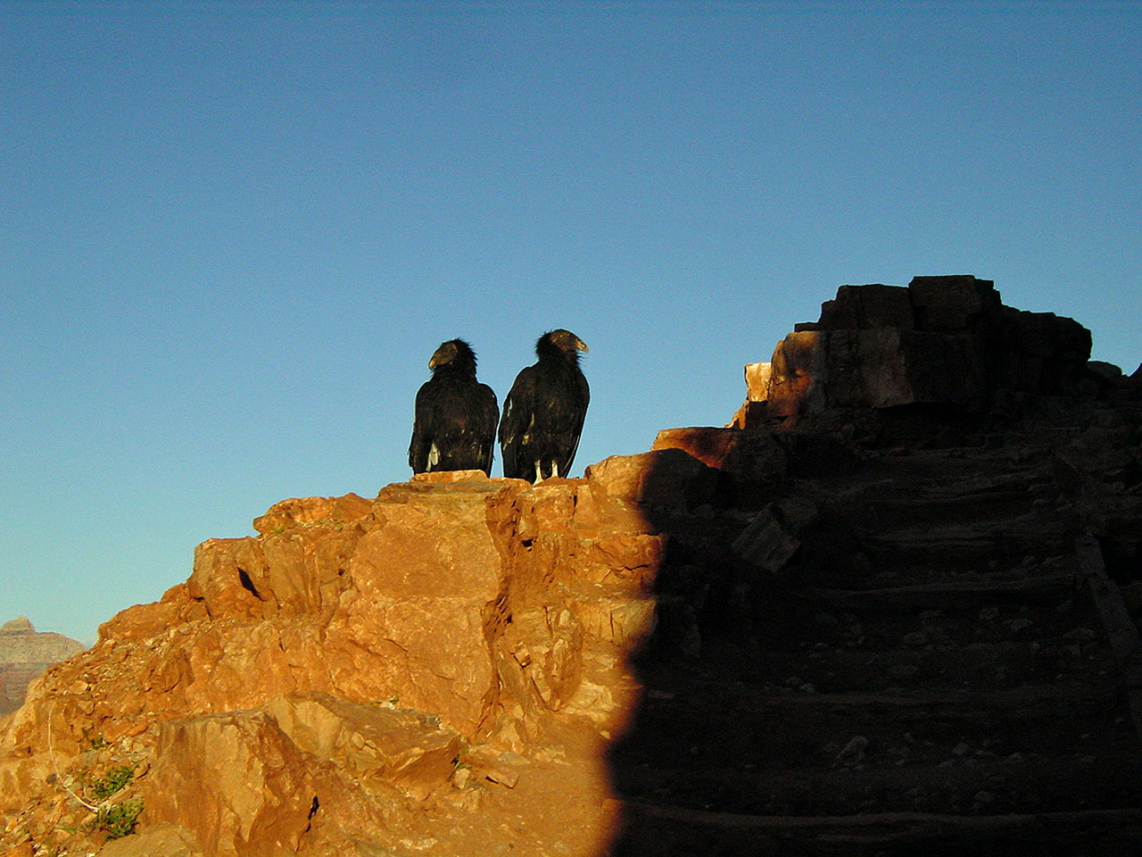
| John climbs down route. | Zoroaster Temple. | Two condors along trail. |
| Hiking back up the South Kaibab, we felt a bit dejected at missing a chance to follow this route to the Bright Angel trail. But, that quickly changed when we reached the top of the Redwall and were treated to a couple of California Condors perched right along the edge of the trail. We stopped and took a few pictures, thinking that they would fly off at the least amount of movement. But, they just sat there. So, I walked slowly by them, snapping a couple of photos along the way. Then, John walked by them. Nothing! Well, it was quite a thrill for us and the perfect cap to a wonderful day in the canyon. |
|
|
||
|
|
Return to Hiking Grand Canyon home page |
|