|
|
|
Old Tanner Trail: Wednesday, April 13, 2005 by Dennis Foster |
|
|
|
|
|
|
|
Old Tanner Trail: Wednesday, April 13, 2005 by Dennis Foster |
|
|
|
|
|
For quite some time I had been interested in checking out the Old Tanner
trail. It is only the upper section that has become old and
disused. The current trailhead is at Lipan Point, to the
west of the Desert View and its Watchtower, while the old trial left from the
east side of the bay to the east of the Watchtower. I had the time
off and the day was perfect for this hike.
I left Flagstaff at 7:25 a.m. and had cached my pack near the trailhead at 8:52 a.m. I was going to hike a loop and decided to park in the big lot at Desert View, so I would have some rim walking at both ends of this hike. I paid careful attention to the mileage - it is 2.1 miles from the parking lot to Lipan Point. The roadway at Desert View had been undergoing some changes and this was the first time I had been here when there wasn't a road and parking real close to the Watchtower. That has been all torn up and a giant parking lot built further away. I returned to Desert View to park and at 9:05 a.m. I was on my way. It was about a half hour to the Lipan Point turnoff. Here is where I spied a route through the woods and found an old road. I didn't know it existed, but was happy to follow it all the way to the rim, ending up near the trailhead. Along the way I passed an old trash dump that had some old-timey glass soda bottles still mostly intact. By 9:45 p.m. I had reached my pack and was starting down the trail. |
|
|
||
 The road at Desert View is no more. |
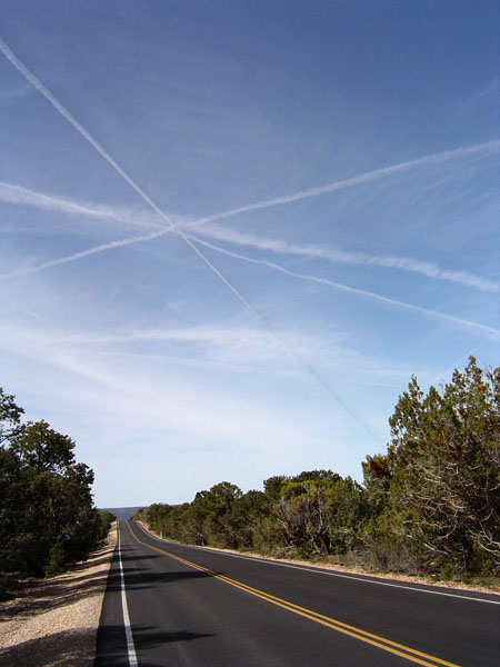 I hiked from the parking lot at Desert View to Lipan Point. Along the road I saw that I was following a giant "X" in the sky! |
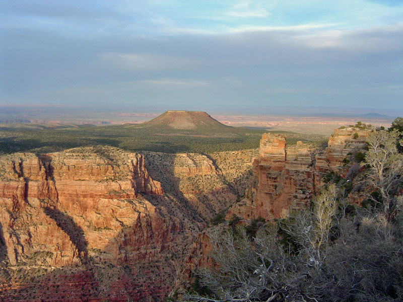
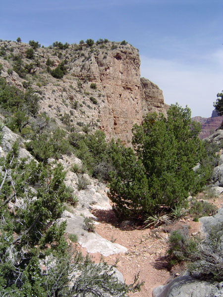
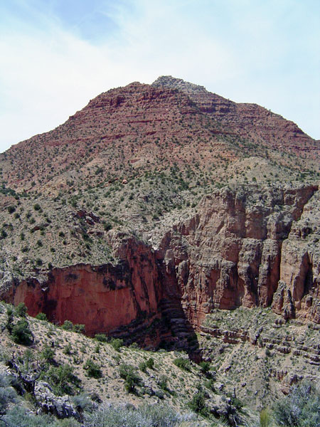
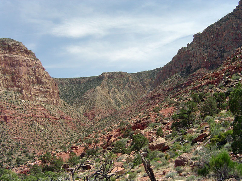
 The view back to the rim and the start of the Tanner trail from deep in the ravine that leads to the head of 75 Mile Canyon. |
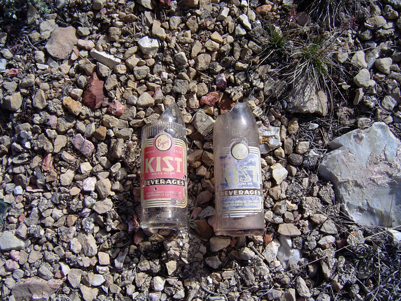 Trash along old rim road. |
||
|
Besides the general direction of the old trail, I really didn't know
whether it would be visible or marked. Near the bottom of the main
descent ravine, just short of the saddle at 75 Mile Canyon, I left the
trail and continued downhill on the east slope. It had taken 68
minutes to get here. I decided that I could have stayed on the
trail longer, but 20 minutes later I was down near the top of the
Redwall, where I saw a tree that had cut branches. That seemed to
mark where the old trail came to meet up with the current trail.
I didn't see any obvious route, so I continued down the ravine to check out some water pockets in the Redwall that Harvey Butchart wrote about as being semi-permanent. It is a bit close to the rim to be necessary, but I suppose on a long hike up from the river, they could be useful. As the ravine deepened, I found a couple of small pools just before everything spills over a sheer cliff. It had only taken about fifteen minutes to reach the water pockets from the tree with the cut branch. From here I climbed up to the east with the intent of angling up to the apparent line that the old trail would take as it contoured into the big bay to the east of Desert View. I only hiked until 11:46 a.m. and then stopped for fifty minutes to eat my lunch and enjoy the view. |
|
|
||
 |
 |
 |
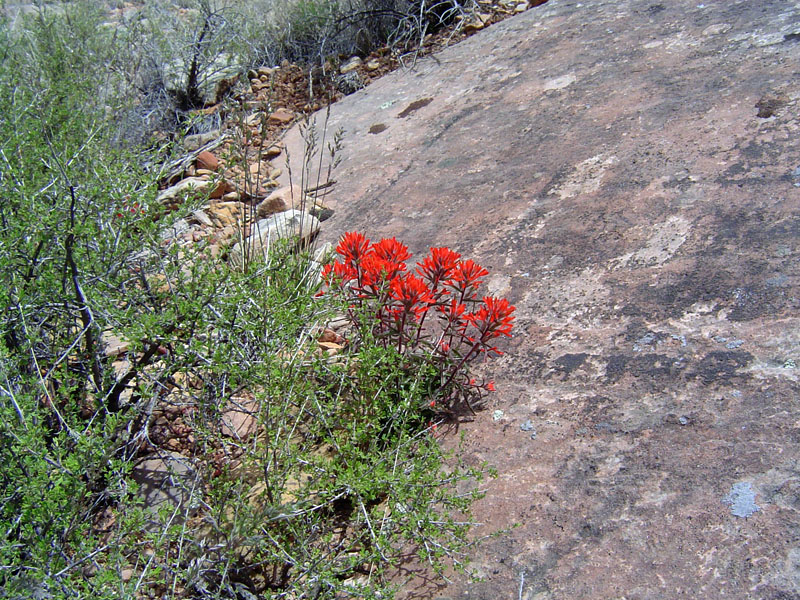
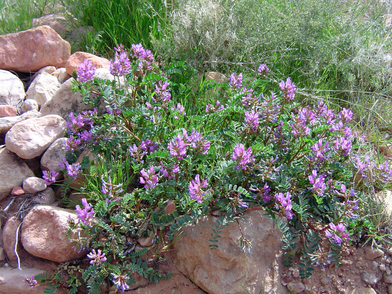
| The saddle at 75 Mile Canyon. | Springtime flowers. | A marker for the old trail? |
|
|
||
 Harvey Butchart reported that a rather permanent water pocket lies deep in a ravine off the Tanner trail. So, I looked. |
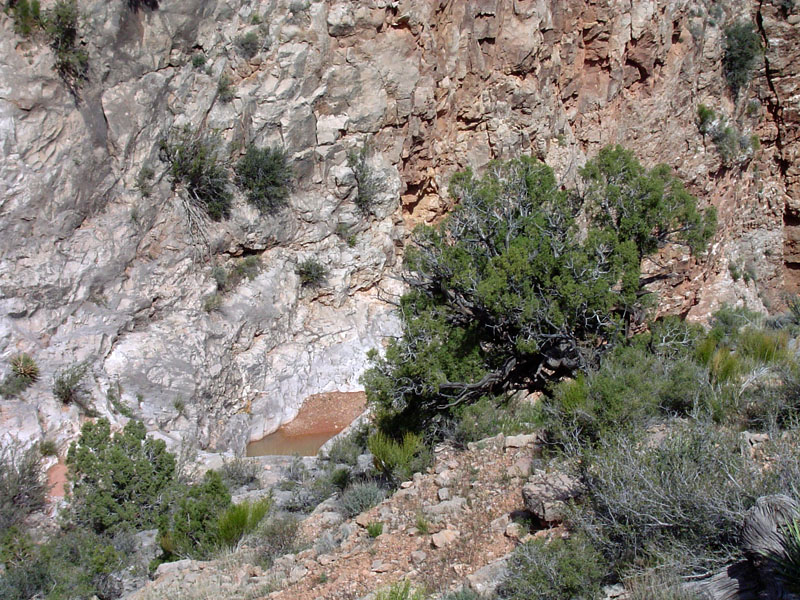 Here is the water pocket/pool. |
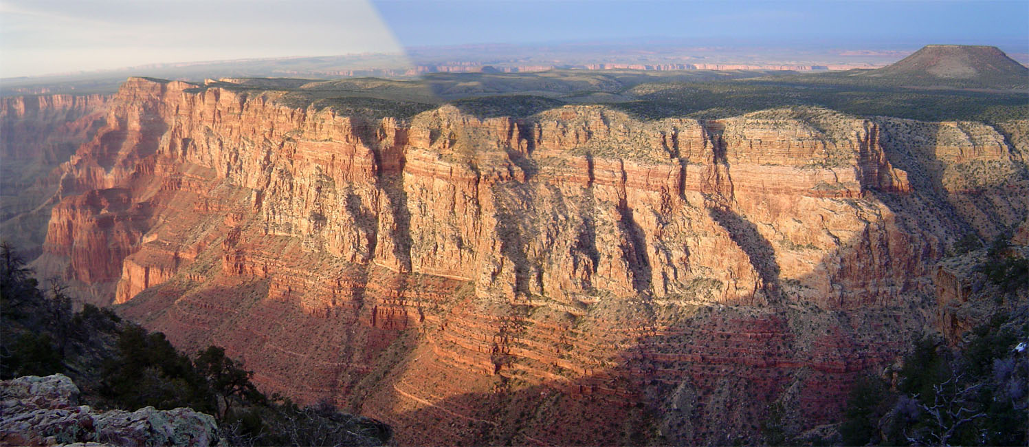
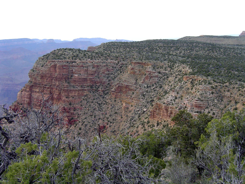
 Looking back at Escalante Butte as I followed a route atop the Redwall. The water pocket ravine is more dramatic from here. |
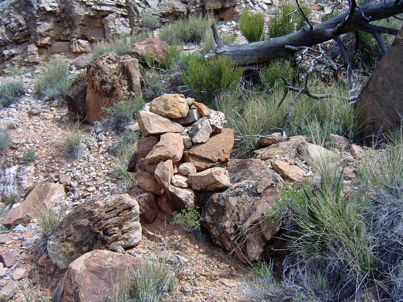
 A cairn along the old trail. |
||
|
At 12:36 p.m. I was on my way. An hour later I had a terrific view
of the river. I figured I was pretty much directly below the
Watchtower. Fifteen minutes later I was starting to turn the
corner into the bay and was following a pretty decent path marked by the
occasional cairn. An hour and a half after leaving my lunch spot I
was in the bed of the big bay and ready to take a second lunch break,
which lasted nearly an hour, until 2:56 p.m. I had started the day
with four liters of water and as I left this latter lunch spot I still
had two left.
Going up this
bay I found absolutely no signs of a trail or even a faint route to
follow. I just slowly worked my way up as best I could until I
reached the ravine that comes down from the east that will take me up to
the rim. Along the way, a ridge that separates the two main
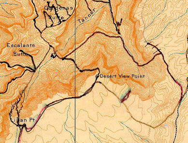
ravines in this bay looked like a As I headed up the exit ravine, I could see that it was going to take me all the way to the rim. But, it was very steep and rocky with poor footing. I topped out at 4:42 p.m. and was huffing and puffing - when there is no path to follow I tend to just head straight uphill! And, there was no path to follow. Nor were there any cairns I saw along the way. Even at the rim, where there wasn't much leeway in where one comes out, no cairn or other sign of this being the old route. I am reasonably sure I was in the correct spot, but may have to look into this some more. The map to the right is Harvey Butchart's map that is available from the Cline Library at Northern Arizona University. It shows the water pools (the "W") east of Escalante Butte and his route into the bay and out the east side, which is what I did. In his book, Harvey wrote, "All but the top hundred yards are gone. However, with careful route-finding, one can still follow the old trail." Well, maybe today, even the top hundred yards are also gone! As grinding of a haul as it was, I still had 1.5 liters of water when I reached the rim. Another source of info on this old trail can be found in Wayne Tomasi's Grand Canyon Hiking Adventures. He writes that there is a big cairn on the rim where the trail begins, which I did not see. Still, he warns that whatever you see as a trail, "probably only exists in your imagination." He did this loop three times, but always from east to west. I would say that climbing up from the bay is much preferred to picking your way down that steep route. |
|
|
||
 |
 |
 |
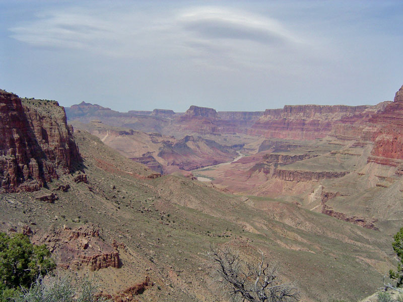
| Indian paintbrush. | The river came into view. | Another cairn to mark the route. |
|
|
||
 |
 |
 |
| Looking up the bay at Tanner. | Taking a break. | More flowers. |
|
|
||
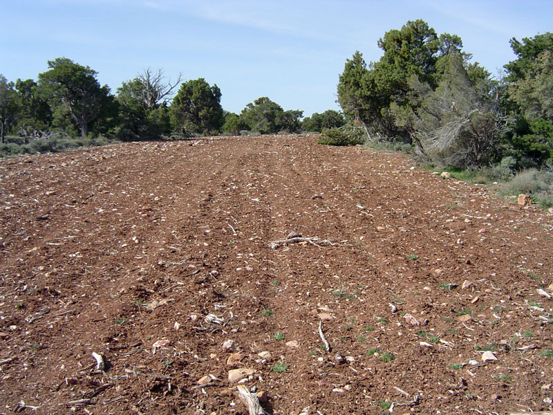
 Some exposed Supai layers in this bay resemble the pronounced Esplanade layer in the western portions of Grand Canyon. |
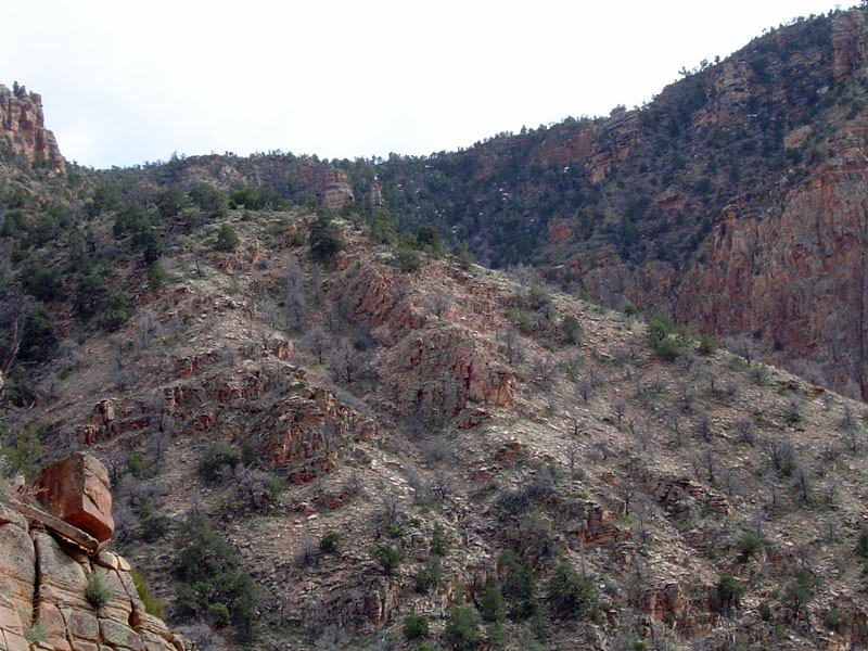 A possible exit up this slope? |
 Looking back on my exit. |
 A bunny tries to hide! |
 Least scenic view of the peaks ever! |
|
| I
followed the rim to the south and east until I met up with the road that
goes from Desert View to Cape Solitude. I didn't see any cairns
along the way. At the road, it appeared to me that there is
another break in the cliffs and that you could climb down to the bottom
of the bay. It only took me about fifteen minutes to reach the
road from where I popped out on the rim. From here it only took me
another fifteen minutes to reach my truck in the parking lot. I
didn't know exactly where I would come out here but the road dumped me
out in the general area and I was able to figure out how to get to the
parking lot. Along the way I passed the water treatment plant which is
tucked well out of sight from the tourists, but has a funny view of the
San Francisco Peaks through the chain link fence. Forty minutes
later, at 6:53 p.m. I was all set to drive back home.
|
|
|
||
|
|
Return to Hiking Grand Canyon home page |
|