|
|
|
Following
the
Old Grandview Saturday-Sunday, March 4-5, 2006 by Dennis Foster |
|
|
|
|
|
|
|
Following
the
Old Grandview Saturday-Sunday, March 4-5, 2006 by Dennis Foster |
|
|
|
|
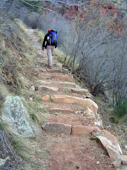
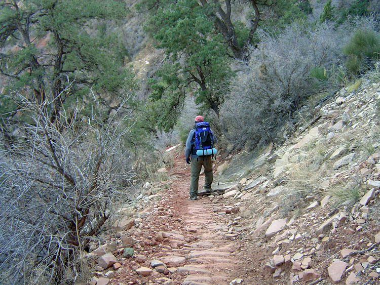
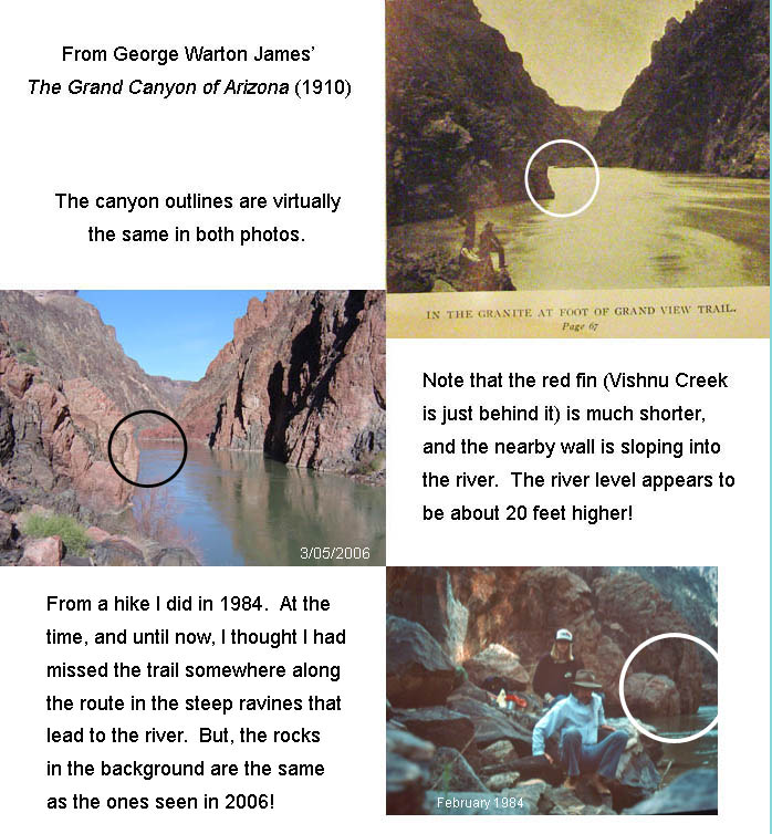
This is a hike I have wanted to do for many years. But, my interest was especially piqued by volume 6 of Burton Holmes' Travelogues, published in 1910, which I acquired from 5 Quail Books. About a third of the volume relates to the Grand Canyon and it is loaded with pictures. I found one that was titled, "At the foot of the Grand View Trail." Years ago, in Harvey Butchart's journals, I read of his attempt to find the old trail, leading off the Tonto Plateau and following it to the river. He remarked that there wasn't much room to wander about at the river, but that he was able to match the area up with photos from an old book. There is a photo in George Warton James' The Grand Canyon of Arizona (also 1910, and one of my all time favorites), and I thought that was the photo he used. But, that photo is dark and there is precious little detail to use in matching up that this is the right spot. Well, Holmes' photo is much better, and there is quite a lot in the foreground that one can use in discerning the exact location of this spot. As I realized that this was the photo that Butchart must have been using, I wanted to check this route out. Again. I had started down the so-called Old Grandview Trail in 1984. Halfway down the Vishnu Schist I was sure I had gotten off the trail, but I did make it to the river. Since then, I have been convinced that I missed the real trail, and I always wanted to go back and scout out this route again. So, with hiking buddy John Eastwood, we headed down the Grandview Trail early on Saturday morning, March 4. We were surprised, right away, by the extensive improvements that had been made to the upper section of the trail, in the Kaibab limestone. Apparently, a huge rockslide wiped out a big chunk of the upper trail. In fact, in one spot, the trail used to go between the cliff and a very large boulder - the latter is no longer there. What is really neat about the trail work is that it replicates the old look of the trail with lots of wood cribbing used to shore up the trail bed. You do still hang out over the edge a bit, but the trail is in better shape and wider as well. In fact, the work was so widespread, that the trail had been closed for many months, late last spring and into the summer.
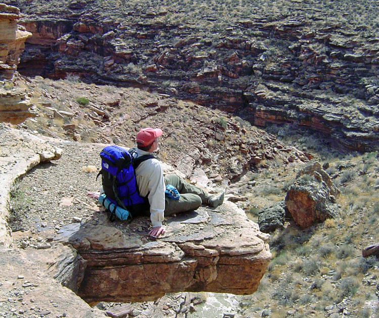
In a little over three and a half hours, John and I were lunching beside a small waterfall in Cottonwood Creek, off the west side of Horseshoe Mesa, where the Tonto Trail crosses. It was clear and the temperatures were pleasant. While here, we saw our second hiker of the day, so it was not crowded! While contouring along the Tonto Trail, I couldn't resist sitting out on a protruding rock, in the spirit of the Kolb brothers! |
|
|
||
|
The upper section of the Grandview Trail, in the Kaibab Limestone, has been heavily repaired with extensive cribbing. Here a rock slide began. |
Even in
the Supai layer, some of |
|
|
|
||
|
|
||
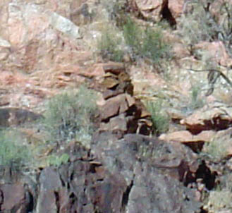
The old trail drops down through the Tapeats cliffs as the Tonto Trail rounds the bend from Cottonwood Canyon to Grapevine Canyon. It really does seem improbable, as we can look down the thousands of feet to the river from this area, and it is very steep. We did, in fact, miss the old trail junction, which is actually well-marked by a pile of rocks. We were just clueless about how that happened, since we had been here a few years ago, and knew about where the spot was located. Still, as we rounded the bend into Grapevine, we knew we had to backtrack to get to the old trail.
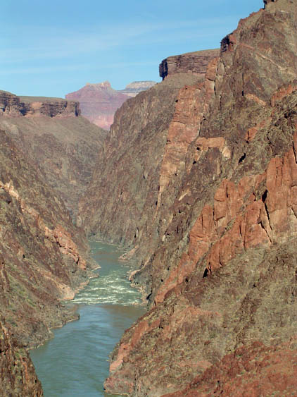
At the river, there were small sandy spots and lots of rocks. We really couldn't go very far in either direction - Harvey Butchart's 50 yard estimate seems about right to me. The river was a dark green color, which is a good sign when you are counting on that as a water source. When it is brown, filtering out the sediment can be excruciating. We reached the river at about 5:30 p.m. with just enough time to soak my tired feet in the water and for us to fix, and eat dinner. With darkness, we pulled out our space blanket mummy bags, which were just right for the early morning hours. |
|
|
||
|
|
|
|
|
John on saddle below Tapeats. |
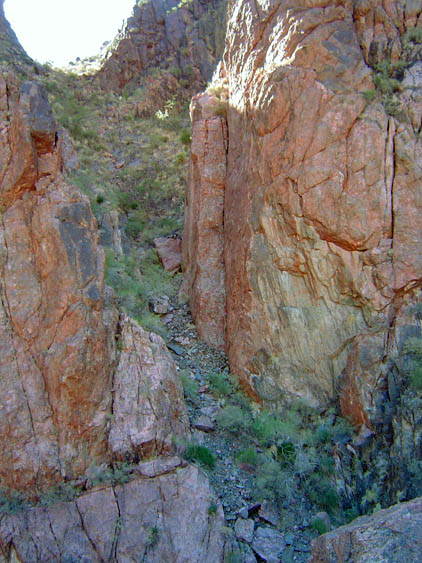
A descent ravine is part of old trail. |
Grapevine Rapids. |
|
|
||
|
In the morning, I played a joke on John. The previous evening, when he was retrieving water from a little sand bar island, I noticed I could hear him but not see him. So, this morning, when I was getting water, I grabbed a rock when I was on the little island. Out loud, I was commenting about how odd an angle it was to dip the bottles into the river. Then, I let out an “Eek!” and tossed the big rock into the river. John shot up from his spot and was frantic for a couple of seconds, and when I could see him, I just broke out laughing. Well, I just couldn’t resist.
Matching up the photo from James' book was much more difficult.
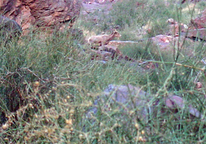
After some time, it seemed to us that we Then, when I got home, I got a real shocker. I looked up my picture from 1984 and found that I had been in the right spot all along. But, like in the old James picture, the river was very high when I was there, so there was no beach. But, the rocks in the background, from 1984, matched the rocks that we were next to on this trip. The photos, to the left, show the one from the James book and the shot I just took. Click on the image to see a larger version, along with my 1984 photo and some annotation pointing out the similarities. So, I had been here in 1984! I would never have believed it unless I had been able to match up these pictures. As we headed up the ravine, from the river, we met up with a young Bighorn Sheep. He led us up the route to the broad area below the Tapeats and, then, we lost sight of him. We had a fantastic view of the canyon at Grapevine Rapids, as the sun was shining on both sides of the river. It was clear and sunny all day, with some wind gusts from time to time. We lunched, again, at the small waterfall in Cottonwood before heading up to the top. Our total time, from trailhead to river, was 9:03 going down and 9:04 going up! The going up time includes longer rest breaks, while the going down time includes about an hour fumbling around looking for the old trailhead atop the Tapeats. Still, over many stretches of the trail, our hiking times were practically the same going up as going down. |
|
|
||
|
|
|
|
|
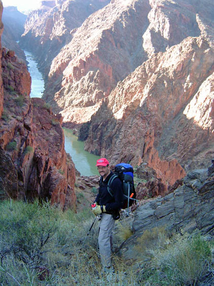
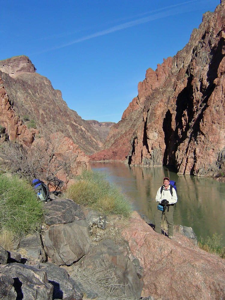
Dennis at foot of Grand View Trail. |
Shadow on sand bar at river's edge. |
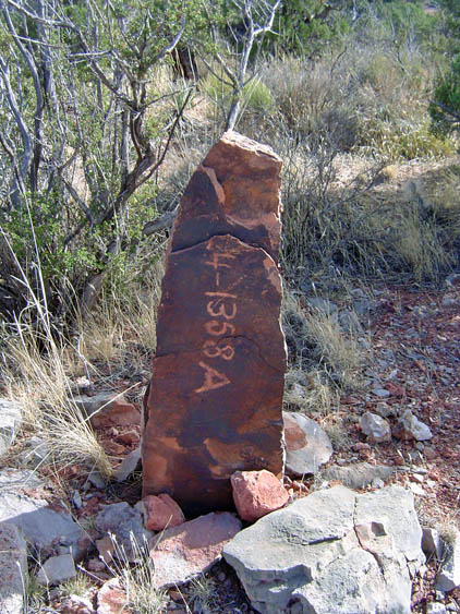
A marker on Horseshoe Mesa. |
|
|
||
|
|
Return to Hiking Grand Canyon home page |
|