|
|
|
Clear Creek Tuesday - Sunday; March 20 - 25, 2007 by Dennis Foster |
|
|
|
|
|
|
|
Clear Creek Tuesday - Sunday; March 20 - 25, 2007 by Dennis Foster |
|
|
|
|
|
An acquaintance of mine from the Coconino Astronomical Society, Bill
Ferris, was recently smitten by the Grand Canyon bug. Knowing
that I have a lot of experience hiking the canyon, he started asking me
about hikes to take. Last fall, we did a couple of day hikes - down
to Plateau Point (on the Bright Angel Trail) and a circumnavigation of
Cardenas Butte (on the Tanner Trail). This spring, Bill got a permit for Clear
Creek and graciously invited me along. The trip was planned for six
days and five nights - the first, and last, at the Bright Angel
Campground, and the middle three in Clear Creek. Of course, I jumped
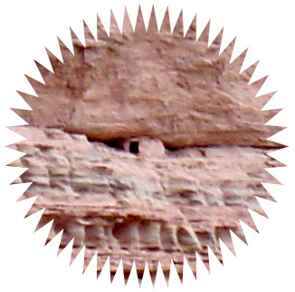
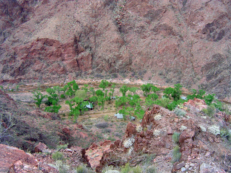
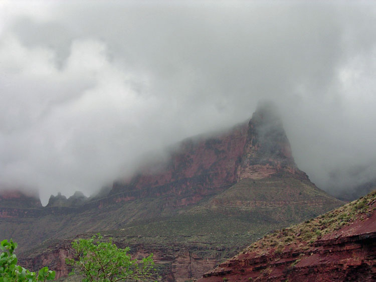
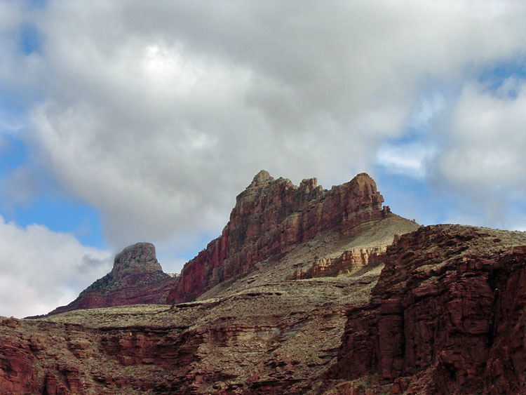
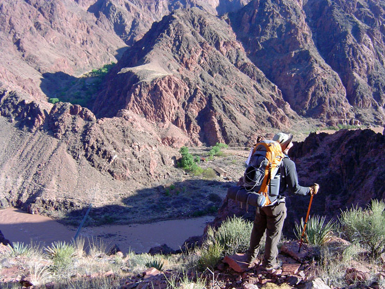
at the chance to spend this nice, big, chunk of time in the canyon. We had hoped to get some meal reservations at Phantom Ranch, but the dinners were sold out. Still, since we decided to go down the Bright Angel Trail, we stopped by the lodge to check, once more, on these meals - no luck for us! We headed down the trail at about 11 a.m., which is rather late in the day. But, the weather was quite nice, although a bit on the cool side, even down at the river. We lunched at Indian Garden and, then, headed east on the Tonto trail. I took Bill down the old section of trail, where the phone line can be seen. This stretch, down into the Pipe Creek drainage, reached the current trail at the point of the original "Devil's Corkscrew." The route is in good shape, and you can still see a great deal of the trail construction through here. Along the way, we passed by some ruins, including a granary, wedged into a ledge, shown in the photo to the right. [Click on any photo to see a larger image.] We reached the Colorado River, at Pipe Creek Rapids, by 4:30 p.m., where I took an extended break. I was quite worn out. The dark clouds over Zoroaster were a nice backdrop when the sun would poke through and light up that butte. The trail hadn't been especially crowded all day, and I didn't see anyone while here at the rapids, so it was all rather "otherworldly." I reached the campground by 6 p.m. and was ready to call it a day. Bill cooked, and, afterwards, we went up to Phantom Ranch, to have some hot cocoa, and write post cards, in the canteen - quite relaxing. Shortly after turning in for the night, it started to rain - we would get some on every day of this trip! I ended up covering my pack with my poncho just before midnight, when the rain was especially fierce, if brief. |
|
|
|
|
|
|
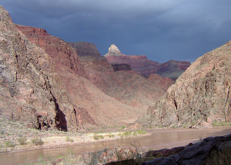 Zoroaster catches a bit of sunshine. |
||
|
|
||
|
|
|
|
|
|
|
|
|
|
||
|
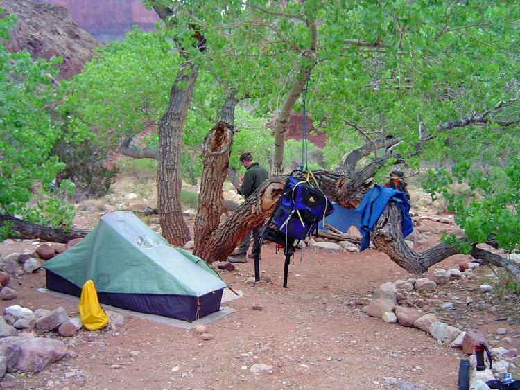
Despite the rain, I
slept well. I was using my REI Roadster tent for the first time,
and found it be quite a nice setup. I was plagued by a faulty Thermarest
- aargh! I couldn't tell where it was leaking from, but
it hardly would hold the air in for more than 15-20 minutes. I
always bring along a piece of blue foam pad, to sit on during the day,
and I used that to alleviate this a bit.
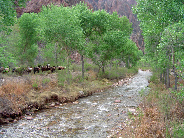
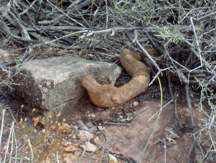
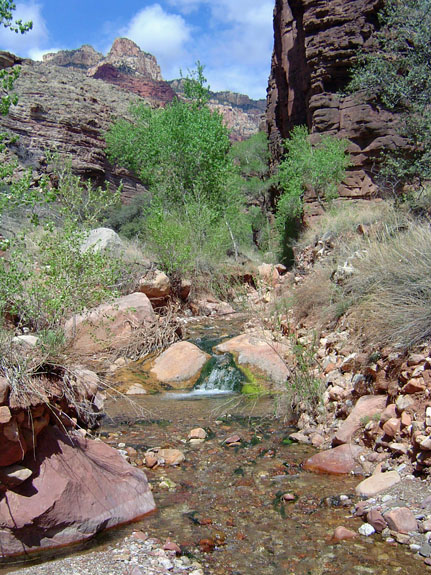
It was almost 10 a.m. by the time we were headed out of camp on Wednesday. We weren't especially pressed to reach Clear Creek before dark, and the additional time spent getting ready was worth it. It was a pleasant, and long, day over to Clear Creek. We did happen by a rattlesnake, shortly after lunch. Bill was in the lead, and the unmistakable rattle shook us out of our hiking reverie. The snake was about two feet off the trail, and not in a very good position to strike. Still, we were somewhat more alert for the rest of the day! We did see one couple, heading back to Bright Angel, having done a day hike to Clear Creek! We pulled into Clear Creek at 5 p.m. and chatted with two guys that were camped by the water - John and Brian, both from Ohio, had been there for a couple of days and were headed out the next morning. After setting up camp and having dinner, we sat around their campsite swapping stories for a while. Although the night sky started out clear, we did have some rain in the early morning hours. On Thursday, we
decided to head up the canyon, and check out some ruins and a route to a
cool cave. We thought it would be an easy day, but we were racing
to get back before dark. There are some ruins a short distance
upstream, where the wet arm of the canyon, which is coming from the
direction of Ariel Point, meets up with the main arm of the canyon,
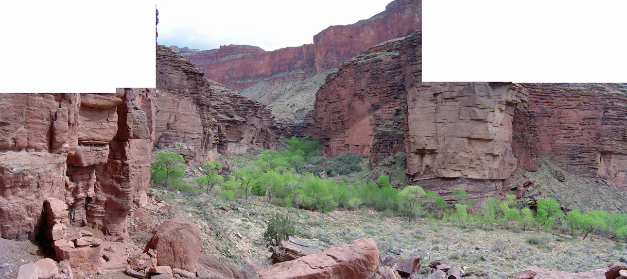
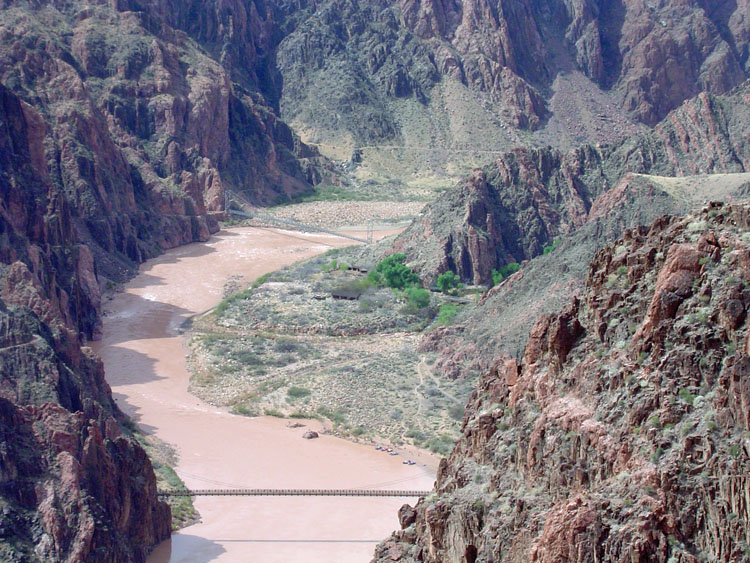
which leads to Chevaya Falls. [See the panorama photo at the top
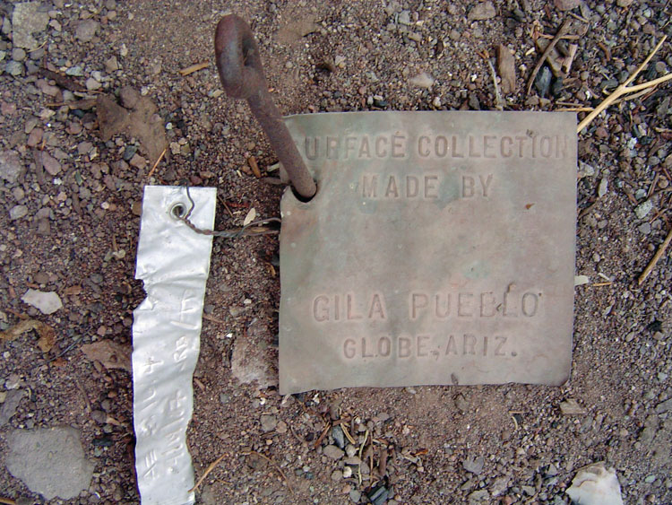
of the page for a view of this area.] The ruins, which are
casually referred to as the "Gila Pueblo" are strung out along
the base of a cliff, barely rounding the corner into the wet arm of
Clear Creek. There are a number of room outlines and few small
structures that are still in good shape. There is a register
there, and we read through a number of entries, and added our own.
Quite a few people noted that the canyon had changed quite a bit over
the years, and I had the same impression. When I first visited
Clear Creek, back in the late 1970s, or early 1980s, I remember that the
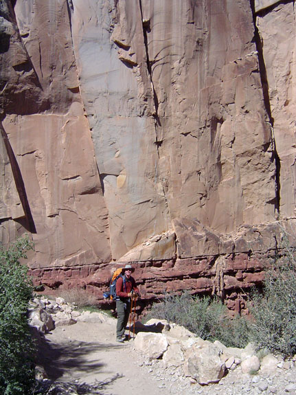
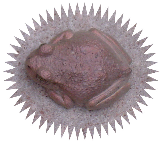
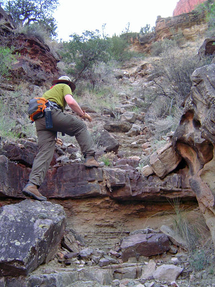
bed was choked with giant white slabs of From here, the canyon is much narrower, and what trails exist are scanty. We often crossed back and forth over the water. At one spot, I nearly stepped on a toad - it really blended in well with the rocks. We reached a junction, with most the water coming from the north, but a trickle coming from the west. We stopped to look around, and we could see the cave that is mentioned in Harvey Butchart's book. A split-twig figurine was found here, back in the 1930s, which dates the site to many thousands of years old. We tried to climb up to the cave, but there are two cliffs to scale, and, as best we could tell, some difficultly actually getting to the cave from the final ledge. We stopped at the first climb, and took a couple of photos. We also had a good view of the spring that feeds most of the creek. It was up the canyon a short distance, on a talus slope below the Redwall. It was after 5 p.m. when we were back at the creek bed, and ready to return to our camp. We made good time, but we had to pass up the chance to check out a couple of granaries that we spotted on the south side of the Obi Canyon drainage. So it goes. Once back in camp, we had a chance to take a quick shower - we had set out a water bag for that purpose, and it was not too bad. After dark, a big party of nine came into Clear Creek, and camped about 100 yards downstream from us. |
||
|
|
||
|
|
|
|
|
|
||
|
|
|
|
|
|
||
|
|
|
|
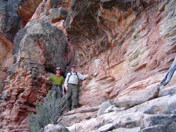 The end of our climb to the cave. |
||
|
|
||
|
We had planned on
hiking down to the river on Friday, thinking that it would be a rather
grueling day, and we should have recovered well enough from the days
spent hiking with our packs. But, we got a lot of rain the
previous night, and it continued, on and off, all morning. I took
a brief walk up the short spur canyon, where the trail is located, and
reached an impressive fall. Although it was still sprinkling,
there was no waterfall here, but I'll bet that during the monsoons, it
is quite a sight.
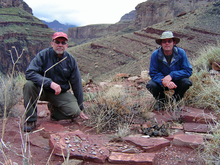
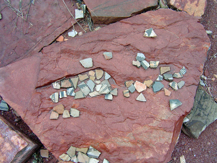
In the early afternoon, Bill headed out to explore and came across some old ruins. Lucky for me, he had to return to get his camera, so I was able to return with him to see this site. Lots of pottery shards here, which indicates that it is not often visited. In fact, it looked like many displays had been arranged by past hikers (which the park service frowns on, but, then, they frown on a lot), and that these had been slowly washing away by the rains. I took the liberty of calling this site, "Billopolis" in honor of its (most recent) discoverer. The rain paused for most of the afternoon, and into the early evening, but did return later that night. |
||
|
|
||
|
|
|
|
|
|
|
|
|
|
||
|
|
|
|
|
|
||
|
On Saturday, we
awoke to partly cloudy skies, which kept us nice and cool most of the
day. We did have to pack up some our gear without getting a chance
to completely dry it out. By 8:30 a.m. we are ready to leave our
campsite, and head back to Phantom Ranch. We made such good time
on the trail, that we decided to defer lunch until we reached the
campground. We passed through Phantom Ranch at 1:30, and made
another check on dinners - no go, but we did decide to sign up for
Sunday breakfast, so we were looking forward to that.
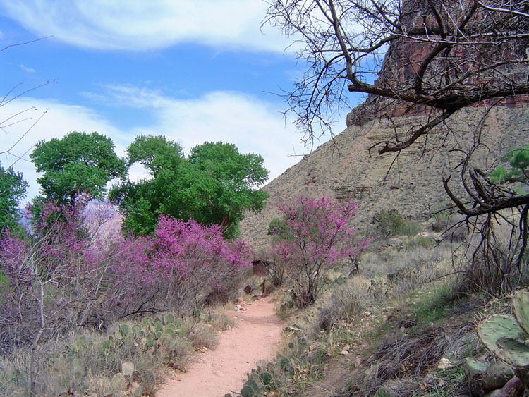
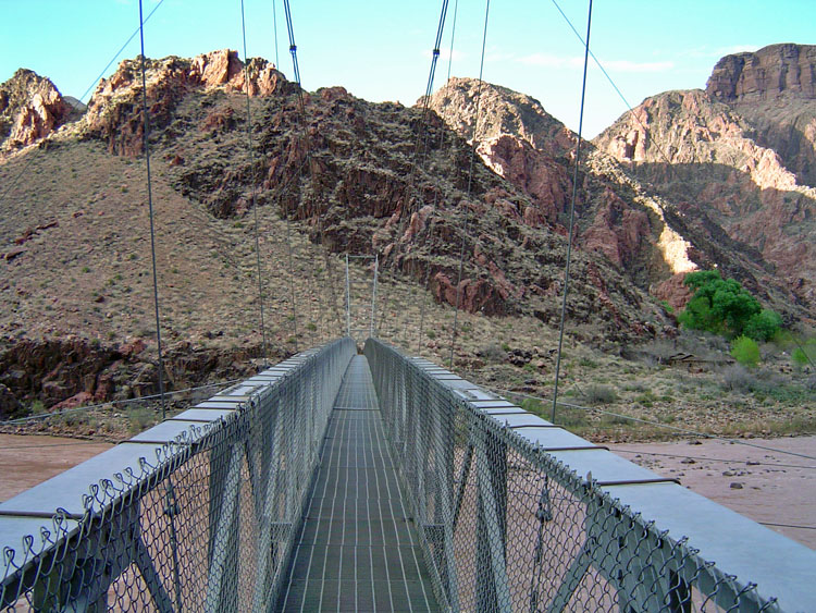
We picked a site on the creekside so that we could soak our feet for a while. That was nice. It was a pleasant, and relaxing, afternoon. We even returned to the canteen for a beer, just before they closed down for their dinner service. We got up just before 5 a.m. on Sunday morning, in order to make the 5:30 breakfast. The bacon, eggs, pancakes, juice and coffee really hit the spot! By 7:30 a.m. we were on our way. Our hike out was planned to be a mini-adventure. I took Bill up the "Old Miner's Route," which leaves just past the silver bridge, and climbs to the Tonto plateau just a quarter mile, or so, from the South Kaibab Trail. There are fabulous views along this steep and rocky route. We reached the Tonto Trail by 10:30 a.m. and were on the rim at just past 2 p.m. |
||
|
|
||
|
|
|
|
|
|
||
|
See Bill Ferris' site, GCAdventure.com for more on this trip. |
||
|
|
||
|
|
Return to Hiking Grand Canyon home page |
|