|
|
|
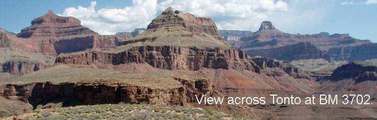
BM 3702 - West of Plateau Point Thursday, May 17, 2007 by Dennis Foster |
|
|
|
|
|
|
|
BM 3702 - West of Plateau Point Thursday, May 17, 2007 by Dennis Foster |
|
|
|
|
|
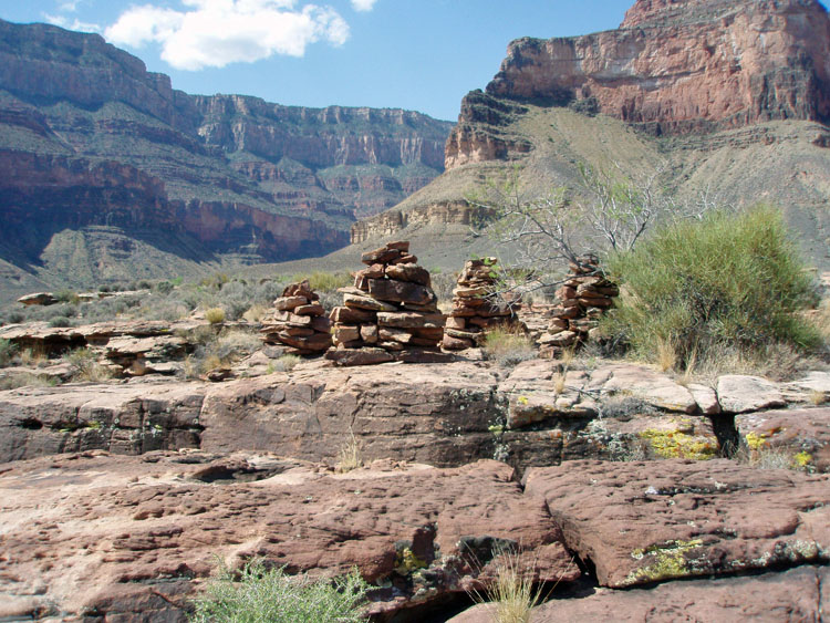
My hiking buddy, Bill Ferris, was taking a cool four day trip, down the Hermit Trail and over to the Bright Angel. Well, not all that cool - even though it is just past mid-May, canyon temps are rising to near triple digits! I was out of town during the front end of his trip, but had the chance to hook up with him on his last day, hiking out from Indian Garden. He would be camped a few miles west of there. So, I thought it would be a nice day hike for me, either nine miles, round trip, from the rim to Indian Garden, or, if I went out to Plateau Point, twelve miles. But, on the Yahoo Users Group, a question came up about the big rock cairn out in the Elves Chasm area. I had seen that cairn in 1981, and it is quite special - some three to four feet tall, and very well rounded, appearing very much like a cylinder (as opposed to a cone). I got a good photo of it, with Apache Point in the background. So, what does it mark? I don't know, and that was the question posed at the Yahoo group. But, it did start me thinking about cairns I've seen around the canyon - e.g., a big one west of Asbestos Canyon, and one marking a trail through the Tapeats northeast of Horseshoe Mesa stood out in my mind. There are also many other smaller ones, that took some time and energy to put together. I tried to find some photos of these cairns, and one of the spots I was hunting up is marked as "BM 3702" along the rim of the Tonto Plateau, just a bit west of Plateau Point. I had been to this benchmark site once, and remembered that it consisted of a few large rock cairns. But, I could not find any photos; at least, not right away, since I am sure there must be some I took back then. There is a neat ravine just west of this site, that allows passage through the Tapeats cliffs. I have used that five times - twice just to do it (there are names carved in an overhang), once as an exit from Horn Creek (contouring below the Tapeats all the way) and twice as a loop back to the Bright Angel (once, down to the river and over to the rest house, and the other time, staying below the Tapeats all the way to Garden Creek). Well, hiking down to meet up with Bill would provide me an opportunity to revisit these cairns and get some good pictures - at least, digital ones! So, by 7:20 a.m., I was on the Bright Angel Trail, heading down just a bit ahead of the mules. As I passed the corral, the head wrangler was orienting the riders about their trip. One of his comments, I caught in passing, I just had to write down: "The mules walk where they need to walk. They will never be as close to the edge as you will tell your friends they were." |
|
|
||
|
Click on any picture to see a larger image. |
||
|
|
||
A view of the Coconino from near the tunnel. Brahma and Zoroaster are the two faint background buttes. |
 Plateau Point and Indian Garden. |

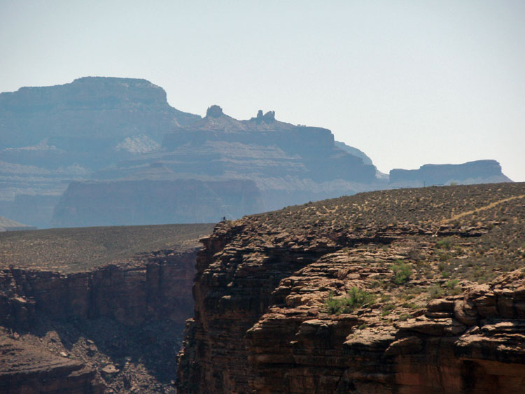
A self portrait just below the Tonto rim at BM 3702. Horn Creek Rapids just barely seen in the background. |
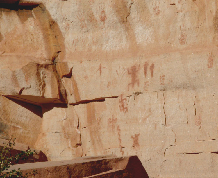 Pictographs at 2 Mile "corner." |
||
|
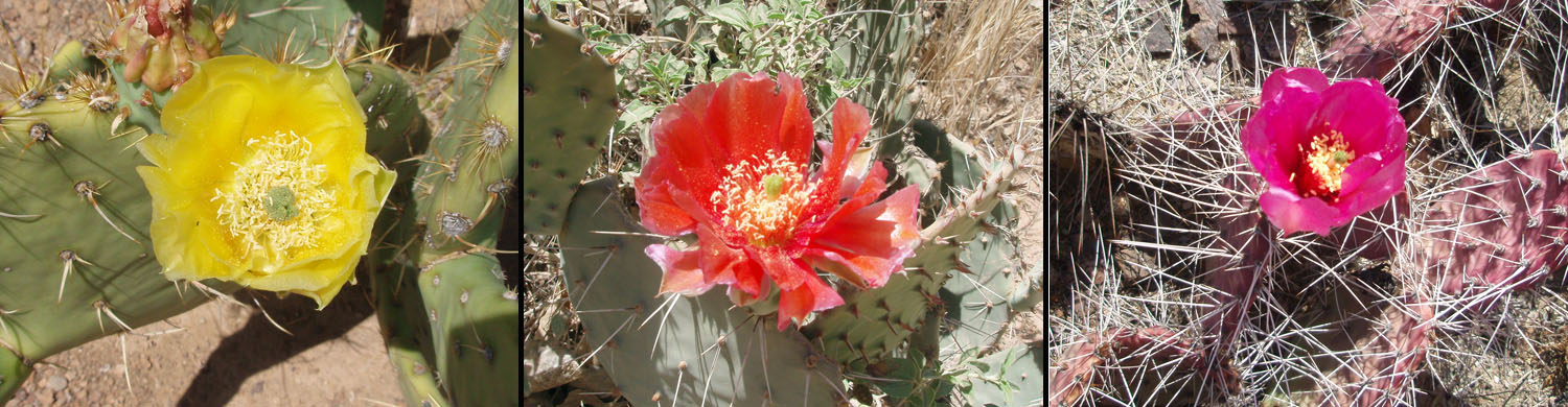
I made great time down the trail, and felt very fit. I made it past the 3 mile house in one hour. I met up with Bill about ten minutes away from Indian Garden. He was feeling the heat and was anxious to hike in the relatively cool time of the day. We stopped for a bit, in the shade of some bushes, and I told him I had a special treat for him. I pulled out a small, soft sided cooler, where I had put a couple of pounds of dry ice, two sodas and four single serve ice creams. Well, he was quite appreciative of this "cool" treat. The ice cream was still frozen and the sodas were icy cold (and becoming frozen!). It was my first experiment with dry ice, and it will figure into my future trips, I am sure. After about 20 minutes, we parted ways, since I still wanted to see the cairns at BM 3702. We thought that we'd still meet up on the rim, and, that turned out to be, as I topped out just as he was finishing up an ice cream cone outside the Bright Angel Lodge. [Read about Bill's trip at his site - Grand Canyon Adventure]
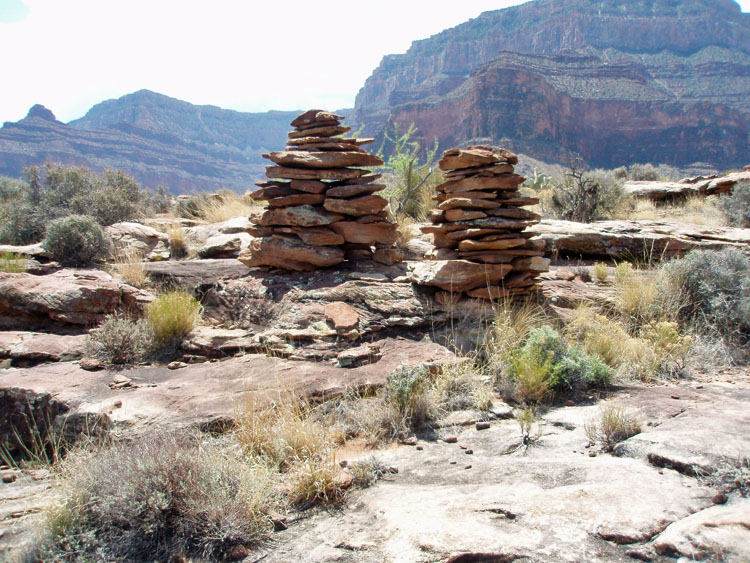
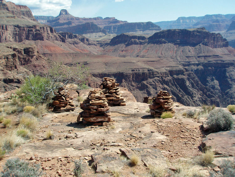
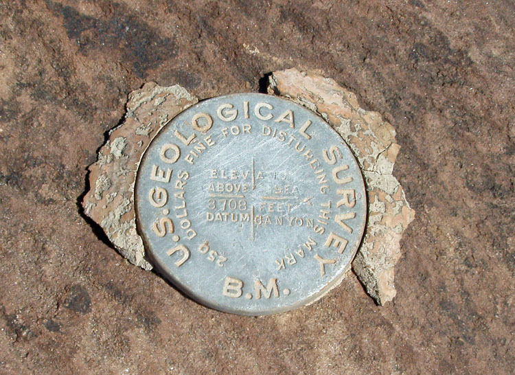
It only took about ten minutes of walking across the plateau to reach the rim. The cairns are not visible until you are almost there, as the rim drops down a few feet from the plateau. And, there they were - four of them. Not as imposing as the one at Elves Chasm, but quite distinctive nonetheless. I found a marker, which is what you'd expect for a benchmark site, but I don't recall seeing it on my previous visit, back in the late 1970s/early 1980s. And, the marker shows the elevation as 3708 feet, a few feet higher than the 3702 designation on the big park topo map. I haven't taken a look at the newer quad maps to see if this elevation notation has been changed. |
|
|
||
 |
 |
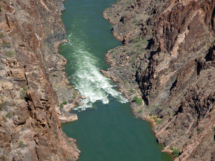 |
| Four cairns mark BM 3702. | The later marker - elevation is 3708? | Horn Creek Rapids. |
|
From the four cairns, one has a terrific view of the river, and the
canyon. It is comparable to Plateau Point, of course, since
it is not too far away. I got a photo (to the left) of a few
people standing at the railing there. My favorite
I dug into my dry ice cooler, and had a partially frozen can of
soda. I had to leave it out for about ten minutes before I could
drink it! After my sandwich, I had another ice cream - way too
decadent! For the record,
skip the Ben & Jerry's - they are smaller and messy. The
Haagen-Dazs and Breyers were better sealed and more substantial.
With only one ice cream left in the cooler bag (along with the dry ice,
which was holding up well), I decided to fill up my liter bottle and put
it in the bag. That turned out to be fantastic! I After lunch, I spotted two more cairns, about 20 yards west of the other four (shown to the left). There didn't seem to be anything in particular that they were marking. Also, nearby is an NPS marker, not unlike the USGS marker, but with only cryptic information, at least to me - "LPL 1 84" which may mean it was placed in 1984, but, otherwise, I am clueless. I wrapped up my lunch break and was hiking back by 11:00 a.m. As I wandered back to the Tonto Trail, I found a faint trail headed out to this site, from the southeast. I couldn't follow it back to the Tonto, but it probably was the main trail many, many years ago. I only stopped at Indian Garden for six minutes (yes, I keep a record), to drink some water, and finish some trail notes. I hiked up past the 3 mile house, and didn't stop until the 1.5 mile house, where I spent twenty minutes. I topped out on the rim at 2:17 p.m. At the rim, I had the last ice cream from my cooler. It was cold, but soupy - I think the warm-ish water I put in (at my lunch spot, and a quarter liter at the 1.5 mile house) disturbed the cold equilibrium enough to cause this. [The next morning, the dry ice was gone, although my quarter liter was icy and, indeed, still partly frozen!] I hooked up with Bill on the rim and we visited the Kolb Studio Art Exhibit, which is currently featuring historic post cards, stamps and other Grand Canyon postal history, before heading home.
|
|
|
||
|
|
Return to Hiking Grand Canyon home page |
|