 |
|
|
Kanab
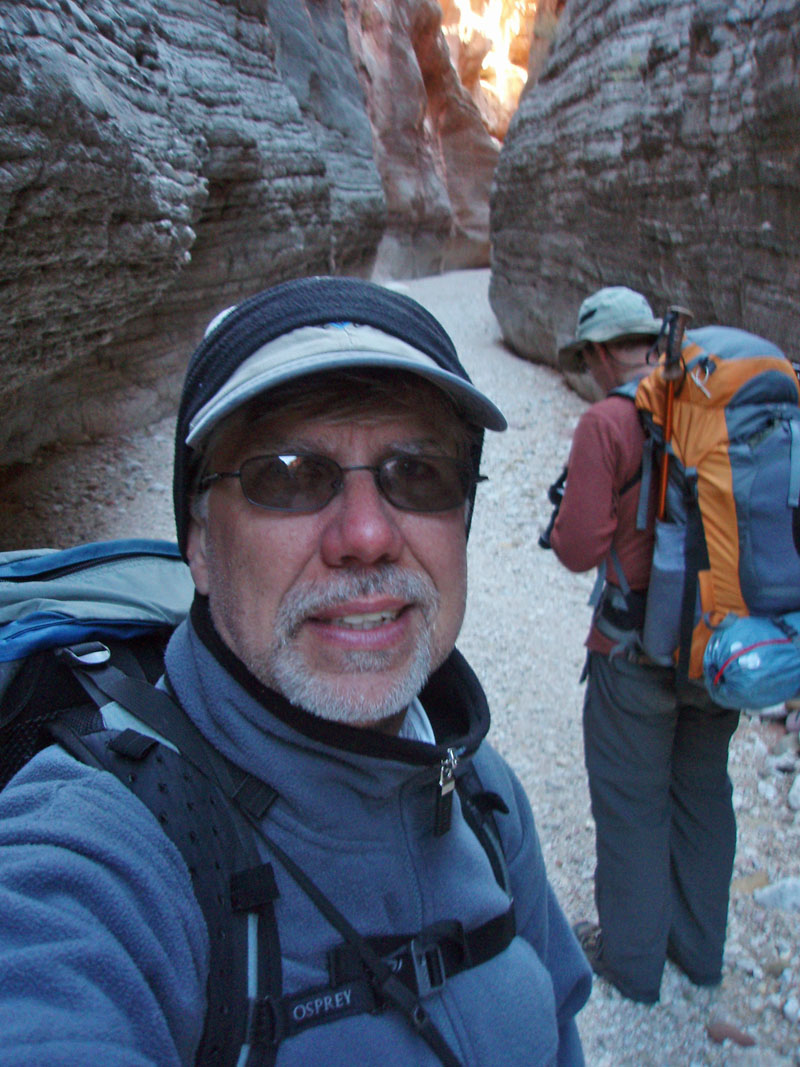
Creek Loop: Saturday-Tuesday, December 27-30, 2008 by Dennis Foster |
|
|
|
|
|
|
|
Kanab
Creek Loop: Saturday-Tuesday, December 27-30, 2008 by Dennis Foster |
|
|
|
|
|
|
|
Hiking in the winter in Grand Canyon presents some obstacles, but also
some opportunities. We often go all the way to January before
getting any significant snowfall, meaning that you can access trails
that are impossible to get to later in the spring. But, invariably
it will be cold and with short days, you spend long restless nights in
your sleeping bag. Still, this can be a chance to hike in places
that are way too hot during even the shoulder season. So, I made
plans to hike around Fishtail Mesa for the very last days of December of
2008. Joining me would be Bill Ferris, who has developed an avid
interest in backpacking the canyon over the past couple of years.
Bill also writes up trip reports on these hikes and you can read his here.
[Indeed, I have to look at his site to see photos of me and he has to
look at my site to see photos of him! Maybe we should do some
photo swapping?]
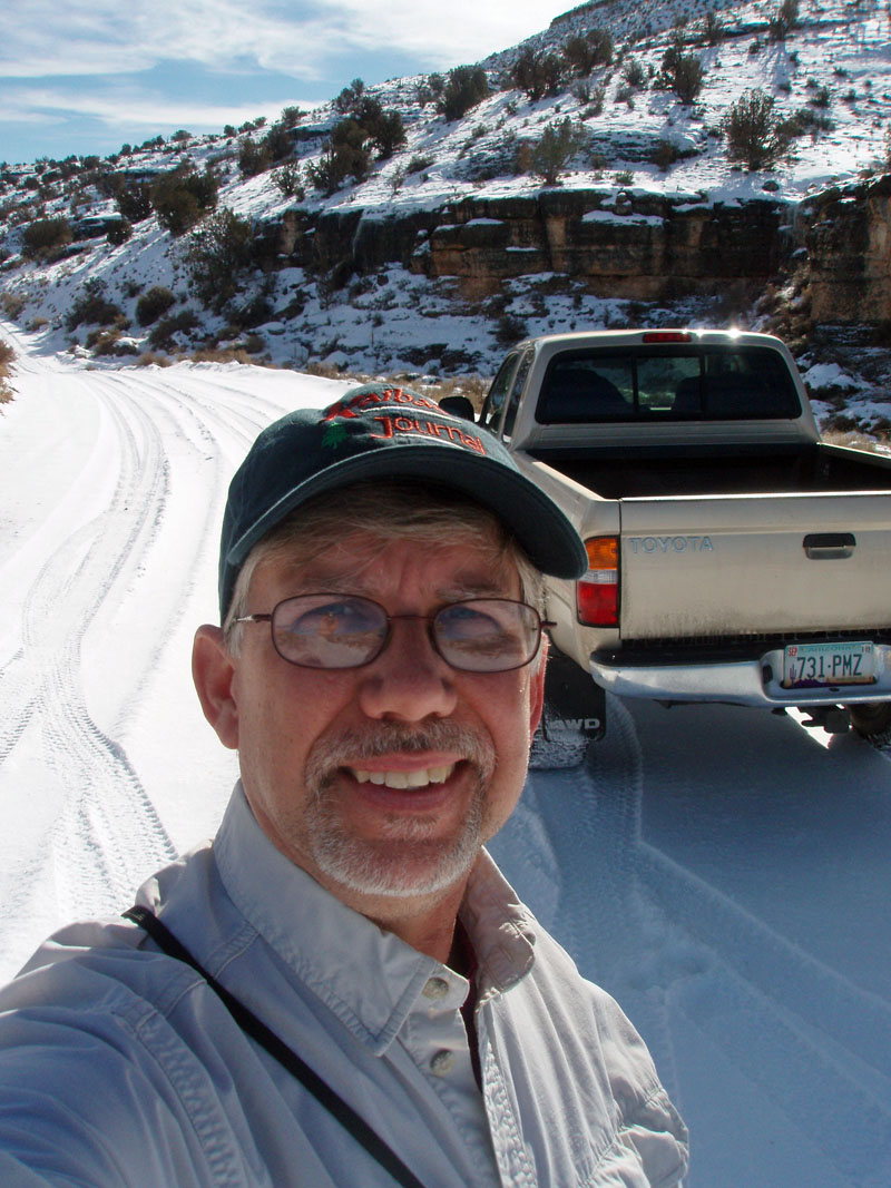
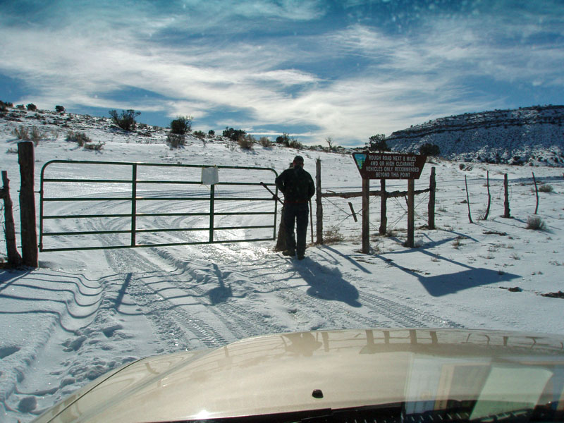
Given that permits are sought after months in advance of a hike, you never can plan for perfect weather. And so it went for this hike. We got loads of snow in the late fall, and it covered relatively low elevations. It was quite a sight to see snow dusting the top third of the Vermilion Cliffs as we drove across the edge of the Navajo Reservation and across the bridge at Lee's Ferry, which is just a tad over 3500 feet in elevation! Not a good sign seeing as how we are planning on accessing roads on the North Rim that run up to and over 8000 feet!! But, a wondrous sight to behold, nonetheless. At Jacob Lake, the parking lot was plowed and we were quite sure that "Plan A" was going to be a moot point. But, we wanted to be absolutely sure. The itinerary was to park just past the Indian Hollow Campground, on the north rim of the Grand Canyon. During the summer, you can start your way there by catching a road only a quarter mile away from Jacob Lake. But, there is a "winter" access road, which comes out of Fredonia (FR22), which can get you into this section of the park when these higher roads are snowpacked. For more on this, see my Winter Access to North Rim report. Well, as we expected, even the "winter access" would be impassible. We didn't even get to elevations where the pines grow before being stopped by the snowy conditions. So, we turned to Plan B - a trip in the Kanab Creek Wilderness Area (which doesn't require a permit), via Hack Canyon, whose trailhead access is at about 3800 feet in elevation. The highest point along the road getting there would be at about 5000 feet and that turned out to be just barely workable. Good thing, as there was no Plan C. |
|
|
||
|
|
||
|
|
||
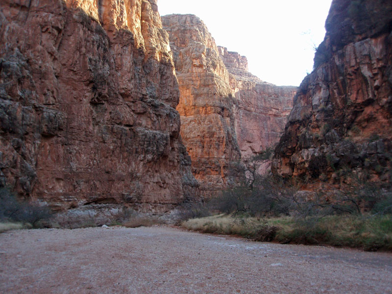
| Day
1 - Down Hack Canyon (Saturday, December 27): To
access this trailhead, you drive west of Fredonia and catch the Mt.
Trumbull road, which goes all the way to Toroweap (or, Tuweep).
This gravel road is usually in excellent condition. For this trip,
we were mostly driving on a thin snowpack. There is a turnoff at
21 miles that takes you down into Hack on a more primitive road.
The going was slower, but the snow was slowly disappearing as we
descended to the bottom of this canyon. The final few miles (of
the eight total miles from the gate) were snow-free and, not
surprisingly, we found that we were the only ones here. Well,
besides the grazing cows.
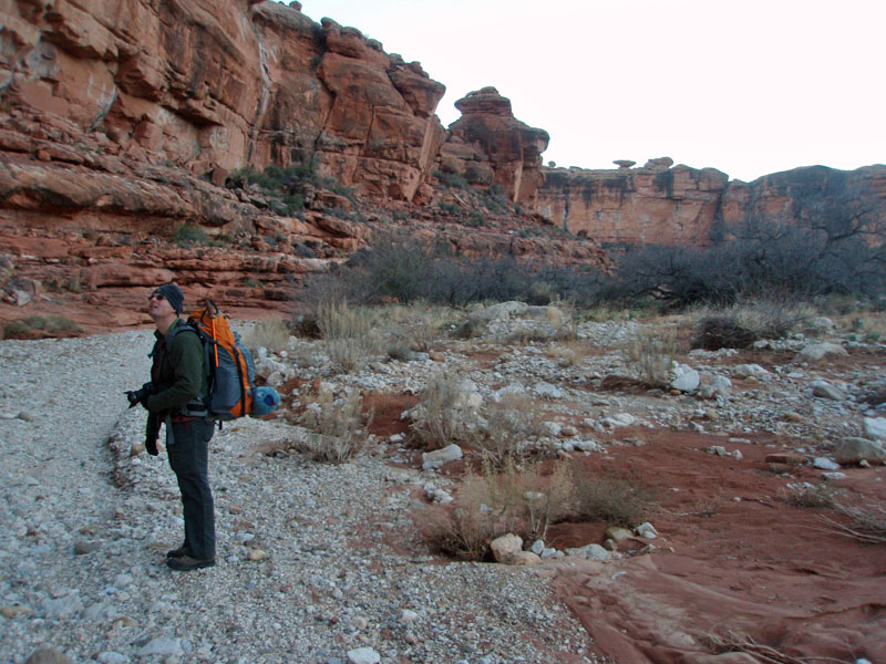
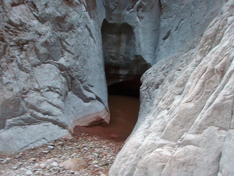
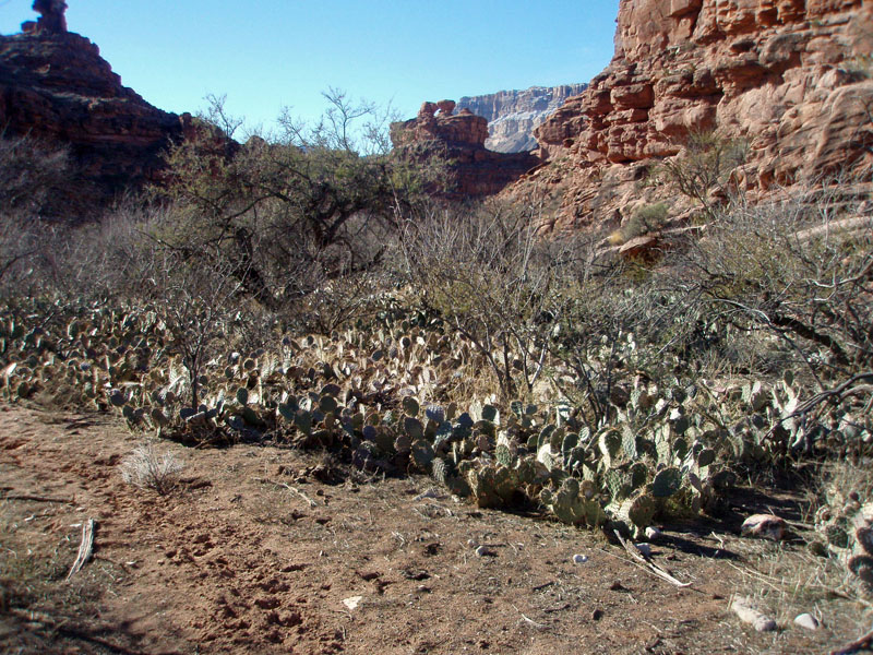
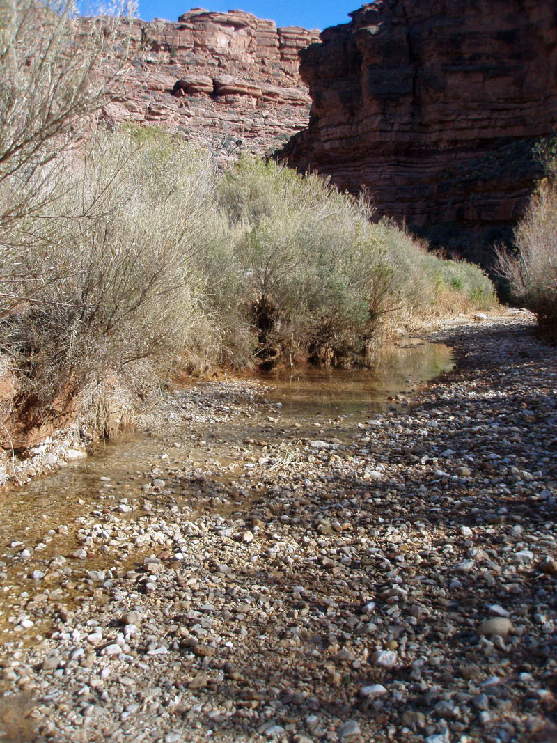
We had left Flagstaff at 7:00 a.m. and even with our ten mile detour on FR22, we were at the Hack Canyon trailhead at 1:00 p.m. One hour later we were on our way down the wide bed of this canyon. But, not for long. While we had spent six hours on the drive, we really didn't cover any of the logistics of the actual hike until we were on the trail. I was running through a list of things, and to my comment, "OK, you have the stove," Bill reacted by stopping and gazing up into the air. "Oh, crap," I think were his exact words. We had worked out a sharing arrangement insofar as dinners, the stove, fuel, a pot and the water filter goes. Sometimes it isn't worth the trouble and everyone just packs what they need. But, there are savings when working out shared common items. Bill was going to bring the stove, but I was going to bring the pot. Well, he keeps his stove in his pot and so when he left his pot behind, he ended up leaving his stove behind as well! That's what happens to us creatures of habit. If we had known that earlier, we could have bought a new one at Marble Canyon, or in Fredonia. But, we didn't have to. I packed up my stove, the "pocket rocket" in the truck just in case we wanted something hot to drink at the end of our hike and didn't want to drag his out of his pack. So, we turned around, hiked back to the truck and grabbed this stove. Lucky for us, we hadn't gone far, so it didn't set us back at all, and given that it all worked out, it was worth our chuckling over the situation later. The temps were cool, but the air was still. Hiking in the sun generated enough heat for us to take off jackets, but they went back on once we reached narrower parts of this canyon and were hiking in the shade. It was quite a contrast with my previous visit here, in May of 2003, when Cara Lynn and I were car camping with two of our dogs and doing lots of day hikes. Then, we camped on the rim to the north and followed a trail down into Hack and almost hiked all the way to Kanab before returning. It was brutally hot that day and we spent a couple of hours hunched down into a low overhang and later ran out of water before reaching our first cache. At 5:00 p.m. we found a great spot to camp. We hadn't reached Kanab Creek yet, but it turned out to be only about ten minutes away. We made a fire (another thing you can do in the wilderness area!) that kept the cold at bay for a couple of hours. By 8:00 p.m. we had both turned in for long, cold night. |
|
|
||
 Cold, still air held these contrails. |
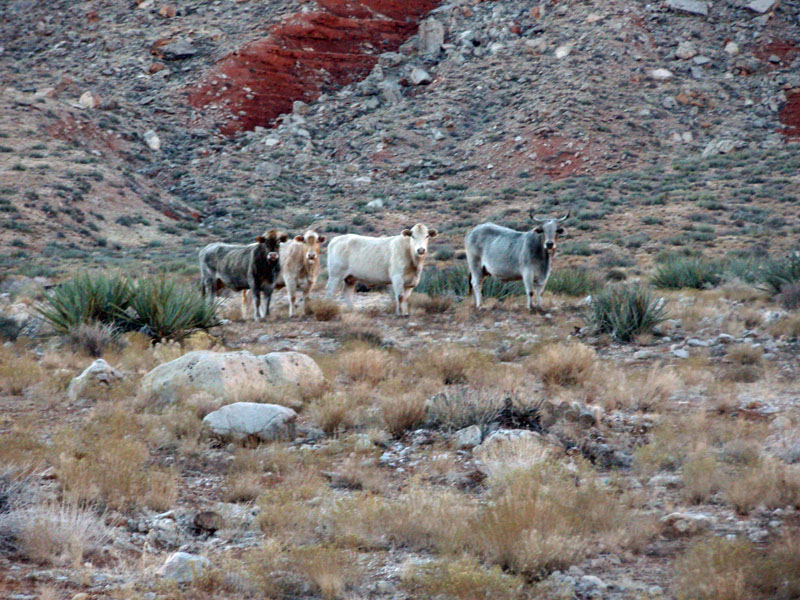
 Yeah, there are cows here. |
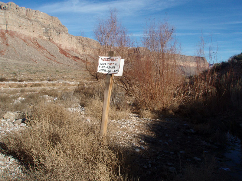
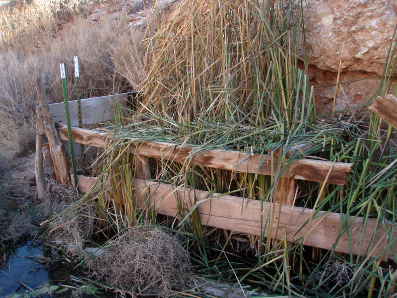 Willow Spring near trailhead. |
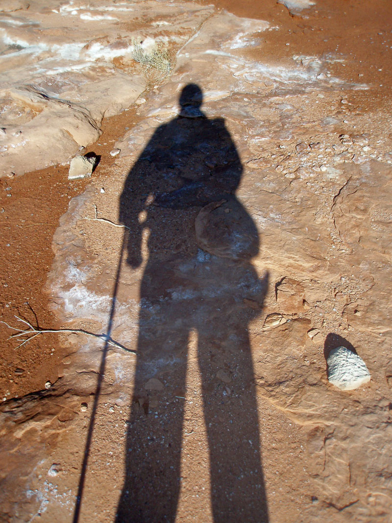
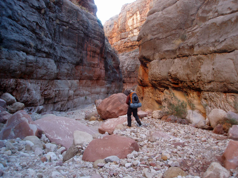
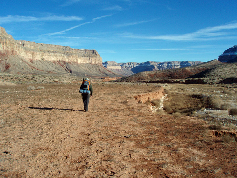 At the start of our hike. |
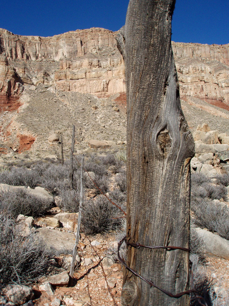
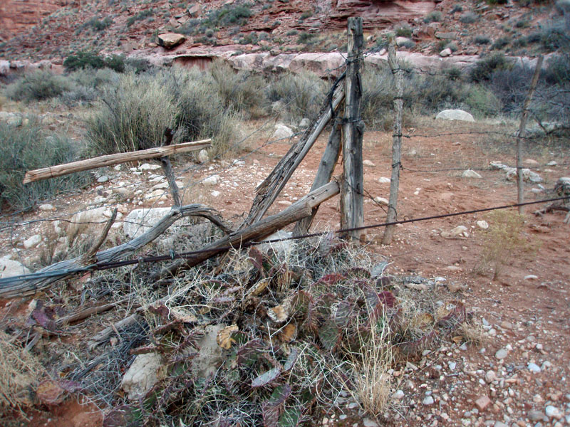 Periodic fencing to control cows. |
 Hack canyon. |
 |
 |
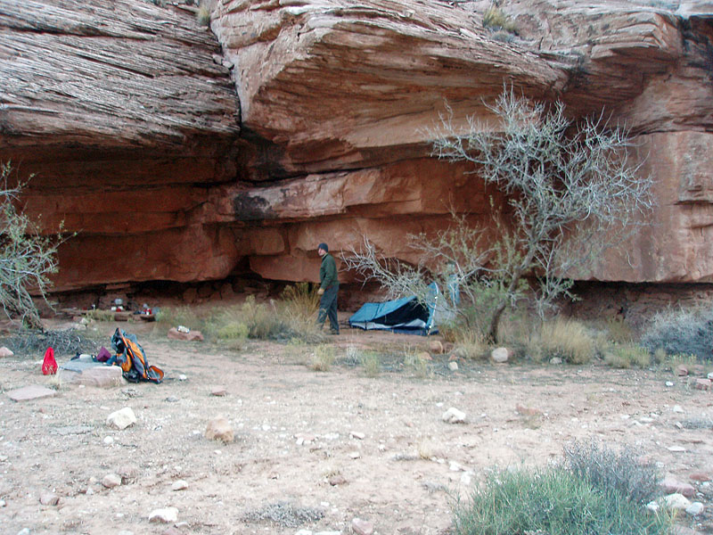 |
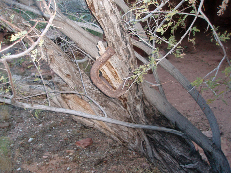
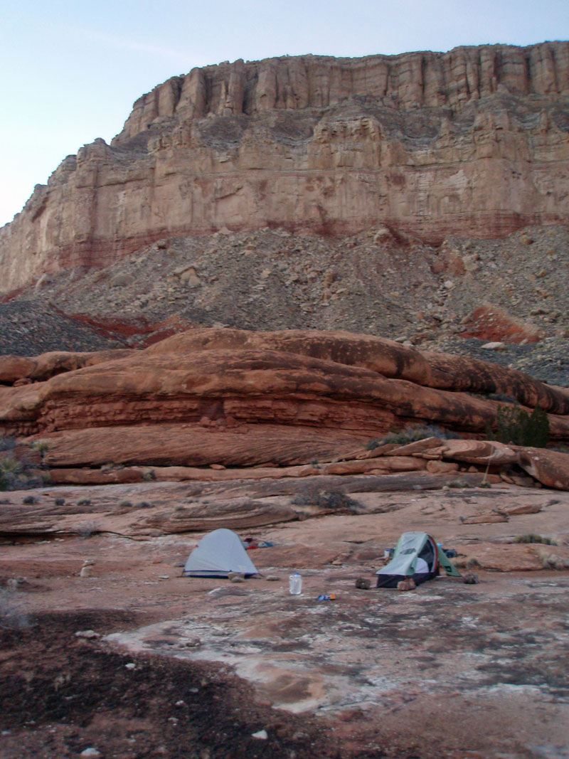
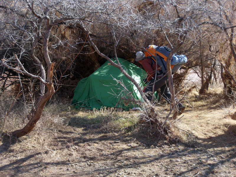
| Campsite - my side. | Lucky horseshoe? | Campsite - Bill's side. |
Day
2 - On the Esplanade (Sunday, December 28): As
expected, it was a cold night. To help in that regard, in addition
to my down sleeping bag and one man tent (which holds the warmth better
than a bigger tent), I had a space blanket
and a thin poly/fleece blanket (which I think I snagged from a airline
trip somewhere). That combination worked
well - of course I was also fully clothed in poly long  johns,
socks and headwear. I had to get up at 5:30 am, but was soon back
in my bag and not up for good until 7:30 am. My pocket thermometer
recorded a low of 27° overnight. Brrr. johns,
socks and headwear. I had to get up at 5:30 am, but was soon back
in my bag and not up for good until 7:30 am. My pocket thermometer
recorded a low of 27° overnight. Brrr.
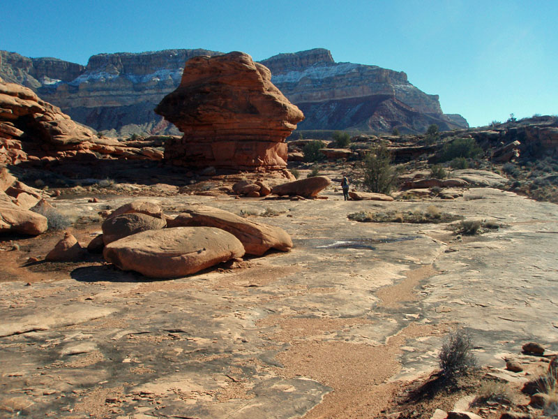
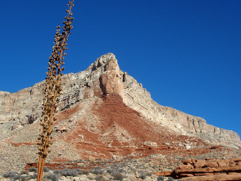
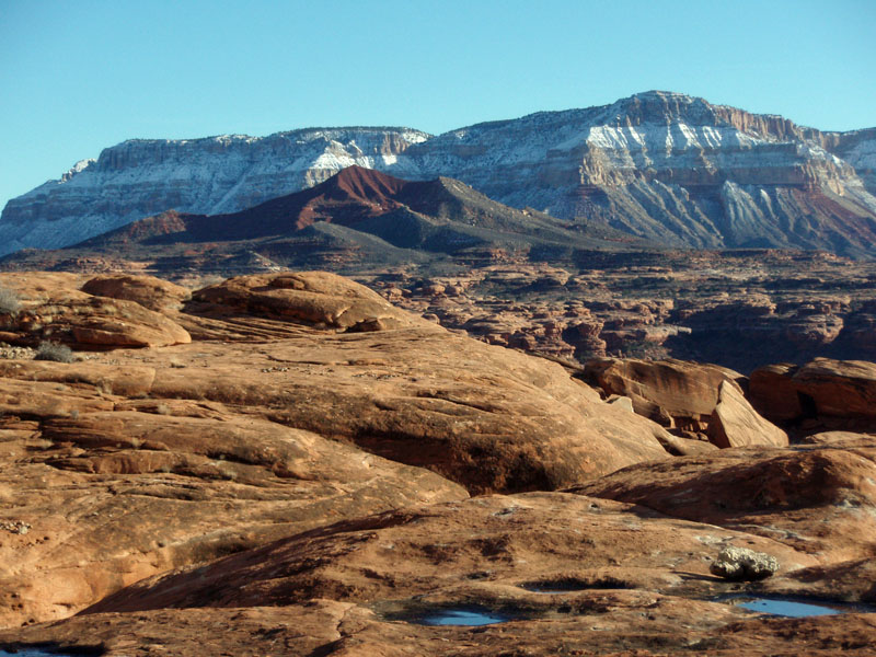
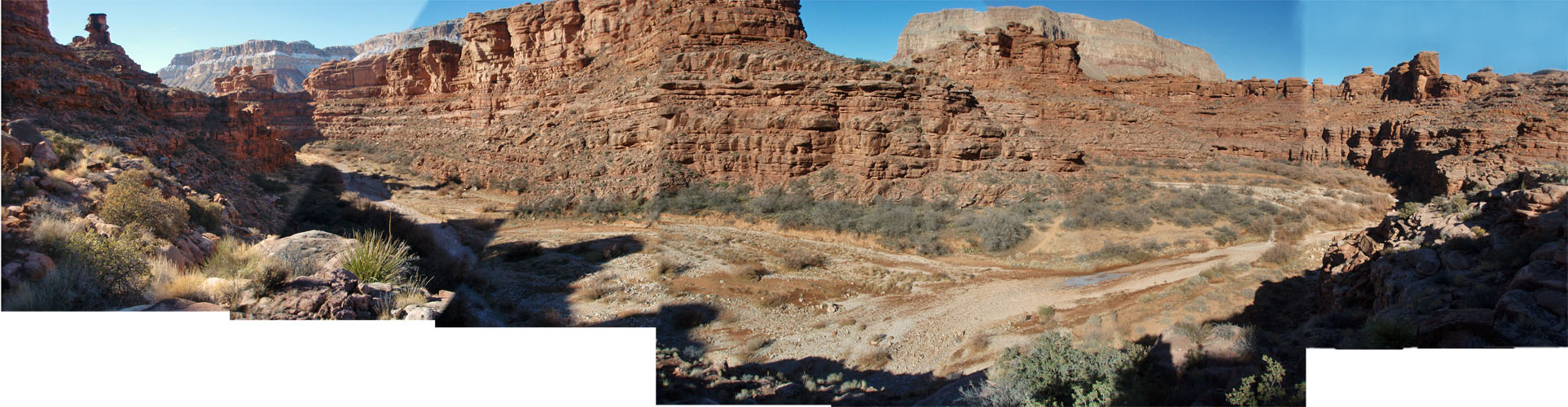
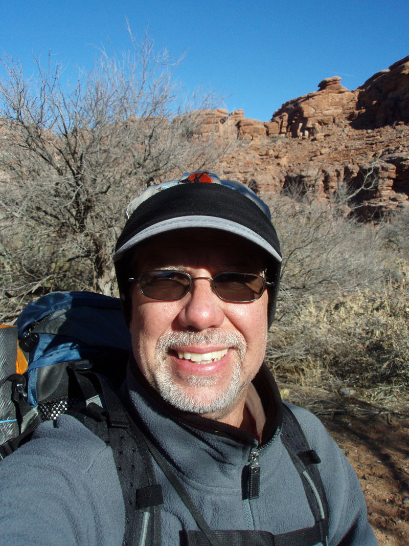
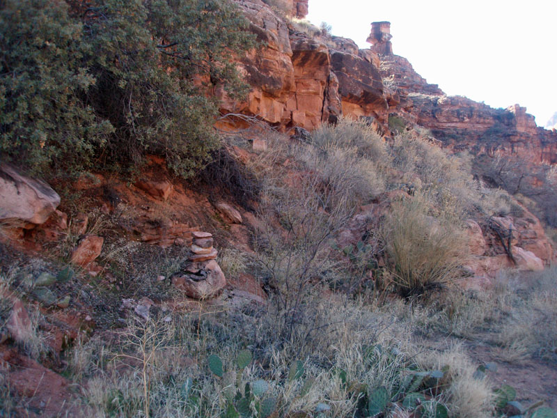
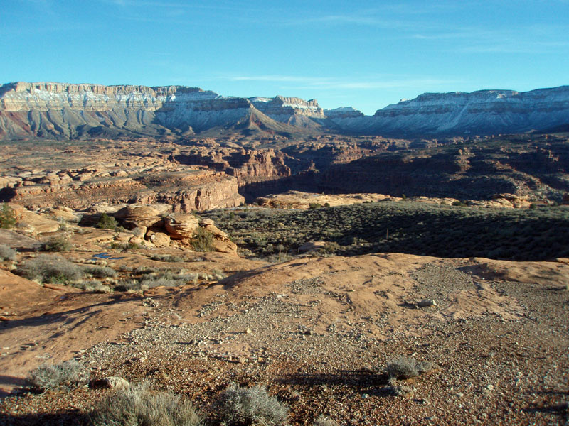
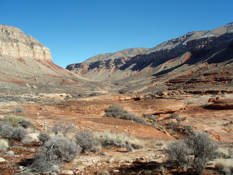
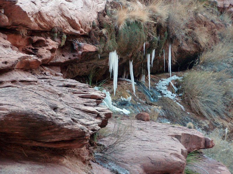
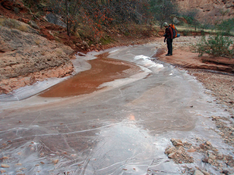
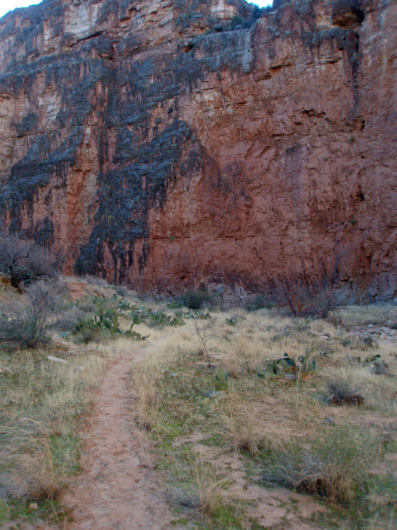
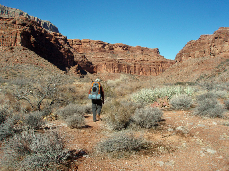
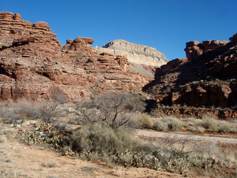
Usually, I plan on two hours from the moment I get up until I am ready to continue my hike. This morning it would take three. The cold was just unrelenting. One interesting problem involves the necessary shovel duty. Without getting too graphic, that is a challenge when the ground is frozen solid! And, even when we left, at 10:30 am, the sun had not yet reached our campsite, south facing though it was. We quickly made it to Kanab Creek. There were some frozen over ponds there, and we broke through one to get some water. We were going to ascend to the Esplanade level, but had no detailed information on a specific route. But, we didn't need any, as it turns out there was a trail a bit opposite of Hack, and well cairned, leading out of the bed. It's nice to hike in the wilderness area! By 11:30 am we had topped out onto the Esplanade, and finally into the sun, which felt great. We stopped for a half hour to take off our jackets and snack a bit. At 12:40 pm we met up with the "Ranger Trail" that I believe comes all the way down from Snake Gulch at the upper end of Kanab. Hiking along the Esplanade under these conditions is just fabulous. I really love the terrain, with the weird rock formations and the reasonably level walking. We stopped for a lunch break from 1:50 to 2:30 pm. Coming around Jumpup Point, we could see Fishtail Mesa and Jumpup Canyon. My notes say it all - "Spectacular." The snow on the north side of Fishtail was just awesome. If we had been able to follow through with Plan A it would have been a grueling hike and I can't imagine how we would have been able to hike up and out Indian Hollow. We had a slight breeze this day, which kept things on the cold side. While hiking, it was fine to take off coats, but whenever we stopped to rest, they would quickly go back on. Along the way I kept a close look at overhangs we passed by and we spotted some cool pictographs. Quite a treat. By 4:30 pm we stopped to camp where there were many water potholes available for us to draw from. That might seem a bit too early to really stop for the day, but getting enough water from these kinds of sources takes a significant chunk of time. We fixed up dinner and turned in for the night by 7 pm. |
|
|
||
|
|
||
 More Esplanade. |
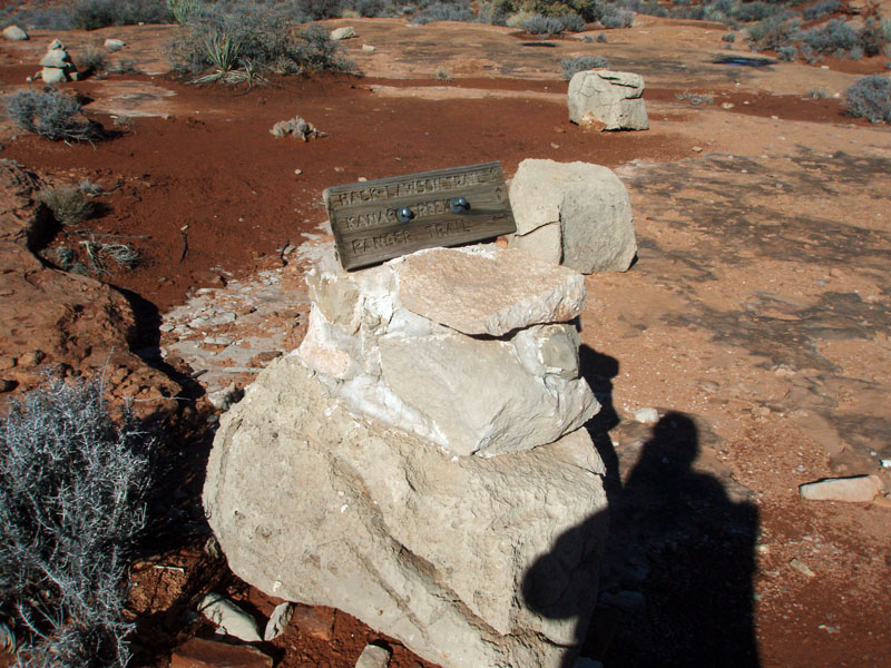 Trail sign. |
 Bill on Esplanade trail. |
 Even more Esplanade. Must stop! |
 Jumpup Point. |
 Racetrack Knoll and Fishtail Mesa. |
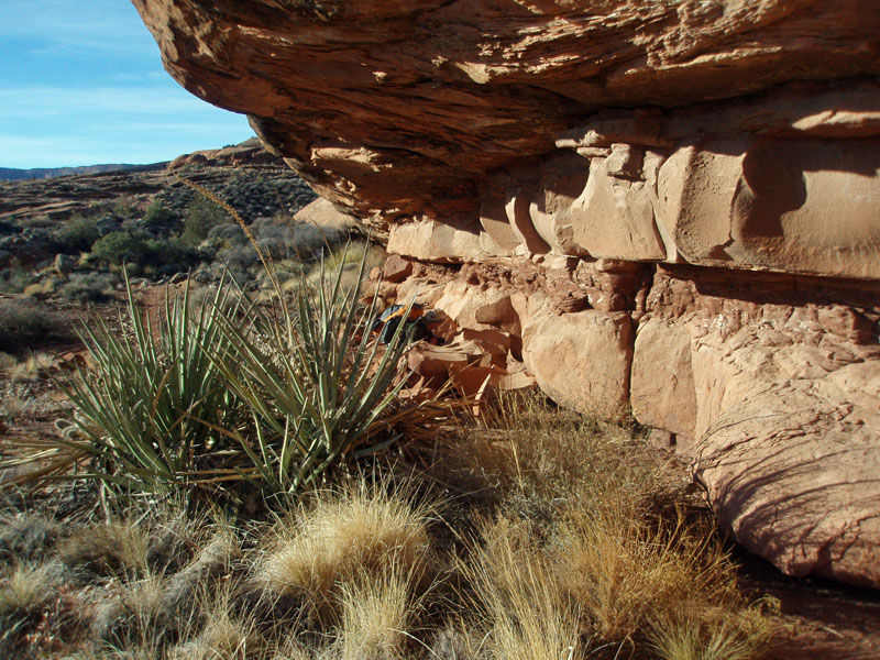 Overhang with pictographs. |
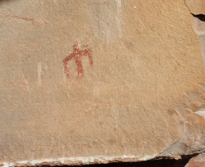 Pictograph. |
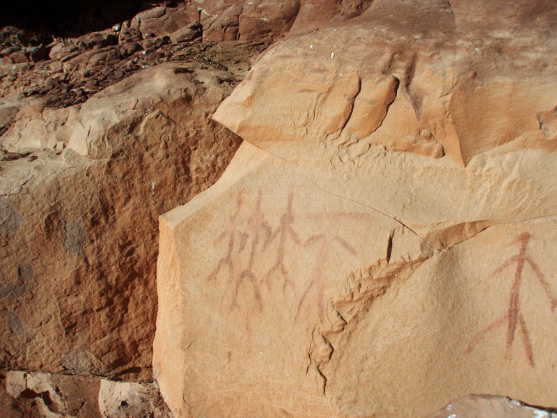 Pictograph. |
| Day
3 - Down into icy Jumpup (Monday, December 29): Up a
little earlier today - 6:30 am. But, not leaving camp much earlier
- 10:45 am!! A frosty rime covered everything. I expected as
much on the tent walls, ceiling and rainfly, but was surprised to see it
on my pack, which was sitting out overnight. The overnight low in
the tent was 32°. We got sun early - 8 am - and that
really felt good. I was treating myself to a double dose of glad
tidings with a breakfast of freeze-dried bacon and eggs. It is a
nice break from the more monotonous bagel and oatmeal, and sure tasted
good.
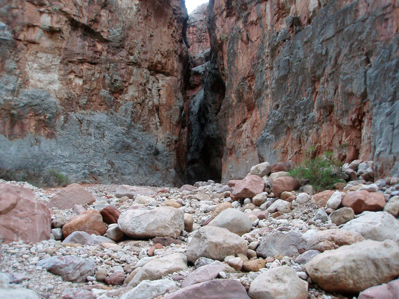
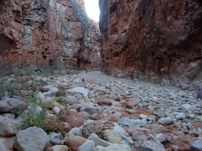
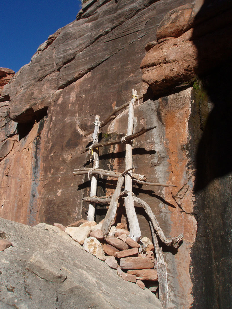
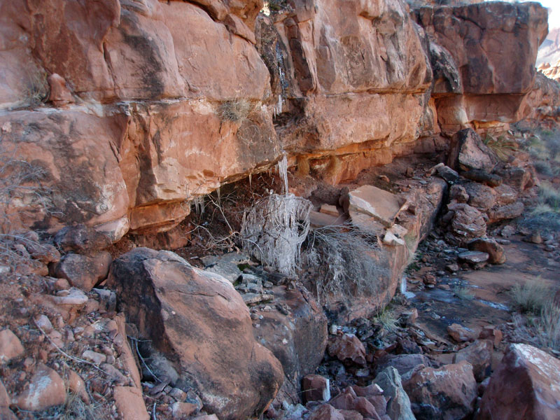
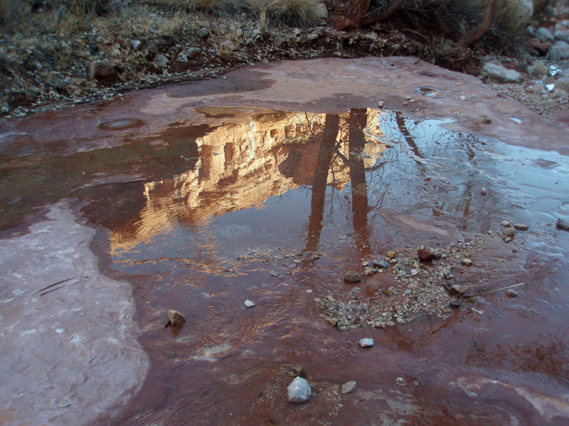
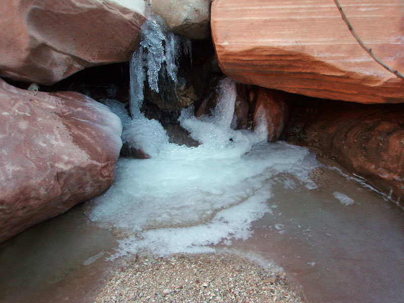
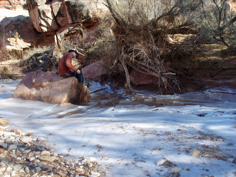
Our delayed start today has probably more to do with the fact that this loop hike is not really all that long, as it does with the cold. We enjoy the lounging around knowing that we have plenty of time to make our next target - at, or about, Kanab Creek. It only took us an hour to reach an old cattle fence, near the head of Jumpup in the Supai layer. It led us down into the canyon on an easy track, where we found some flowing water. At noon, we dropped our packs to scout out where this was going to take us and we soon came to a big dry fall in the bed. We had read that there was some kind of funky setup here, and we weren't disappointed. The are a series of step-like ledges that go part way down the cliff and then you transition onto a crudely-made ladder, propped up on a pile of rocks. Once down the ladder, there is a large sloping rock surface to negotiate to finally reach the bed. It took us a while, and we lowered our packs through here to insure against mishaps. That whole process took about an hour and a half. At 1:20 pm, once down to the bed, we stopped alongside the flowing creek and had lunch and filtered six liters of water. Cold in the shade and lots of ice down here where the sun doesn't shine. |
|
|
|
|
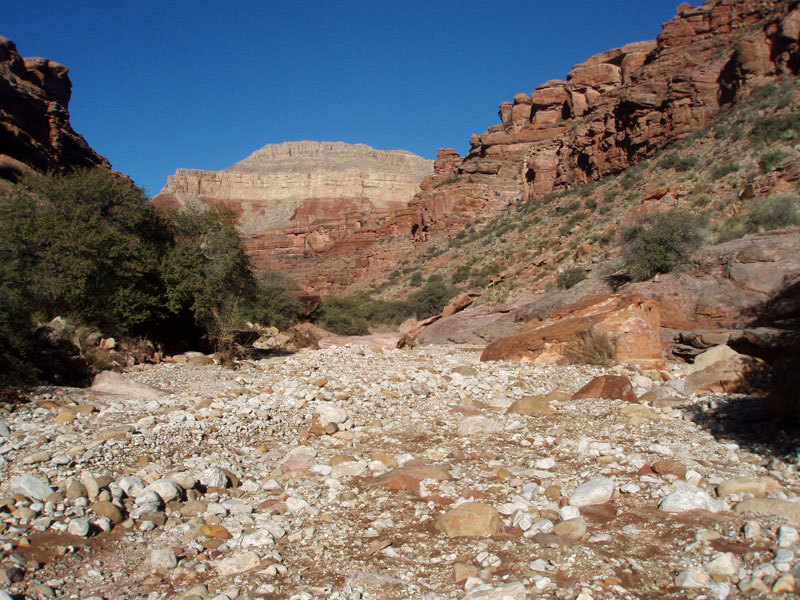
At 2:00 pm we were on our way. The canyon widened out quite a bit as
we passed by Kwagunt Hollow at 3:10 pm. I had been here once
before, back in early June of 1991, when Neil Jacobs and I did a hike
off of Sowats Point, following Kwagunt to this spot and then down to
Kanab and further down to a place called Scotty's Castle before
returning over the same route. Then, it was hot, but a blessing to
be in the shade. Now, it was cold, and on came the fleece jacket
and ear protection.
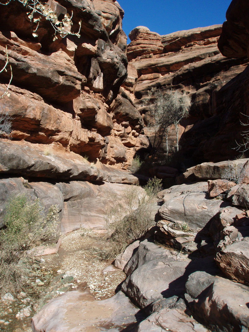
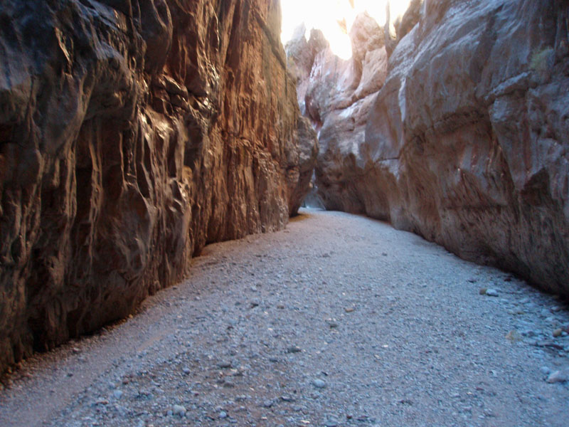
Just within spittin' distance of Kwagunt, you reach the upper part of the Redwall formation and the canyon narrows down quickly into a very eerie passage. Not a place you'd want to be during a flash flood! One stretch through here had the floor scoured making it seem almost paved. We passed Indian Hollow at 3:50 pm. I had come down this canyon once before, on a loop that would take me all the way to the Colorado River before ascending back to the rim. As narrow as Jumpup is, Indian Hollow looks like something you'd have to squeeze through. We might have taken a short walk up that canyon, but we were fast running out of time and needed to cover some distance to reach a suitable campsite and still have daylight, and whatever "warmth" it held, to take us through setting up our tents and fixing our dinner. After another half hour we reached a tentative camping spot, near to what seems like a permanent water pocket. Neil and I may have camped here in 1991, as we were here long enough to name the little pond "frog hollar" in honor of the noisy critters inhabiting the place. But, I also remember it being of dubious quality and am thinking we may have passed on using any. Bill and I didn't need any water, but we did take a look at it. At just a few minutes past 5:00 pm we came to a big bend in the canyon where there was a relatively expansive terrace that had great camping spots. The dry creek bed was totally under the overhanging cliff, which was at least a hundred feet above us. Quite a spectacular place to settle in for the night. |
|
|
||
|
|
||
|
|
||
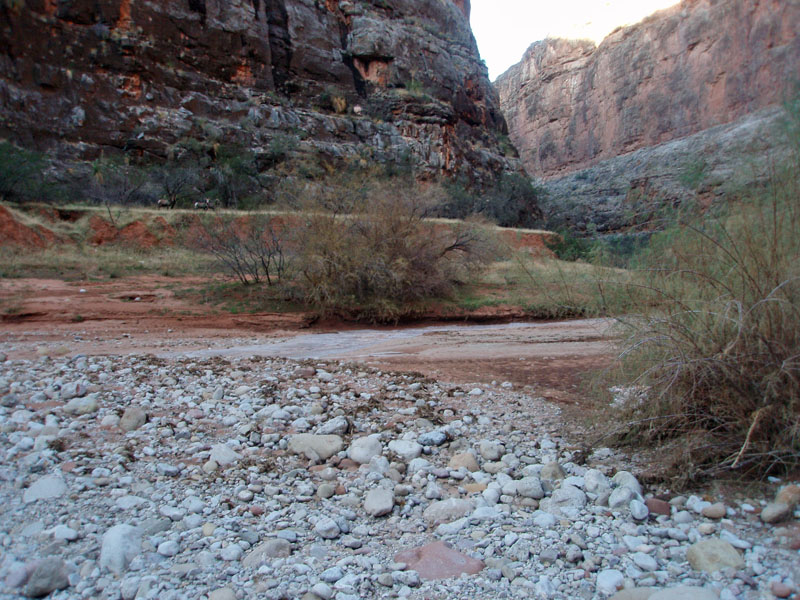
 Indian Hollow meets Jumpup! |
 In Jumpup below Indian Hollow. |
 Frog Hollar. |
| Day
4 - Up Kanab and out Hack (Tuesday, December 30):
What a surprise - by 8:45 am we were all packed up and ready to
go! It wasn't as cold overnight and I recorded a low of
41°. We were up at 6:45 am, so it was the standard two hours to
get ready for our departure. And, then, it only took us 15 minutes
to reach Kanab Canyon! Of course, we didn't realize we were so
close, otherwise we might have pushed all the way here the previous
night.
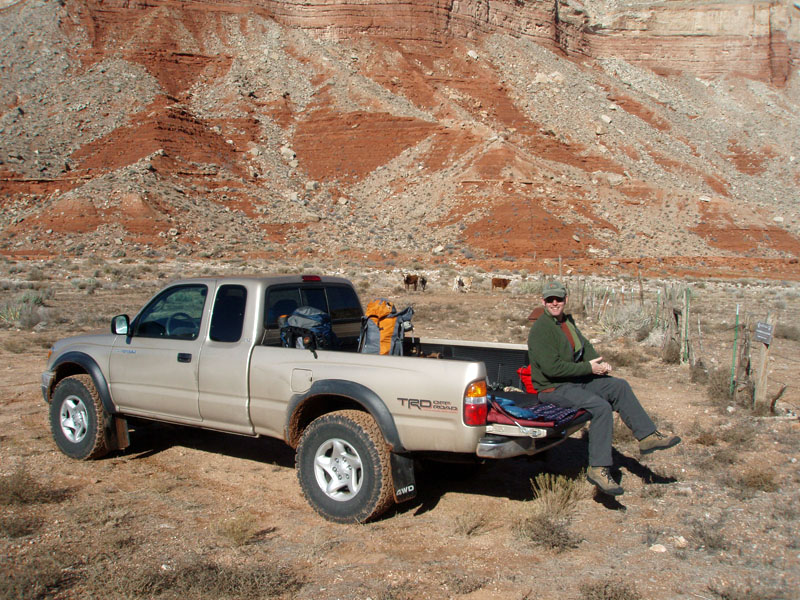
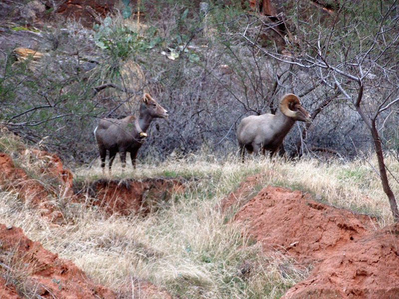
But, perhaps it was a good thing we didn't. When we got to Kanab, we ran into a small group of bighorn sheep. What a treat, although it was cold and most of my pictures didn't turn out well! There were pools of water all along here in Kanab, mostly with an icy covering, at least until the sun started shining on them. We were able to easily walk up the bed, but when a terrace appeared to either side, we invariably had a nice trail to help propel us along our way. At 10:40 am we passed by a big canyon to the west, which is unnamed but shows up quite prominently on the map. An hour later we reached the top of the Redwall formation and ten minutes after that, at 11:50 we were at Chamberlain Canyon, which was quite impressive. We spotted a green tarp under some bushes here and investigated. It was a huge cache of camping supplies and judging by all the tracks around here, used in conjunction with some horseback trips. From here on, all the way to Hack, we followed an excellent horse trail and rarely had to hike in the creek bed. There wasn't a continuous flow of water throughout this portion of Kanab, but there were short flowing segments that were above ground as well as periodic pools. We took a lunch break from 12:45 to 1:30 pm at our crossing of a big canyon running in from the east. It was also unnamed, and just south of Lawson, which is the canyon opposite Hack. We reached Hack at 2:15, and stopped to fill up some water bottles for the last leg of our hike. Fifteen minutes later we were on our way. When we passed our first campsite, we stopped to pick up our trash cache. Since we were doing a loop it didn't seem to make any sense carrying it around with us! It was well protected and undisturbed. It took us about two and a half hours to hike up Hack and we reached the truck at just a few minutes past 5:00 pm. |
|
|
||
|
|
||
|
As with our start, there were cattle grazing nearby and they certainly
took an interest in us. I think they probably only see people (and
trucks) that have come to feed them! So, maybe we were something
of a disappointment to them! While we were packing up the truck we
saw a couple of vehicles come down the road about a quarter mile away,
including a big truck hauling a horse trailer. They started
setting up a camp, but I wouldn't be surprised if that cache at
Chamberlain wasn't theirs. We rolled out at 5:30 and it took us
until 7 pm to reach the paved highway. I'm sure it took the folks
with the horse trailer a long time to come down into Hack - good thing
we weren't out earlier. Meeting up with them would have taken some
time to negotiate our way around each other on this narrow road.
It was a great hike, even though it was our Plan B. But, the weather was quite accommodating. The cold was more than offset by the fact that the air was still. The bright sunny days, with blue skies were fabulous, and our modest mileage objectives each day helped keep the tempo positive throughout the hike. Also, we didn't have to worry about water, even if we had to sometimes break through some ice to get to it. At the end of the hike, my pack weighed in at only 26 pounds, with about one liter of water still available. The starting weight was 34 pounds, when I was carrying 3 liters, and, of course, food. As to a hike around Fishtail Mesa . . . maybe next year. |
|
|
||
|
|
Return to Hiking Grand Canyon home page |
|


