|
|
|
Winter
Access to the North Rim Friday, February 27, 2009 by Dennis Foster |
|
|
|
|
|
|
|
Winter
Access to the North Rim Friday, February 27, 2009 by Dennis Foster |
|
|
|
|
|
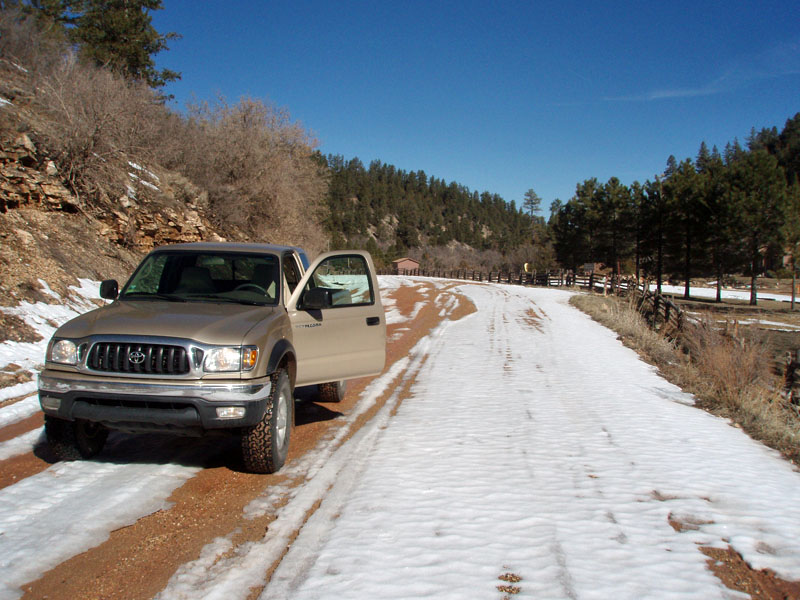
It is getting close to spring break and my thoughts have been turning
more and more to the hike I have planned - nine days from Crazy Jug
Canyon to the South Rim Village at Grand Canyon. Only on the final
day will we (three others have agreed to come along for this hike) be on
a formal trail. I had planned this same hike in 2008, but the snow
along the access roads kept me from reaching the trailhead in time to
insure that I could complete this hike.
This year, we have had three major snowstorms in the region. As of now, the snowfall in Flagstaff is already at our seasonal average, and we usually get quite a bit in March and April. But, it has been quite dry for a few weeks, and temperatures are into the 50s around Flagstaff during the day (we are at 7000 feet), and projected to get into the low 60s during the next few days. So, with only two weeks to go until this hike, I am feeling increasingly confident that last year's problems will not reoccur. Still, I
decided that I should scout out the route ahead of time, just in case we
need to make some adjustments in our hiking itinerary - like adding some
extra time to hike in over the snow! So, I was on the road by 6:30
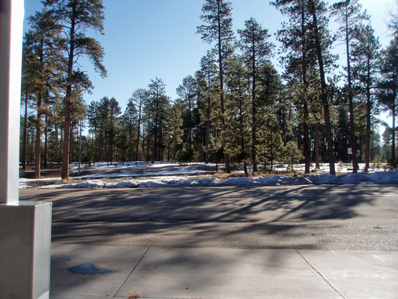
am for a trip There wasn't
much snow in the forest around Jacob Lake, but the high access route to
the Crazy Jug area, via FR461 and FR462 (FR stands for Forest Road), was
too iffy to try. The dirt road had been plowed to a Forest Service
facility, about a quarter mile from Highway 67, and some crude plowing
had been done from there to the RV camp (which is closed in the
winter). Beyond that, it looked like only snowmobiles had been
over the road, and I decided to forgo any further investigation
here. That's too bad, since it probably is only about 3 miles to
reach a point where you don't have to worry about the snow. This
is a good shortcut - it is eight miles from Jacob Lake to FR22, the main
road leading into this section of the north rim of the Grand
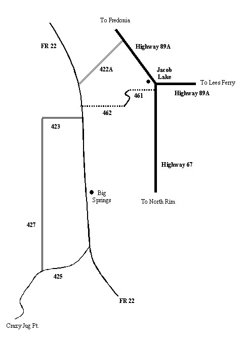
Canyon. Via the route I took, it was twenty-six miles. To
better visualize this, if you aren't already familiar with the roads in
this area, refer to the stylized map, below. Click on it to see a
larger image.
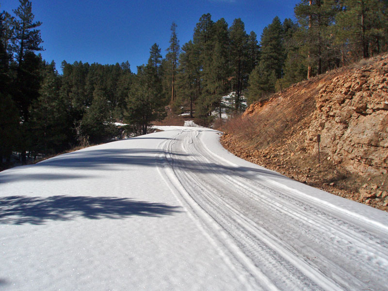
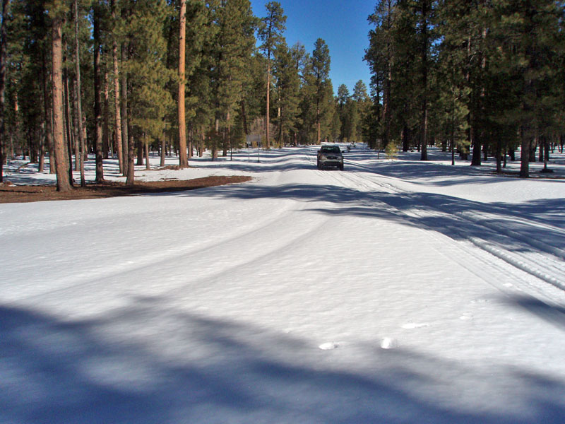
The junction of FR22 with FR462, where you'd come out from the high access from Jacob Lake, was bone dry and sure looked inviting. On my way back out, in the late afternoon, I drove up FR462 and part way up FR461. But, I reached a spot, still well below the plateau, where the going was slippery and there was just too much snow to make me feel like I could have made it all the way to the RV camp without getting stuck. Past this
junction, FR22 was nice and dry until I passed by Mangum Camp.
Along this stretch, there were patches of snow, which continued up to,
and a bit beyond, the Big Springs facility. Last year, it was here
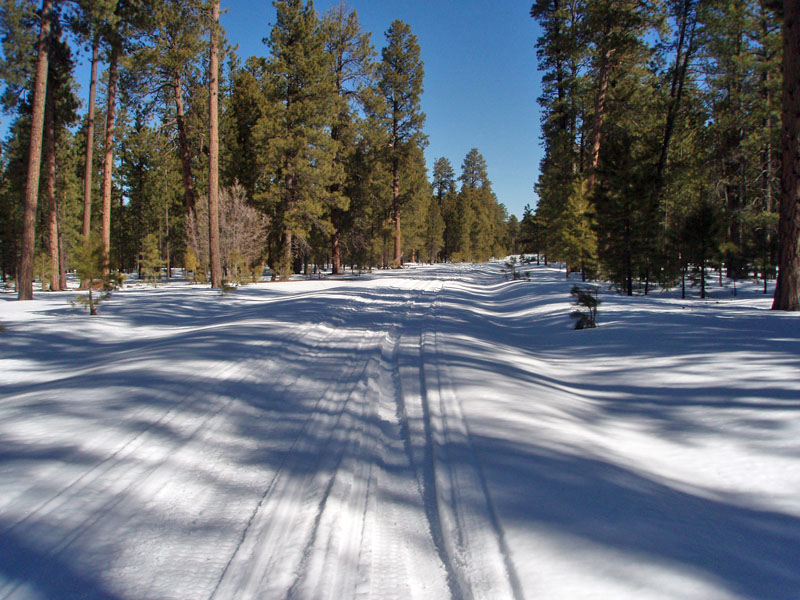
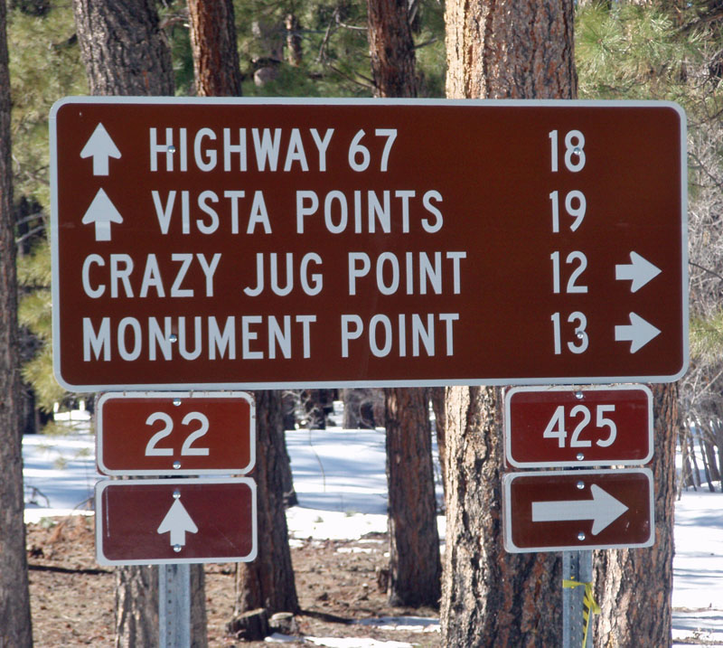
that John and I had to park the Once on the highest stretch of the plateau, the snow was deeper and my tires would sometimes sink in below the snowmobile tracks. Still, I was able to continue on without incident. It was in here that I saw the coyotes - a couple of them running through the forest. Later, I often noticed coyote tracks across snowy patches in the road. At the junction with FR425, which goes to Crazy Jug Point, I had to give up on this route. There were no fresh tracks down this road, and I was not confident that I could really get very far. Since the nearby sign showed that it was still 12 miles to Crazy Jug, I was disappointed in not being able to get any closer to my objective. But, I had a backup plan . . . |
|
|
||
 |
 |
 |
| No Fishin' at Big Springs! | Snowy road at Big Springs. | Snowy climb beyond Big Springs. |
 |
 |
 |
| The snow deepens. | Many miles short of objective. | Faint track on FR425 is not inviting. |
|
For many years, I have been using these roads to access the Crazy Jug
area (FR461, FR462, FR22 and FR425). I am pretty sure that there
used to be a sign along FR425 indicating that a side road allowed for
"winter access" to Fredonia. As I was contemplating this
scouting trip, I remembered that sign and I began to look at my forest
map more carefully. What I found was that there was another road
that could get me out to FR425. I asked my buddy, Bill, to run
this route through his TOPO software to get me an elevation
profile. What he got was a route that was mostly below 7000
feet. That was good news, because just past Big Springs, on FR22,
you climb up past 7000 feet. The FR22/FR425 junction, where I
turned around, must be at/or about 7700 feet. So, this alternate
route seemed promising, and now I had a chance to check it out.
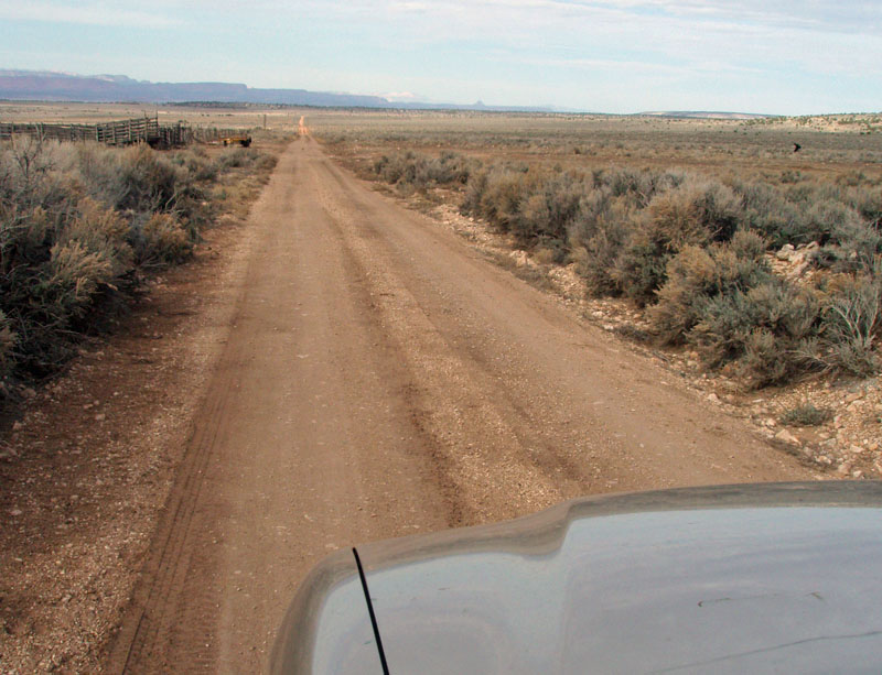
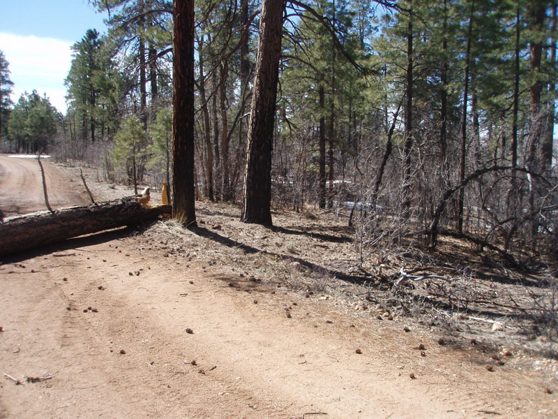
The route
starts on FR423, which is just two miles south of the FR22/FR462
junction. FR22 is paved from Fredonia to a bit past FR462, so this
junction is a pretty useful landmark. FR423 heads off to the west,
down Oak Canyon, and there is a corral right near the road that is easy
to spot. The road heads a couple of miles west and then becomes
FR427 as it turns south to parallel FR22. Much of this route is
along a scrubbier terrain that gets plenty of sun. Eventually, you
do start to climb into the ponderosa forest, and there were were some
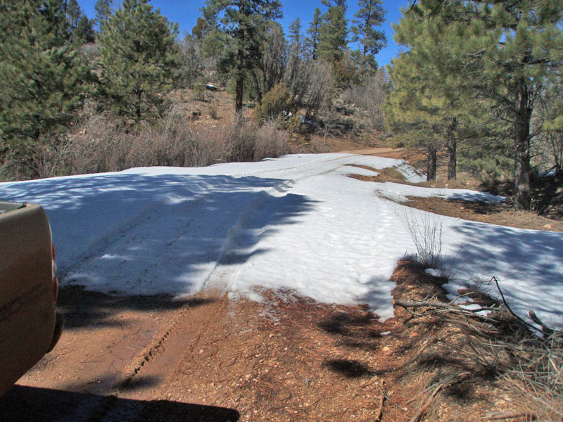
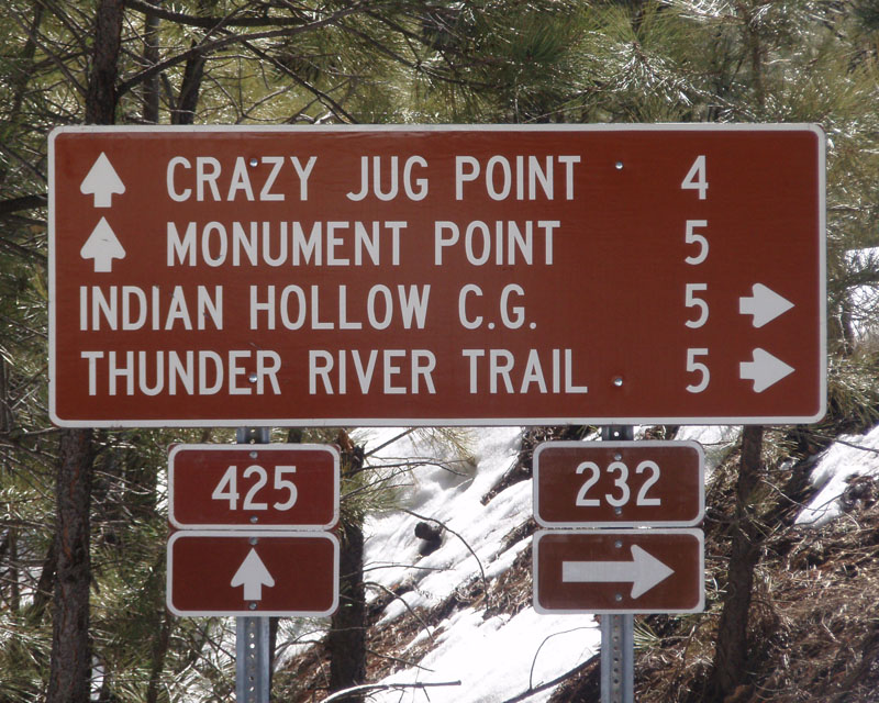
snowy patches through At first, travel along FR425 was pretty good. Lots of snowy patches, but they weren't deep and there were lots of bare spots. Still, I decided to put on my chains to insure better traction. So, I found a nice bare spot and proceeded to chain up. But, I don't seem to have the right aptitude for this. As soon as I headed off, I could hear the sound of the chains thumping against something. But, when I checked, they seem tight and snug. So, I took them off and continued on my way. I soon passed the road to Sowats (FR233) and the road to Indian Hollow (FR232). That put me at only four miles from Crazy Jug, and I was feeling pretty good about this alternative route. But, not more than a half mile from this last junction, I got stuck in the snow. It took me the better part of an hour to finally extricate myself from this dilemma. Indeed, once I got free, I was backing up and continued to do so until I reached a bare spot. Then, I had to trudge the approximately half mile back to the spot to retrieve my chains, which I had used to help my wheels gain traction on the snow. Thus went my explorations of this alternative route. I am impressed with this route, and am glad to have expanded my opportunities to visit this interesting area during the winter season. And, I am hopeful that a couple more weeks of dry and warm weather will actually allow us passage all the way to Crazy Jug Point so that we can start our hike off in proper fashion - from the rim! |
|
|
||
 |
 |
 |
| Speedy going along FR423/FR427. | Until I reached this tree! | The way around. |
|
|
||
 |
 |
 |
| Snowy patches on FR425. | The route ahead. | Furthest south. |
|
|
||
|
|
Return to Hiking Grand Canyon home page |
|