 |
|
|
Tuckup Trail to Shamans' Gallery Sunday, May 24, 2009
by Dennis Foster |
|
|
|
|
|
|
|
Tuckup Trail to Shamans' Gallery Sunday, May 24, 2009
by Dennis Foster |
|
|
|
|
|
Some years ago, I stumbled upon some photos of a fantastic pictographic
panel in the western reaches of the Grand Canyon that is called
"Shamans' Gallery." The photos are in a book titled,
"On
the Edge of Splendor," by Douglas Schwartz, who has authored
many books about archeological sites in the canyon. This book came
out in 1989, and the pictographs had only been made known to the park
service in 1986. So, they were a recent discovery, so far as
anyone knows.
Of course, I
wanted to find this site and see it for myself. In Schwartz's
book, there is a reference to a 1988 park service report by Polly
Schaafsma, who surveyed this site in 1986. I went to the Special
Collections and Archives at NAU's Cline Library, and found this
report. Well, sort of. What I found was a photocopy of the
actual report. It was generally vague on the exact location of
Shamans' Gallery ("For details of site location contact Grand
Canyon National Park."), although there were some clues that could
be used to help place this site (known to be in Tuckup Canyon): Armed with this information, and a copy of the photocopied picture in the report that was labeled, "View up Tuckup Canyon looking northwest from vicinity of shelter," I felt that I could find this site. So, on Friday, October 25, 1996, I went up to Tuckup Canyon with Mathieu Brown and my dog, Peppyr. We camped on the rim for two nights, and spent Saturday wandering around on the esplanade level looking for this site. But, we came up empty. Later, on December 18, 1996, I returned to that area and camped out for a couple of days, determined to find this place. I decided to start looking in earnest further up the canyon than Mathieu and I had done. And, that was the key. I found the site, took pictures and scrambled up the opposite slope to return to my camp. That night I could hardly sleep, as I was wracked with stomach cramps that would cause me to double over (while laying down!) in pain. The next morning it took me all day to hike out a distance that took me only a couple of hours to hike down to. The cramps continued and even while driving home (which took 6 plus hours) I was occasionally forced to stop off the side of the road to recover. One might say that it is just bad mojo, but it really was bad water. My doctor said that I had some kind of virus, and unless it actually killed me, I should just take some antibiotics and get better - it's what the human body does. He said that they'd probably name the virus after me if it really killed me, sort of like Legionnaire's Disease. Lucky for me, I got over it. For years I have been thinking about how to put together the photos I have so that I can actually see the pictographic panel in context. I never got around to doing that. And, then comes along the digital revolution. So, now I have been thinking about a return to Shamans' Gallery to take some digital photos, which are much easier to work with. And, after first finding this place, I thought that I could visit this site as part of a really long day trip from Flagstaff. Cara Lynn was interested. So, off we went on this Sunday before Memorial Day, 2009. |
|
|
||
 |
 |
 |
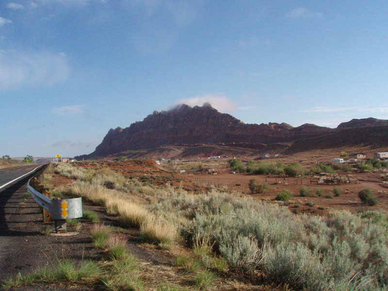
| San Francisco Peaks. | Wispy cloud shrouds ridge at Gap. | Hancock Knoll. |
|
It was a really nice day for this trip. The San Francisco Peaks
were stunning in the morning light, as we headed up to Cameron.
Passing by Gap, the clouds were swirling around the top of the rocky
ridge, giving the place an ethereal feel. We drove up to Fredonia,
gassed up, and headed down the road to Pipe Spring for eight miles,
before turning off on the dirt road that leads to Mt. Trumbull and
Toroweap. It is about 47 miles to the trailhead, and the road
deteriorates steadily as you near the end. It takes at least two
hours, as long as you don't mind the jostling and bumping around!
I had made a copy of part of the Heaton Knolls quadrangle to help us
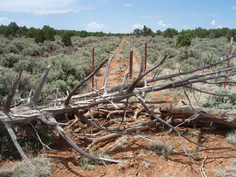
navigate and that turned out pretty well. There are some roads not
marked on this older map, and some roads are closed, but the main route,
once you turn at June Tank, takes you to the Tuckup Trailhead. The
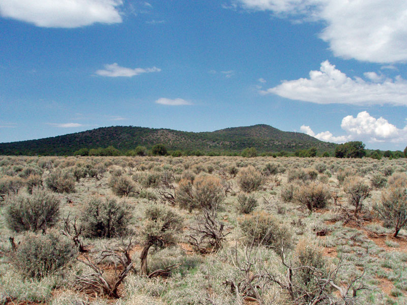
main geographic feature along this stretch is Hancock Knoll, which
stands out against the flat sagebrush terrain that dominates much of the
early part of this route.
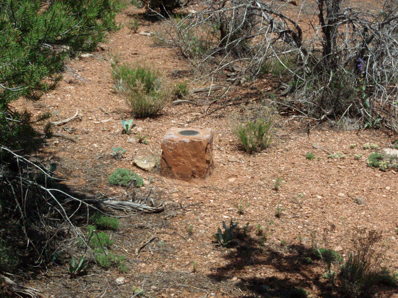
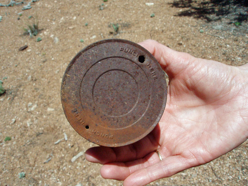
On the way, we decided to find the benchmarks that are shown on the map. I have tried to do this in other places, and usually come up empty. But, I know they must be there! So, we decided to look for three benchmarks along the way - 5749, 5918 and 5870. The second one is at a road junction, so not too hard to find. The third one is on a slight hilltop, and we found it rather quickly. The first one was found after just a little poking around, but there isn't anything definitive about this location, so we really lucked out here. Still, at all three places, there were some old cans and trash around that helped alert us the the location of the benchmarks. One old can, which Cara Lynn found, and shown below, had "Punch Here" stamped into it. Milk??? |
|
|
||
|
The second BM (5918) was at the intersection of two roads. Buried by the sage, it took a bit of looking around to finally find it. |
||
|
|
||
|
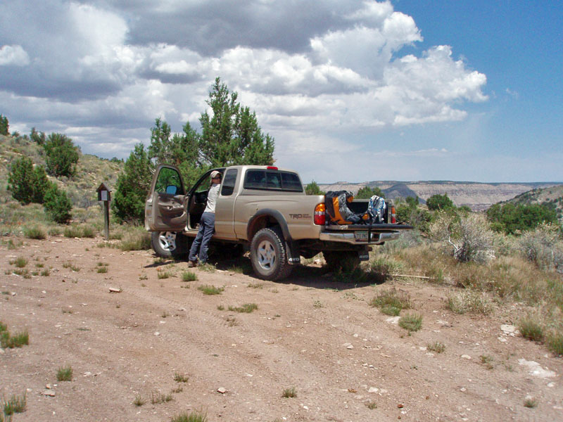
We left Flagstaff at shortly before 6 a.m. and arrived at the trailhead
at 12:20 p.m. So, yes, this is a long day, when half your driving
comes to more than six hours! Surprisingly, there were two
vehicles at the trailhead area. I note that because once you cross
over into the national park, the road gets really bad, and maintaining
15 mph is a challenge. So, we really didn't expect to see anyone
here.
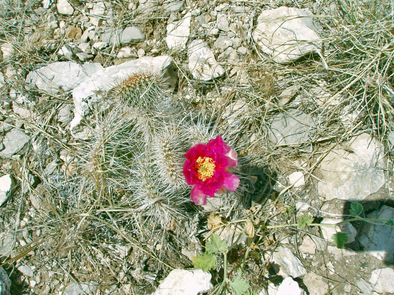
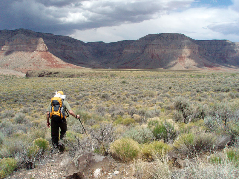
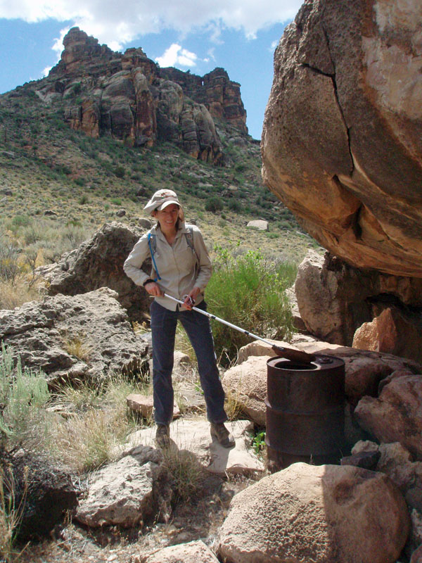
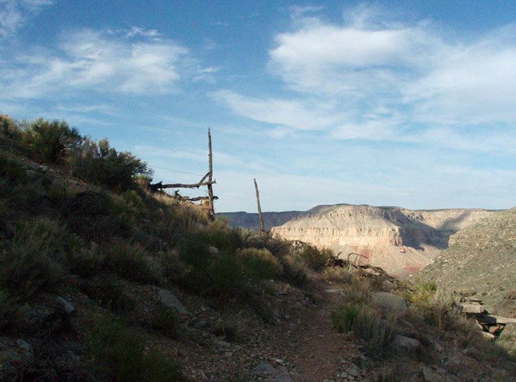
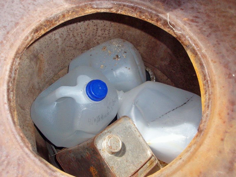
We quickly headed down the trail, which is clear and easy to follow. There are some neat fossils in the limestone here and an old barbed wire gate that you walk through. You start off in a hanging valley and then come to an opening where you can see down into Tuckup directly, with our view dominated by the "basalt lava flow escarpment" mentioned in the park service report. There is a huge boulder that dominates the local area, and we headed for that, even though it is not directly on the trail. [But, it must be on the route that follows the esplanade to the west, towards Tuweep.] There is a big barrel there and we found that hikers had placed water jugs inside it. On the top jug was written, "4/8/09 M Guy." Later, at Shamans', there was an entry in the register for a Melissa Guy, from Flagstaff, on 4/8/09. So, I guess she didn't need the water! Instead of following the trail into the creekbed, we hiked directly across the lava terrace to the point that I recalled was opposite Shamans'. Nice and easy walking - the ground is soft, there is no cactus and the bushes are flexible. Along the way, we could see The Dome to the south - a dramatic canyon butte that few people actually get to see. The weather had been really good to us. The clouds rolled in and kept us quite comfortable. If it had been sunny, we would have been whining a lot! |
|
 |
 |
| A few cactus were blooming. | Dennis heads off across lava terrace. | The Dome. |
|
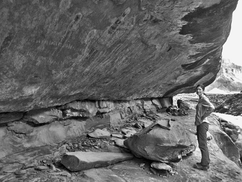
Since it has been 13 years (!!!) since my visit, I was a bit uncertain
on exactly how we could scramble down to the bed from atop the lava
cliff. But, we found a good spot (in fact, the only spot!) and got
down to the bed right opposite the overhanging ledge with all the
pictographs. It took us a bit over 2 hours to hike here, making
this about 3 miles from the trailhead.
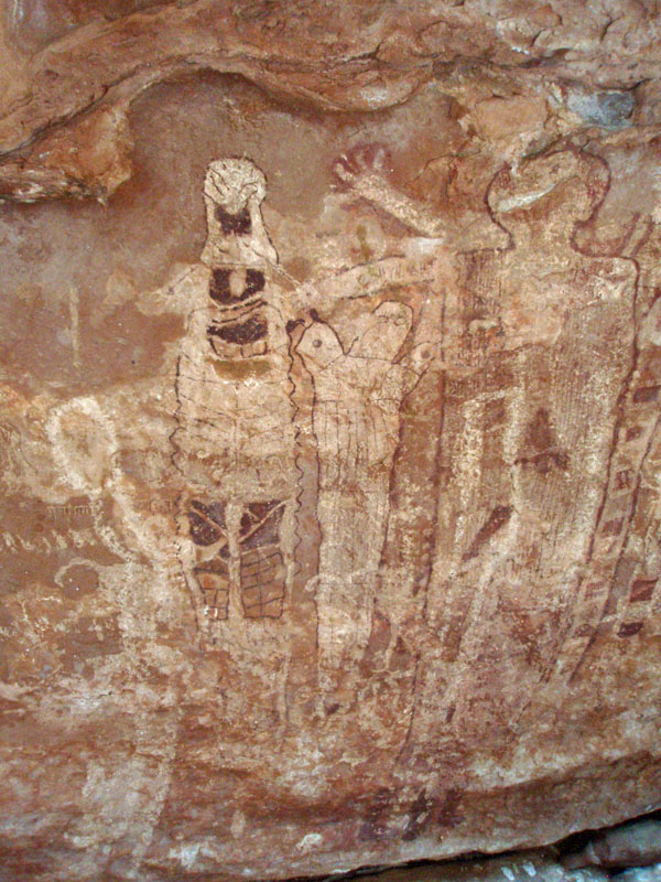
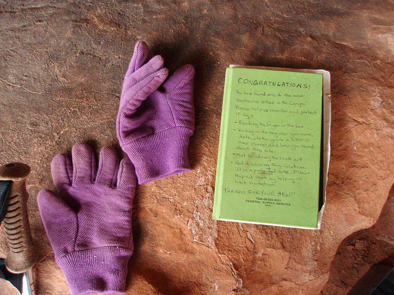
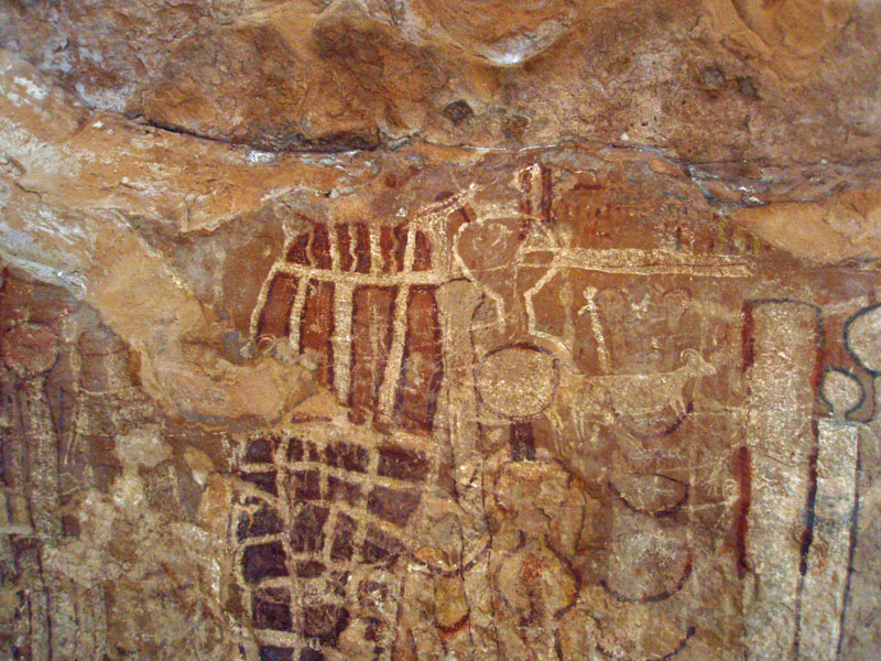
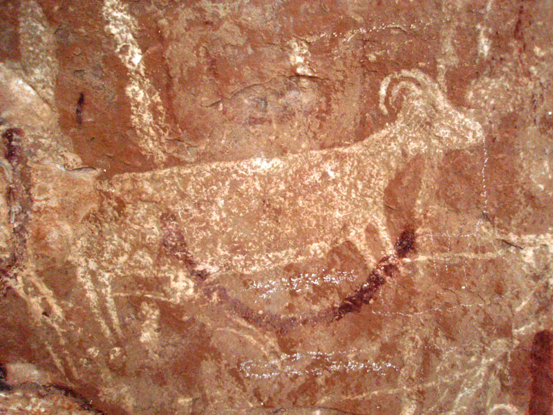
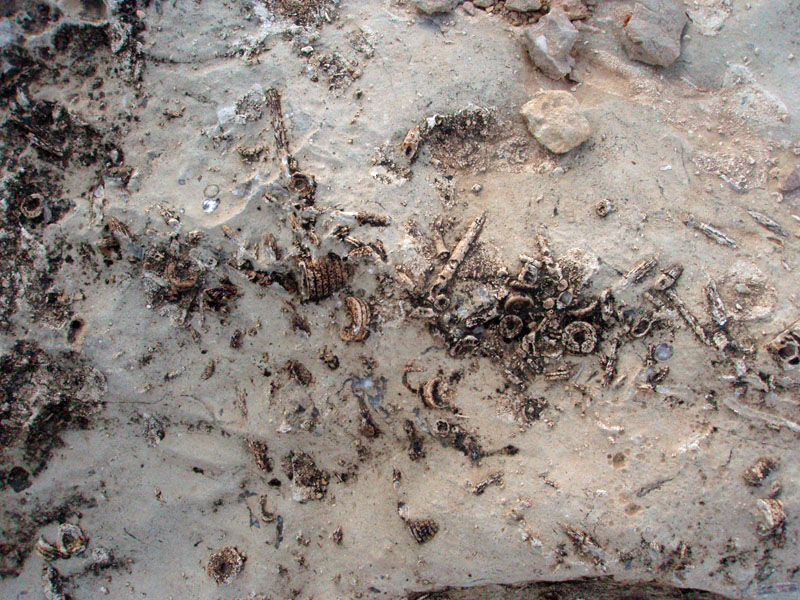
We had lunch here, looked over the panel, took photos - including a bunch that I have stitched together into the panorama below - and read the register. The current book is only a year old, but still about 10+ pages of entries. A lot of entries noted that they found out about this place from a couple of web sites: gordons panel and zion national park (a tourist related site, not the government site). The former was posted up by the cowboy that found the site in the 1980s and told the park service about it. He wants to be able to run mule/horse rides down to it, but has been rebuffed by the park service. The latter web site has some cool links to rock art sites, including Shamans' Gallery. |
|
|
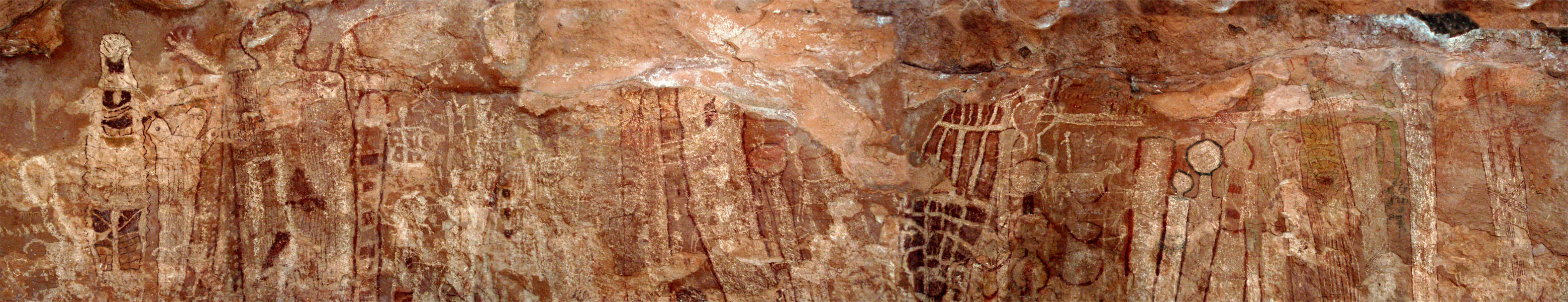 A panorama of the main portion of the Shamans' Gallery panel. |
 |
 |
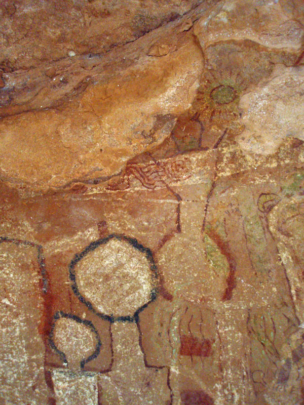 |
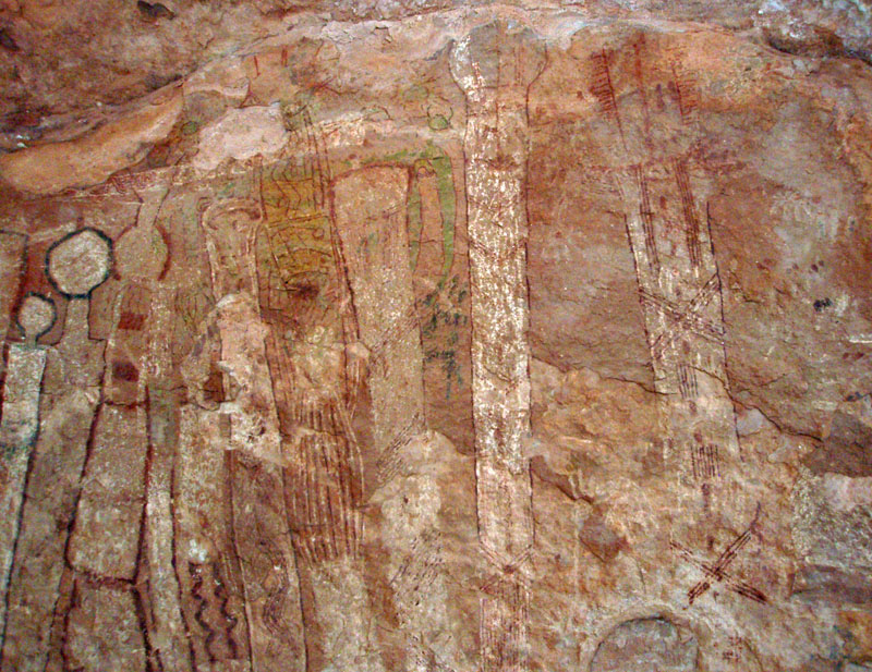
| Shamans' Gallery from descent. | Bizarre, long figures. | Heads, patterns, green sun. |
 |
 |
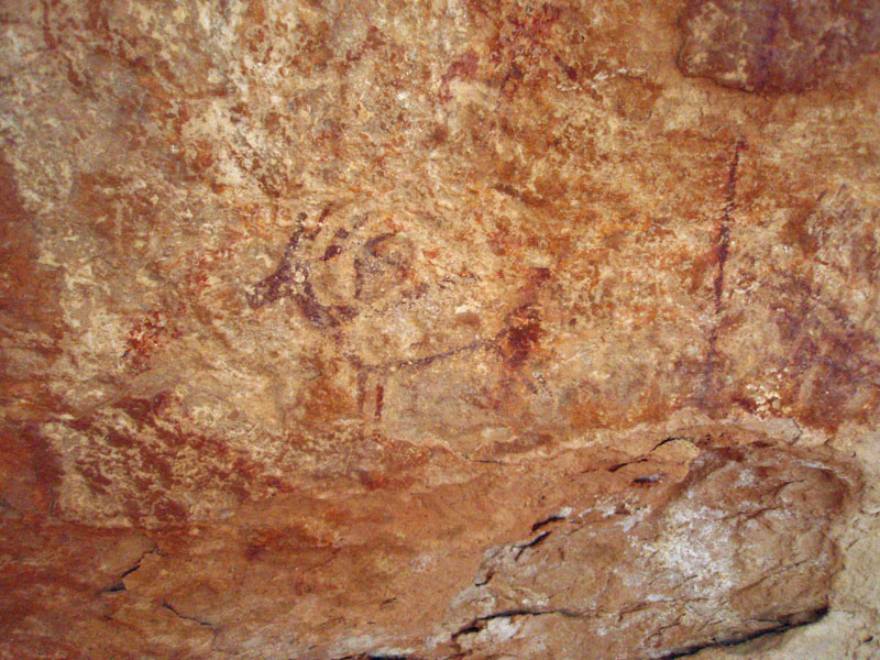 |
| Trail register. | Cara Lynn & panel - 1940s? | Deer. |
 |
 |
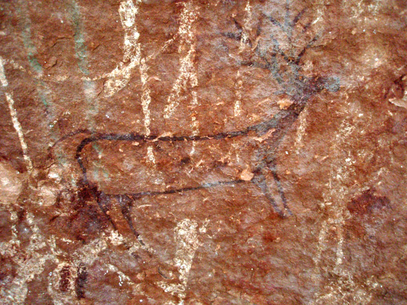 |
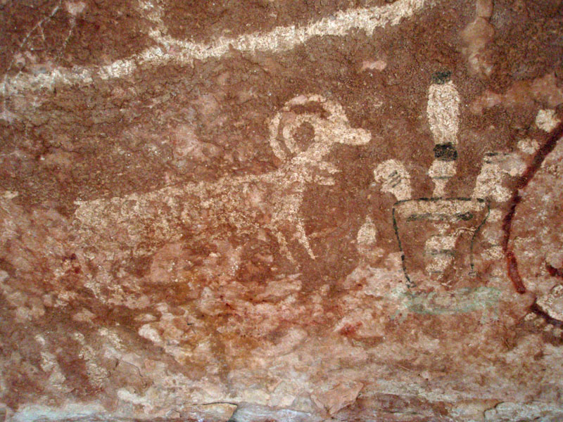
| Bighorn and bizarre head. | The tall figures; one is green. | Another deer. |
 |
 |
 |
| Strange figures (an owl?). | More bighorn. | Descent route opposite Shamans'. |
| It is really a challenge to take good photos here. The ledge is not especially wide, and going down to the bed is not really helpful. I laid on my back and kept scooting over to take pictures straight on and that seems to have worked pretty well, especially for the panorama. We hung around for a bit over an hour and then headed back, this time up the canyon and following the trail. The sun came out and heated us up right away, so we rested a couple of times in some shady spots. Once we started to climb, we were able to catch east facing slopes that were nicely shaded in the late afternoon (we were at Shamans' until about 4 p.m.). |
|
|
||
 |
 |
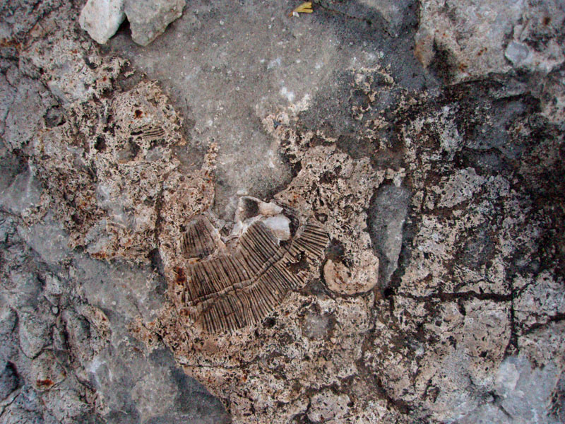 |
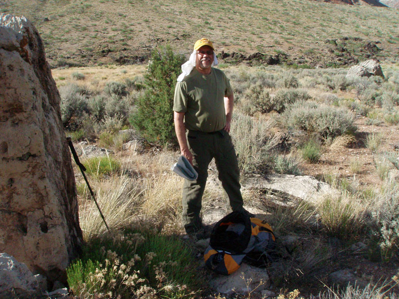
| Old barbed wire next to Dennis. | Crinoids in limestone. | Fossil shell. |
| We got back to the trailhead at almost 6:30 p.m. The other two vehicles were gone! But, we had seen another entry in the Shamans' register from somebody for the same day - they were probably coming up the trail when we were hiking across the lava terrace. It was a long slog back to the paved road, which we reached just a few minutes before 9 p.m. And, we didn't pull into Flagstaff until 1:15 a.m., making this truly a long (but, quite satisfying) day trip! |
|
|
||
|
|
Return to Hiking Grand Canyon home page |
|

