 |
|
|
Trekking to the Little Colorado River Camping out at Palisades Creek
Friday-Monday, Oct. 30 to Nov. 2, 2009 by Dennis Foster |
|
|
|
|
|
|
|
Trekking to the Little Colorado River Camping out at Palisades Creek
Friday-Monday, Oct. 30 to Nov. 2, 2009 by Dennis Foster |
|
|
|
|
|
In 1991 I planned a trip that I hoped would take me to the Little
Colorado River. I went up to the South Rim and got a permit, drove
to Lipan Point and hiked down the Tanner trail to the river. Then,
I hiked up along the river hoping to reach Palisades Creek (which is
probably almost always dry). I didn't make it all the way and when
I did stop I was totally wiped
out. The next day I was counting on a day hike to the LC,
but just didn't have the energy to do
so. I did go up as far as Palisades, but that was it. Also,
the river was running very
muddy and even with water set out
overnight, the sediment was not settling out very quickly. So,
filtering out water was a slow
and tedious chore.
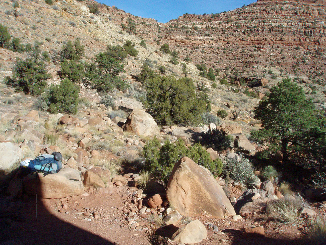
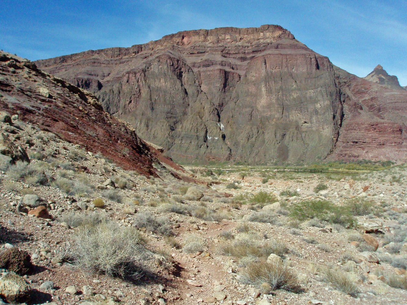
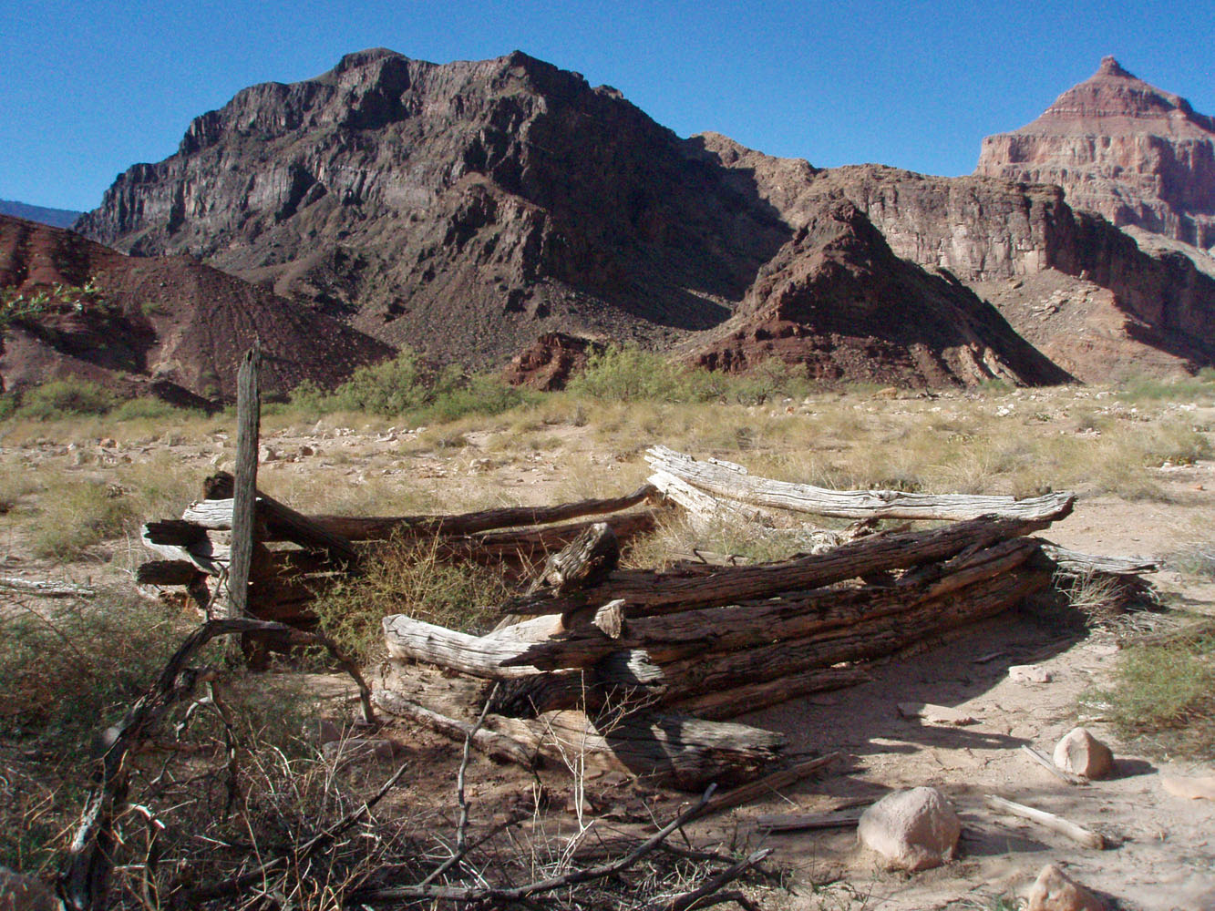
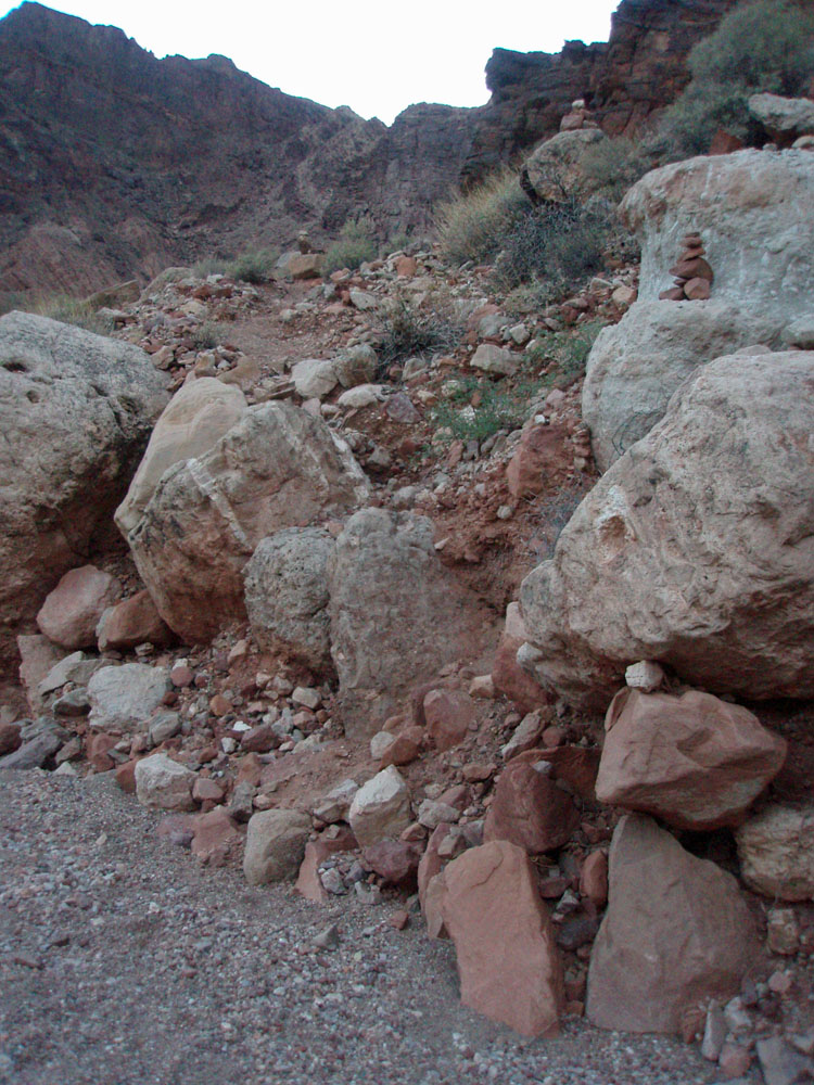
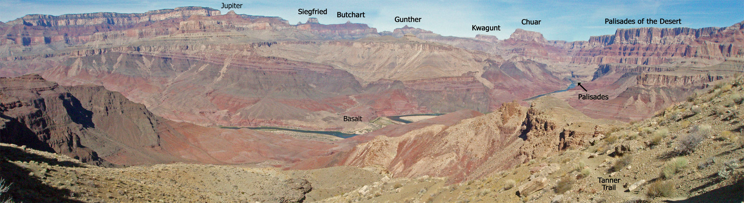
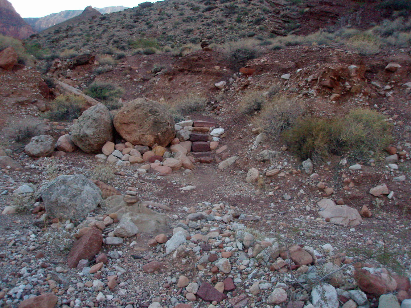
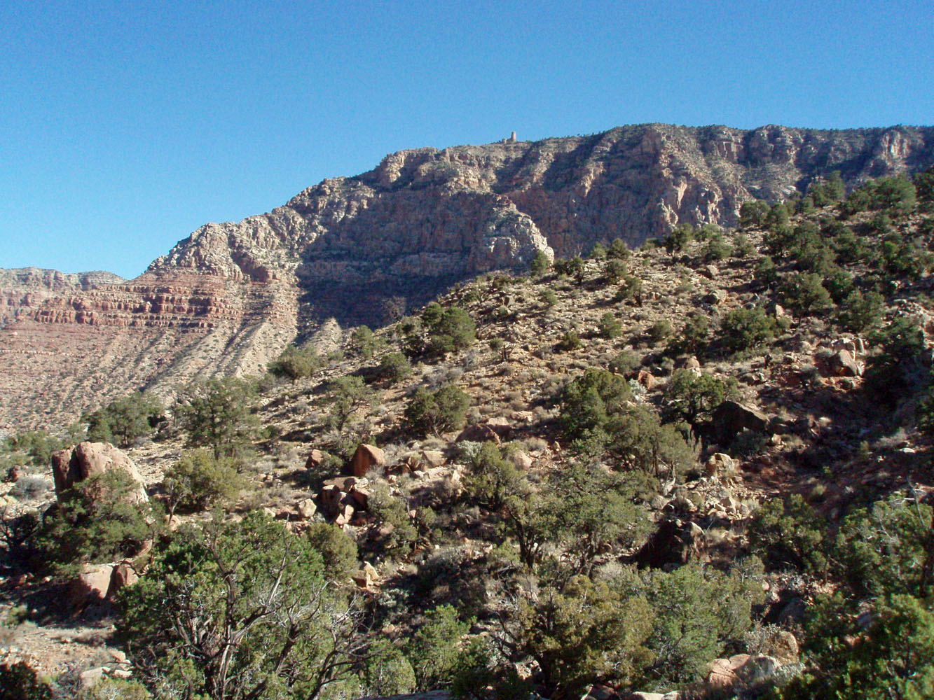
Day 1 - Getting to Palisades - I was on the trail by 7:30 a.m. with a pack weighing only 40 pounds This included two liters of water that I would cache along the way - one along the Esplanade level between Escalante and Cardenas Buttes, and the other at the little rest area below the Redwall. I reached the lower spot at 10:45 a.m. and had to tape some cushioning to my ankle area that was being rubbed raw by my boot. Below the Redwall, in the Muav and Bright Angel layers, the trail winds along at a fairly level elevation as it heads for a ridge that will take one down through the next rock layers. Along here is a small saddle, where you get a great panorama view of this part of the canyon. [Click on the photo below to see some annotations.]
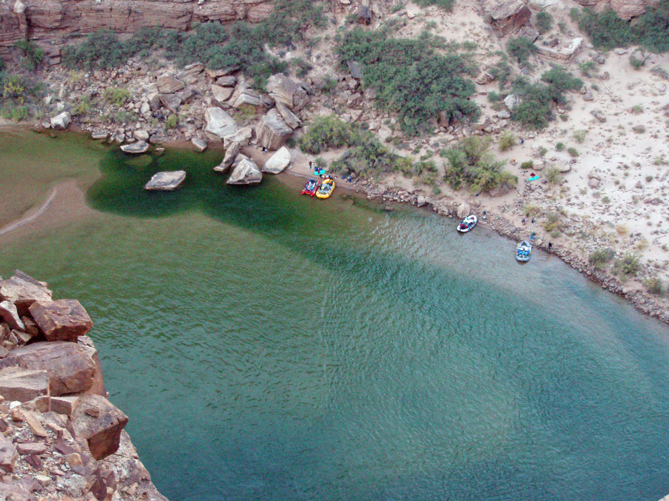
Below the Tapeats I came across a large party heading out. They were led by Sally Underwood, whom I had not met before, although I have read her messages on the Yahoo Grand Canyon group site. They had been to Palisades and were planning on a final night camped above the Redwall on their way out. At 12:30 p.m. I neared the beach and reached the junction with the trail that heads up the river. I took a 40 minute lunch break along here, overlooking the river. |
|
|
||
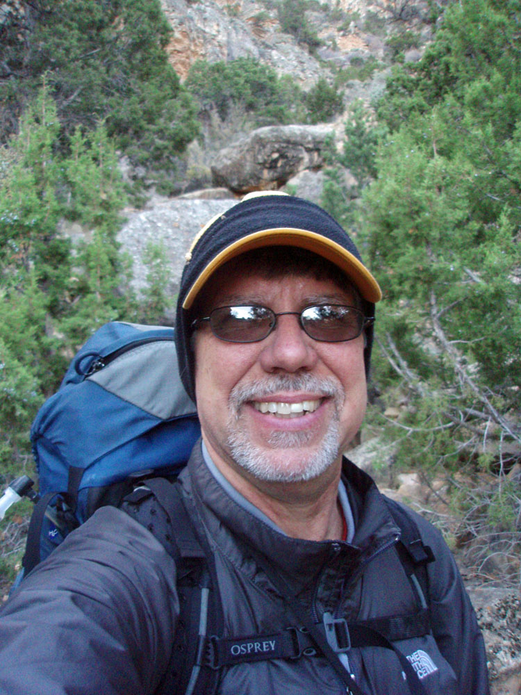 Self portrait from the bed of the ravine above the 75 Mile Canyon saddle. It was a bit chilly at the start of this hike. |
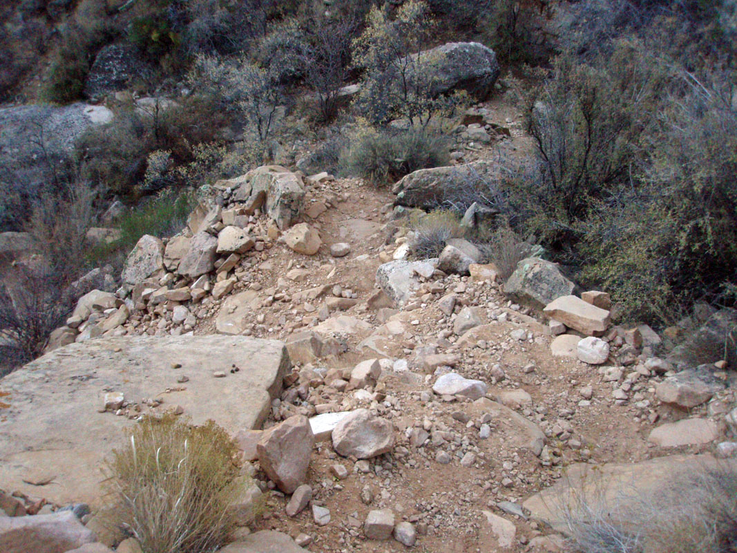 A typical segment of the Tanner trail. |
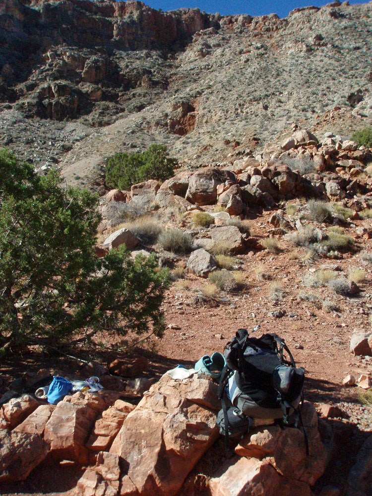 I cached two liters of water along the way. The lower one was here, below the Redwall formation. |
 The spot for my first water cache. |
||
|
|
||
 |
 |
 |
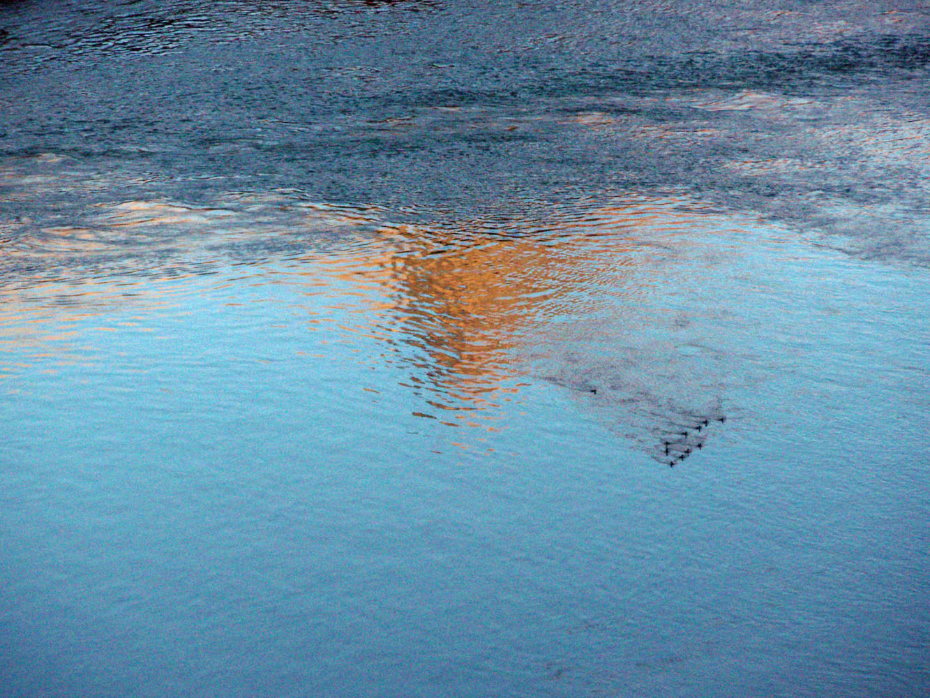
| The final leg to the river at Tanner. | Cairns mark the river trail I used. | My lunch spot, just above Tanner. |
|
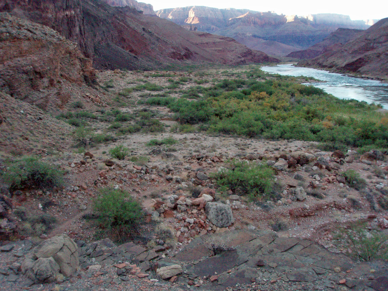
In less than an hour and a half, at about a quarter to three, I reached
the Palisades area. This is a rather broad and flat expanse,
although finding a good camping site can be a bit of a challenge.
I dropped my pack at a good place near the river - sandy, flat and
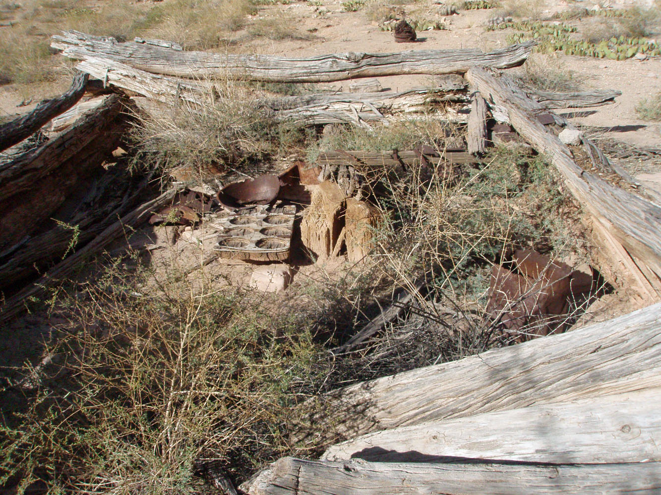
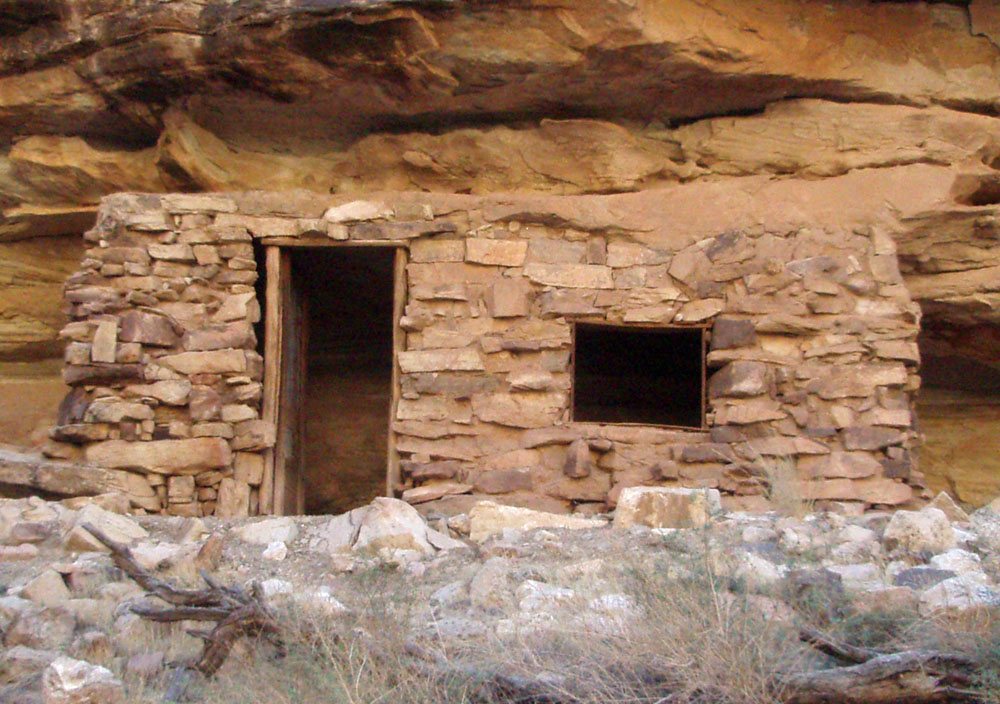
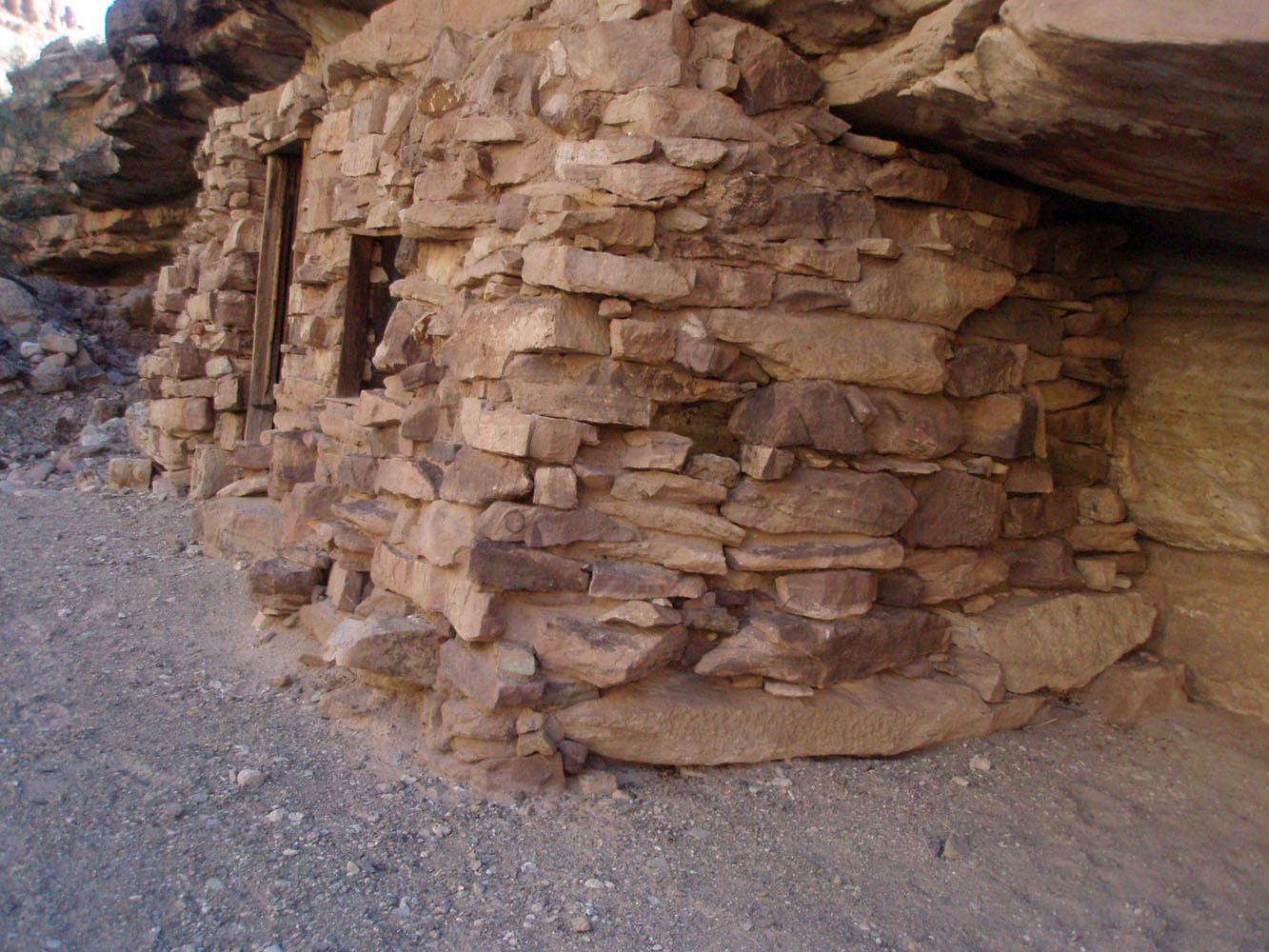
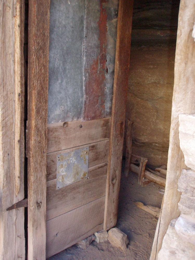
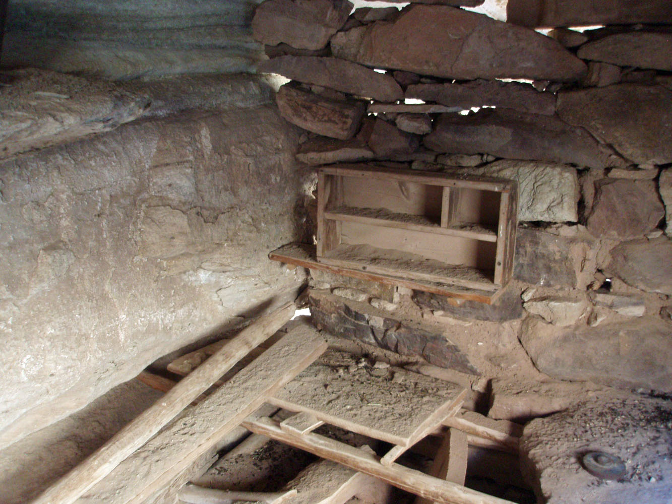
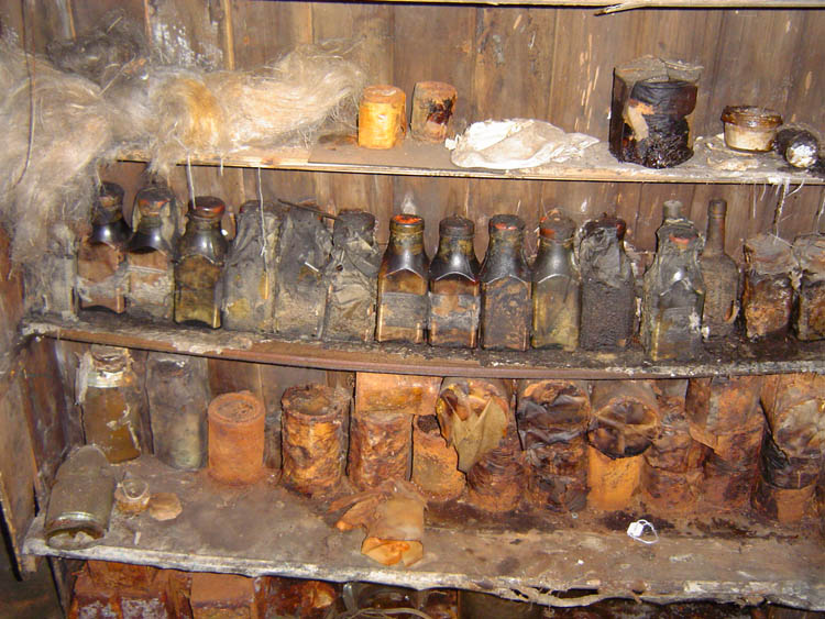
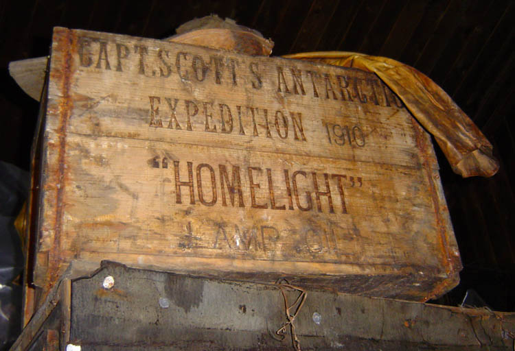
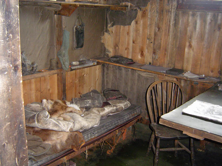
partly shaded. Then, I wandered around to the old cabin and took
some photos. There were some items scattered about - a frying pan,
an odd looking wooden piece with circular depressions (sort of like a
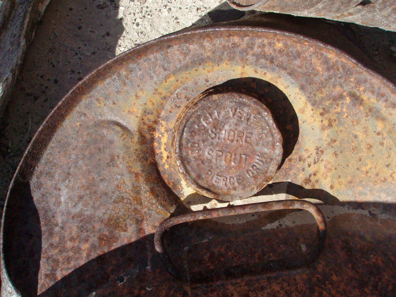
wooden muffin pan) and the lid from an old gas, or oil, can. On
the lid you can still read what it says - "Self Venting Shore Spout
Don't Pierce Drum."
I decided that my spot was going to be fine, so I set up my tent. I had to prep some water right away as I had just finished the two liters I brought with me. It was just enough! About an hour later a solo hiker passed by and at dusk I saw a light further upstream. Later that seemed puzzling because I didn't see him the next day when I hiked up to the Little Colorado. The sunset was fantastic (see below) and by 6:30 p.m. I was in my tent wearing a light jacket to fend off the chilly conditions. |
|
|
||
 The Beamer trail is in good shape. |
 Tailing from Copper Blossom Mine. |
 Mining structure. |
 Inside the old cabin. |
 "Self Venting Shore Spout" |
 Campsite in Palisades. |
 |
||
| Day
2 - To the Little Colorado and back - I wanted
to get an early start, so I set my alarm for 5 a.m. But, it was
just too dark then, so I stayed in my sleeping bag for another
hour. While the light is fine for hiking at 6:30 a.m., I didn't
get on my way until about 7:30 a.m.
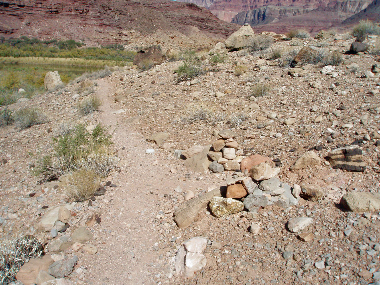
It only took me a half hour to cross over the Palisades area and climb up to the top of the Tapeats, where the trail stays all the way to the Little Colorado. The route was easy to follow and marked with cairns in some places. I soon had a great view down to the river at Carbon Creek, where a river party was making preparations to leave. Although it looks like the Beamer is a straight shot to the LC, you have to do a lot of contouring in and out of all the ravines. At ten o'clock I reach areas getting sunshine, near an island marked on the map, about two-thirds of the way to the LC. I took a short break here and made a list of all the things I forgot to bring with me on this day hike - my map, my swimming suit, and my water bucket. As it turned out, I didn't need any of them! |
|
|
||
 By 7:30 a.m. I was on my way to the Little Colorado River. Even though I am down at the river, it was still chilly. |
 Looking back on Palisades. |
 A couple of cairns mark the route out of the bed of Palisades Creek (dry). The trail was easy to follow to the LC. |
 A river party at Carbon Creek. |
||
 |
 |
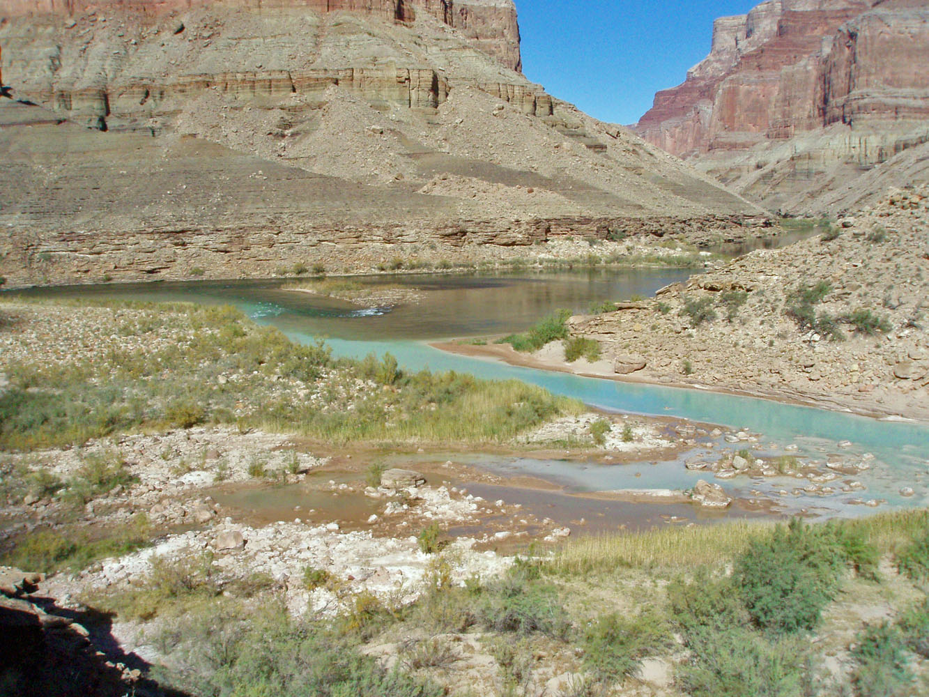 |
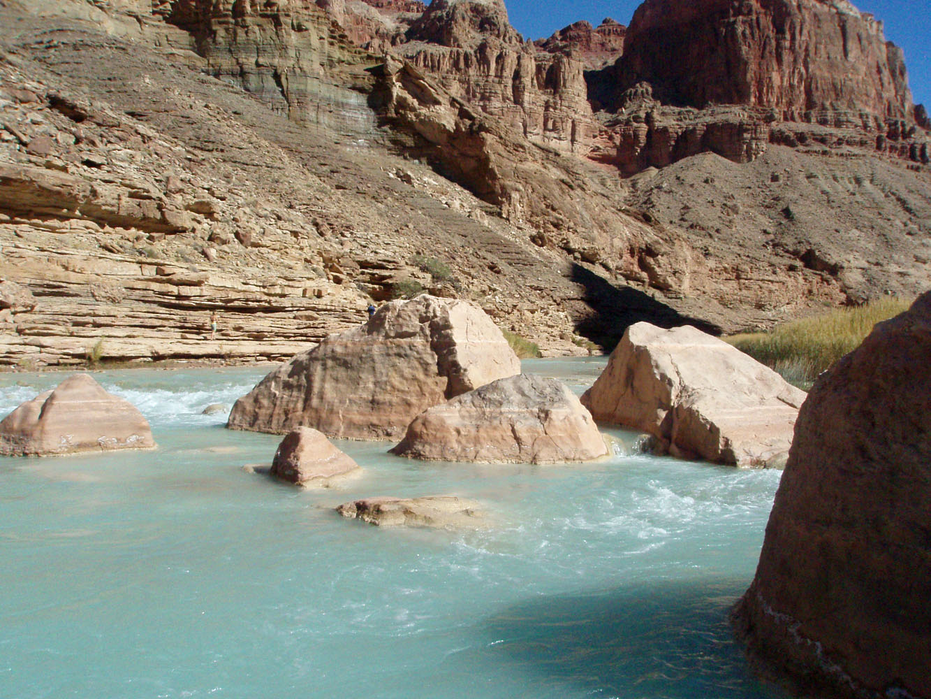
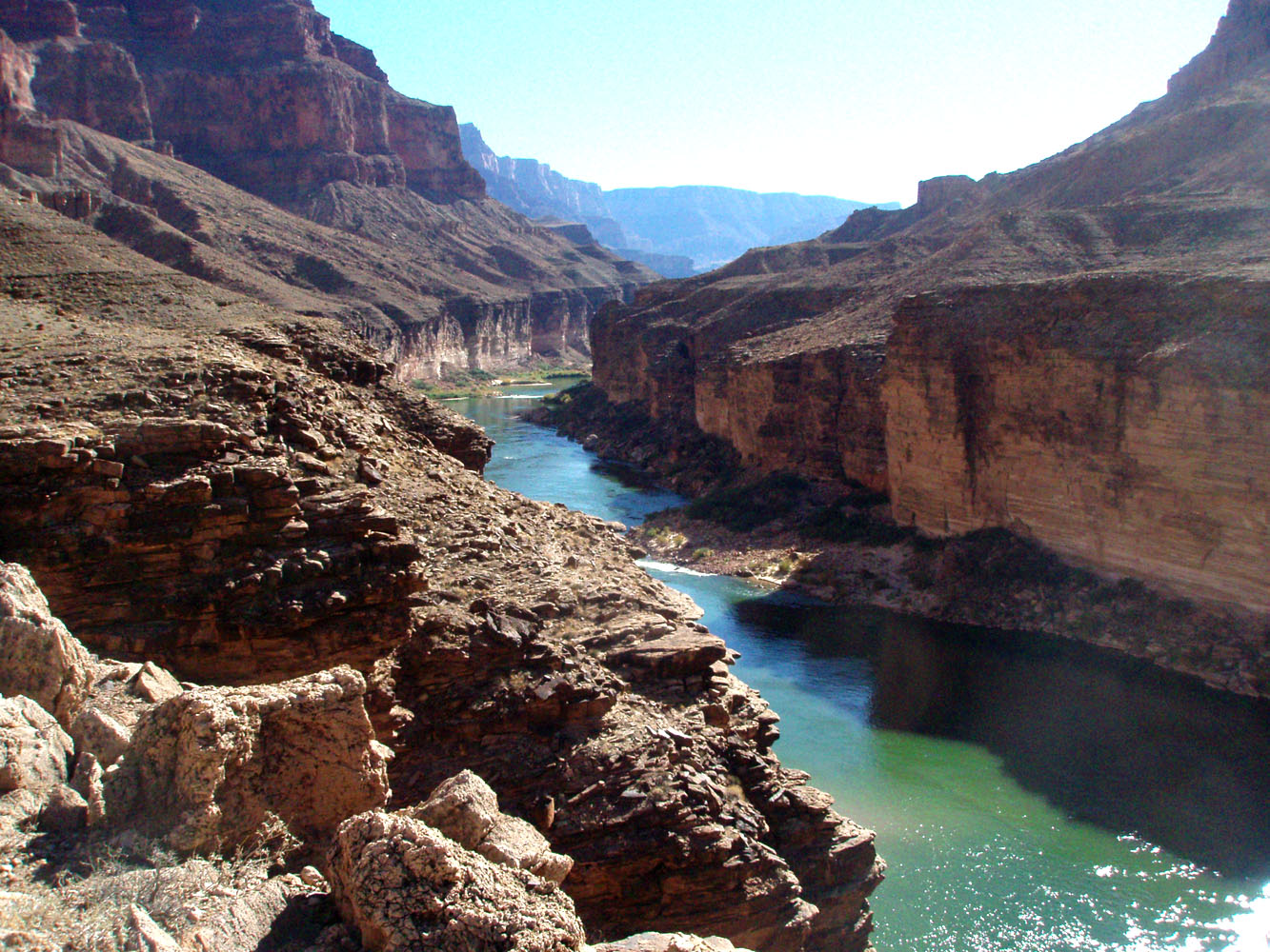
| At times, the trail is precarious. | Aqua LC entering Colorado River. | The LC/Colorado confluence. |
|
Just a bit before 11 a.m. I passed the last spot where you can camp
below the LC. [The Park Service has the confluence off limits for
camping.] About thirty minutes later, I reached the LC and the
trail took me right by the old Beamer cabin. Beamer was a miner in
this area more than a hundred years ago. I recall that Powell had
seen an Indian ruin when his party came down the river. Since no
one has seen it since, the presumption is that Beamer rebuilt it into
the cabin that's here now. He also claimed to have irrigated about
ten acres here for crops and that must have been quite a chore.
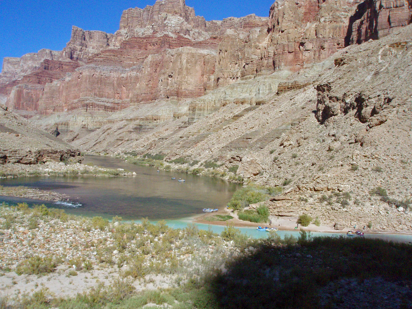
I poked around the cabin for a while and got some pretty good photos. I had been considering a trek up the LC to the Hopi Sipapu site. But, with many more miles to go, I had to abandon that plan (so, I didn't need my map). Instead, I decided to just take a long lunch break alongside the aqua waters of the LC. The water looks pretty, but you wouldn't want to drink it! And, it was way too cold for a swim (so, I didn't need my trunks). Just before heading out a big boat party arrived and they started hiking up the LC, but on the north side, away from my location. At 12:30 p.m. I was on my way back to Palisades. |
| I
reached the descent into Palisades at 4:20 p.m. There were more
river parties camped on the other side - at Carbon and at Lava. I
still had one liter of water, of the three and a half I started with
(so, I didn't need my water bucket). I saw some fresh boot tracks
on my way back to camp, but no signs of another hiker here. By
4:45 p.m. I was back in camp.
For dinner, I brought along an old freeze dried package that had been opened up a year and a half earlier. It was turkey something or other. I thought that this stuff stayed good forever, but have since learned that is not the case. The turkey didn't reconstitute very well and it didn't taste very good either. The next day, I would wonder more about that! Day 3 - An attack in Palisades - I had a free day in my schedule and thought to spend it looking around the Palisades area. It's a good thing I didn't use the previous day for this as I wouldn't have been able to see the Little Colorado. That's because I spent the day sick as a dog in Palisades.At the early hour of 4 a.m. I shot out of my tent and had an attack of the runs. I managed to get back to sleep for a couple of hours, but then woke up cold and nauseous. At 7 a.m. I was throwing up out in the bushes. An hour later, more of the runs. An hour after that I was throwing up again. An hour after that I had another attack of the runs and an hour after that, at 11 a.m., I was throwing up again. Needless to say, I was just drained. Could it have been the funky turkey? That is what I thought, although a doctor I saw later seemed to think it might have been the norovirus. Well, that may be. And, the turkey could still be the source. But . . . someone in Sally's group also got violently ill here in Palisades just a day or two before I got there. And, a week later I was doing a day hike down the Tanner (to the top of the Redwall) and a hiker came up that reported his hiking buddy, who was still down at the river, was also quite ill. So, maybe it was part of some bigger problem. So, guess what? No pictures from this day at all! Following my last attack I was back in bed for a while. A bit later I did manage to eat a quarter of a piece of bread and swallow a couple of sips of Gatorade. But, that was it. In the early afternoon I walked down to the river and got more water and filtered it. At 2 p.m. I took a very slow walk around my local area. I was very tired, but couldn't lie down flat for fear of throwing up again. I ended up laying on the side of a hill for a while, which worked well except that I got cold and had to give it up. Eventually, back at camp, I climbed into my tent and propped my head up with my pack. I got an hour's worth of sleep from 3:30 to 4:30 in the afternoon. I woke up feeling a bit better and ate a fruit cup (peaches), another quarter of a slice of bread, and made a packet of oatmeal and hot cocoa. I thought I might have overdone it, but by 5:30 p.m. I was feeling OK. I felt like another night of rest might be good enough to help me hike out from here on Monday. |
Day
4 - The long road out - I got up at 4:30 a.m.
because I figured I would be a rather slow hiker. Two hours later
I was ready to go. I didn't have anything to eat and only a couple
of sips of water. I knew that would be unsustainable, but
I needed to make sure that I didn't aggravate my tenuous stomach
condition. As I was 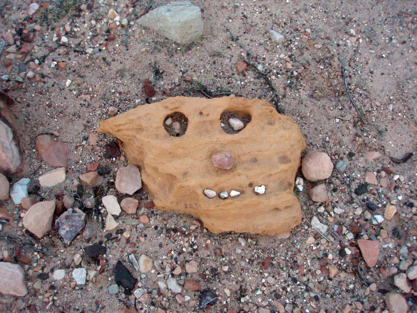 walking
along the river trail, I came across a funny rock that someone made look
like a face - kind of like I felt! Well, I thought it was funny. walking
along the river trail, I came across a funny rock that someone made look
like a face - kind of like I felt! Well, I thought it was funny.
It took me two hours to reach the Tanner trail. It was cool and shady the whole way, which helped quite a bit. From 9:30 to 9:50 I rested below the Tapeats. At 11:15 I reached my lower water cache, below the Redwall. I laid down here and fell asleep until noon. I felt better, but still quite tired and not able to eat or drink much. From my campsite to my upper water cache, all I ate was one granola bar, one small bite at a time. I started off at noon, reached the top of the Redwall at 12:40 p.m. and my upper water cache one hour later. So, my hiking progress had been quite good, as ill as I felt. I did run into a hiker that was going to keep an eye out for me on his return - he was day hiking - in case I crashed before getting out. Since I wasn't drinking very much at all, I left the upper water cache in place, to be retrieved the following weekend when I had a day hike planned. I took a half hour nap and decided to eat a pudding. That turned out to be a mistake, as I threw it up shortly thereafter. At 2:15 p.m. I was back on the trail, reaching the 75 Mile saddle at 2:45 and the top of the trail at 4:45 p.m. My debilitations didn't really affect my ability to walk and while I felt like I wasn't going very fast, I was able to keep up a steady pace all the way out. |
|
|
||
|
|
Return to Hiking Grand Canyon home page |
|

