|
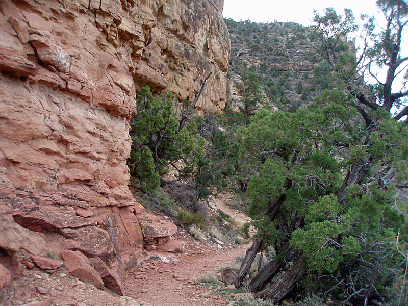
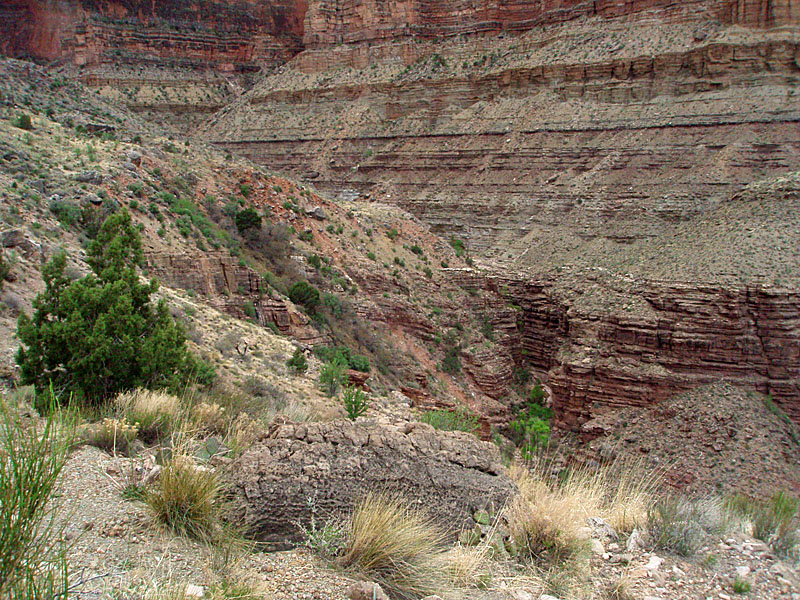
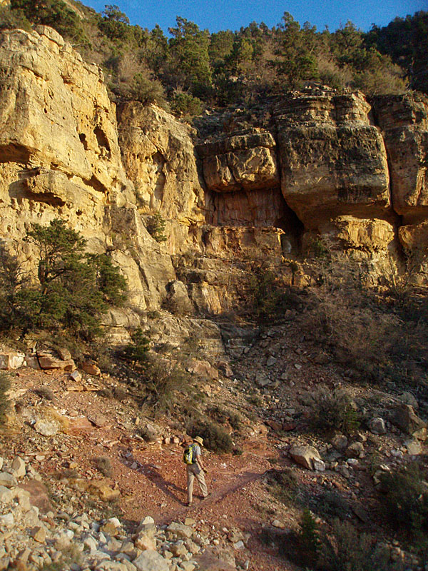
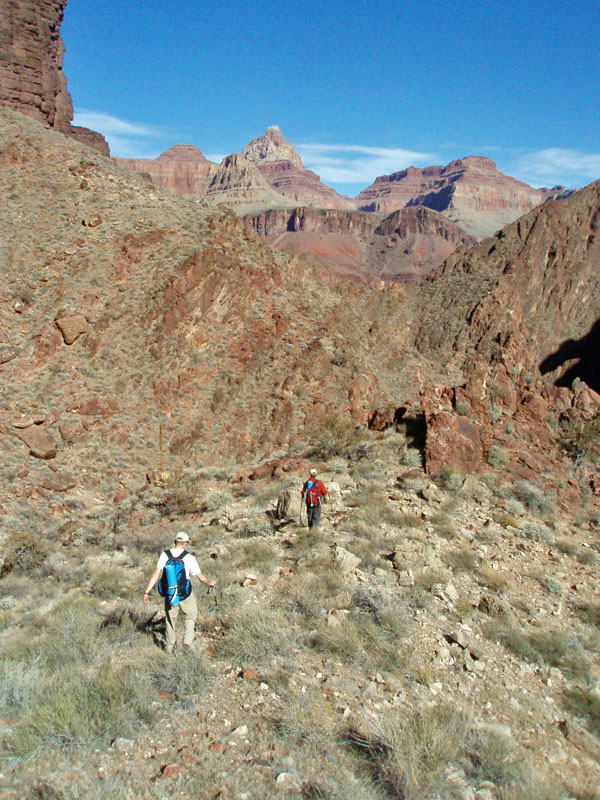
I joined hiking buddy Bill Ferris and his son Matthew for a seven day trek from Tanner to Grandview in mid-March. We spent a lot of time hiking through the "Grand Canyon Supergroup," which are old rock layers that appear with some infrequency in the canyon. [For instance, none of the rock layers in my header photo above include the Supergroup.] Once home, I pulled out my copy of "Hiking the Grand Canyon's Geology," by Abbott and Cook (referred to as HGCG in references below). The authors walk you through the geology that you are seeing as you hike down many of the trails in the canyon. I read through their description of the New Hance Trail as it had a lot of good information on these Supergroup rock layers. In fact, this trail is in Red Canyon, so-named for the brilliant red Hakatai shale, which is a prominent layer of the Supergroup. After reading the text, I was anxious to return to the area and to go down the New Hance Trail and really pay attention to the geologic story. For years I have bemoaned the fact that there is no such thing as an "emergency holographic geologist" that I can take on hikes.* But, I once did a day hike down the So. Kaibab and up the Bright Angel with a retired geologist. He told tons of fascinating stories that I have since totally forgotten. But, I wish I hadn't. Forgotten, that is. So, I planned to do this hike and got another one of my hiking buddies, John Eastwood, to join me. We left Flagstaff a bit past 5:30 a.m. and were at a parking spot near the New Hance trailhead by 7:30 a.m. It's hard to get an earlier start without overnighting at the canyon, but so it goes. As a consequence for us, we weren't able to get all the way to the river on our day hike - there just wasn't enough time. Well, that and the fact that we stopped for mini-geology lessons all along the way. I copied ten pages from the book and blocked off sections to read at various points along our hike. We then would take a closer look at our surroundings and marvel at our new found insights. We both agreed that it was worth the time spent to actually interpret what we were seeing, even though we had both been down this trail many times. There is no parking at the actual trailhead. Generally, people park about a half mile to the west, at a short spur road (that leads to a locked gate), or about 1 mile to the east at Moran Point. But, over the last couple of years I have noticed vehicles parked at decent pull-off spots along the road much closer to the trailhead (where there are "No Parking" signs posted). So, we found the best spot, in my opinion, and were happy to have just a short jaunt down the highway (the most dangerous part of this hike!!) to the launching point for our trek. |
|
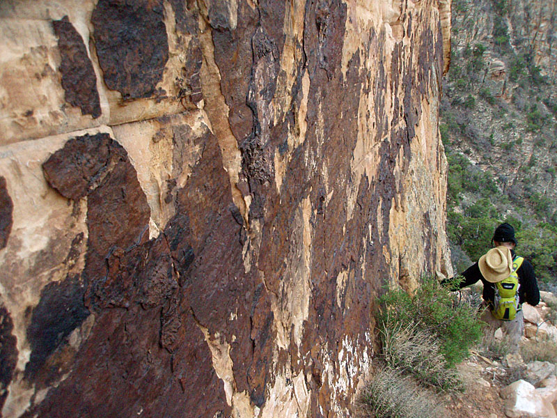
John and I were both carrying pretty light day packs. Since John left his lunch at home, his was even lighter than planned! I was carrying 4 liters of water, with the intent of caching two along the way down. John had 3 liters and a SteriPEN with the intent of picking some up at the creek, which seems reliable, even if you have to walk a ways up the bed once the trail gets down that far. It took us about 15 minutes to reach the rim, where there is a trail sign. The sky was mostly clear, but we had some overcast later in the day. There wasn't any forecast of precipitation, but it seemed threatening for a while and we did feel a few drops when we were down in the creek bed after noon. I'm glad it didn't last since we both left ponchos at home. From the rim I did the first reading from the HGCG, noting that we would soon see some rare white fir trees, see some fossils hardened into chert nodules in the Kaibab limestone, and see a U.S.G.S. benchmark just above the Coconino cliffs. HGCG states that the benchmark is "a silver disk attached to the cliff at shoulder level." [99] We found a black disk, that seems to me to be bigger than the usual silver disk, and it was more like at waist level. There was no date on the benchmark, so it could have been a newer one (the book was published in 2004). In hiking through the Coconino sandstone we looked for the dark "desert varnish" that covers parts of the exposed rock. As it is more resistant to erosion, it sticks out a bit from the wall. Further down we saw a feature of small holes in the rock that are called "tafoni." They make for a bizarre-looking formation. The HGCG also notes that the lower Coconino tends to be red because we are on a fault line and that has allowed "mineral-charge waters" to percolate into the rock. [100] We were soon down near to the saddle between the rim and Coronado Butte. A large ponderosa pine tree marks the approximate transition to the Hermit shale, although the area is covered in vegetation. Here I cached my first liter of water. |
|
|
||
 |
 |
 |
| A heavily varnished wall of Coconino. | "Tafoni" feature in the sandstone. | Coronado Butte. |
|
From the saddle, we descended a ravine through the Supai layer to the
top of the Redwall. It took us a total of about two hours to get
here from my truck. While taking a break we were passed by a young
couple. They were moving very well and made it all the way to the
river and then passed us again on the way back up in the middle of the
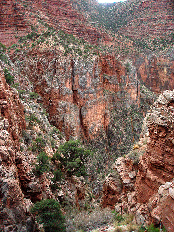
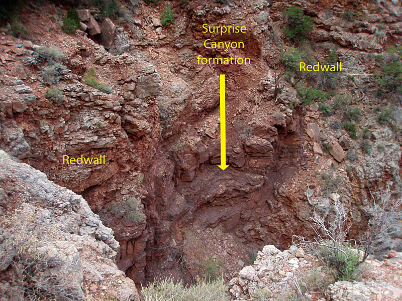
afternoon. From here, you must traverse along the top of the Redwall for about a mile to reach the route through the cliff. Parts of this traverse were more difficult than I remember from nine years ago. [Actually, I didn't remember any difficult sections. But, it was nine years ago!] We had a couple of boulder slides to climb through that take a bit of thinking to make sure that we were following the cairns correctly. Other parts of the trail are nice and flat and we were able to cover ground pretty quickly. A special stop was made about halfway along the traverse when we were above a narrow slot in the Redwall. Here there is a piece of the Surprise Canyon formation that is visible between flanking cliffs of Redwall. This maroon colored rock lay above the Redwall but mostly eroded away before the Supai was formed. But, in this spot, a sinkhole in the Redwall was filled with this younger formation and it has been protected for more than 300 million years. Later, we could detect more of this formation in some of the rocks along the trail as we descended. |
 |
 |
 |
| At the Redwall descent ... | ... Butchart noted some lettering. | All-American rock along the Redwall. |
|
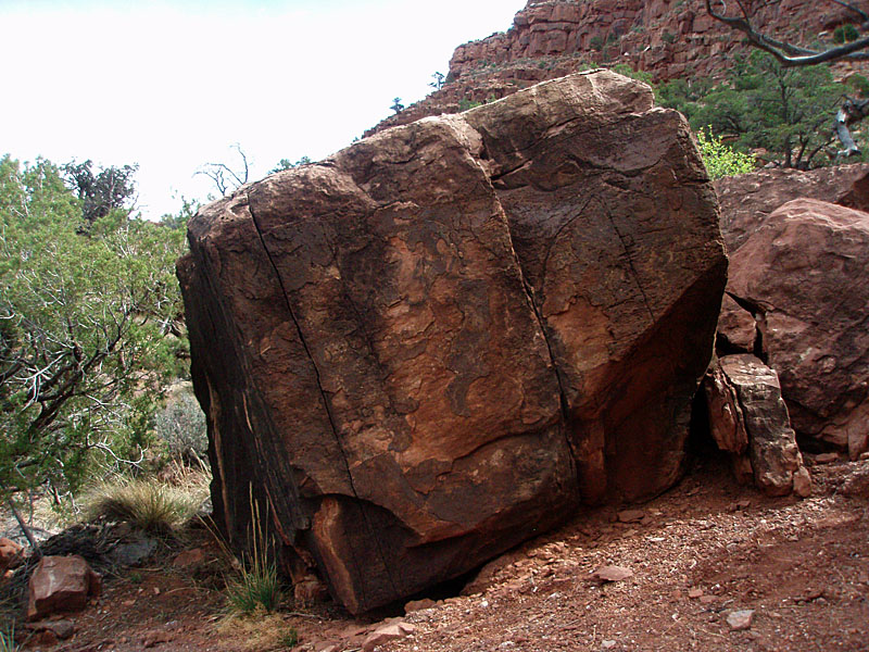
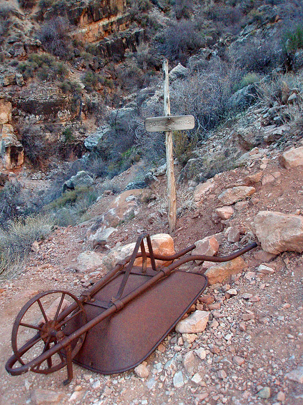
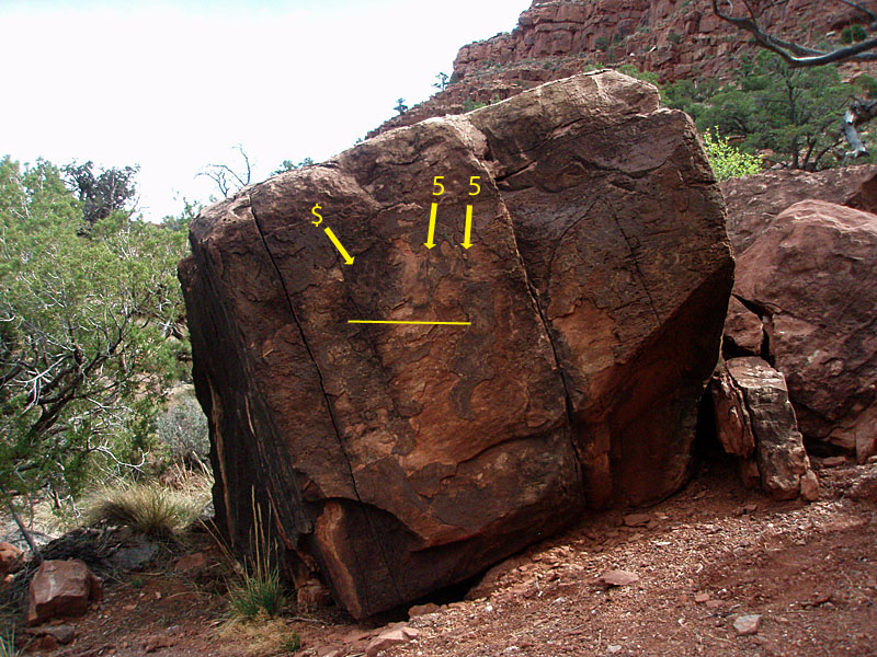
We reached the descent through the Redwall at 10:50 a.m., about an hour
after our rest break at the bottom of the ravine before we started our
traverse. We were just starting to have the sun shine on us,
having been in the shade so far on this hike. But, before long,
the overcast got heavier and we were able to enjoy pleasant temperatures
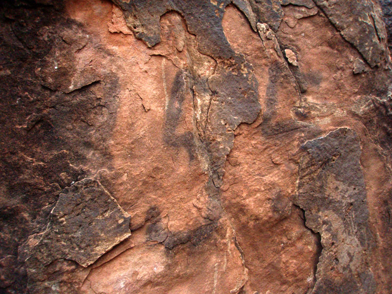
all day. At the Redwall descent, Harvey Butchart wrote that, "The place where the horse trail starts down is marked by cairns and some old lettering painted on the side of a big rock." We went right by it before we stopped so I could review the reference. We found the rock easily enough - it's the biggest one around in the area (see above). It took us a while to detect the "lettering" and longer to figure out what it was. It seems to us that there is clearly a "55" on the rock (see the photo above), that is in black on the red part of the rock. On the black part of the rock there looks to be some other letter, or maybe a symbol. But, it doesn't look painted - more like it was scraped into the rock (through the black part to the lighter red). I think it looks like a dollar sign. Click on the larger image and once you find the "55" look to the left to see what I mean. If you have trouble, see this annotated version. Seems like an odd notation, unless John Hance was selling Grand Canyon adventures for $55!! |
|
|
||
 |
 |
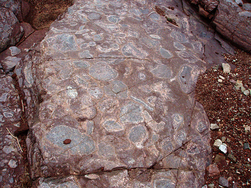 |
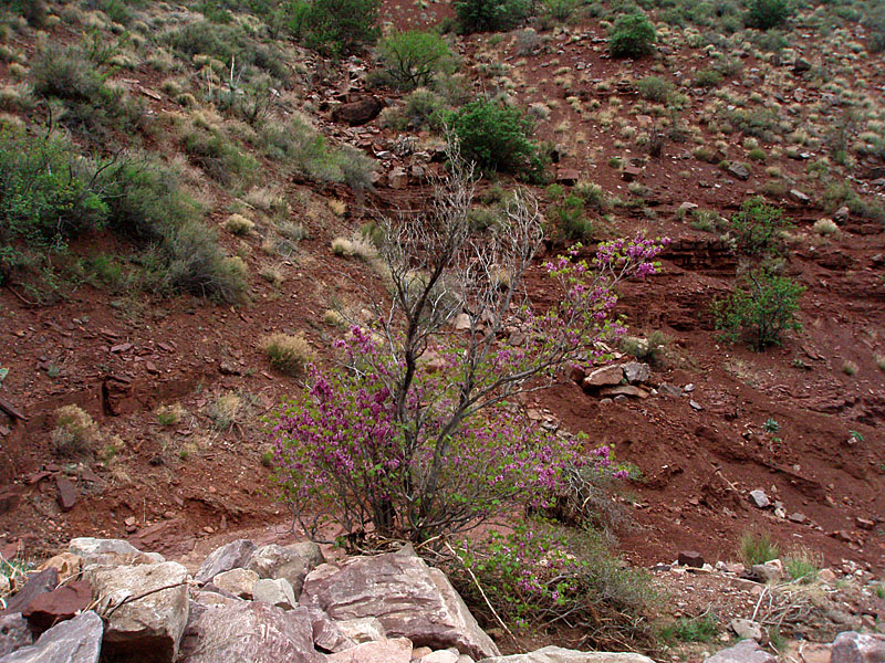
| Blooming redbud tree. | Me & John near stromatolite site. | Bass limestone w/stromatolites. |
|
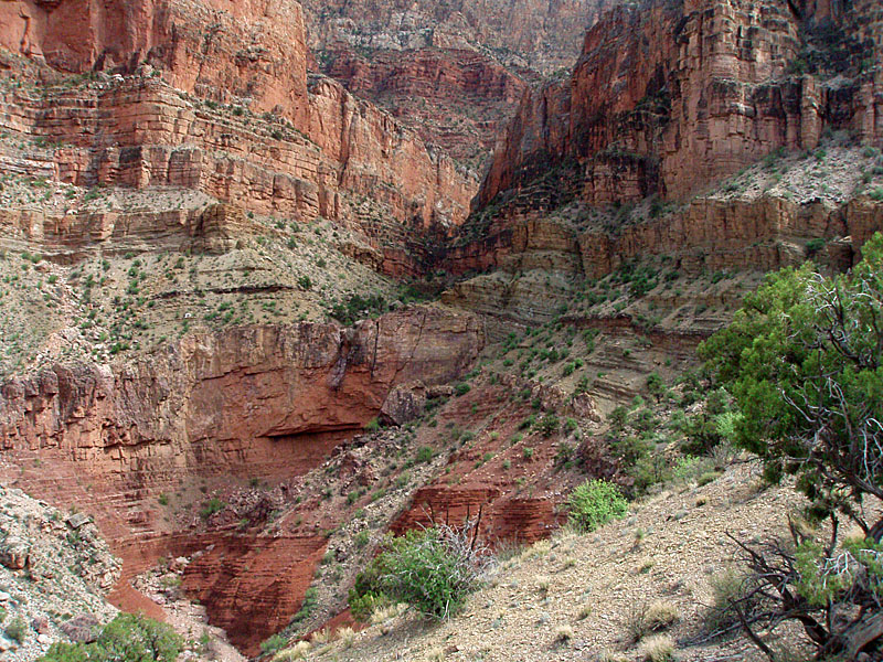
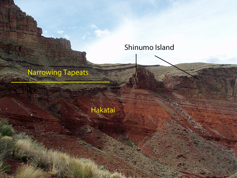
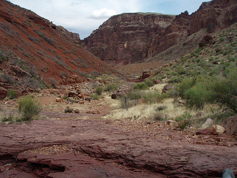
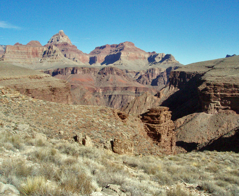
Once below the Redwall limestone, we descended through the Muav layer
and the lower Bright Angel shale. Normally, we would then be atop
the Tapeats sandstone, which forms the broad Tonto Plateau throughout
much of the canyon. But, there is no Tapeats where we are standing
and we next met up with the upper part of the Grand Canyon Supergroup -
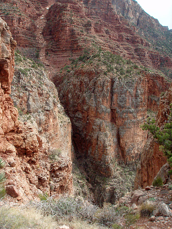
the Shinumo quartzite. Indeed, the 70+ mile
Tonto Trail
begins down at the river, at the end of the New Hance Trail, and climbs
up along with the emerging Tapeats. [At least, that is true on the
south side of the river - one can find the Tapeats layer on the north
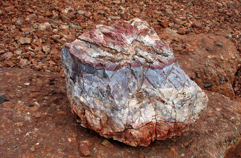
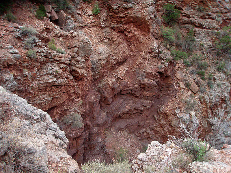
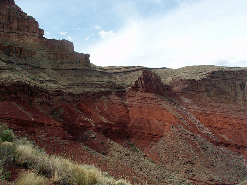
side.] The Shinumo is a very hard rock layer and to the west we can see a Tapeats cliff that peters out where a large outcrop of the Shinumo towers over where the Tapeats would normally be. Here, the Shinumo was an island that persisted for millions of years (I think that's right) while the Tapeats was forming. [See the photo below.] At the bottom of these rock layers is the Bass limestone. The trail passes through a major ravine, where we saw two redbud trees in bloom. Just down the bed about twenty yards are some pieces of limestone that have fascinating circular structures embedded in them. These are called "stromatolites," and were part of a mat of bacteria - Earth's earliest life - that were whipped apart by an ancient hurricane. Somehow, they came to settle into these shapes and become part of the limestone that was forming. If you miss them, the trail climbs up the hillside and you'll soon be looking down into this ravine and you'll see the limestone ledge that creates a pouroff that helps mark this spot. It took us about an hour to reach this spot from the "$55" rock, although we did stop partway down the Redwall so I could cache my second liter of water. |
|
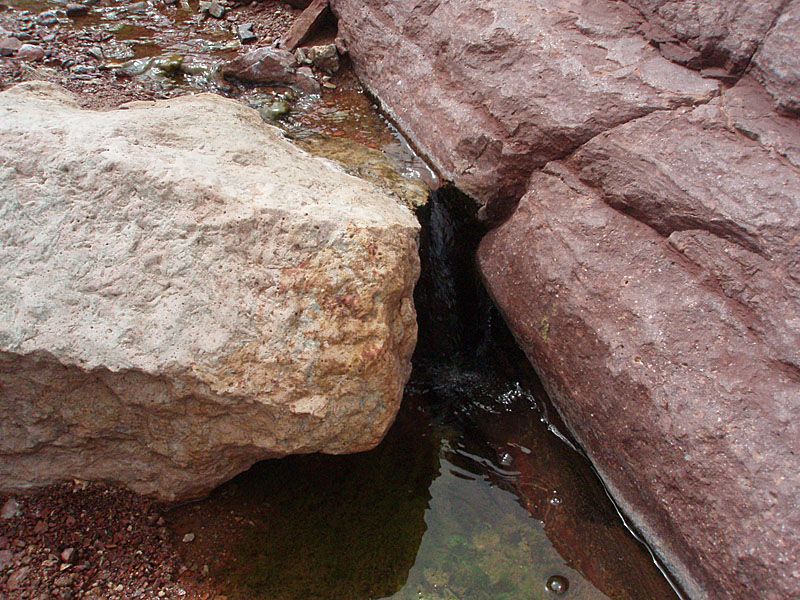
At 12:30 p.m. we reached the creek bed, where there was a small flow.
We had seen some water in the bed further upstream, but it didn't seem
continuous. I was once here in August of 1999 and found water
further up the bed where there is a long fall and many cottonwood trees.
While we were only about two miles from the river, we had targeted 1:30
p.m. as our absolute turn-around time. We probably could have
hoofed it down to the Colorado, but we wouldn't have had time for a
leisurely lunch and would have had to really bear down for the hike
back. So, we decided that this was as far as we'd go. There
was a huge boulder here, where we could sit in the shade and enjoy lunch
and rest up before trekking out. And, John decided to pull out a
liter of water here, which he ended up drinking from before we reached
the rim. Although he had plenty of snacks, I shared my lunch with
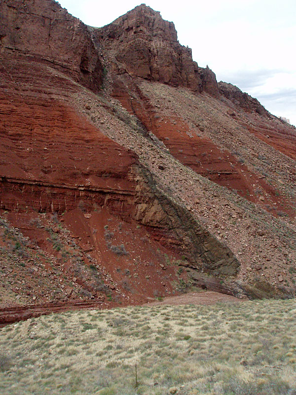
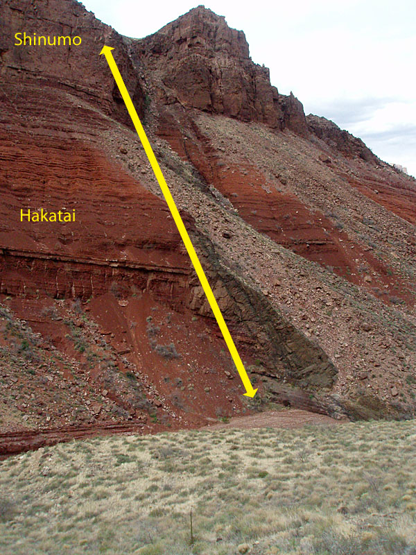
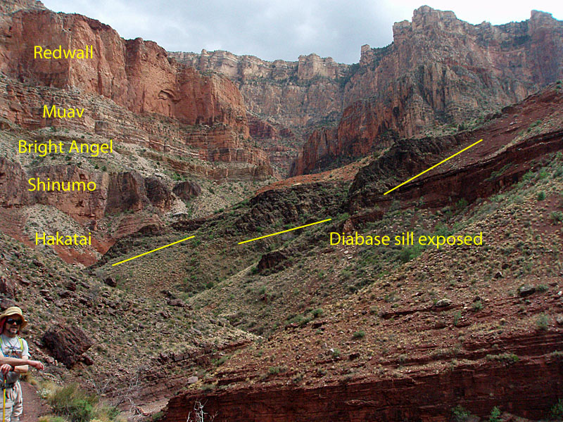
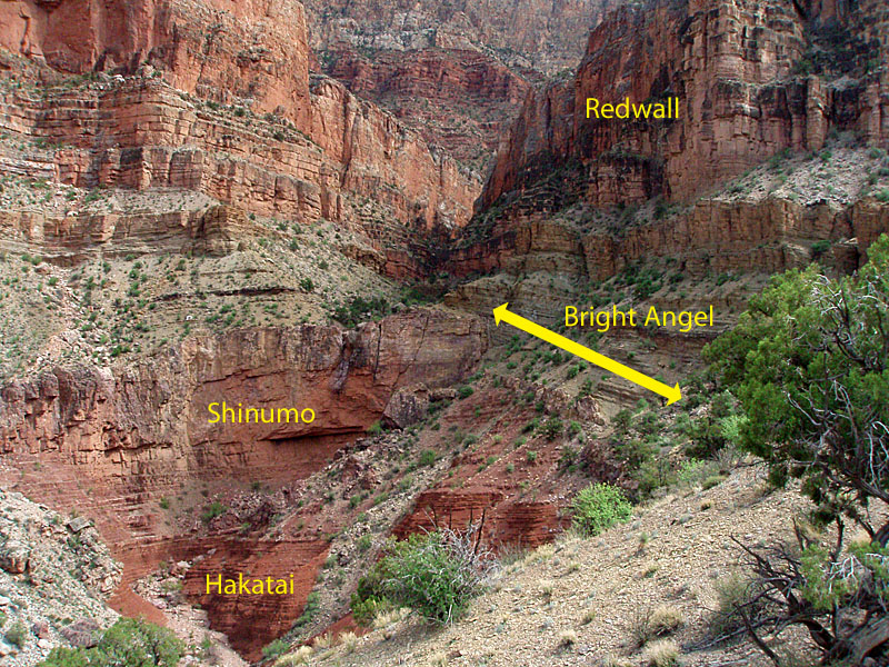
John. I think that means he owes me lunch. More intriguing geologic features in this area are the lava intrusions that form dikes and sills (sills lying along the existing layer of rock; dikes cutting through layers). One sill was visible above us as we hiked down to the bed and an impressive dike was pretty much just across the canyon near where we stopped for lunch. What especially fascinated me was the fact that these intrusions heat up the surrounding rock and subtly, or not, change it. The Hakatai gets much darker near the ancient lava flow. "At mile 5.6 the rubble-covered slope changes for a few yards from red to dark green. This change marks where you cross the diabase dike." [104] And, if you've seen the white talus beneath Hance's asbestos mine on the other side of the river, that is also the result of the lava heating up and "bleaching" the Bass limestone. [105] At 1:45 p.m. we were packed up and heading back to the rim. We figured the hiking might go a bit faster since we weren't going to be stopping for geology readings, nor investigating the geological features we checked out on the way down. We did stop for a bit and look at the big side canyon that comes down from east of Moran Point. This is the same one where the stromatolites are located. The trail heads up the slope that flanks this canyon and as we got up to the Bright Angel shale we had a good look up toward the rim. The rock layers here are a mess with the Shinumo diving under the shale. There must be a story here, but I don't know what it is. I have annotated a photo and included it above. The hike out
was tiring but went well. We had spent 4.75 hours coming down and
would spend 5 hours getting back, which included two long 25 minute rest
breaks at my water caches. Here are some details on these hiking
times coming back up: The couple that passed us going down passed us going up when we stopped at the water cache in the lower Redwall. Besides them, we only saw three other hikers - they were camping atop the Redwall at the bottom of the Supai ravine and we chatted briefly with them on our way out. So, even though this is a popular time of the year to hike this trail, it certainly wasn't getting much traffic on this day. |
|
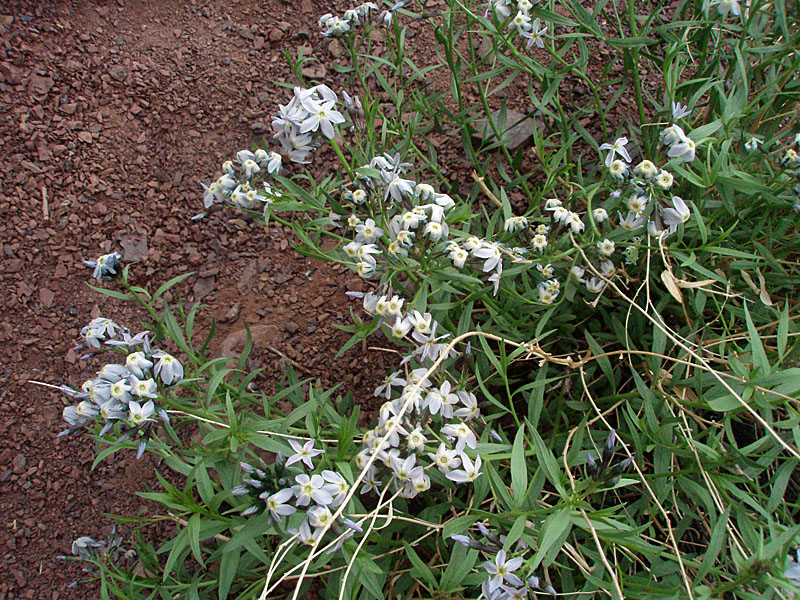
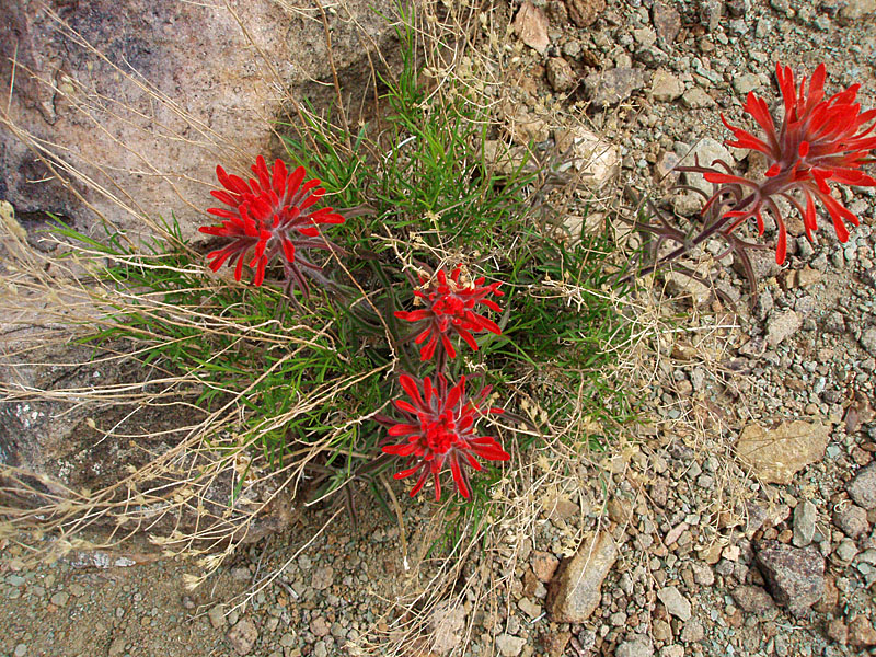
It was a good time for wildflowers, with many small blue and purple
flowers blooming. [I don't know what they are. Now I need an
emergency holographic botanist!] We saw only a couple of Indian
Paintbrush blooms. The new agave were still not shooting up,
although I saw many that were a couple of weeks earlier on the Tanner to
Grandview hike. Also, it is still too early for the cactus to be
blooming.
We reached the rim at 6:47 with dusk befalling us. On the walk
back to the truck every vehicle that passed us had their lights on, but
it wasn't really dark yet. The shoulder of the road is very narrow
in here, and drops off sharply into the brush, so it is not pleasant
dealing with the vehicle traffic, especially when a big tour bus comes
by! It was dark by the time we pulled out onto the road at 7:15,
so our timing was spot on. That is even more true since John
didn't bring a headlamp. I guess he really was concerned about
keeping his pack weight down!! We stopped at the Cameron Trading
Post for dinner on the way back home - I am becoming quite partial to
their enchilada plate. We pulled into town a bit after 9:30 p.m.,
making it a very long day. My pack weighed just 9 pounds at the
end of the hike, although I was still carrying a bit more than one liter
of water. [At the start, it weighed 16 pounds.] |
|
|
||
|
|
Return to Hiking Grand Canyon home page |
|


