 |
|
|
A Return
To Trinity Sunday, Oct. 20 - Saturday, Oct. 26, 2013 by Dennis Foster |
|
|
|
|
|
|
|
A Return
To Trinity Sunday, Oct. 20 - Saturday, Oct. 26, 2013 by Dennis Foster |
|
|
|
|
|
|
|
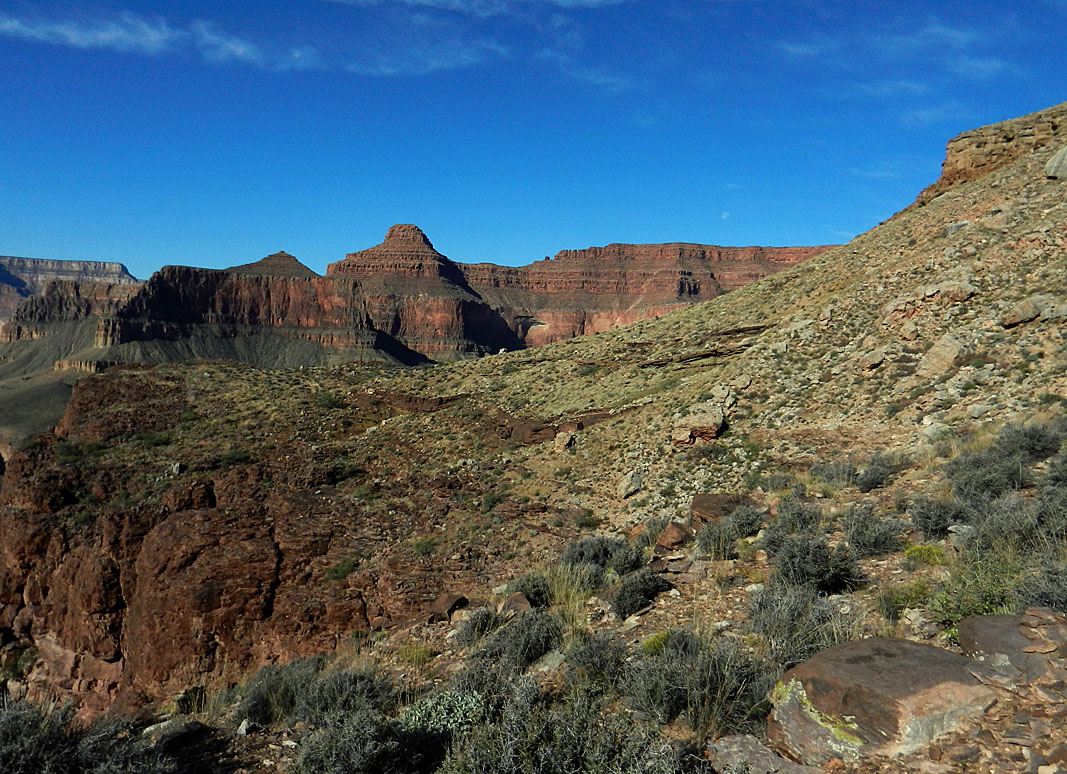
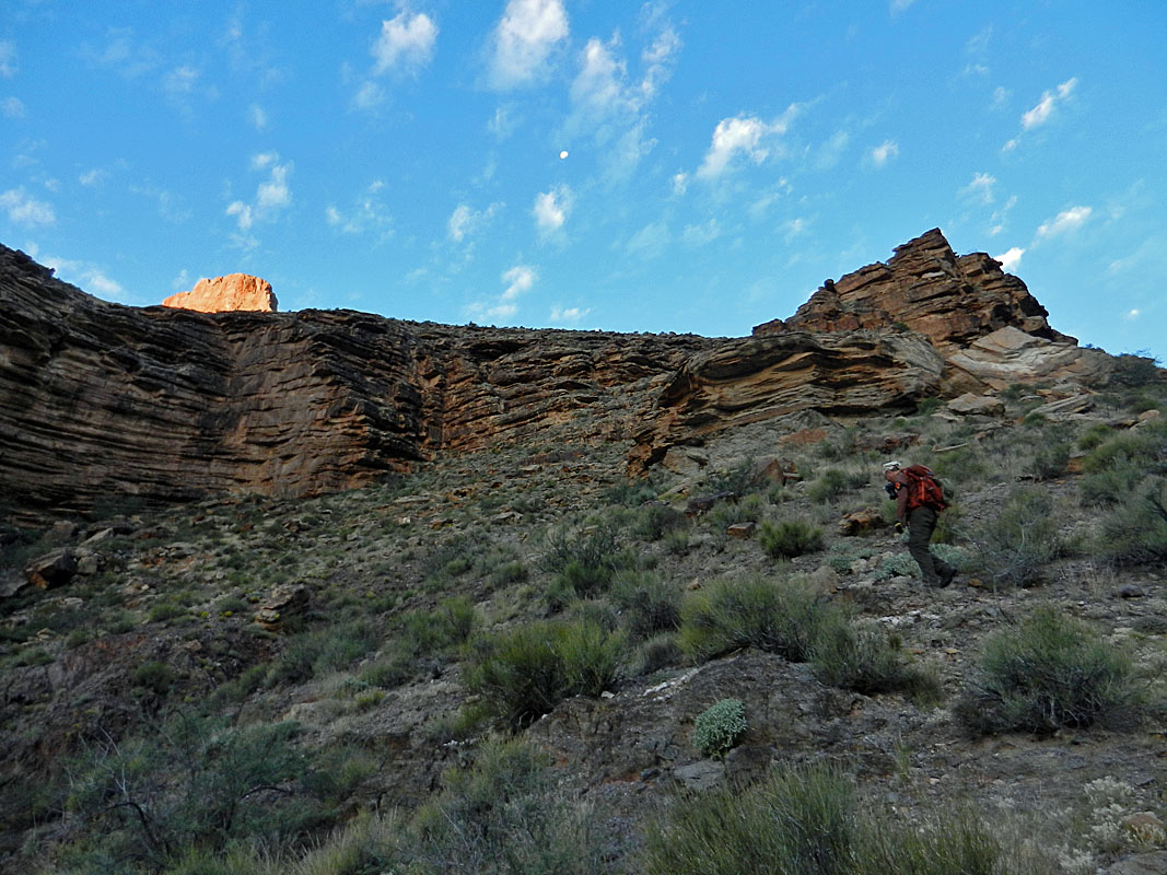
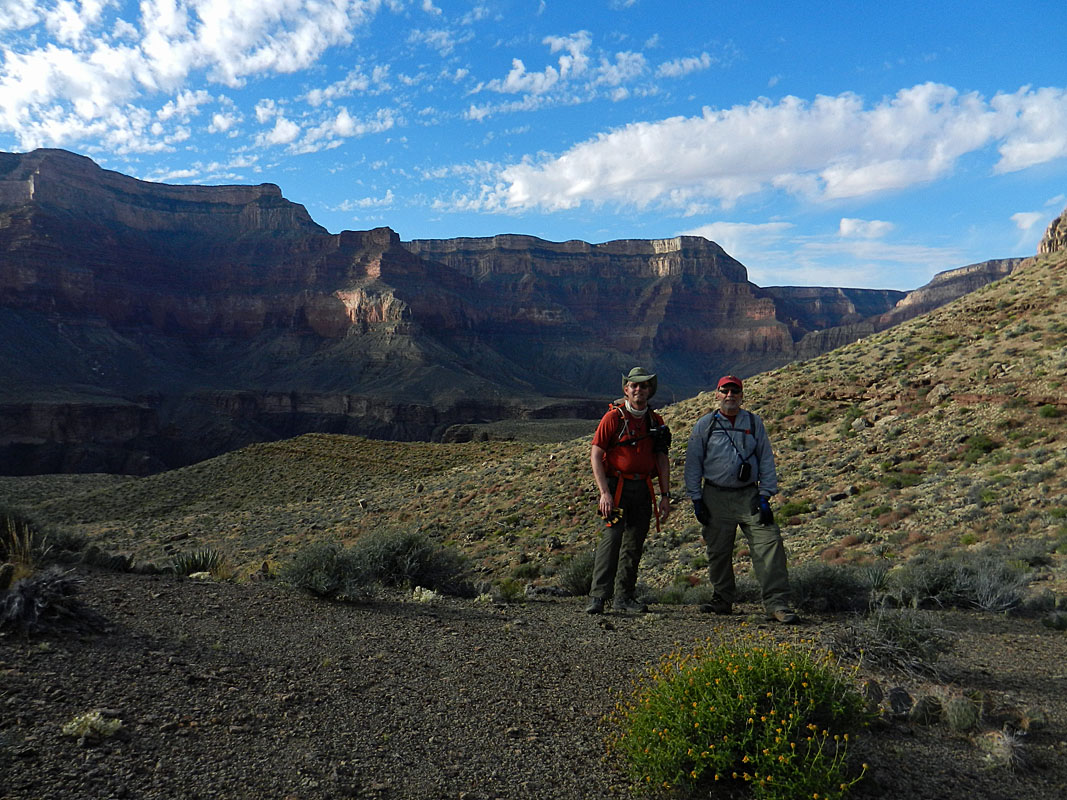
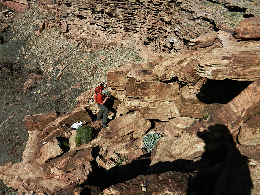
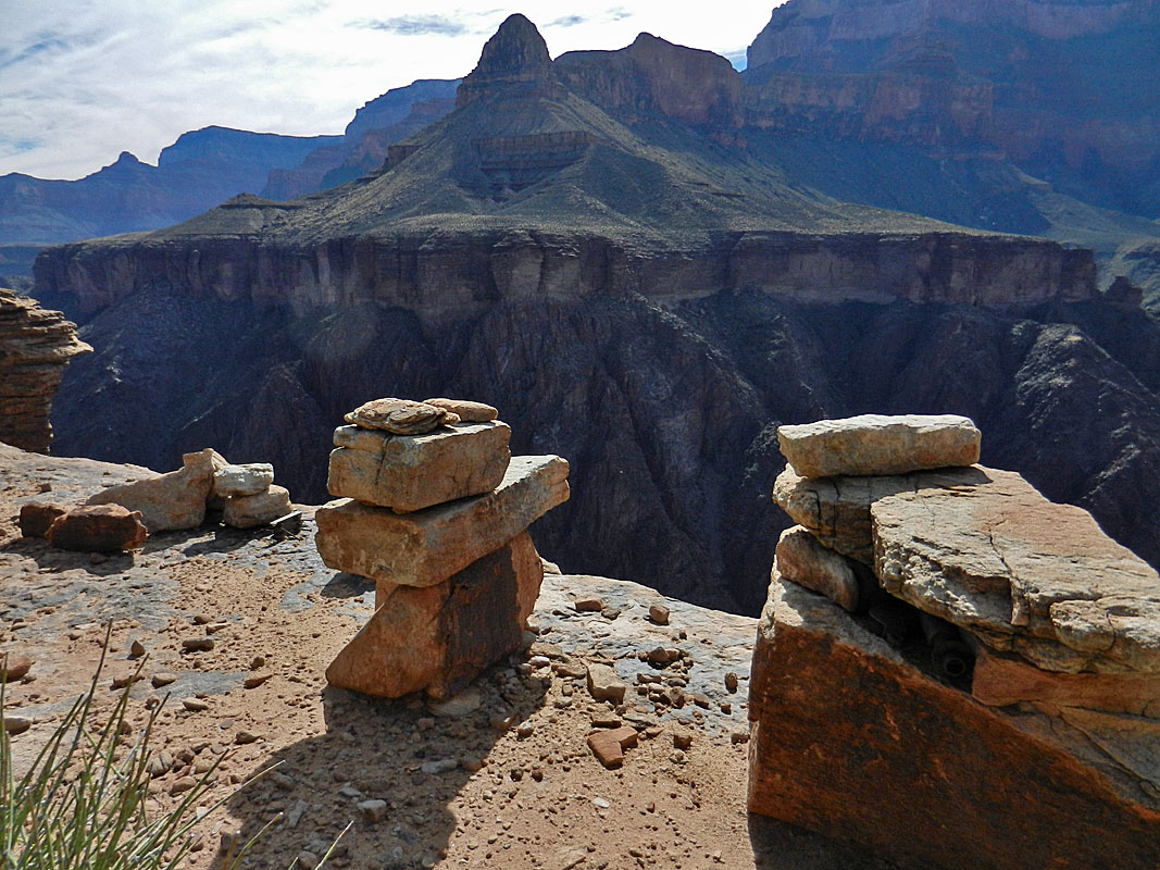
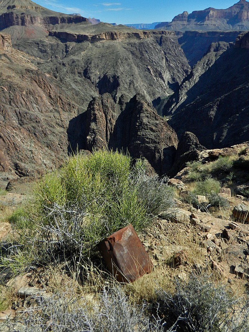
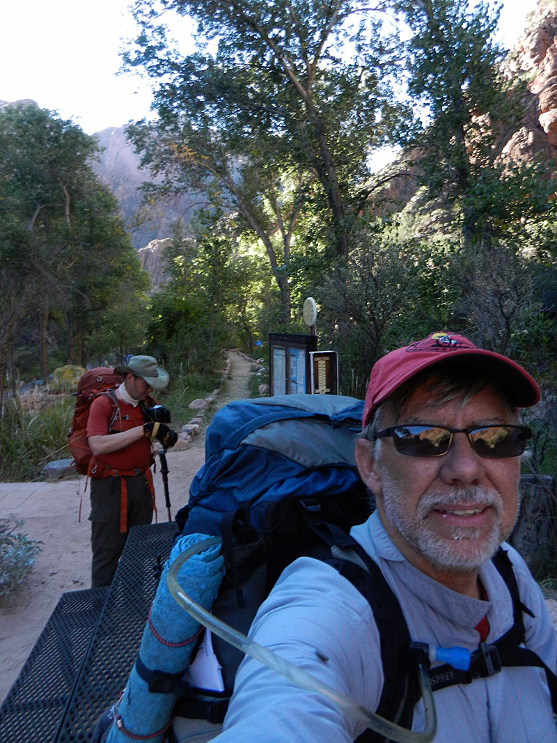
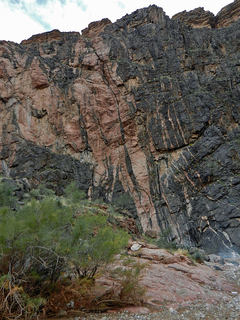
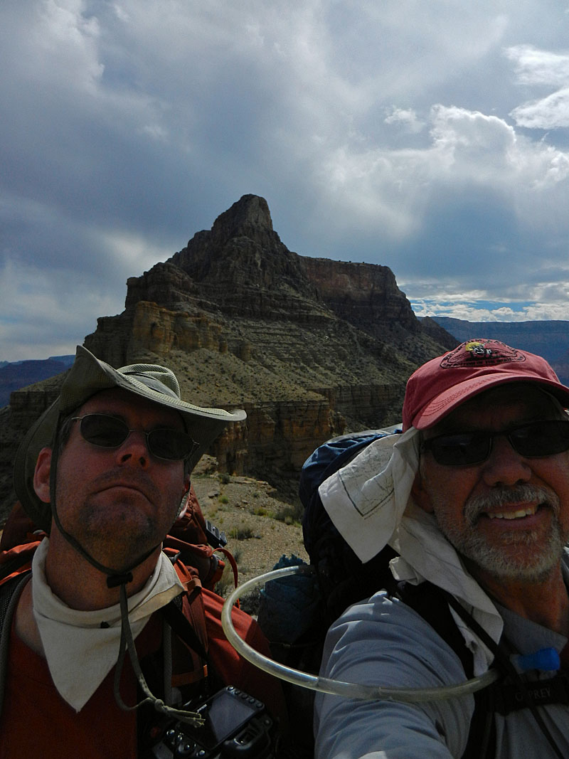
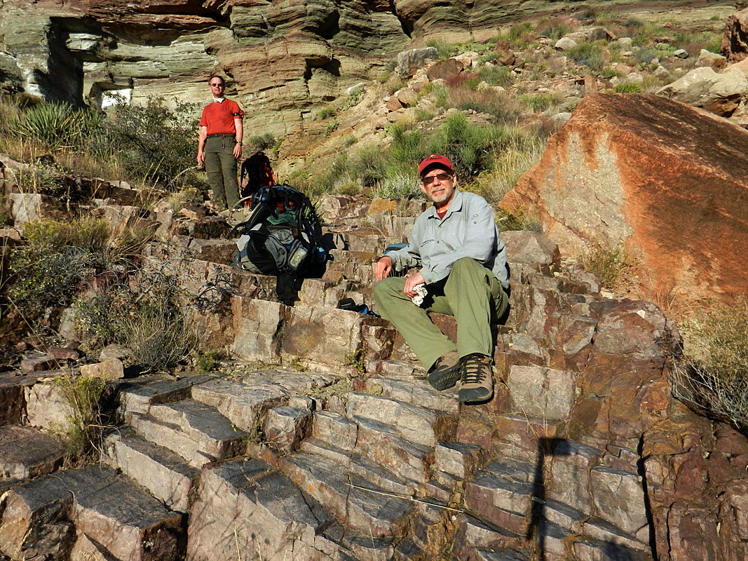
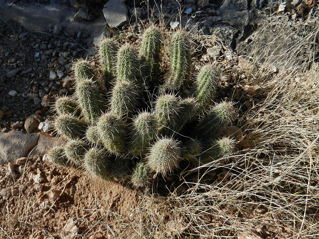
In 2009, hiking buddy Bill Ferris and I made a late November trek to Trinity Canyon so I could "finish" a hike that was cut short by an accident that resulted in my getting a helicopter ride out. To make the trip more meaningful, I gathered up some information I had on a crew that camped in this area in 1919 while surveying a route for an aerial tram across the canyon. That report is written up here. Since then, others have followed in our footsteps and we've heard of another major cache site here. Also, the survey crew's last camp was here, atop the Redwall near the Tower of Set, and I still wanted to give that a try. So, we made plans to return to this area. Our itinerary called for four nights in Trinity, with another night coming in and one going out. Water would be an issue that could use up a day, but I hoped we would have time to hike up to the Shiva-Isis saddle on one of our day hikes. My pack weight started out at 42 pounds, which included three liters of water. The weight at the end of the hike was 32 pounds, and I was still carrying two liters. Day 1 - Down the South Kaibab Trail (Sunday, October 20): Because we were going to be leaving late in the day, the first night of our permit was for the Cremation use area, east of the South Kaibab Trail on the Tonto Plateau. From there, it would be a grind to Trinity, but that's the best we could do. We left Flagstaff at about 1:45 p.m. and were on the trail at 4:30 p.m. I also brought along some notes from the book Hiking Grand Canyon's Geology so that we could watch for some of the special geologic features along this trail. As we expected, there were very few people still on the trail this late in the day. At Cedar Ridge we chatted briefly with three guys who were headed back up and they were the last hikers we saw until Monday morning. At the saddle with O'Neill Butte there was a huge pile of rocks (pictured below). What's up with that? It didn't look like it was construction-related and I haven't seen it before. We had the light of a nearly full moon to guide us for a while, but by the time we reached the Redwall descent, the headlamps came on. Then we saw another fellow traveler - a scorpion. Right on the trail and a big one! We reached the Tonto trail a bit past seven o'clock and headed east. When we came to a big spot that was all cleared out we stopped and set up our tents. |
|
|
||
 Along the South Kaibab Trail. |
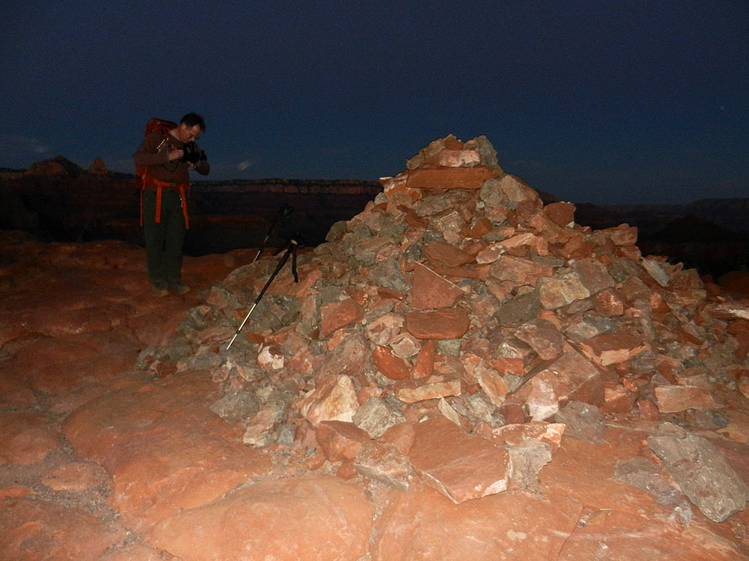 Rock pile near O'Neill Butte. |
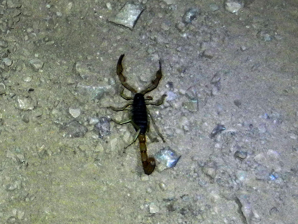 Nighttime scorpion on the trail! |
|
Day
2 - To the BA campground, up to Utah Flats and the Cheops-Isis saddle (Monday,
October 21): It was a cold night but not
unpleasant. We were up at 4 a.m. and on our way by 6:15 a.m.
By 8:00 a.m. we were at the campground at Bright Angel. We took a
short break and loaded up with water - each carrying about 6.5 liters.
So, now my pack was verging on 50 pounds. So it goes. By
nine o'clock we were starting our grind up the rough route that leads to
Utah Flats, an area of exposed sandstone at the Tonto level. We
made a wrong turn at one spot and ended up at "the wall." When I
first came up through this route in the 1980s, this is the only way I
knew of. But, there is a bypass lower down. Was it there in
the 1980s? Since I was living and working at the canyon then, I
had pretty good information sources, so I don't think the bypass was
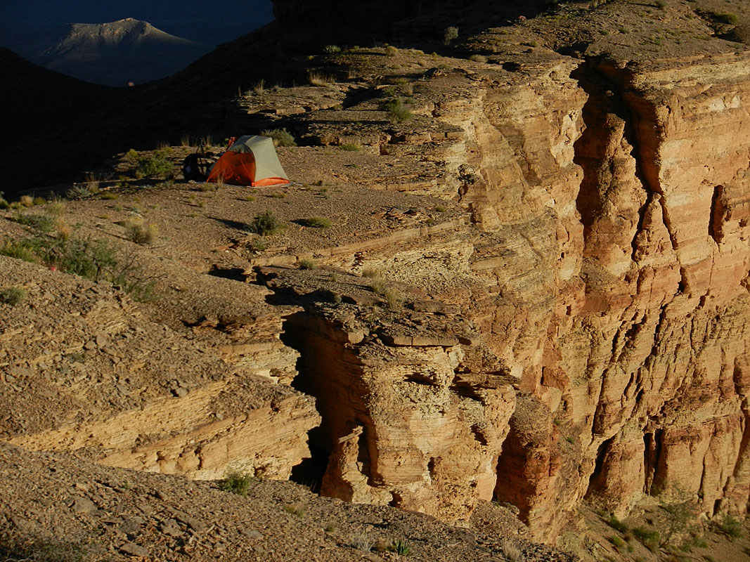
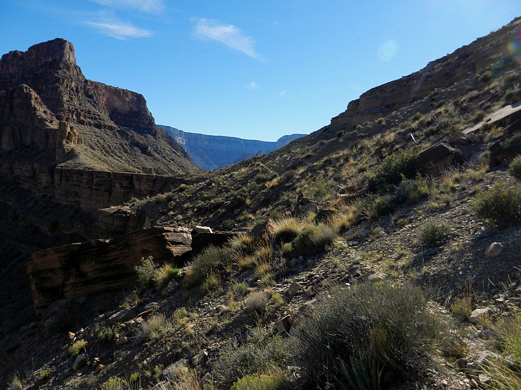
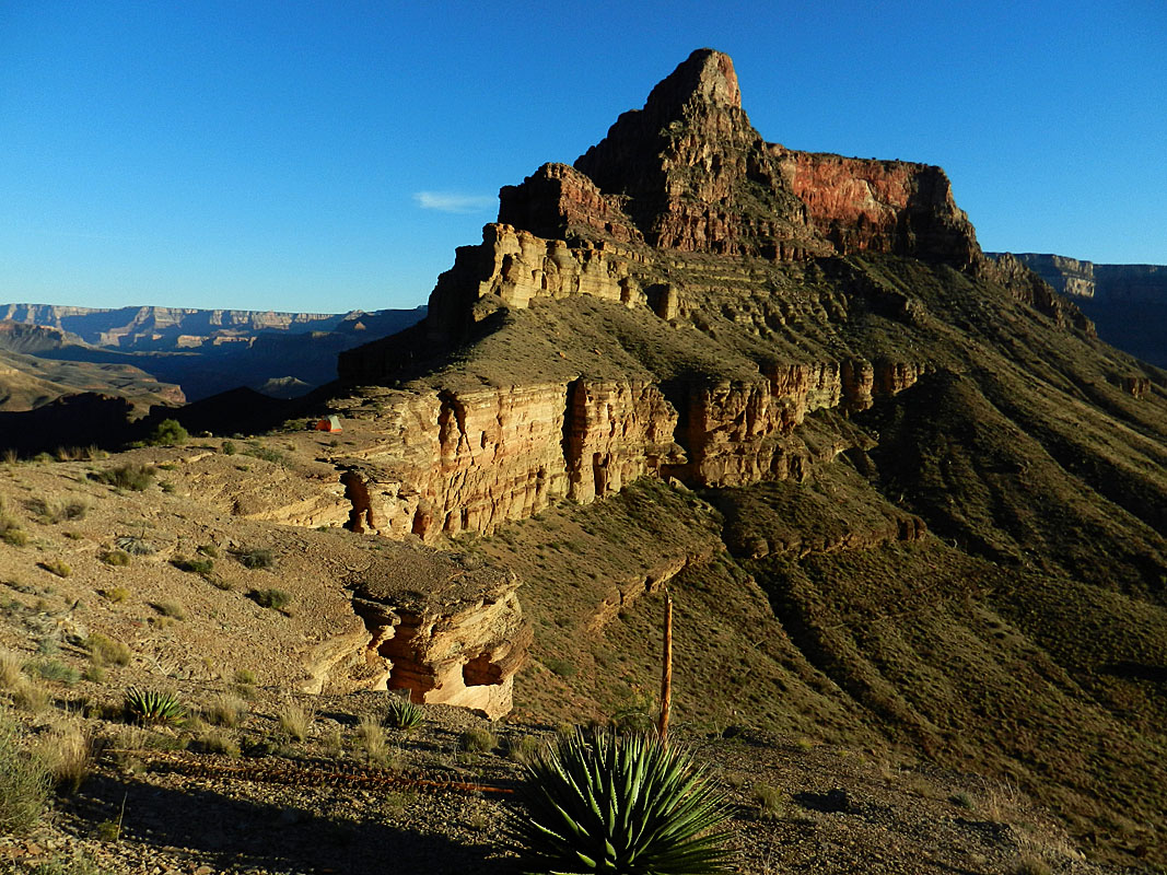
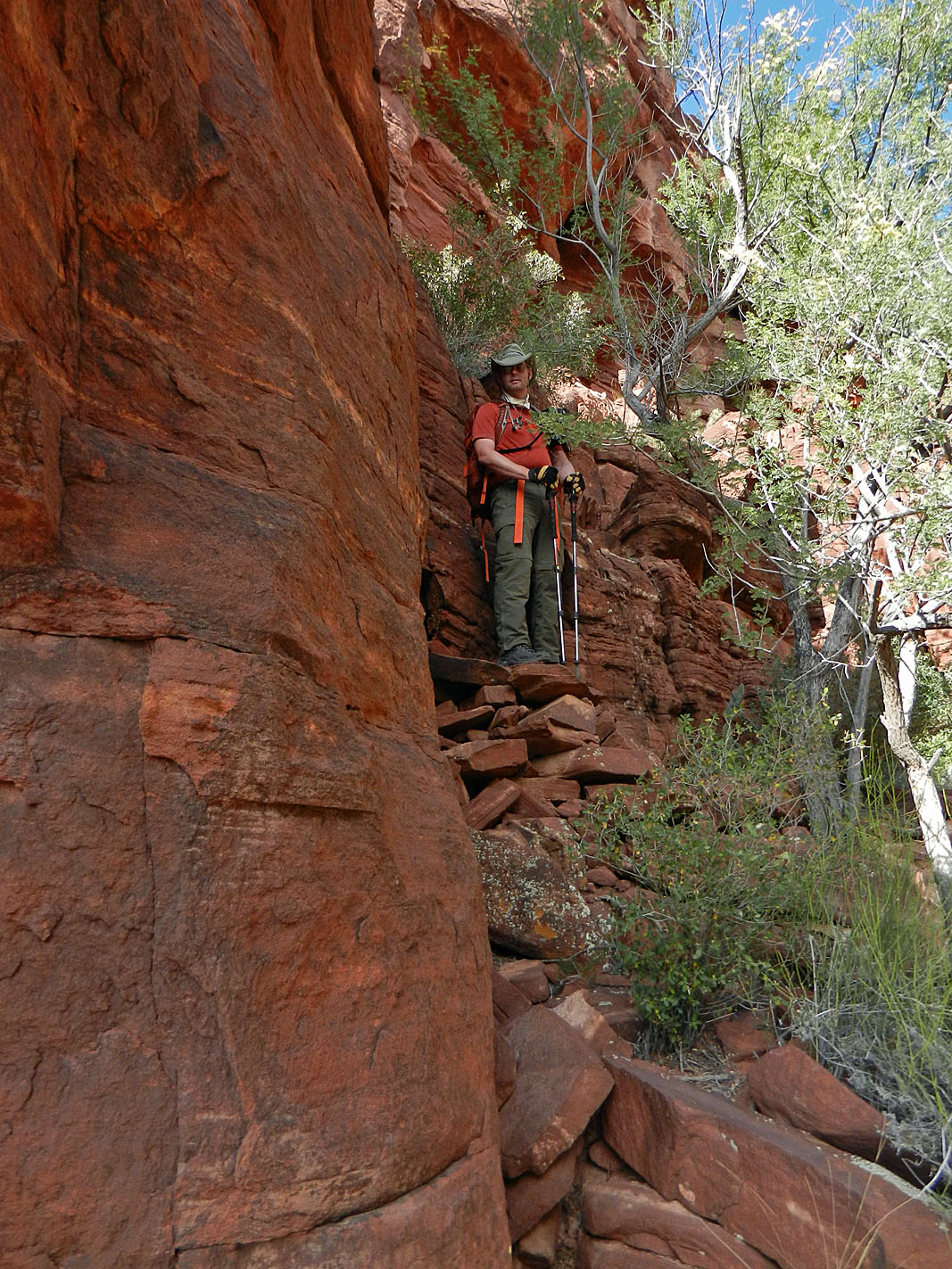
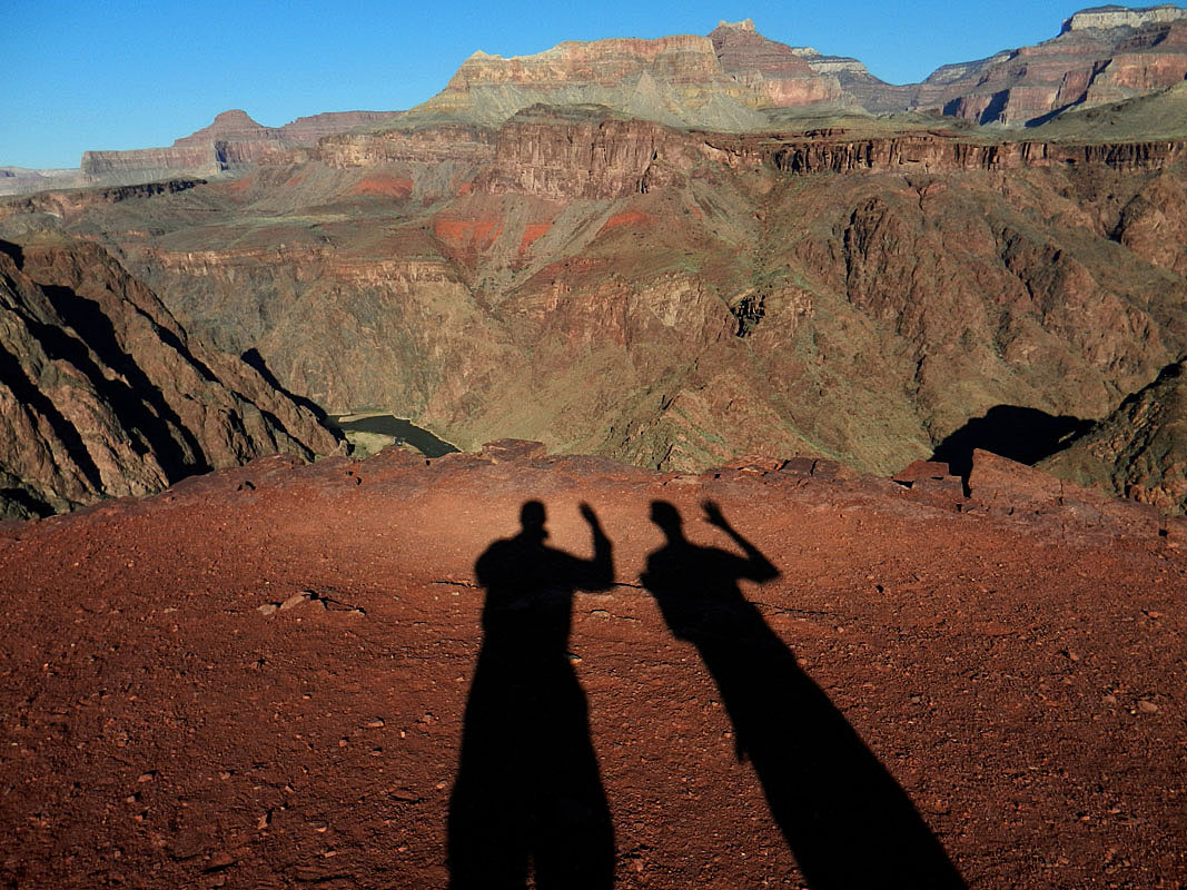
there. It took us an hour to reach a shady ledge just before a small saddle overlooking the hanging valley that leads to the so-called "Piano Alley," a ravine choked with huge blocks of Tapeats that you must maneuver over and around. By 11 a.m. we were through the alley and at the top of Utah Flats. We stopped in a shady spot for an hour-long lunch and a well deserved break. Coming out of the Utah Flats area a trail starts to appear that you can follow. That is a help over the cactus covered slopes here. This continues all the way to Phantom Creek and has definitely improved since I first hiked into this area in February of 1981! By 2:50 p.m. we reached the saddle between Cheops and Isis with some decisions to make. Neither of us were keen on making a water run from Trinity - either to the river at 94 mile, or back to Phantom Creek. But, we didn't know what the water situation would be like in Trinity. We were hoping to bring enough so that we could look for water for a full day and not be pressed into making a water run until the second day. But, it was clear to me that we weren't going to make Trinity this day. I was tired and running out of steam. The last thing I needed to do was take on this descent while fatigued. Bill thought our best option would be for us to camp here, on the saddle, and he would make a run down to Phantom Creek for water. So, that's what he did. I met him part way down on his way back up and we had our headlamps on when we got back to the saddle. I was feeling nauseous at dinner and ate only about a quarter of my meal before sealing it back up. I turned in hoping that some sleep would help me out. That seemed to work. At 12:30 a.m. I was awake and finishing my Kung Pao Chicken. Bill was up too, taking some cool night photos, including one with our tents lit up by our headlamps. |
|
Day
3 - From the Cheops-Isis saddle to Trinity (Tuesday, October 22):
We were up at 4:20 a.m. and on our way at just a few minutes past seven
o'clock. We descended to the bench atop the Shinumo Quartzite
cliffs in just 45 minutes, following a trail about half the time.
From here we would sometimes catch a a faint track until we reached the
end of this bench to begin the descent into the "east" arm of Trinity.
[The one that drains the southwest bay of Isis.] The only problem
spot along the way is a rubble-filled ravine that must be carefully
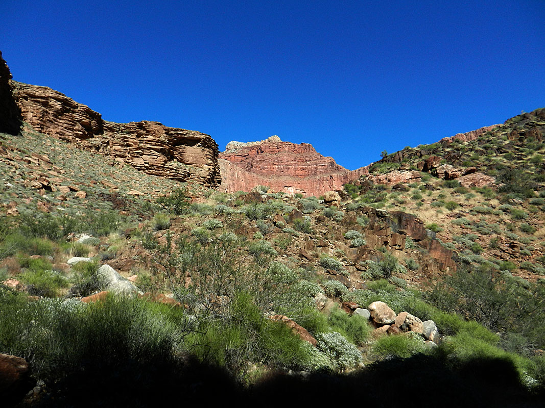
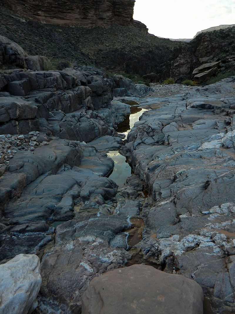
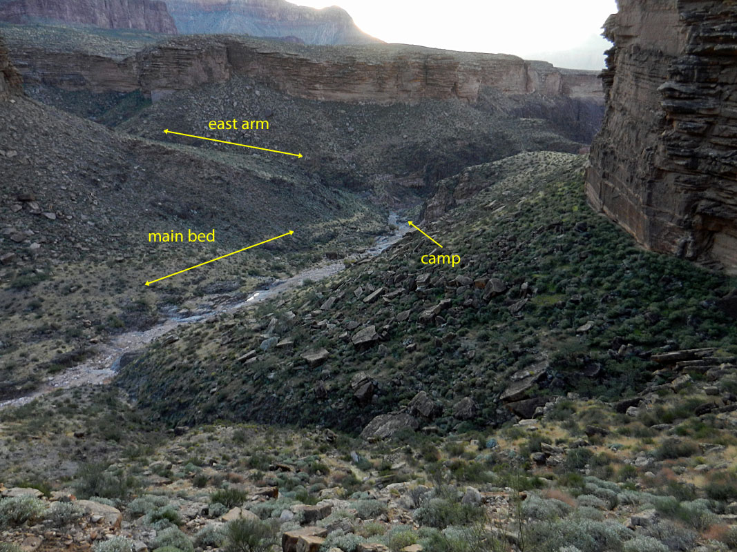
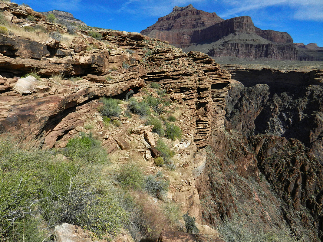
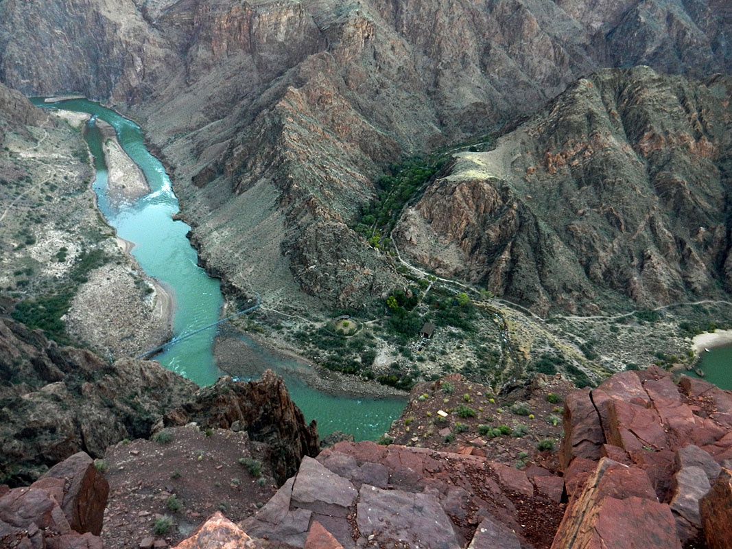
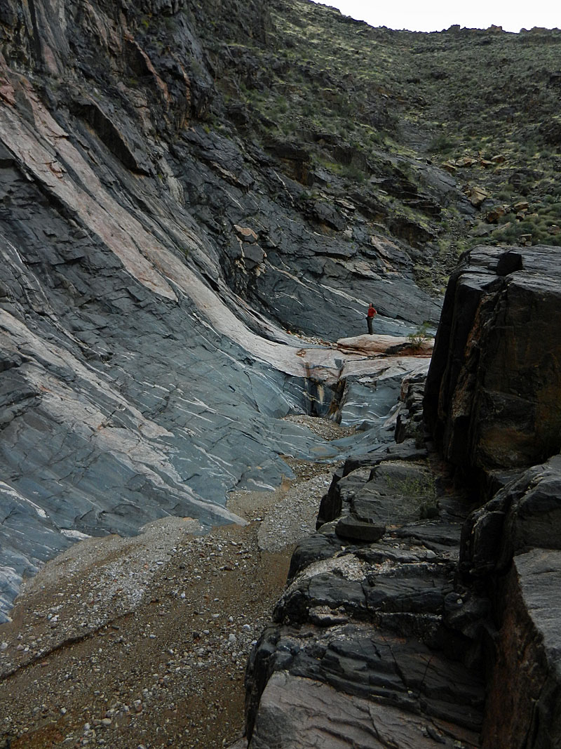
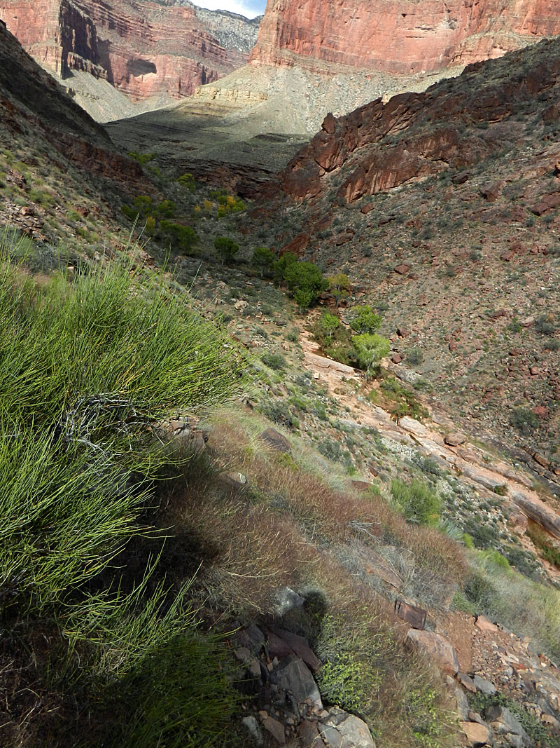
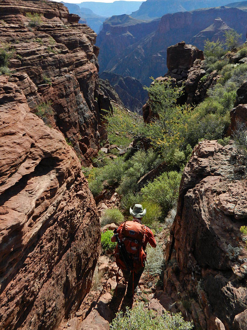
navigated. We reached the point of descending into Trinity at 10 a.m. and were in the bed fifty minutes later. There is a faint trace through here that crosses over three, or four, main gullies, as it angles down to a hillside and then down its nose to the bed. There is a ravine down lower that provides access to the east arm, but we wanted to be thorough in our search for water in here. That search turned up nothing. By 11:20 a.m. we were at the junction of this arm and the exit ravine just mentioned. Nice shade here, so we decided to have lunch. We stopped for an hour and in another hour, by 1:30 p.m., we were at the junction with the main arm of Trinity. And, there, we met with a most pleasant surprise. Water. Not only water, but flowing water. That seemed to solve our most pressing problem. We found some spots to set up our tents and hung out all afternoon. I pumped three gallons through my filter. It tasted ... soft, if that makes any sense. Bill thought it tasted "buttery." Harvey Butchart's trail log from 1973 noted that the water here had "a slightly salty taste and had a laxative effect." It turns out he was right on both counts., the latter of which would plague me for the next couple of days. |
|
|
||
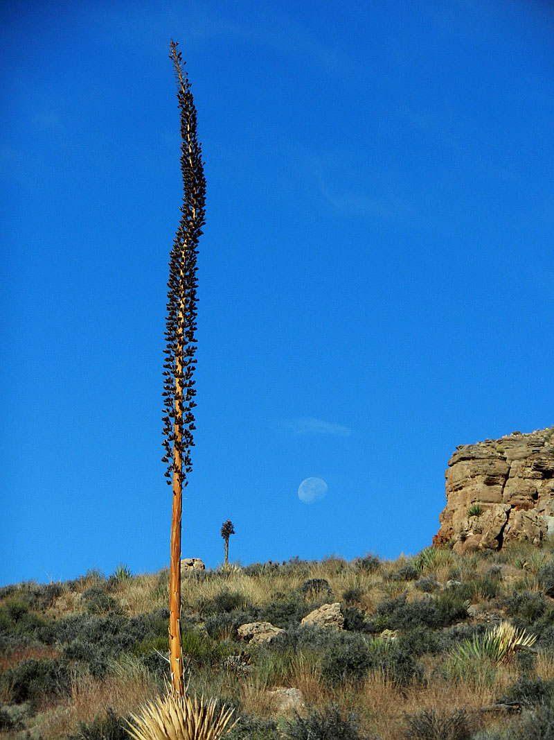 The route descends off the Cheops-Isis saddle to a relatively flat and wide bench atop the Shinumo Quartzite. The dead agave and the setting moon gave the landscape character. |
 Looking back to Cheops-Isis saddle. |
 Atop the Shinumo cliffs. |
 Looking to 1919 survey sites in Trinity. |
 View of Isis from my tent. |
|
Day
4 - Day hike to sites used by the 1919 aerial tram survey crew (Wednesday,
October 23): We got up at about 5 a.m. and were
starting our day hike at 6:50 a.m. We went up the main bed to a
route that gets one through the Tapeats. The break isn't obvious
until you're close. You can see one further up the canyon, and
thankfully we didn't have to go up that far. Along the climb we
passed an excellent example of the "Great Unconformity," where the two
adjoining rock layers (Tapeats and Vishnu) are exposed. You can place your hand across
these two, where 1.2 billion years of geologic history is
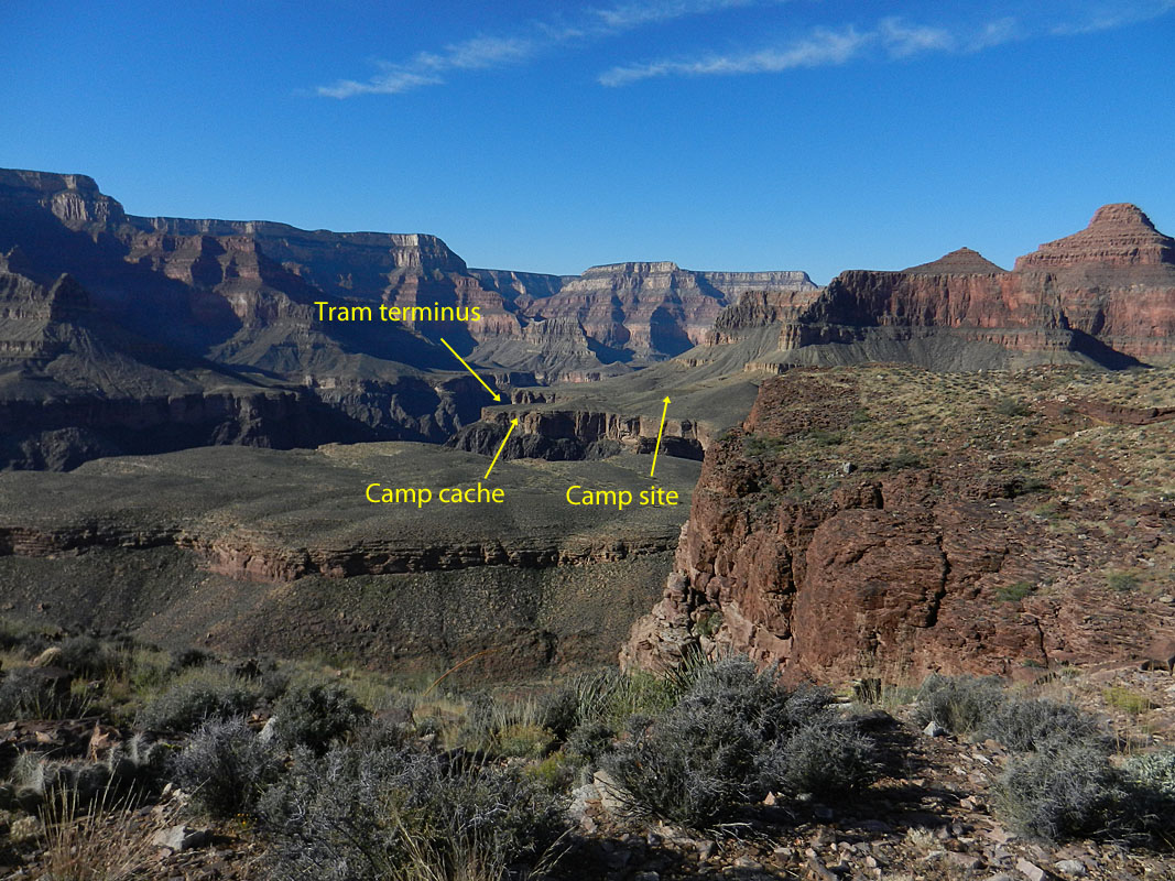
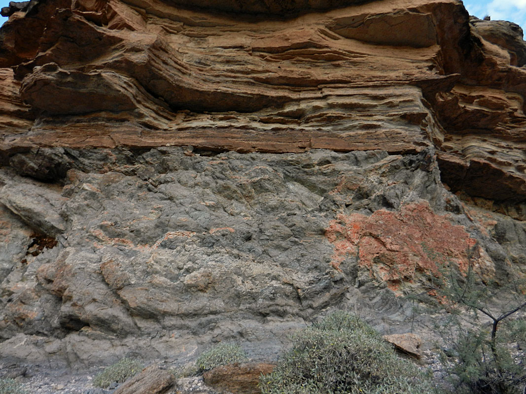
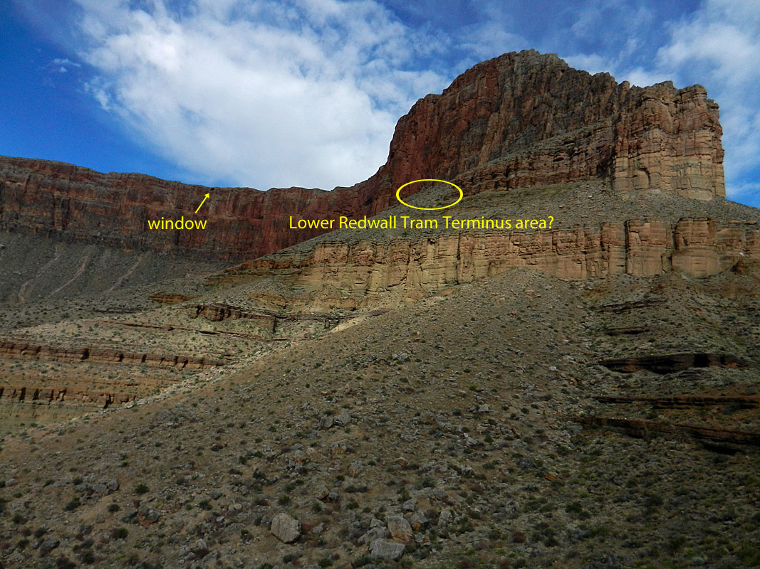
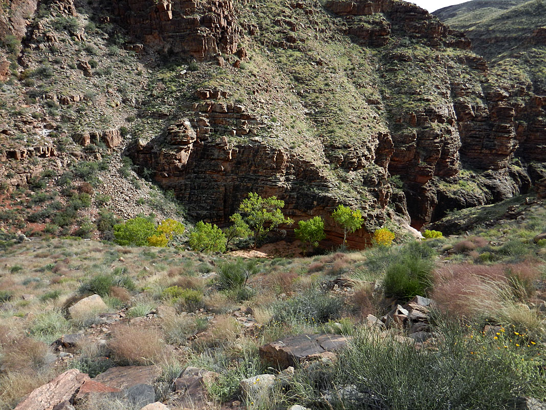
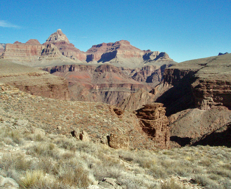
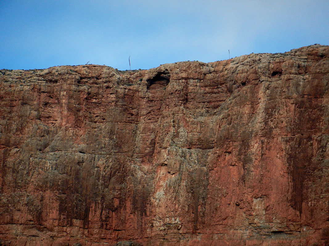 missing. missing.We were up on the Tapeats by 7:20 a.m. and soon contouring toward the river and the site of the Tonto camp for the 1919 survey crew. There is a prominent hill here and instead of going around it we decided to climb up to its saddle with the cliffs above and then contour over to the camp area. I followed the Muav cliffs above here, looking for any signs that their next tram terminus was somewhere in this area (for the one that went to the top of the Redwall). I found nothing and decided that it must have been above these cliffs, which can be access from a talus slope further to the west. Looking in that direction, one may note a small window at the top of the Redwall. |
|
|
||
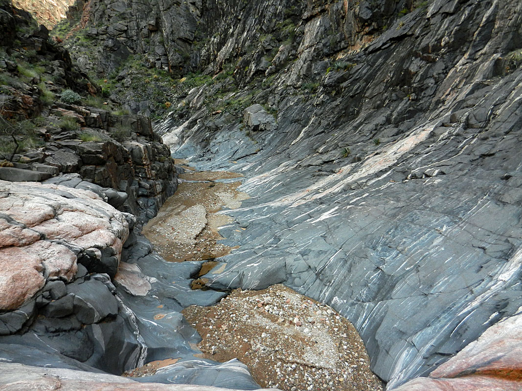
 The trickle of water gave way to many isolated pools in the Vishnu Schist as we headed up the creek bed to a route that would lead us through the Tapeats cliff and get us on the Tonto level. |
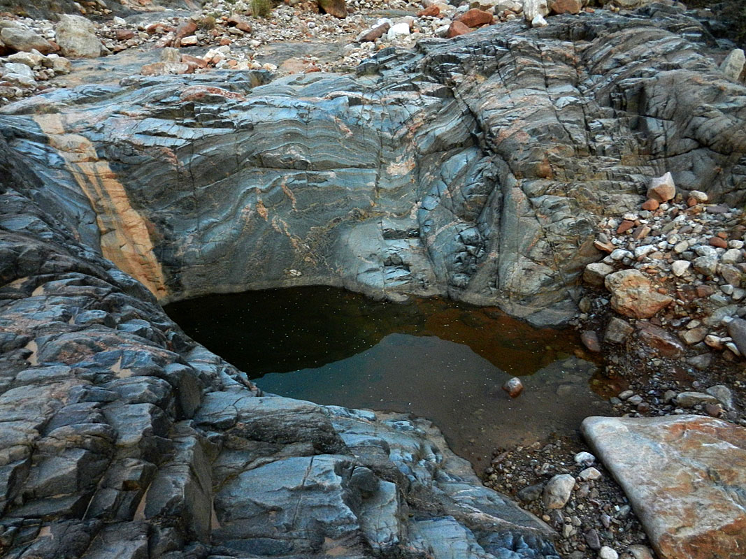 Large (perennial?) isolated pool. |
 Bill heads up to the Tapeats break. |
 The Great Unconformity. |
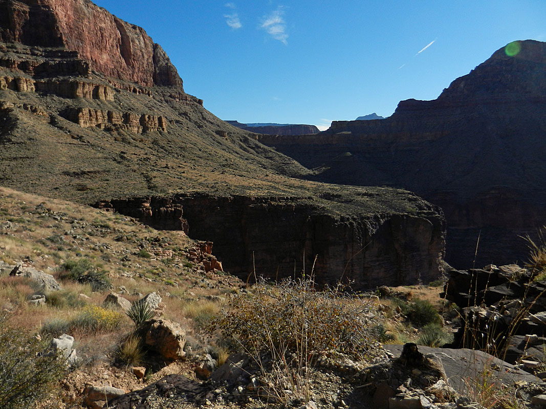
 Looking back down Trinity. |
|
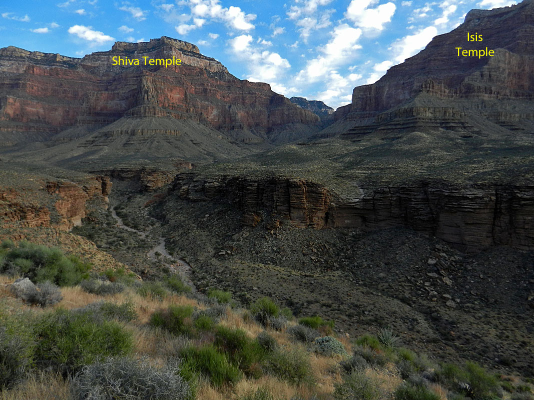 Looking to the Isis-Shiva saddle. |
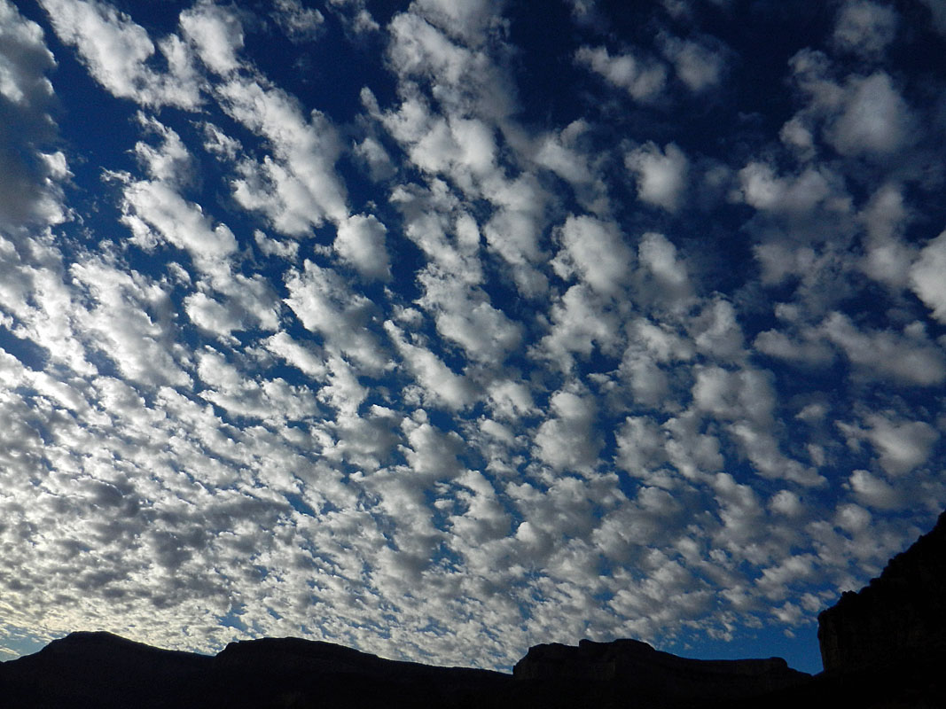 Mesmerizing clouds. |
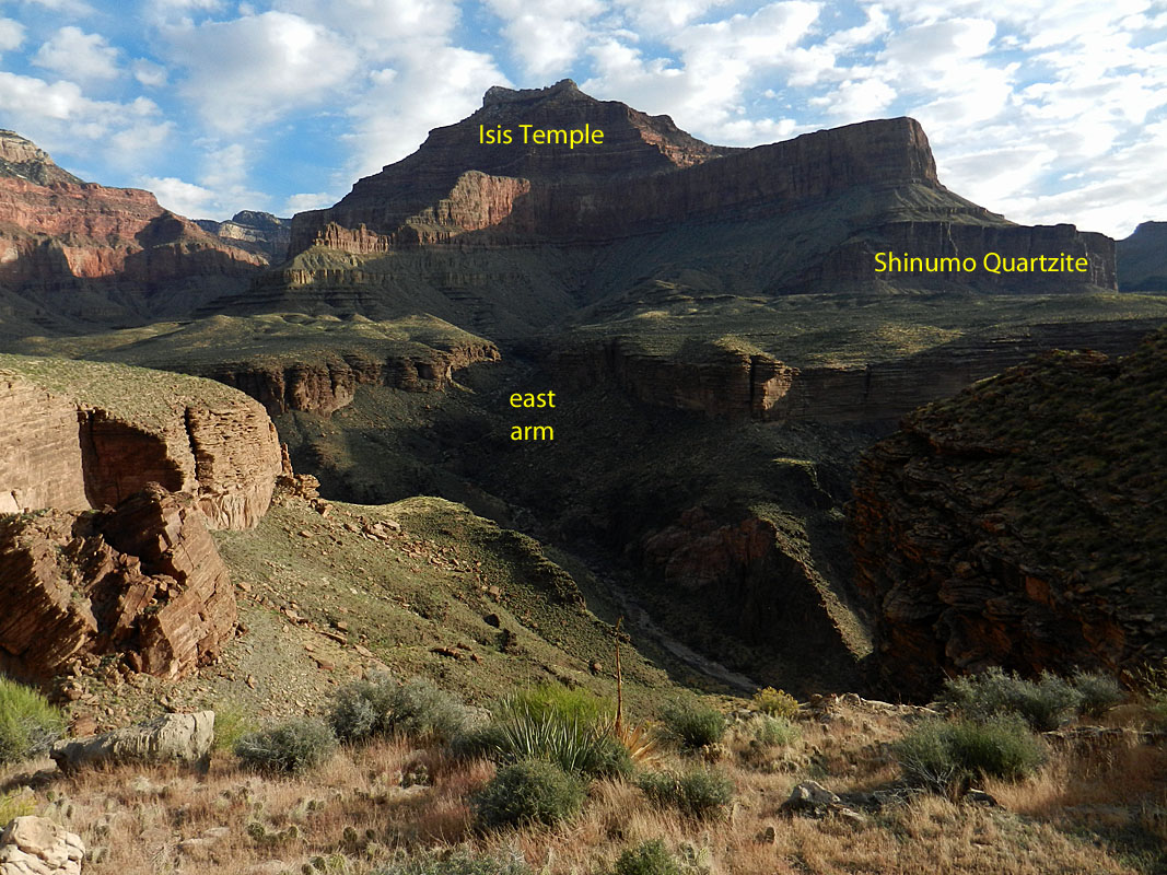 Looking up to Isis and our route down. |
 On the small saddle near survey camp. |
 The Muav and lower Redwall. |
 Redwall viewed from survey camp. |
We were soon at the old camp site - a level terrace well above the
Tapeats rim. Bill started going over the area closely. Four
years ago we found scant signs of the old camp. But, other hikers
found cans and even a canteen here. I
had copies of some of their
photos and I
wandered around trying to match up these with the terrain. After
all, that's
 how
we found the this site four years ago (by matching up the view with
photos from 1919). After a bit I started finding cans and lids.
They were off the side of the terrace, to the east. These other
hikers found an odd can that they called a hinged cigar box. In doing
some research on-line, I couldn't find an example that held cigars.
But I did find some of these boxes that held either tobacco or
cigarettes, like
this one, or
these ones. In looking through the old survey crew photos
on-line there is only one that shows someone smoking and he's
smoking a cigarette. how
we found the this site four years ago (by matching up the view with
photos from 1919). After a bit I started finding cans and lids.
They were off the side of the terrace, to the east. These other
hikers found an odd can that they called a hinged cigar box. In doing
some research on-line, I couldn't find an example that held cigars.
But I did find some of these boxes that held either tobacco or
cigarettes, like
this one, or
these ones. In looking through the old survey crew photos
on-line there is only one that shows someone smoking and he's
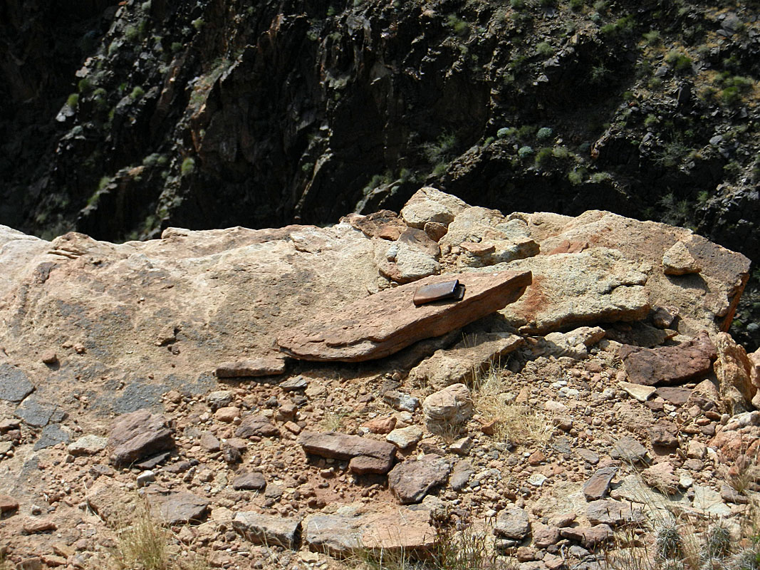
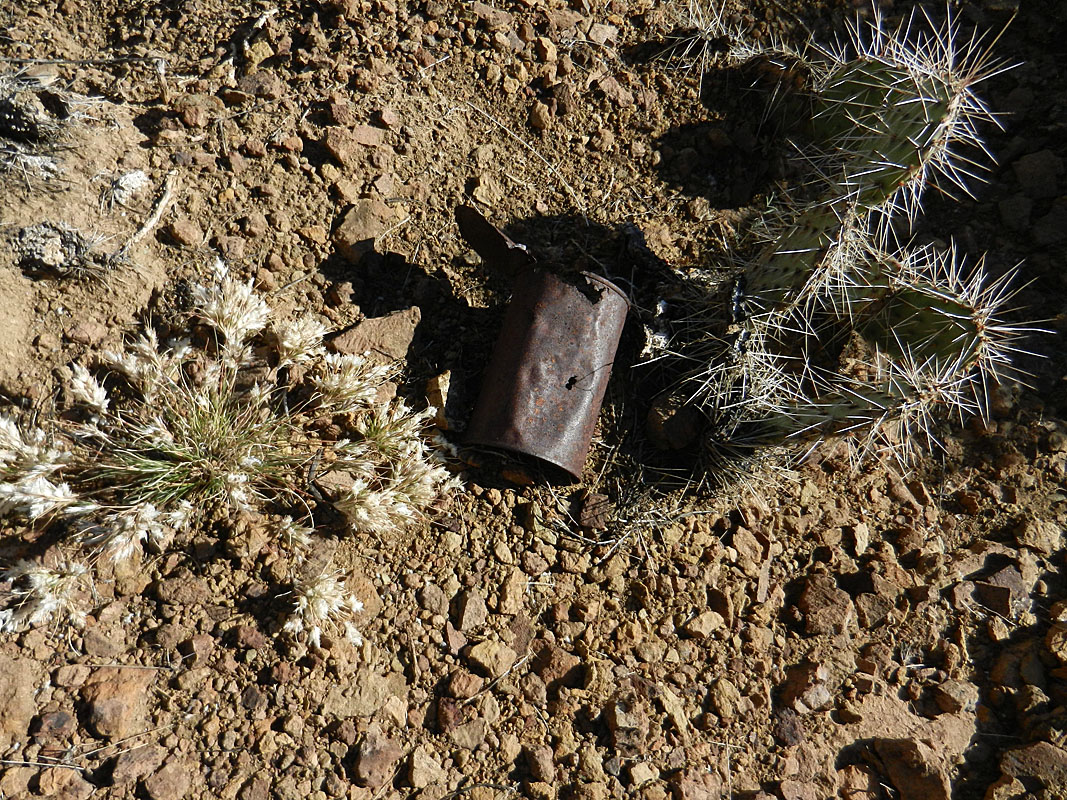
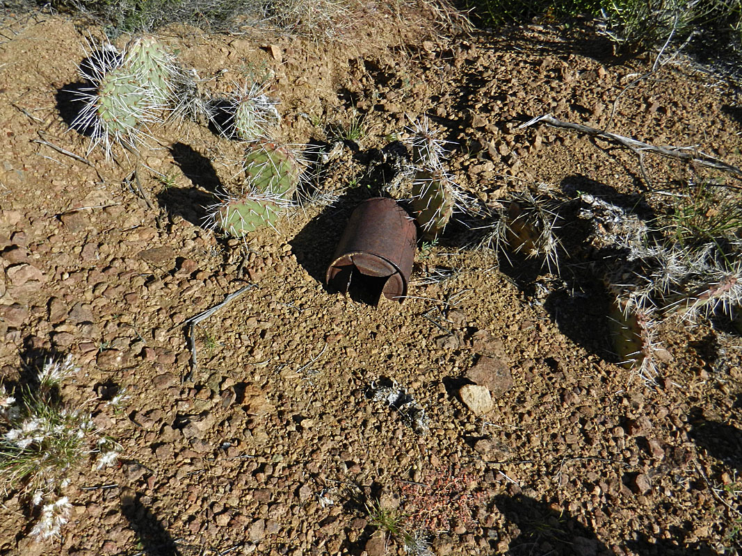
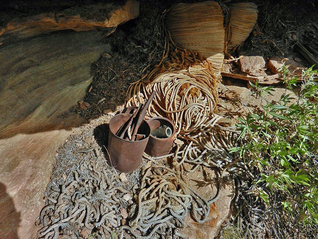
smoking a cigarette.We went over to the front end of the camp terrace and I took some photos of Bill along the hillside to match it up with one of the old photo showing five of the survey crew hauling supplies up to this camp. It's hard to get an exact view, but it seems close enough and looks kind of cool. We ambled down to the edge of the Tapeats a little west of the tram site so we could more closely look over this area. Bill spotted some material down in the rocks. He went down and found a small cache of rope and canvas material. It all looked a little too precarious to me, so I only got a pic of Bill snapping his photo. Over at the tram terminus, we found another tobacco tin. I don't recall seeing it before. We did only a cursory look around since we had spent so much time here in 2009. We were anxious to find the other site, where there were camping supplies tucked under an overhang. |
|
|
||
 One of a few old cans at ... |
 ... the old survey crew's camp site. |
 Including this tobacco tin. |
 Bill checks out rope cache. |
 The Tonto tram terminus. |
 Tram terminus cache. |
 From 1919, the crew climbs up to the Tonto camp site. |
 Five Bills do the same in 2013, sans duffel. |
|
We followed along the rim to the east and north a bit to find this other
cache site. I had a photo taken from the front of the site,
looking east at the river and the canyon. So, I tried to match up
that view. We found the general area pretty easily, but it took us
a while to locate the actual spot. We peered over the edge, looked
for ways to climb down to lower ledges and couldn't quite make it all
work. But, then Bill found it. In retrospect, it seems
obvious, but that always seems the case! It was much higher than I
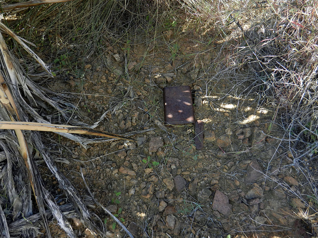
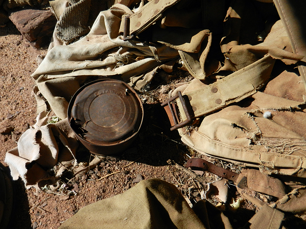
thought. The site isn't large, but there is some neat stuff here. This is a cache of their camping supplies: metal plates, utensils, jars and cans and a frying pan. Also, bedding material, blankets and knapsacks. One especially cool item is the "Armour's Veribest Grape and Apple Jelly" container. Under some of the bedding we made another cool find - an old candy tin labeled "Bunte." We shook it and it was half full! Peering in, they looked OK. Later I though maybe we should have looking in the jelly jar as well! There had been an old copy of Popular Mechanics that the other hikers found, but we only saw a single page. But, we didn't really do much to disturb the materials here, as much in disarray as it is. One side of the magazine page had ads of all sorts. Click on the link below the photo to see a very large copy and you can read some of these ads. When we left this site I spotted a gas can leaning up against a bush. I knew immediately that this must be the one that Harvey Butchart found in 1973. Here's what he wrote: "Gerrit called my attention to a very old rusty 5 gallon kerosene can lying beside our route near the rim not far west of Trinity." I am quite sure this was the same can. And, it is almost directly above this cache site, so he was very close. |
|
|
||
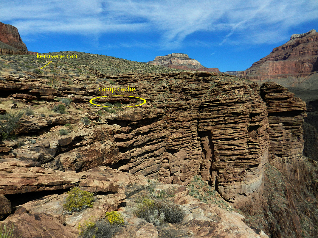 The site of camp cache and gas can. |
 Bill at camp cache site. |
 Camp cache ledge is near the cliff. |
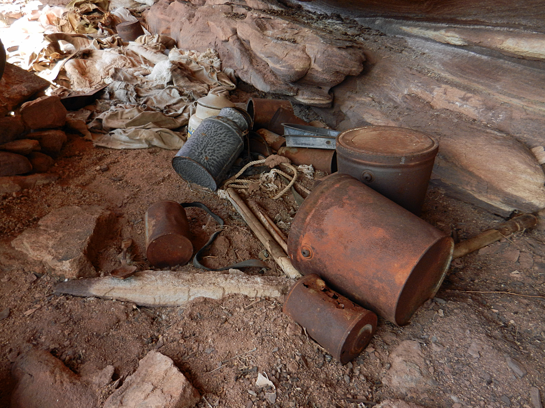 Jars and containers. |
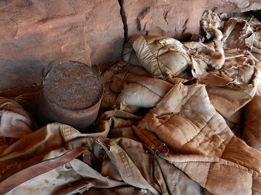 Bedding materials and bucket. |
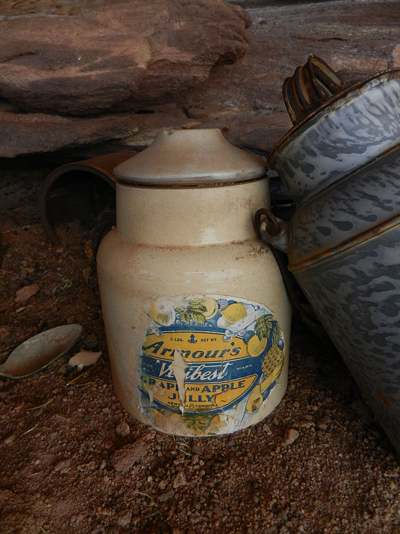 The usual pots and pans and utensils aren't too exciting. But, this old jar is a different story. I found a similar jar for sale on-line, and a list of other Armour's products like this. |
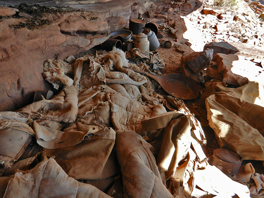 Looking along whole cache. |
 Pack material and hardware. |
|
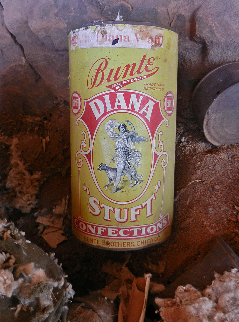 Our coolest find was this old tin of candy hiding under some of the bedding. It is in great shape (one on eBay was selling for $325!). When we shook it up and down ... |
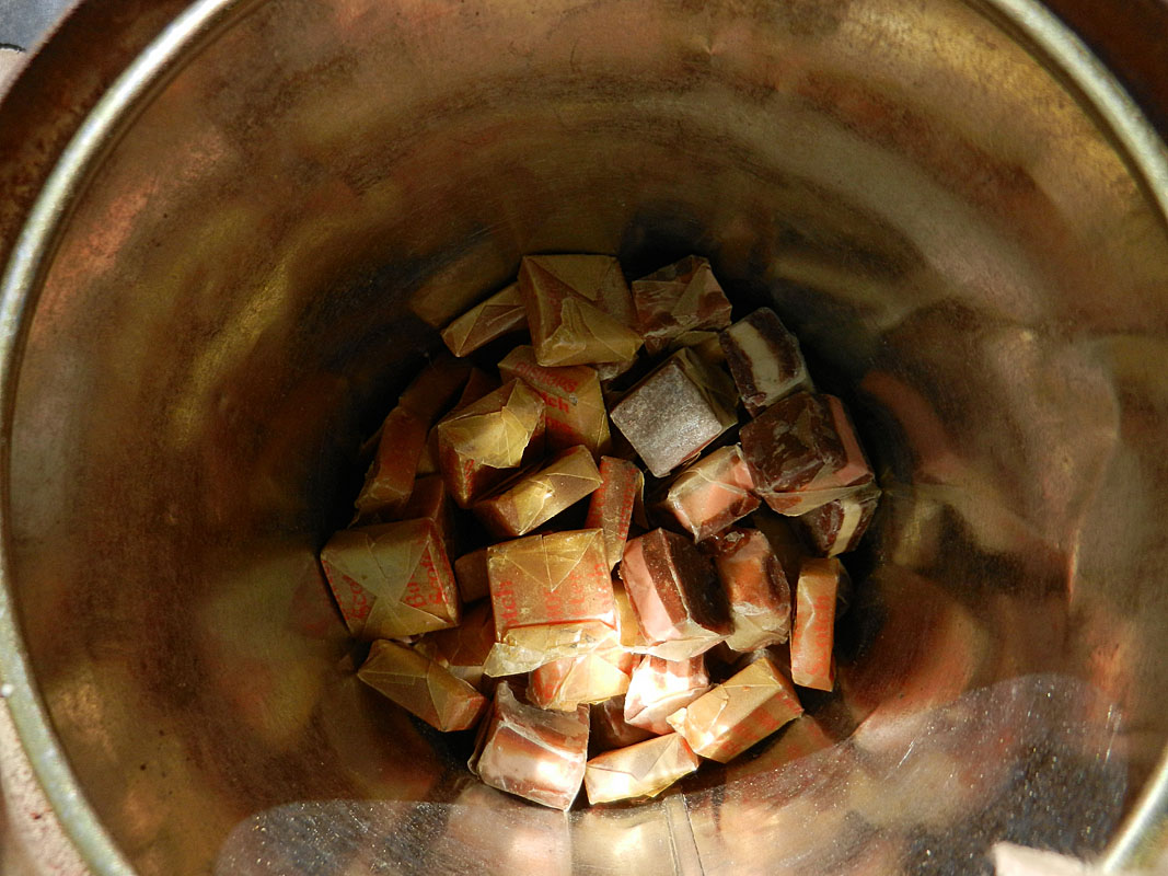 ... we found it was half full of candy! |
 Once we left this site and climbed up to the Tonto level I spied this can leaning up against some bushes. This was a cool find since Harvey Butchart mentioned it in his trail log from 1973. |
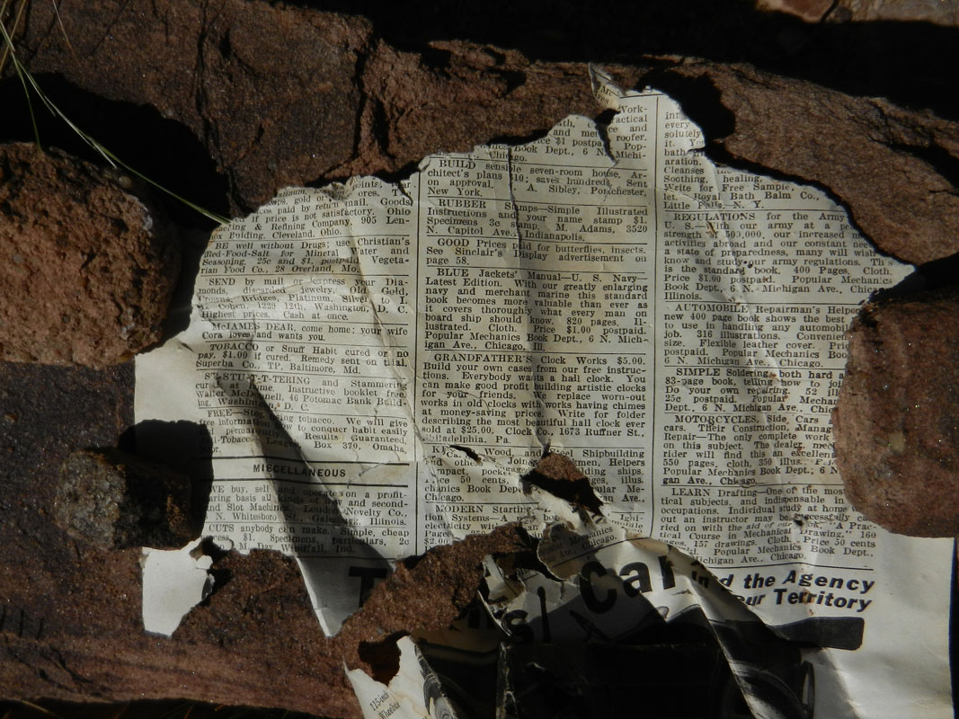 Magazine ads (largest view). |
||
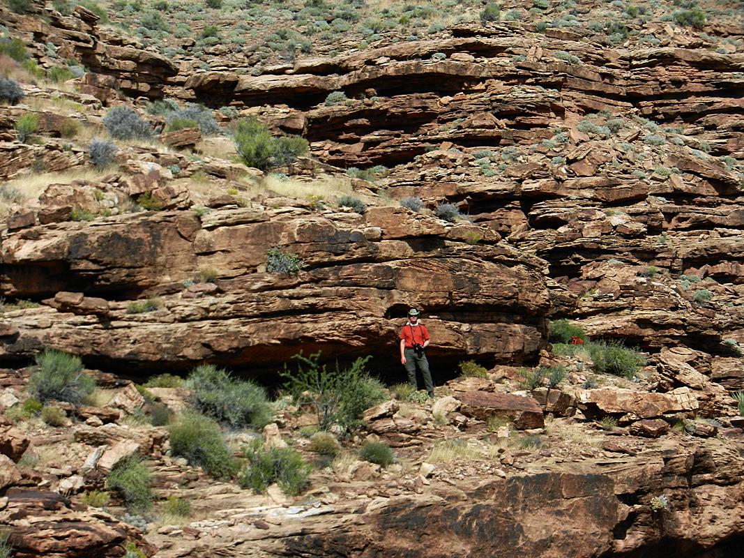
| The hike back went by rather quickly and we were in the creek bed by 2:30 p.m. We decided to take a walk down the bed and check that out. We started at four o'clock and found numerous pools down through this stretch. We only went down about thirty minutes before turning around and heading back to our camp. |
|
Day
5 - From Trinity to Phantom Creek (Thursday, October 24):
I was up at 11 p.m. the night before because of the effects of our Trinity water. I
was up again at 5 a.m. doing the same thing. So, at breakfast we
decided to forgo a day hike to the Shiva-Isis saddle and, instead, pack
up and head for Phantom Creek. Clearly, I wasn't going to get any
better until we got to a better water source. Indeed, as best I
could tell, I was
getting worse. So, by 7:45 a.m. we were all packed up and heading
up the east arm and the exit ravine. The hiking went well. We reached the top of the Shinumo cliff just a bit before ten o'clock. We took a nice break in the shade before pushing on. The weather was fine - nice and cool. We got up to the Cheops-Isis saddle right at noon and took a half hour break there. Our descent to Phantom Creek took about an hour from the saddle. This route is steep and the footing is often precarious, so the going is slow. We decided to camp in the big spot right where the trail comes to the creek. By then there was a lot of cloudiness and it seemed a bit threatening. We got our tents set up and I went up the creek to a big pool and soaked my feet and splashed water over my head. Quite refreshing. After dinner, Bill headed down the creek to take some photos. Then it started to rain. Well, that's an overstatement. Some drops fell, but nothing really got wet and the skies cleared up soon thereafter. |
|
Day
6 - From Phantom Creek to the BA Campground (Friday, October 25):
We were up at 5 a.m. and on the trail by 7 a.m. We were at the
junction with the route that continues on to Trinity in about 45
minutes. From here, the trail contours along the flank of Cheops
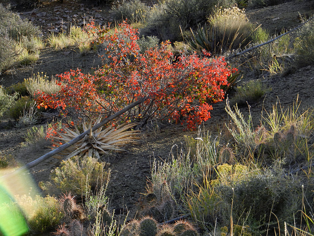
and the going is pretty easy. I made an effort to get more photos
of the plants we have been seeing for the last six days. It took
about two and half hours to get from the junction to the top of our descent
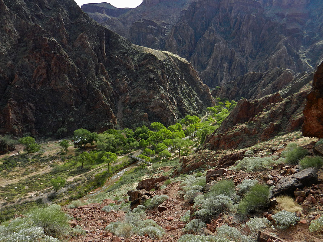
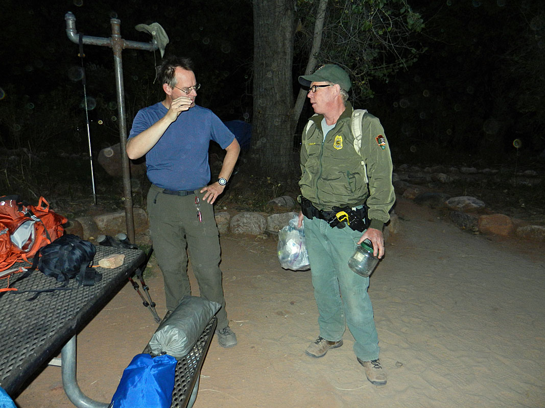
through the Tapeats. It was only 10:45 a.m. when we had crossed over Piano Alley and were on the little saddle that overlooks Bright Angel canyon. Bill got a jump on the descent while I took a short break. Still I was in the campground by 11:30 a.m. and Bill was just starting to set up his tent. We got our camp site all set up - I think we may have been literally the only group in the whole campground. Then we went up to the ranch. We scored spots for the early breakfast for tomorrow and ate our lunches, downing many lemonades. We just hung around the campground for most of the afternoon. Just before dinner we went up to the ranger station to look for Bil Vandergraff. It turned out that he was down at the campground, so we caught up with him there. We chatted for 20-30 minutes. He had some good insights on the recent government shutdown and the park's reaction. He is set to retire in about 18 months and he will be missed. |
|
Day
7 - Back to the rim via the South Kaibab Trail (Saturday, October 26):
We were up a bit after 4:30 a.m. in order to be at the ranch for
breakfast at five o'clock. Perfect timing. What a luxury to
have a nice hot breakfast (eggs, bacon, pancakes) on real dishes, on a
real table while sitting in a real chair. It's funny what things
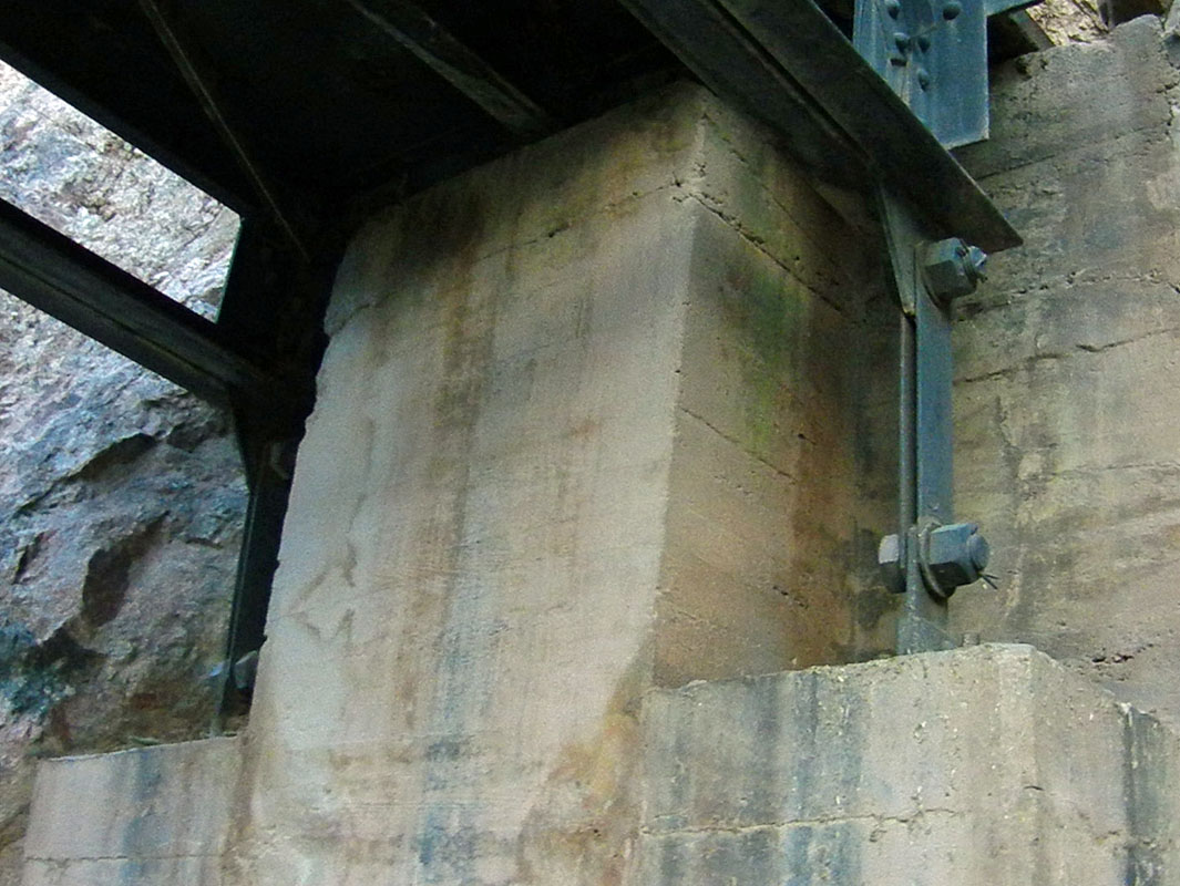
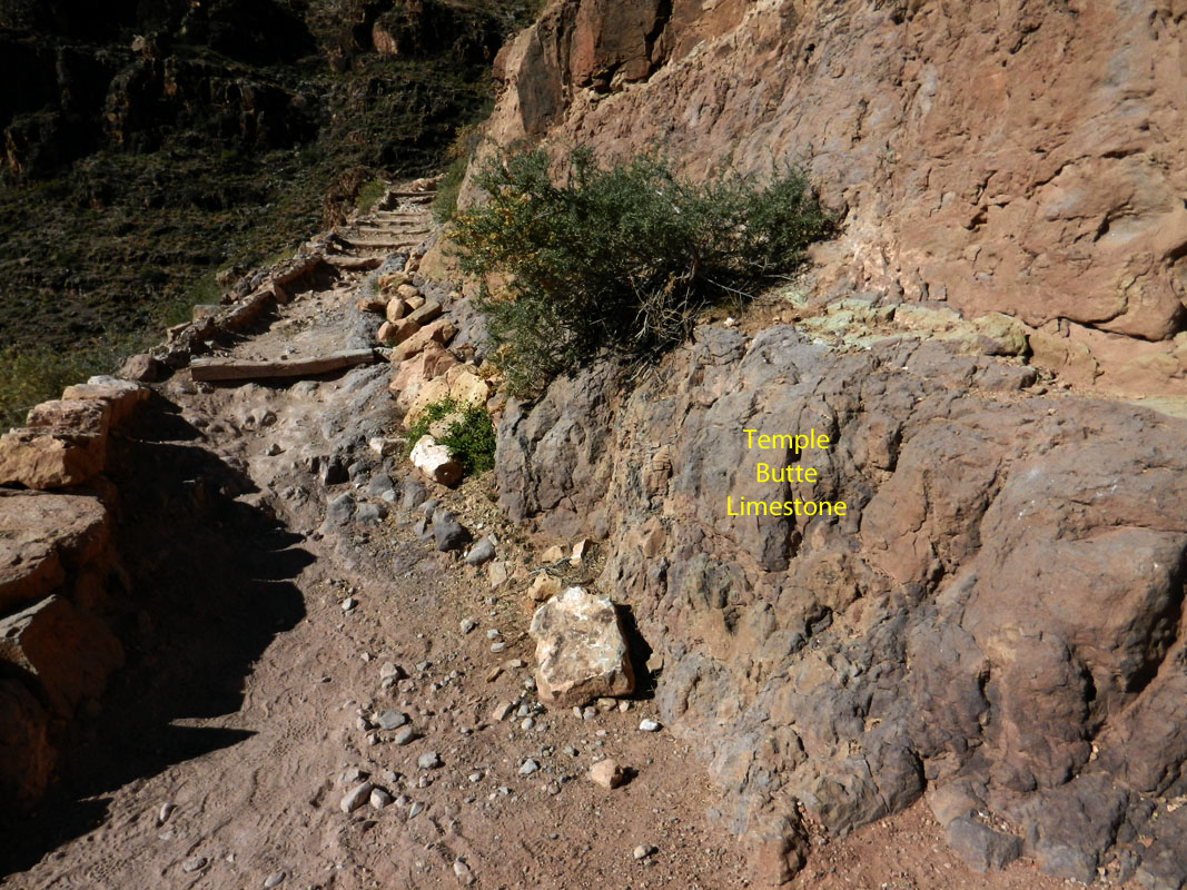
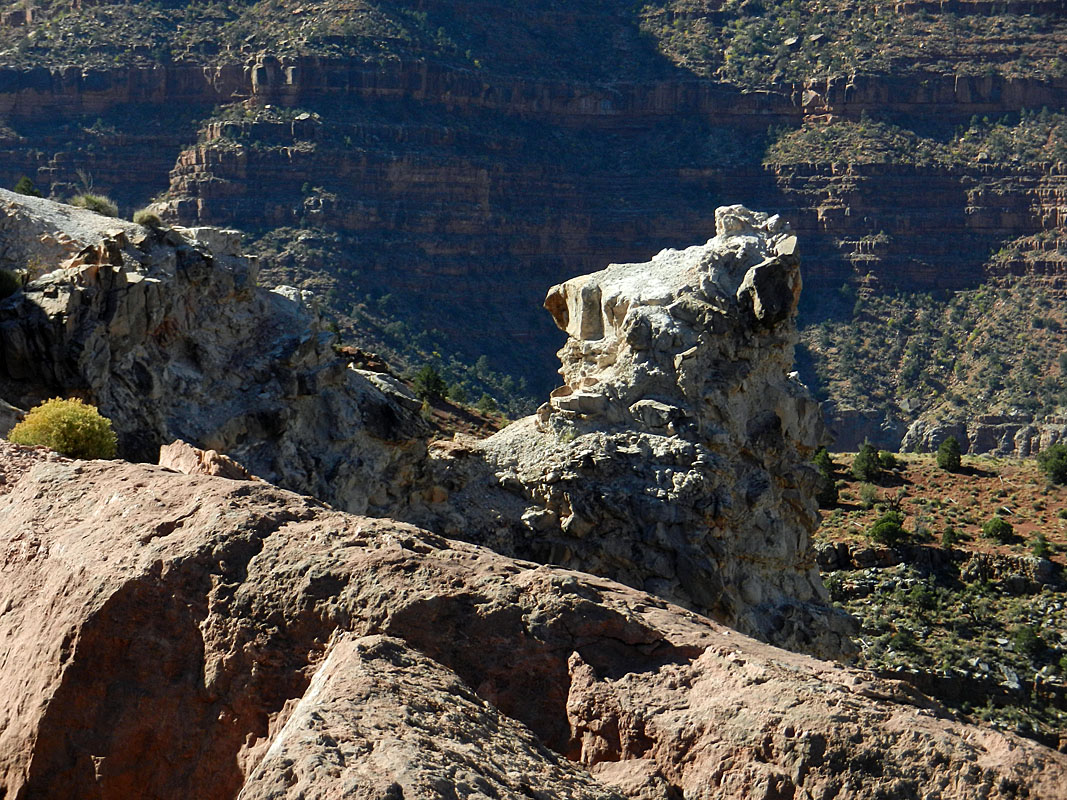
we take for granted! Before we finished packing up and getting on our way, Bil V. stopped by and asked if we needed anything. We chatted for another 20-30 minutes before he had to continue with his rounds and we were on the trail at 7:15 a.m. We got right behind the tourist mule train. We decided to hang behind them, since we weren't in a big hurry. When they started across the bridge I was surprised at how much the end supports of the bridge moved around, even when the mules were on the other side of the bridge. We trailed the mules up to the Tonto, where they all dismounted to use the restroom. After that, they never did catch up to us all the rest of the way to the top. We were able to check out a couple of the geological features I had notes on. One is a small lens of Temple Butte limestone that is at the next to last switchback at the bottom of the Redwall. It doesn't last long, but it edges the trail right here so hard to miss. And, it's purple. Further up, at the saddle with O'Neill Butte, there is a white pillar of rock. This is a breccia pipe, where a cave feature collapsed and filled up with other debris that now form this pillar. We reached Cedar Ridge at 11:30 a.m. and the rim an hour later. |
We rode the shuttle back to the visitors' center, changed clothes and
drove over to the park headquarters, which is the old visitors' center.
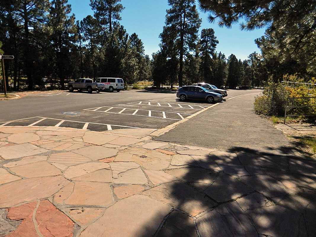
While the park seemed quite crowded - lots of people and vehicles - this
lot was practically
 vacant
(photo above). We went because there is a small display here on
Colin Fletcher and his famous canyon hike of 50 years ago (photo to the
right). Kind of interesting. Then it was on to the Bright
Angel Cafe for lunch. We parked near the railroad tracks, by the old power
station. All the spots around the BA were full. We both chowed down
the "Canyon Burger" with relish. There was an interesting
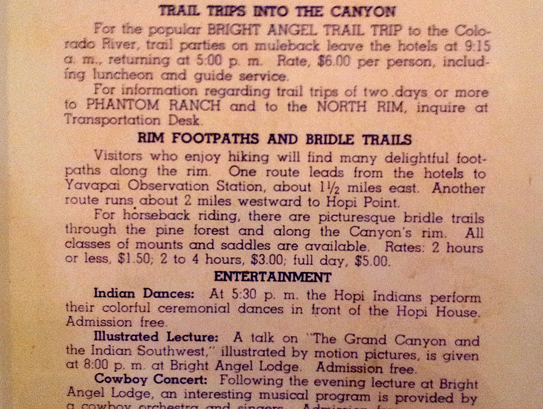
item posted on the wall as part of the decor - it was an old brochure
advertising various canyon amenities from the early days (photo above). Here's what it
said: "For the popular BRIGHT ANGEL TRAIL TRIP to the Colorado
River ..." Wow! A day trip on the mules to the river and back.
Sounds cool. Today, we can only just imagine what it would be
like. So it goes. After our late lunch, we strolled over to
the Kolb Studio to see their exhibit. And, then it was time to hit
the road home. vacant
(photo above). We went because there is a small display here on
Colin Fletcher and his famous canyon hike of 50 years ago (photo to the
right). Kind of interesting. Then it was on to the Bright
Angel Cafe for lunch. We parked near the railroad tracks, by the old power
station. All the spots around the BA were full. We both chowed down
the "Canyon Burger" with relish. There was an interesting
item posted on the wall as part of the decor - it was an old brochure
advertising various canyon amenities from the early days (photo above). Here's what it
said: "For the popular BRIGHT ANGEL TRAIL TRIP to the Colorado
River ..." Wow! A day trip on the mules to the river and back.
Sounds cool. Today, we can only just imagine what it would be
like. So it goes. After our late lunch, we strolled over to
the Kolb Studio to see their exhibit. And, then it was time to hit
the road home. |
|
|
||
|
|
Return to Hiking Grand Canyon home page |
|


