|
|
|
Pt.
Huitzil to the South Bass Trail Saturday, February 4, 2006 by Dennis Foster |
|
|
|
|
|
|
|
Pt.
Huitzil to the South Bass Trail Saturday, February 4, 2006 by Dennis Foster |
|
|
|
|
|
The winter continues to be very dry and the temperatures quite mild. For Saturday, February 4th, the forecast high in Flagstaff was almost 60 degrees! So, it was time to continue doing interesting Grand Canyon hikes that are normally inaccessible during the winter, as the snowfall blocks the roads and obscures the tops of the South Rim's north facing trailheads. My thoughts turned to a day hike down an obscure route off the South Rim, at Point Huitzil, to the Esplanade level, and, then, follow that to the South Bass trail, topping out on the rim at that trailhead. If you are not familiar with the general location, see this map.
Some years ago, over the course of three, or four, outings, I managed to
find the key spot in this fabulous "Point Huitzil route" that
gets one through the Coconino sandstone. That spot is a hole near
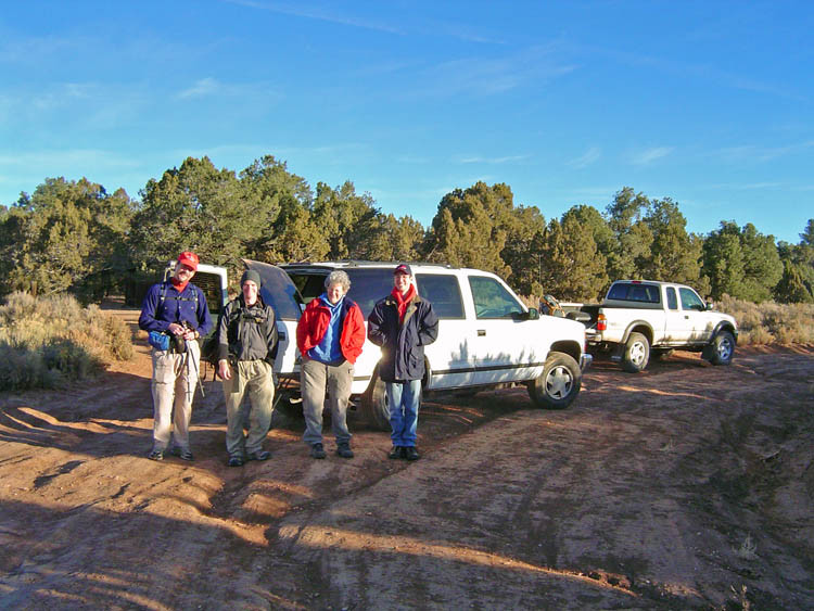
the edge of a cliff, that leads The "loop" hikers consisted of Mark Pebler, John and me. Kathy Eastwood and Keith Wood did the South Bass trail. We left Flagstaff a bit after 5:30 a.m. and were on the 24 mile dirt road to Pasture Wash by 6:45 a.m. We reached Pasture Wash at 8 a.m. and were off hiking through the woods some twenty minutes later. The route to the rim is not difficult, although I have yet to manage the reverse direction without getting disoriented! We start by following the old road (which is now barred to travel - too bad, otherwise we might have finished this hike in daylight) for a mile, or so. Then, we follow an old telephone line, which is just a piece of wire. It is mostly on the ground, although part of it might still be hanging from insulators strung up in the trees. We probably travel another mile until we take a right turn and head north until we reach a discernable ravine, which we follow (to the northwest) to the rim of the canyon. |
|
|
||
 |
 |

|
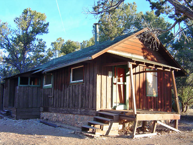
| The old Pasture Wash Ranger Station. | John, Mark, Kathy and Keith. | Apache Pt. from faint trail. |
|
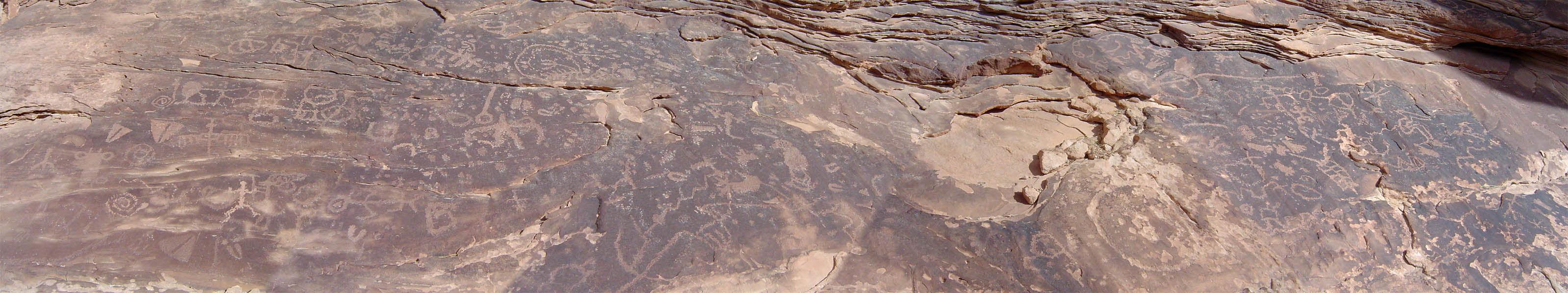
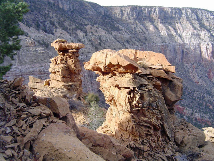
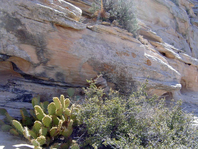
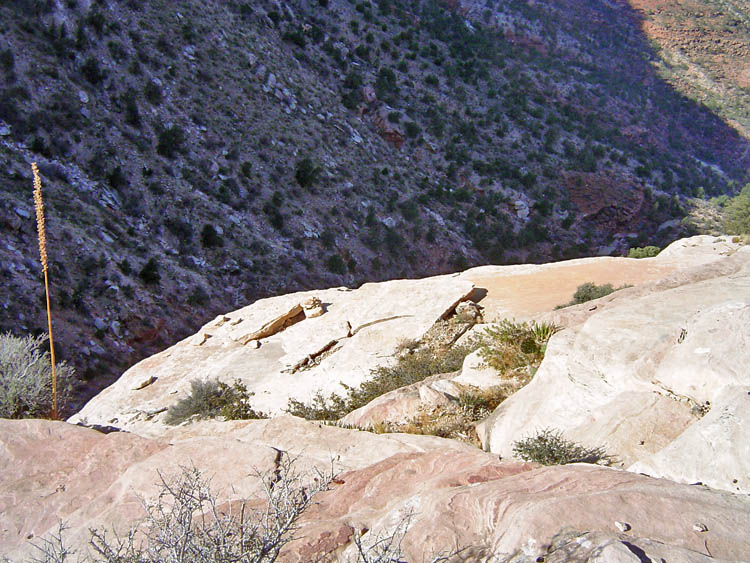
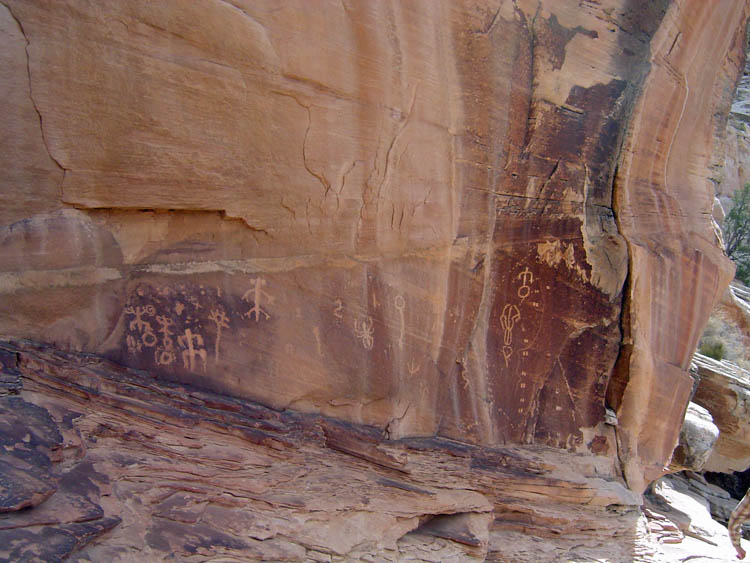
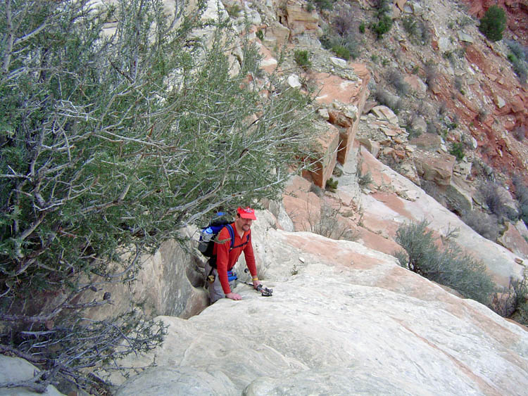
From the rim, we follow the faint trail and cairns through a break in the Kaibab, down a steep slope and near to a couple of impressive towers in the Toroweap. We went down at the towers, but had to backtrack as the correct route descends before you get to them. Still at the very bottom of this route, when you pop out on a talus ridge that goes all the way to the Esplanade, you can see that you are almost directly below these towers. You soon end up on a slanted portion of the Coconino. There is an awkward spot where you have to lower yourself down to a pile of rocks that serve as a step. Nearby is where you must find the hole, at the edge of the cliff, which affords passage to the crack. There is a chimney nearby, which may attract those heartier than me, but which also bypasses the huge panel of rock art that is just below the crack. With our false start, we spent about an hour and a half getting to this spot from the rim. It was just after 11:00 a.m. and we decided to break here for an early lunch and to take pictures of the petroglyphs. Following this we must descend the sloping rock where handhold and footholds have been worn away in the rock. Harvey Butchart called these the "Moki steps." I lowered my pack through here, but John and Mark climbed down with their packs on. By 12:30 p.m. we were on the Esplanade proper, and noted that there was ice in a nearby ravine. The temperatures were pleasant, and we didn't wear any coats during our descent, nor along the Esplanade until it was past sunset. |
|
|
||
 |
 |
|
| The twin towers in the Toroweap. | Rocks piled (center) as steps. | Key feature - hole at edge of cliff. |
 |
|
|
| John and Mark on Coconino. | Rock art below crack. | John along "Moki Steps." |
|
We stopped along the Esplanade, out in front of Montezuma Point, for a
second lunch at 2:00 p.m. We had just latched onto a faint trail in
here, and that carried us all the way to the South Bass. It was
well-cairned and generally well used. So, we really caught a break
on our trek along the Esplanade. There was some high cloudiness in
the We kept seeing Mt. Huethawali as we contoured along the Esplanade. It really dominates this region. We reached the South Bass trail after sunset, but before it got dark. But, we lucked out some more here - the trail has been worked on extensively and is in absolutely fantastic shape. [The one photo I took in the dark was blurry.] So, it was real easy to follow. And, we had the light of a moon that was just at first quarter, which cast enough light so that none of us used our flashlights. I was pulling up the rear and topped out at 7:15 p.m. |
 |
 |

|
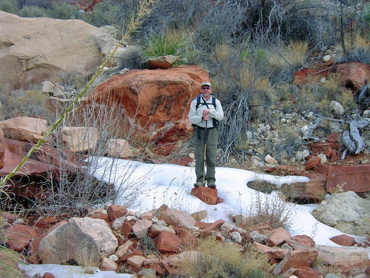
| Toltec Point. | Dennis amidst icy water source. | Mount Huethawali. |
|
Unlike the trail, the road is in absolutely horrible shape - rocky and lots of ledges over the last mile, or so, to the trailhead. Just before reaching the trailhead parking area, a gash in one of Mark's tires quickly flattened a tire. At least they were at the trailhead, so it wasn't blocking the narrow road! Kathy and Keith tried changing the tire, but one lug nut was frozen on. When we reached the rim, we had no success at dislodging the nut either. Thankfully, we took two vehicles, which, in retrospect, I should have changed to just one! It is a good thing that I don't always work this stuff out! [We were taking two vehicles because, as of Friday evening, only Mark, John and I were going. Once we got Kathy and Keith for day hiking, I didn't realize we didn't need both vehicles for the car shuttle.] So, the five of us piled into my Toyota Xtra Cab, with gear tied down in the bed, for the trip back to Flagstaff. I reached home at midnight, after a very full day!
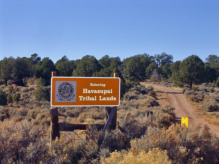
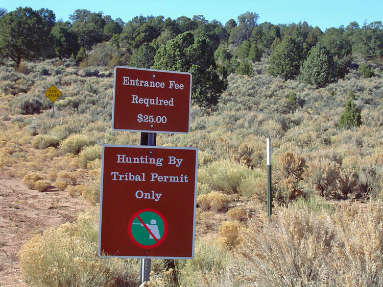
I have written about one problem with accessing the South Bass trail - the road doglegs through about three miles of Havasupai land. The posted sign states that the "entrance fee" is $25. Since you are using a road that was maintained by the Forest Service (and still may be) and that provides access to the national park, this is a textbook example of highway robbery. Indeed, you aren't paying for anything but the right to drive three miles down the road to re-enter the Kaibab National Forest, and, then, the Grand Canyon National Park. I might be a little more sympathetic if the money was being used, at least in part, to improve the road, but, clearly, that is not the case. Well, nobody was there to demand money from us - I suppose that the traffic is just too scarce to make it worthwhile for someone to sit there at the gate. I will urge our local Congressman to earmark funds in the next pork-barrel transportation bill to reroute this road so that stays outside the reservation boundary. |
 |
 |

|
| Entering Havasupai land. | A steep price for a 3 mile drive! | The Grand Canyon is off limits? |
|
|
||
|
|
Return to Hiking Grand Canyon home page |
|