 |
|
|
Jicarilla Point Petroglyphs Sunday, June 7, 2009
by Dennis Foster |
|
|
|
|
|
|
|
Jicarilla Point Petroglyphs Sunday, June 7, 2009
by Dennis Foster |
|
|
|
|
| I
had been to see the cool petroglyph panels below Jicarilla Point three
times - twice in 1981 and once in 1991. I haven't been able to
track down any photos from my 1981 trips, and I only have a scant dozen
that I took on the trip ten years later. In this digital age, I
have been doing a lot of repeat visits to special places like this,
partly with an eye to compiling a much fuller photographic record.
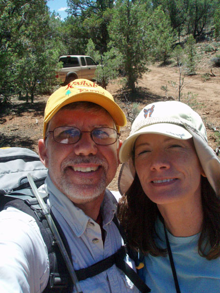
Cara Lynn and I had driven up to the South Rim on Sunday, May 31, in order for me to get a number for the permit line the next day - June 1st is when permits open up for the following October, a highly prized time to hike in the canyon. To fill out our day, we planned a trip over to Jicarilla Point, and the petroglyphs below. Unlike my other visits, we wouldn't be able to drive the boundary road, since the park service has closed it off. Studying my forest service map, and Google Earth, we plotted a course that looked to take us very close to the park boundary fence and road, from where we could quickly walk to another road that runs towards Jicarilla Point. We left the well-traveled FR 328 (which goes out to the South Bass trail) at Homestead Tank and headed up a northerly ravine. We followed the "main" road for a few miles and I could tell we were well off our intended course. So, we stopped and headed through the woods and reached the boundary road some miles too far to the northwest. We tried to navigate our way through the forest to the rim and came out above Turquoise Canyon, to the west of Paiute Point. We wandered through the woods a couple of times and only managed to reach the rim east of Paiute, where we could see the natural arch at Jicarilla Point, across Sapphire Canyon. We determined to try this trip again, a week later. I did more map study and was able to mostly figure out what road we had been on and where we had stopped. Later, I realized that the road I wanted was now marked as closed, and that the road we were on wasn't on the newer forest service map, which I had picked up this week! As usual, it was a full day. We drove about 200 miles round trip, leaving Flagstaff in the early morning, shortly after 8:00 a.m., and getting back at about 11:00 p.m. Over the course of the day we saw many bunny rabbits (especially that evening), an elk, owls and, of course, lizards. Also, we saw a good amount of cactus blooming throughout the day. |
|
|
||
 Rabbit along FR 328. |
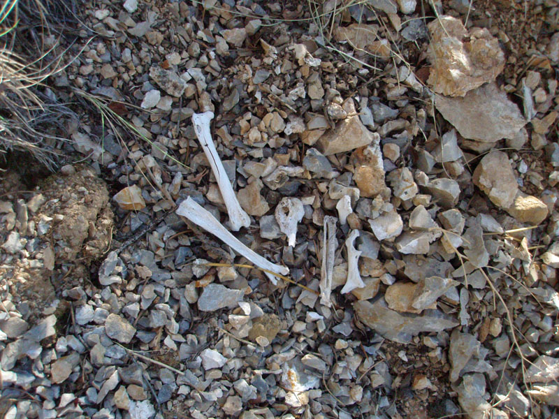 Bone of small animal on hike. |
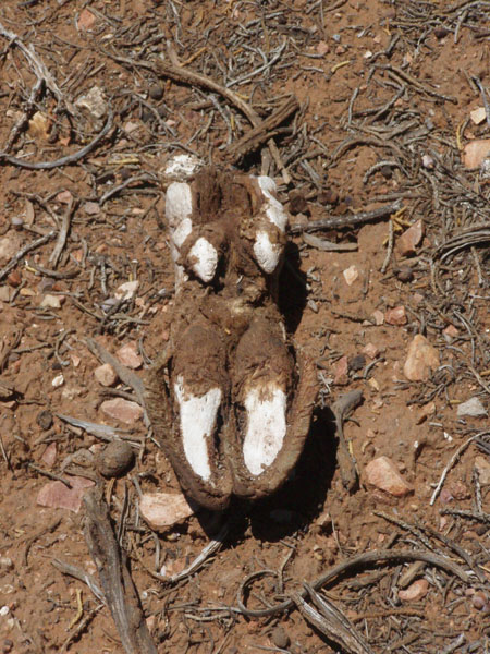
Elk hoof a bit off the
dirt road to |
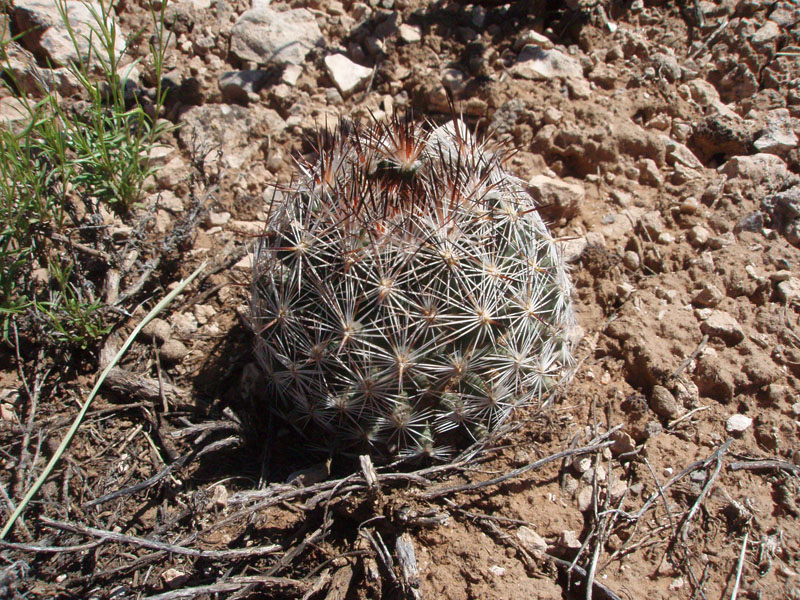 Small cactus. |
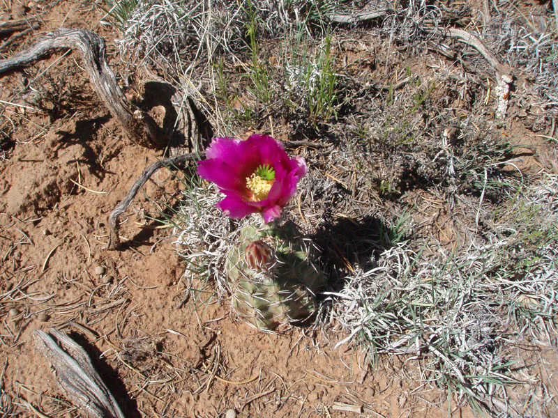 Cactus bloom. |
|
| As with our trip to see Shamans' Gallery, we wanted to find the benchmarks that are shown on the map along our route. The first one we looked for was BM 6205, on FR 328, about three miles west of the junction with the road to Maswik Lodge. We tried this the week before, but came up empty. The same was true on this day, although we found loads of old camp trash, indicating that this area had lots of old-timey use. After giving up on the benchmark, and once back in the truck, I looked over the two maps I had - an older and newer forest service map. And, I discovered that this stretch of FR 328 had been re-routed! The old map showed us going by the benchmark, but the new map showed us about a mile north! No wonder we couldn't find the benchmark! |
|
|
||
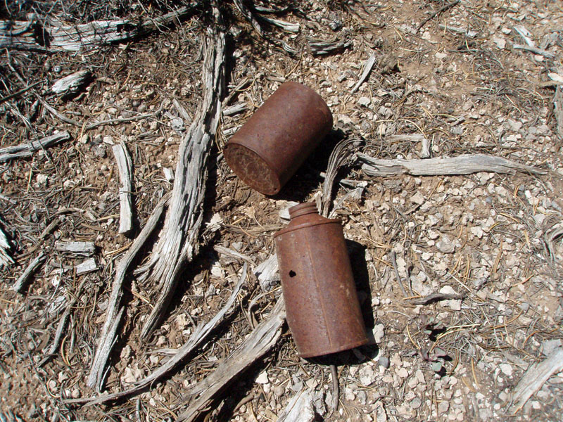 Old cans at false benchmark site. |
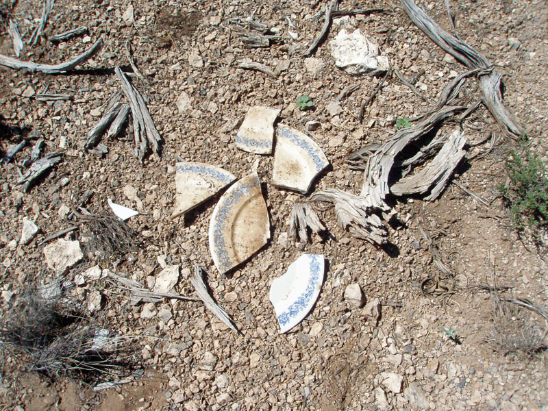 Old porcelain plate. |
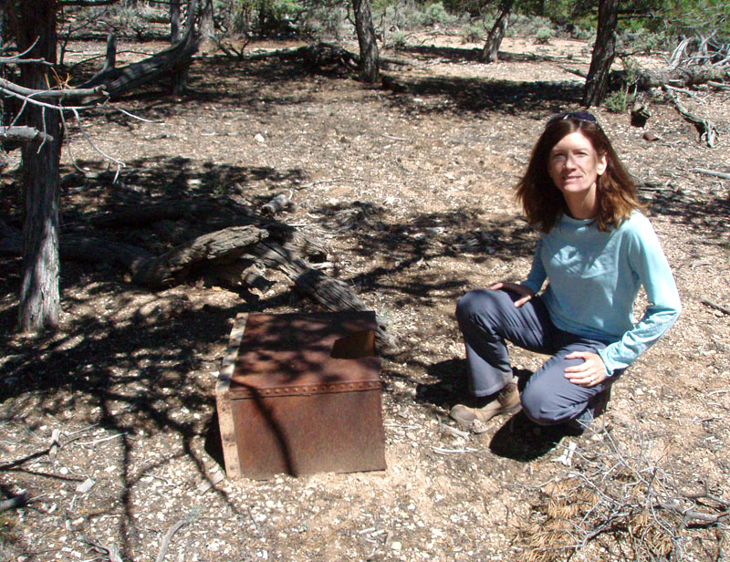 Cara Lynn by metal box. |
 Dennis by old cans. |
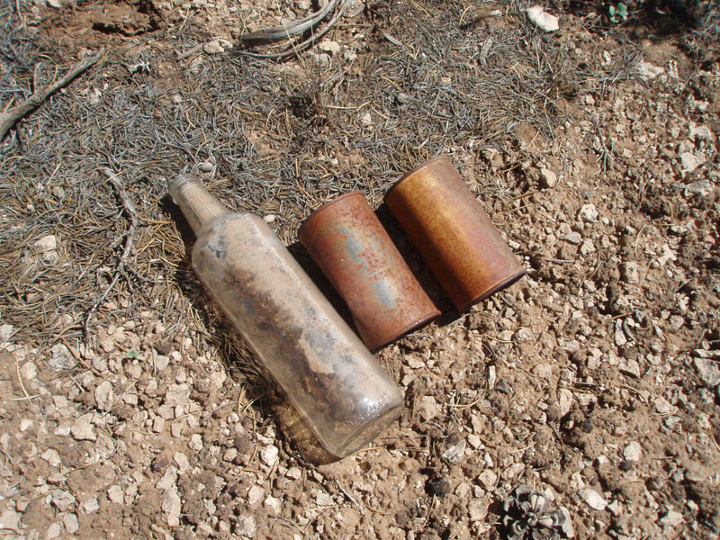 Old bottle and cans. |
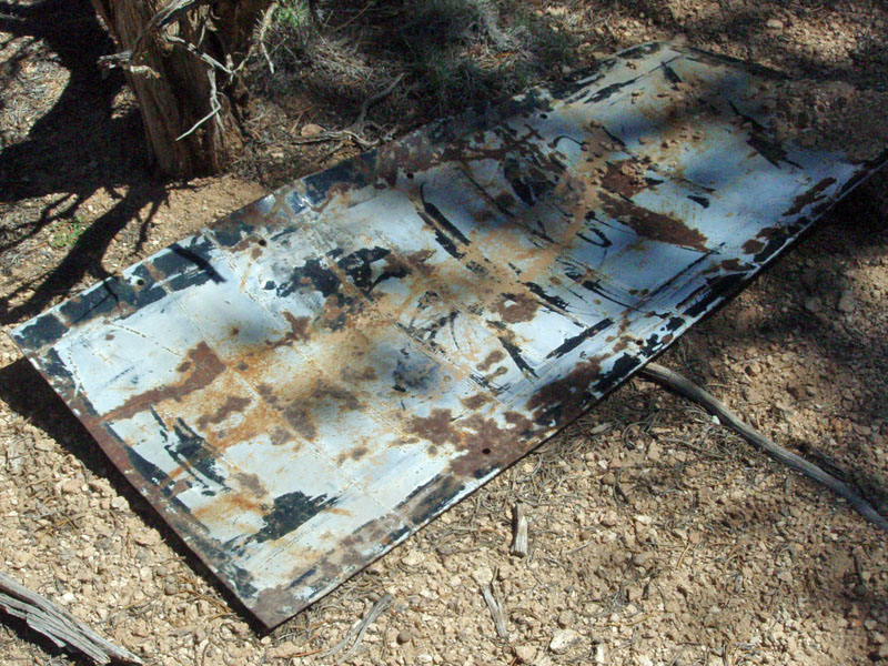 Perhaps an old sign? |
|
The newer map doesn't show the road we were on the previous week,
although it does show more road numbers than the older map. So, I
brought them both. The past week, we missed a left hand turn on
our way back and ended up hitting FR 328 at Sheep Tank instead of
Homestead (and, that road is not on the newer map). This week, we
decided to repeat the route from Sheep Tank, using the notes we took
from the previous Sunday. That worked out pretty well. We
also had a nice topo map of the area, which showed the older roads we
were seeing.
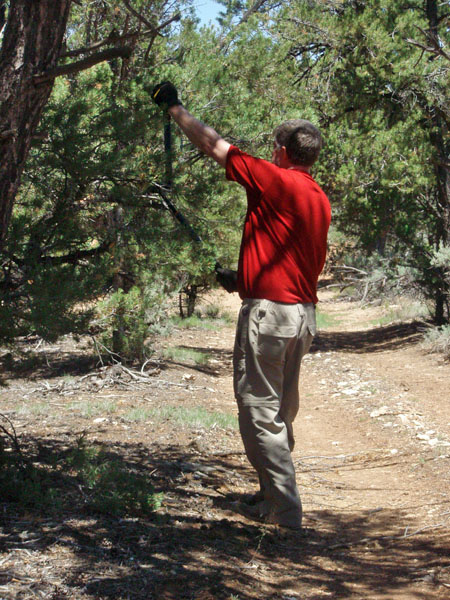
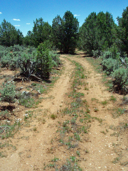
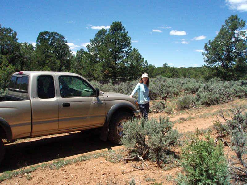
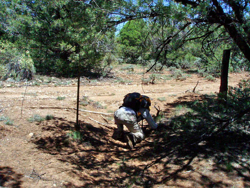
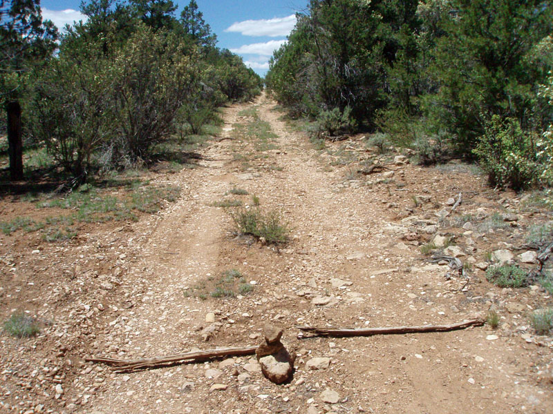
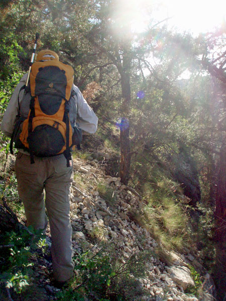
Since this is not a well-traveled road, there are lots of tight spots where tree branches scrape against the truck. For this trip, I brought along some heavy duty pruners (actually called loppers). When we would get to these spots, I would hop out and trim up the overhanging branches. Since we were only traveling a couple of miles over this road, it seemed like a reasonable use of our time. I didn't get every spot, but did a good job of knocking down most of these branches. Our next benchmark target was shown along this old road (BM 6372). We estimated where to stop and looked around. The only visible clue was a tree blaze, and after about fifteen minutes of looking around we gave up and got back in the truck. But, we drove hardly 25 yards away when I spotted a pipe, on the left hand side of the road. That was the benchmark we were looking for. I brought along my GPS unit to help out on this hike. But, I haven't really learned much about its various features. Still, I was able to get a reading here, and the elevation shown by the GPS was well off of the one on the benchmark. Then, the batteries died, so that's all we did with the GPS! |
|
|
||
To minimize the scratches from overhanging branches, this week we brought along a pair of loppers. |
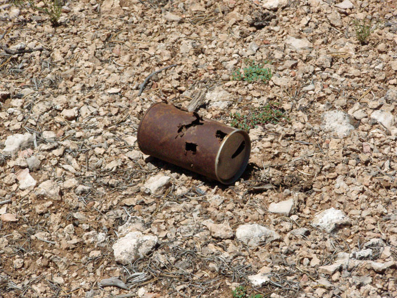 An old "pull tab" can. |
 As we scouted around for BM 6372, we found this tree blaze. The BM was 25 yards ahead. |
 Dennis reviews GPS notes. |
||
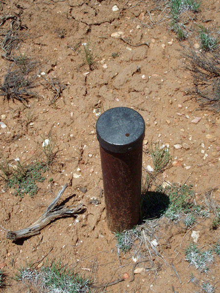 The benchmark! We had started away and I spotted it on the west side of the road on this metal post. I had been looking for big rocks, which are often used to anchor these markers. |
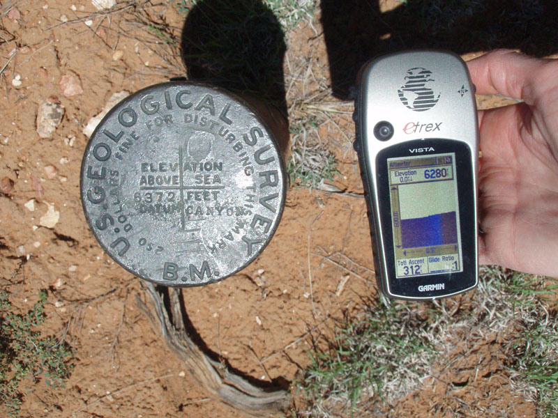 Benchmark and GPS reading. |
 Looking back from the benchmark to a spot in the road where there is a detour around a tree that has overgrown the road. This spot is a good visual cue for finding this benchmark. |
 Cara Lynn with BM behind. |
||
Cara Lynn took a cool picture at the benchmark, from directly above it
with her shadow over the pipe. When we saw it on the camera, it
looked like the pipe was her neck and the marker was her face.
With the rocks showing up in 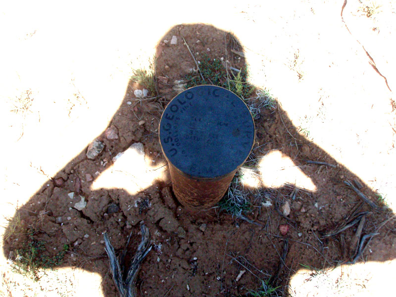 her
shadow, she looked like some kind of mottled alien. Well, we
thought it looked funny. her
shadow, she looked like some kind of mottled alien. Well, we
thought it looked funny.
Four tenths of a mile further down the road brought us to a spot where the road branched off from the ravine we had been driving in. On our topo, it looked like we could stop here and follow the ravine to the boundary road. That worked like a charm. We didn't need to do anything to keep track of our route here, as the ravine was generally well-defined all the way to the park fence. We did put a couple of branches across the road here, so that we'd know where to turn on our way back. It took us hardly ten minutes of walking to reach the boundary fence/road from our parking spot. We knew that we were west of the 4WD road to Jicarilla, so we headed east on the road. I wasn't sure if we would spot this old road, since it has been 18 years since I've been out here! Still, seven minutes later we found the road, marked by an old metal post which must, at one time, have had a sign on it. |
|
|
||
We are off! We parked just before the road left the ravine we had been driving up for some time. A bit of a late start - it was 1:03 p.m. |
 The National Park boundary. |

While we kept looking
for the |
 Our exit spot on the boundary road. |
||
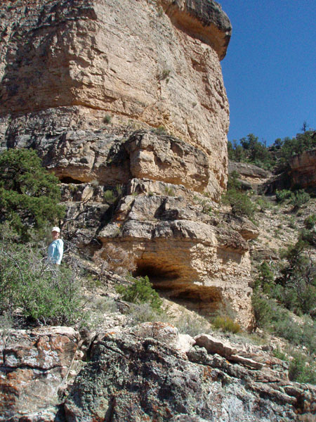
| As shown on the map, this road doesn't actually go anywhere but towards Jicarilla Point. After thirty minutes of walking, our road turned into a trail and meandered to the rim on the west side of Jicarilla Point, south of our descent ravine, which is also south of the natural arch that is out here. Where we do reach the rim, there are giant fractured blocks of Kaibab limestone and a bit of a descending ramp. We hopped around them a bit and then headed north along the rim. Later, we got a good view of this spot from below, and this ramp leads to a sheer drop of many hundreds of feet! |
|
|
||
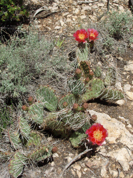
We saw a wide variety
of cactus |
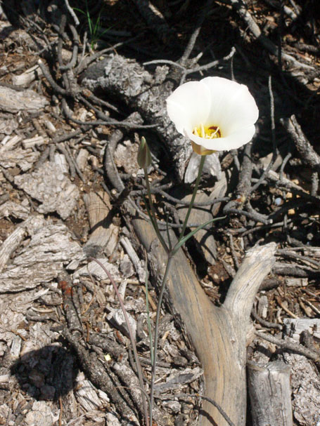 Sego lily. |

We reached the rim SW of Jicarilla Point, at a spot that was dominated by fractured Kaibab limestone. |
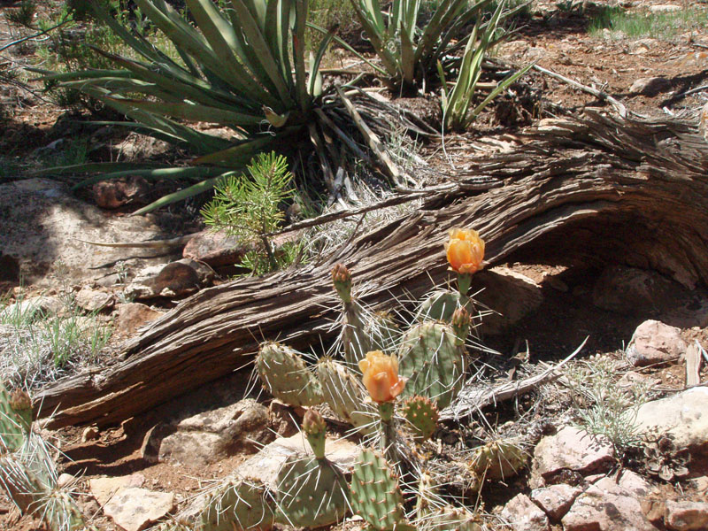 More cactus blooming. |
||
|
We had left the truck at 1:00 p.m. and were at the descent ravine at 2:00 p.m. There is a large cairn that marks this
spot. We spent an additional half hour here, including a short
jaunt over to the next little point in order to get a good view back
at this bay to confirm that we could get down through the Kaibab
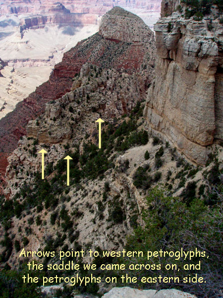
cliffs. Our objective was a sky island below Jicarilla Point, which
sticks up above the Coconino sandstone. Further to the north is
the prominent Pollux Temple. On the west and east sides of this sky
island are the petroglyph panels. I remembered that one side was
much more extensive than the other, and that these panels are as far as
you can contour along these cliffs.
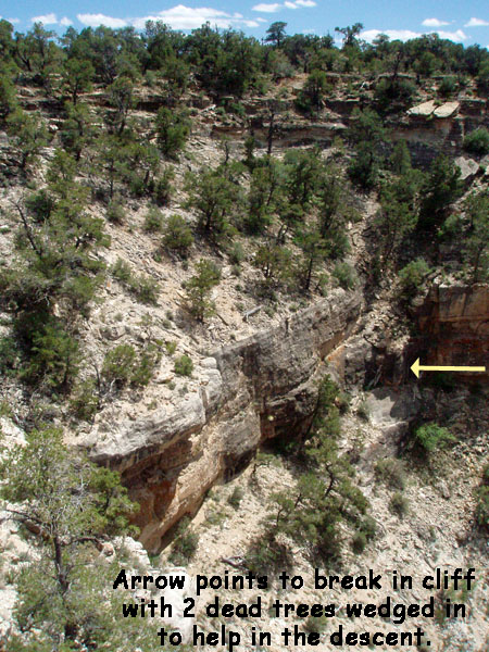
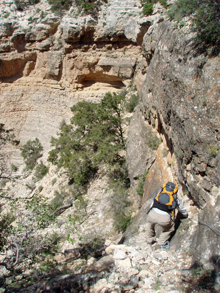
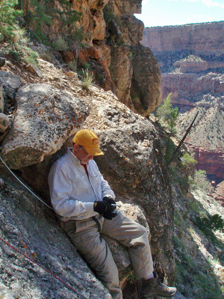
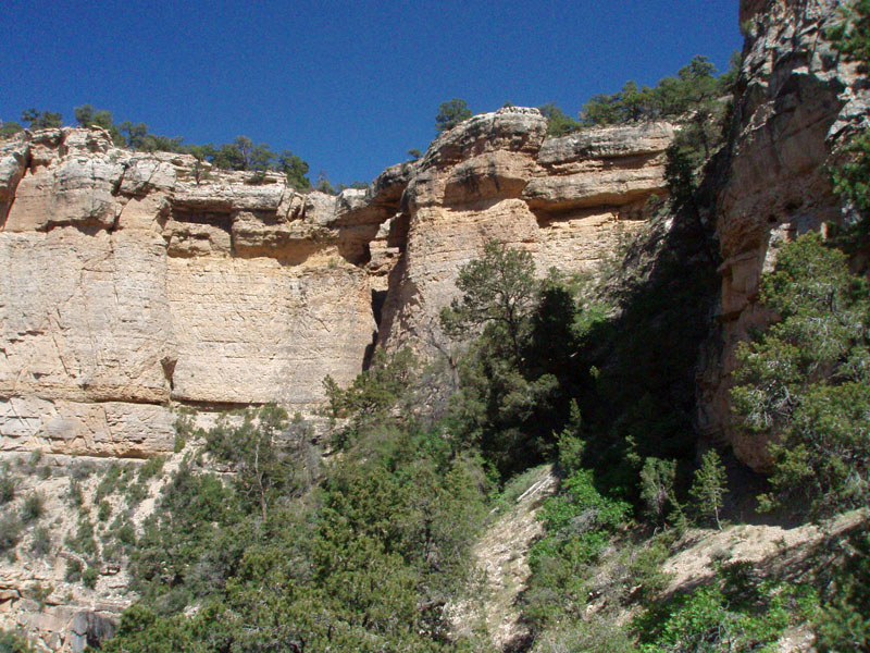
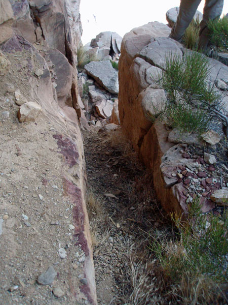
I also remembered that I used a hand line to get through a steep section near the rim. I didn't recall the details, but we soon found out! There is an eight foot drop in the cliff to a narrow ledge that gives way to steeply sloping rock. There are a couple of trees stuck in here, and I am inclined to say that these were here in 1981! They are certainly getting old, and I don't know how much longer they will last before someone ends up breaking off crucial parts of them. Still, we used the rope to hold us as we slid down to a branch we could step on, and then down to solid ground. Going up was easier, although we still used the rope to help steady us. |
|
|
||
 |
 |
 |
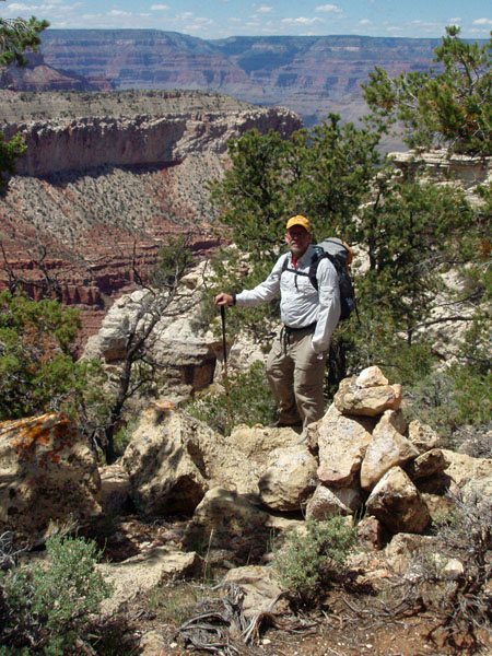
| Dennis begins descent at cairn. | The route ahead towards Pollux. | Looking at our descent from nearby. |
 |
 |
 |
| Dennis readies hand line. | Our "jumping off" spot. | Cara Lynn below cliff. |
|
Our route is fairly direct to the saddle that crosses over to the sky
island, atop the Coconino sandstone. We angled down the descent
bay to the north, and came around a point at the base of the Kaibab
cliffs. We were then in the bay where the natural arch is located,
up near the rim. We continued to angle down through here, although
there is a small cliff to negotiate. Near the middle of this bay
is a relatively easy spot to hop down through this cliff. Then, we
came around another point and angled down to the saddle, which we could
see clearly.
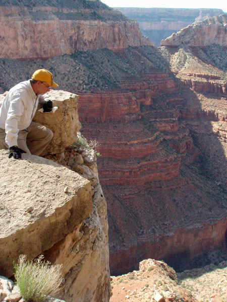
There is one more cliff to get through, right above the saddle. As we angled down, it wasn't clear how we were going to get through this cliff. Behind us, it looked impassible, although if we backtracked to the descent ravine, I think we could get through. I couldn't see any route ahead of us, and wondered if we might have to go around to the east side of Jicarilla to get through. But, we found two cairns along the way, leading us to an easy walk down through this last cliff. It is the only place to get through here that I could see! East of Jicarilla, it would have been impossible. It took us about an hour and a half to get down from the rim to across the saddle, where we dropped our packs and went exploring. |
|
|
||
Cara Lynn rounds the point that separates the descent bay from the natural arch bay. From here we can see the saddle to the sky island. |
 The natural arch. |
At times the hiking was brushy as we had to fight our way through trees and shrubs. Here we are near the middle cliff break. |
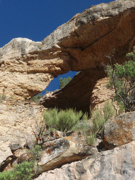 Close up of natural arch. |
||
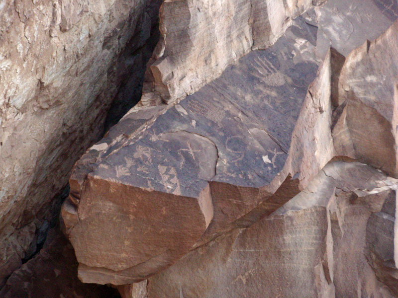
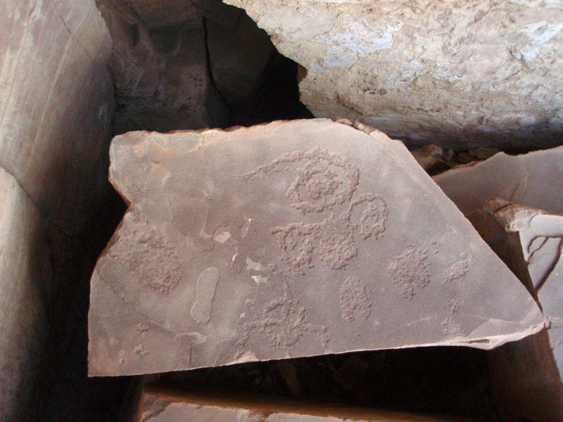
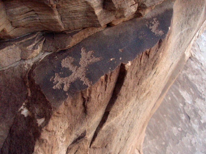
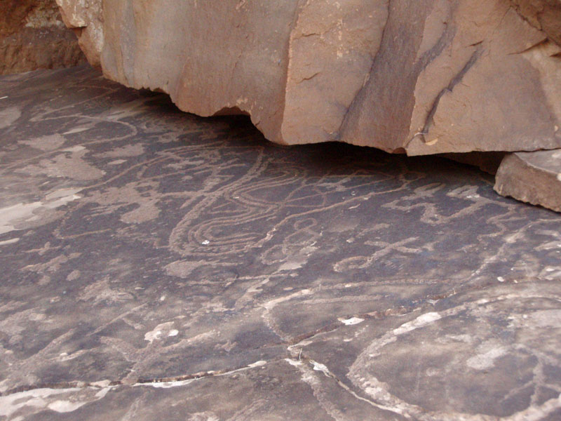
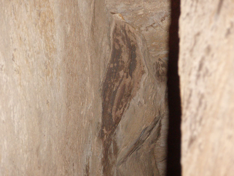
| We first went to the west. The rock art here is more sparse, but closer to the saddle. We soon found that we were really out on a limb here - there is only one route here, and sheer cliffs are down below us. The rock art on both sides is a bit unusual in that it is mostly on rocks that face upwards, as opposed to being on vertical surfaces. Still, they seem to have held up well over the hundreds of years that they have been here. |
|
|
||
 First petroglyphs - western side. |
 Rock art spiral. |
 The western set of petroglyphs is not very extensive and you soon run out of working surfaces and find yourself perched hundreds of feet above the slopes below. |
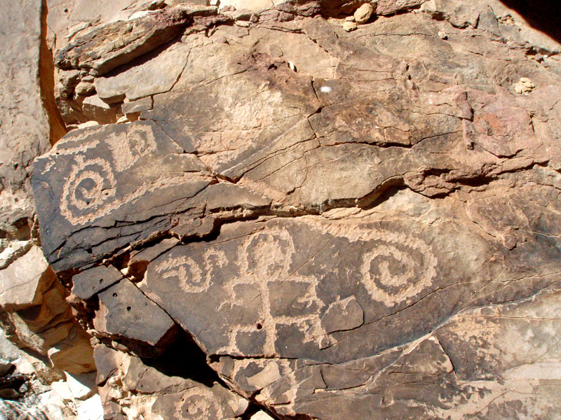 Rock art designs and figures. |
 Our route here. Click for annotation. |
|
|
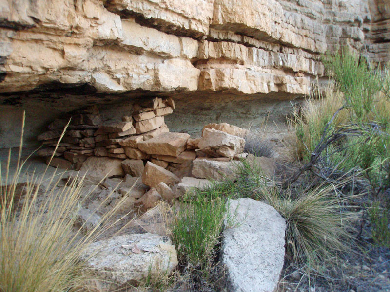
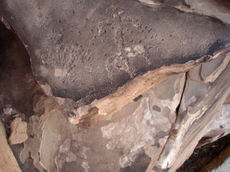
On the east side of this sky island, we had more room to move
around. We first came to a ledge where some residual walls outline
what looks to me like three rooms. To get to Pollux from here, I
think you have to climb up in this area and go over the upper part of
this sky island before you can go down to the saddle between it and
Pollux. We did see a cairn in here, but didn't check it out.
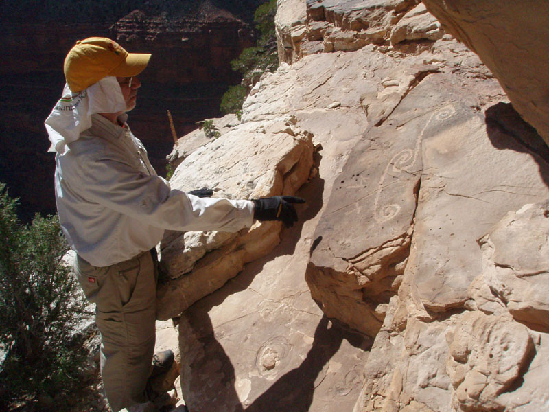
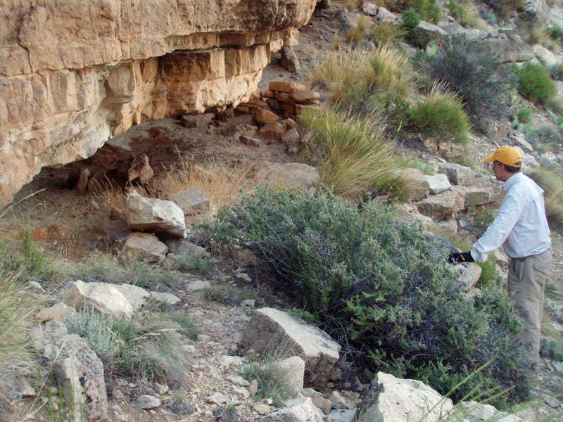
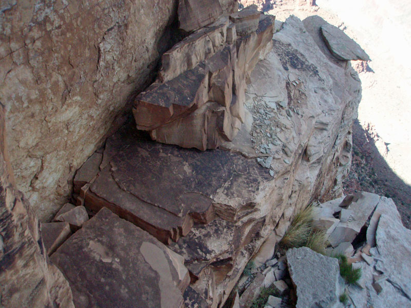
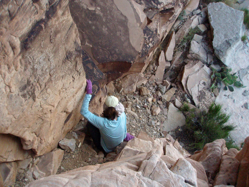
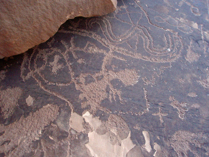
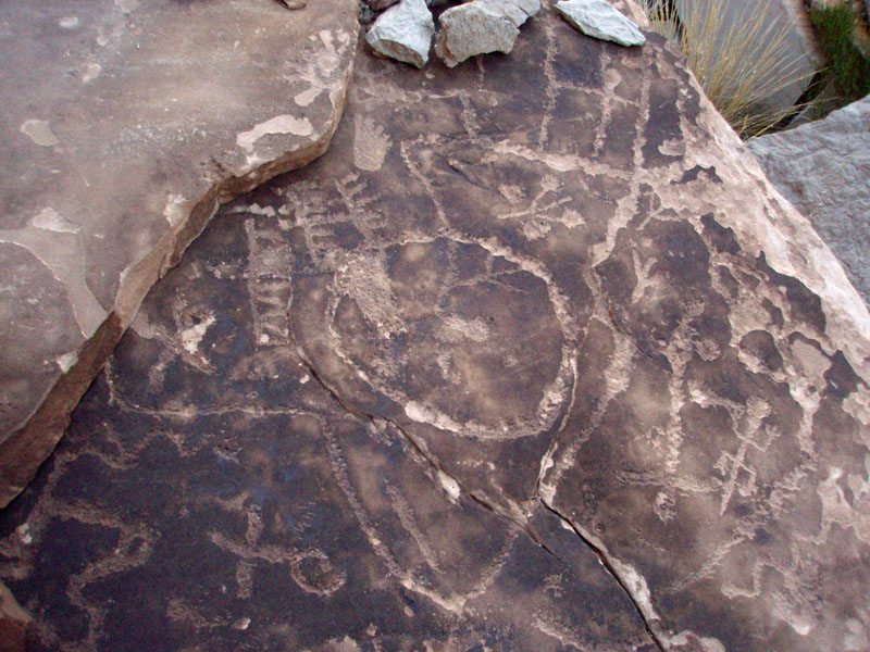
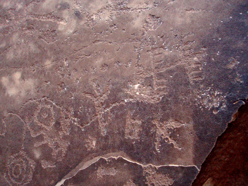
You continue along this shelf until it gives out. Then, a descending ramp opens up and if you peer over it, you can see an extensive set of rock art panels on some shelves below. Surrounded by cliffs, this is as far as you can go along here. Cara Lynn scurried down first and I soon followed to inspect these neat petroglyphs. |
|
|
||
|
|
||
|
|
||
|
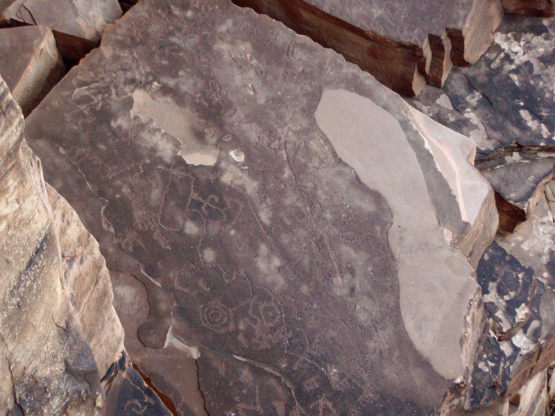
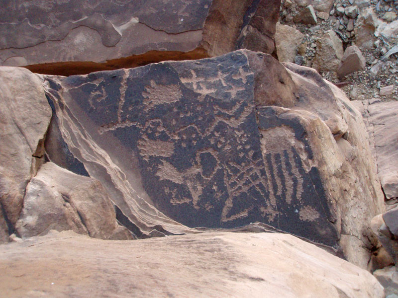
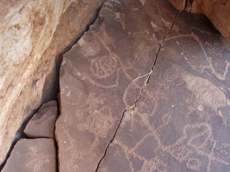
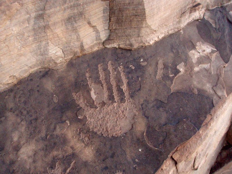
We got a good chance to see these designs and figures up close.
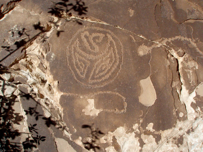
Most of the space here is filled with rock art, sometimes with figures
overlapping. There was a large block of the cliff on the main rock
surface that looked like it might have fallen during the time this site
was being used. There are figures that extend under an overhanging
part of this block, which would seem rather difficult to manage.
But, we couldn't discern if any figures disappeared under it to confirm
our hypothesis. There were designs on top of the block as
well. There was also an intriguing narrow ledge in a crack here
that seemed to have some design on it, but I might just be making that
up.
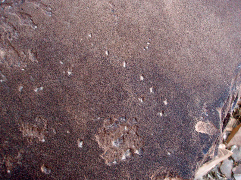
What does it all mean? Of course, nobody really knows. But, just before leaving, my attention was caught by some dots in the rock. They didn't look natural. And, after a little reflection, they seemed to me like a picture of the Little Dipper constellation! Certainly, star patterns would have been an important aspect of whatever spiritual meaning these people placed on our world. So, could some of these figures/designs be their interpretation of constellations? Hmm . . . |
|
|
||
|
|
||
|
|
||
We returned to our packs at about 5:00 p.m. and decided to finally eat
our lunch!! We had just been too busy to stop any earlier.
Knowing that we were beginning to face some time 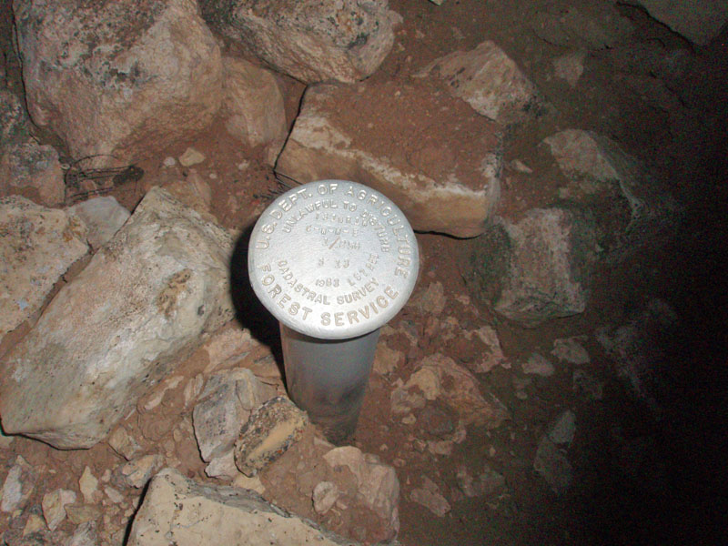 constraints,
we hurried, and, just before 5:30, we were all packed up and on our way
back up to the rim. We reached the top in less than an hour and,
an hour after that, we reached the truck. We had thought to walk
to the arch, but it seemed like that would have taken another hour of
our time, and we really didn't want to have to hike back in the
dark. So, that will have to be another trip. constraints,
we hurried, and, just before 5:30, we were all packed up and on our way
back up to the rim. We reached the top in less than an hour and,
an hour after that, we reached the truck. We had thought to walk
to the arch, but it seemed like that would have taken another hour of
our time, and we really didn't want to have to hike back in the
dark. So, that will have to be another trip.
By 7:50 p.m. we were ready to drive back home, via the Wendy's in Tusayan. We came back by Homestead Tank, and found a marker there. At first we thought it was the benchmark shown on the map, but it isn't in the right spot. It is a marker of some sort, but one placed by the Forest Service, not the U.S.G.S. |
|
|
||
|
Postscript - I had been doing a bit of research on Mystic Spring, which is out near the South Bass trail. I was reviewing some of what George Wharton James wrote about this area during his travels here in the late 1800s/early 1900s. From his book, The Grand Canyon of Arizona (1910), page 78, is this passage, "Midway between Bass Station and Bass Camp, ten miles each way, the road passes a United States Geological Survey monument, which records the fact that here the plateau is six thousand three hundred and seventy-two feet above sea level." Bass Station refers to the place where Bass would pick up tourists that had arrived on the railroad, just a few miles south of the South Rim Village. Anyway, that is exactly the benchmark we found and is pictured above!! |
||
|
|
||
|
|
Return to Hiking Grand Canyon home page |
|
