 |
|
|
Cairns
above Sockdolager Rapids Friday, July 27, 2007 by Dennis Foster |
|
|
|
|
|
|
|
Cairns
above Sockdolager Rapids Friday, July 27, 2007 by Dennis Foster |
|
|
|
|
|
Recently, I have begun to try to assemble the photos I have taken of
various cairns in the Grand Canyon. Unfortunately, I don't seem to
have been a reliable chronicler of these crude structures. And, of
course, I don't have digital photos of the ones I have encountered more
than five years ago. So, I have been thinking about doing some
hikes to cairns I know about, so that I can correct for this
photographic deficiency. [For instance, see BM 3702 -
West of Plateau Point for a recent trip.] Now that the monsoon
season has kicked into full swing in northern Arizona (lots of clouds,
especially in the afternoon, and pretty reliable rain every day), a day
hike to the otherwise broiling Tonto Plateau seemed like a good
idea. I got my hiking buddy, Bill
Ferris, to come along on this hike, so that I could photograph the
cairn that marks a most unusual trail in the Grand Canyon. More on
that later.
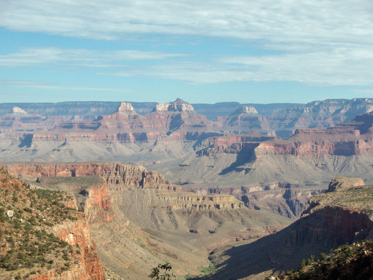
We left Flagstaff at nearly 5:30 a.m. and were started down the Grandview trail by 7:15 a.m. A few years ago (maybe it was just two) the Park Service closed down the Grandview, due to rock slides wiping out a big section of the upper trail. I had been on the trail shortly before that happened, and noted that there was a stretch in the lower Supai that had been badly washed out. The trail was closed for some many months, but the results are fantastic. A great deal of the upper trail was rebuilt and is in great shape, the cobblestone switchbacks in the Supai were shored up to prevent further erosion, and the long Supai traverse was widened in many spots. [See some photos here.] There was a bit of cloud cover to start off our trek, but that didn't persist for long. We reached a saddle, between Hance and Cottonwood, at the base of the Coconino, in forty-five minutes. We took a short break there and cached two liters of water for our return. We saw a couple of people here, but then didn't see anyone else until the other end of the day. This, despite the great weather. Ironically, of the people hiking on the Grandview this day, four were business college profs (like me) from Northern Arizona University, in three different parties. As we were coming up, two were nearing the mesa, where they had permits to camp for two nights, and there was nobody else camping there this evening! In fact, we only did see six serious hikers during the entire day (two more had the crazy notion that they could hike to the river, without water, and in poor shape, on this trail - we disabused them of that notion!). |
|
|
||
 |
 |
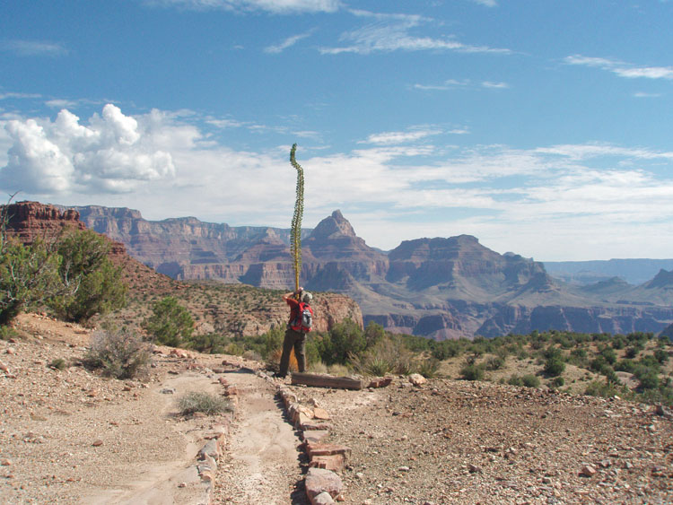 |
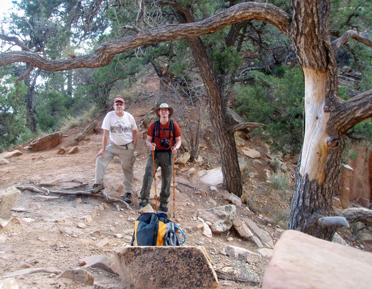
| Dennis & Bill at Coconino Saddle. | Canyon view from Grandview trail. | Bill snaps a photo of an agave. |
|
After passing into the Supai layer, we got sunshine, and by the time we
reached Horseshoe Mesa (3 miles from the rim) we were feeling a bit
warm. We cached another two liters of water just above the mesa,
for our return trip. We headed to the trail that descends off the
east side, to the Tonto Plateau. Near the top we stopped to look
at one mine entrance that was either caved in, or filled in.
Although it is alongside the trail, I don't remember seeing it before.
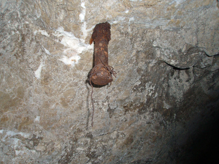
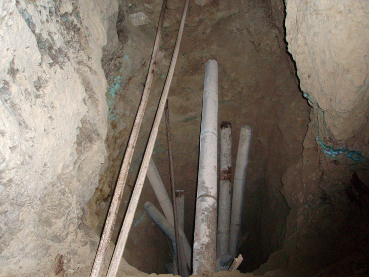
At about 9:30
a.m., about 2.5 hours after starting, we reach the lower mine entrance,
below the east side of Horseshoe Mesa. We stopped here for a while
and poked around. We went as far as we could down each
branch. The main branch becomes impossible to follow at a spot
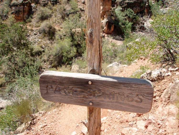
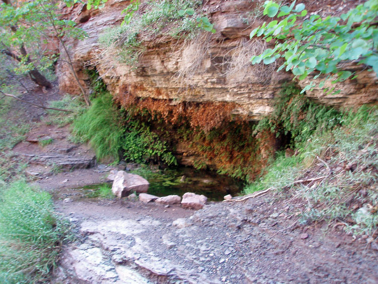
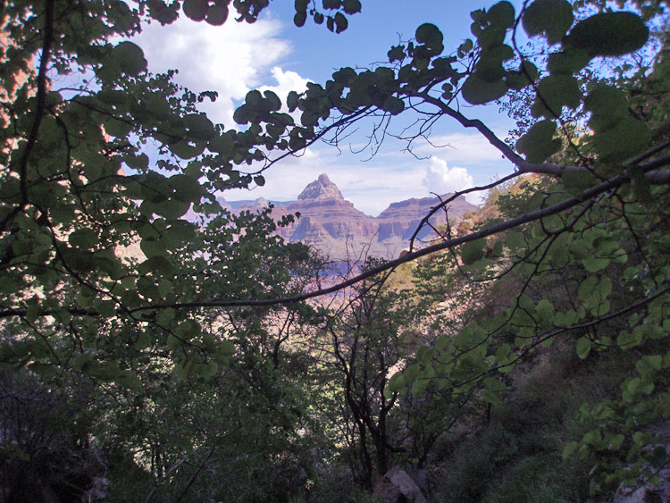
where there is a large hole that is filled with rails and pipes, After visiting the mine, we headed further down the trail for ten more minutes, to reach Page Springs. This spot is permanently shaded (as best I can tell) and there has always been a nice big pool of water here. We snacked a bit and lounged around for a nice solid half an hour. We didn't fill up with water, as we had planned to carry all we'd need. In retrospect, I think I should have brought along an empty bottle to fill up from the dripping springs and tanked up on about a liter. Later in the day, I got low before we reached our water cache, but didn't actually run out. While at the spring, I took this picture, above, of Vishnu Temple, through the leaves of the trees here. A nice view from a fine place to hang out! We noticed that there was a lot of mint growing here - probably not native! But, it sure smelled good, and it looks like it will stay. |
|
|
||
|
Bill at
a site where the mine |
||
 |
 |
 |
| Copper ore in wall of lower mine. | Page Springs junction. | Page Springs. |
|
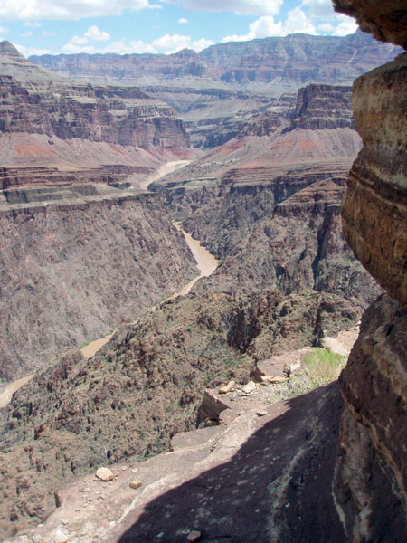
It took us a bit less than an hour and a half to hike from the spring,
to the edge of the Tonto, overlooking Sockdolager Rapids. At the
plateau level, the trail converges with the Tonto, well to the east of
the descent ravine. There is a spur that takes one more directly
to the Tonto trail, but we missed it and had to follow a ridge down to
hook up with the trail. We were getting full sun and it was
heating up quite a bit as we neared, and entered, the noon hour. We
reached our lunch destination - a shady spot below the Tapeats rim,
overlooking the river - at 12:30 p.m., and stayed there until almost 3
p.m.
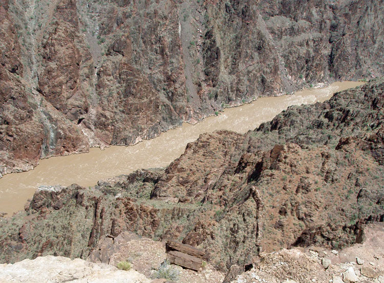
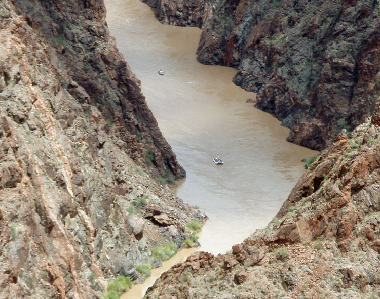
While eating and resting up, we saw some river runners come down and run through Sockdolager. Although we were practically looking straight down at them (or, so it felt), they still looked rather puny. It's funny how a thousand feet of elevation changes your perspective on things! Also, while we could hear the river, we couldn't hear the sound of any motors on these boats, and certainly at least one was motorized. |
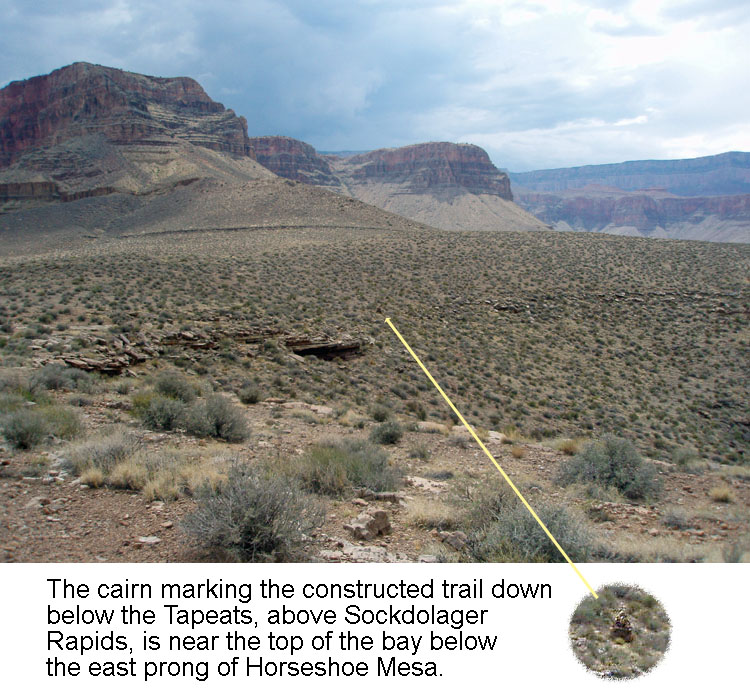
As we scampered into a suitable spot for lunch, I did spy the rock cairn
I was looking for. We'd save that for after our lunch break.
But, from our shady spot, we could also see the big rock cairn on the
north side of the river, west of Asbestos Canyon. I saw it up
close and personal twenty-plus years ago, and it sticks out in my mind
because it is huge and it is very well constructed, like the cairn above
Elves Chasm far to the west. But, for some reason, I must not have
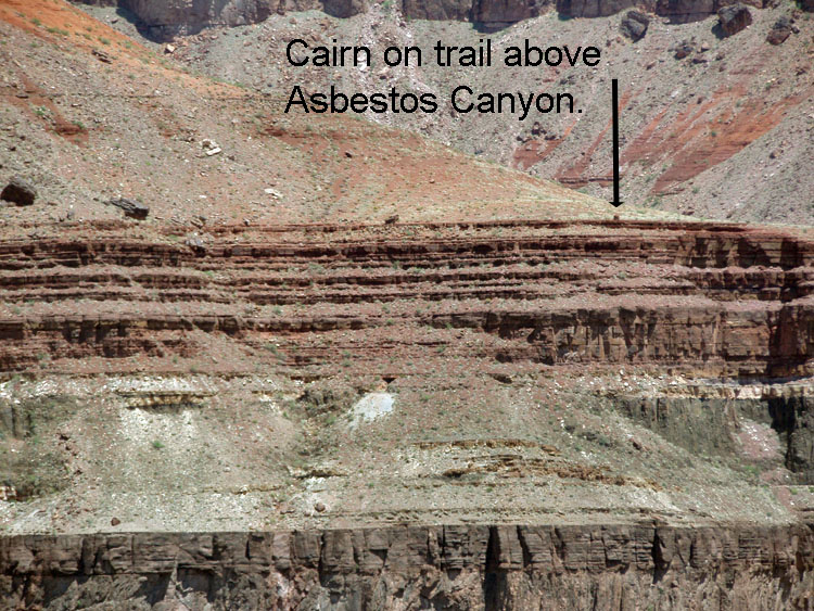 taken
a picture of this cairn, when I was there. At least, I can't find
one in my collection. But, my collection has a distinctive
haphazard quality about it, so maybe there really is one there . . . The
best I could do from our current vantage spot is the photo to the
right. Click on it to see the big picture view with the cairn's
location highlighted. This cairn is along a very well constructed
trail that leads to Hance's various mines. Exactly what it marks,
I don't know. In Harvey Butchart's trail logs, he often would
mention "miner's claims" which I take to mean a rock
cairn. Perhaps that is the purpose of this well-built cairn. taken
a picture of this cairn, when I was there. At least, I can't find
one in my collection. But, my collection has a distinctive
haphazard quality about it, so maybe there really is one there . . . The
best I could do from our current vantage spot is the photo to the
right. Click on it to see the big picture view with the cairn's
location highlighted. This cairn is along a very well constructed
trail that leads to Hance's various mines. Exactly what it marks,
I don't know. In Harvey Butchart's trail logs, he often would
mention "miner's claims" which I take to mean a rock
cairn. Perhaps that is the purpose of this well-built cairn.
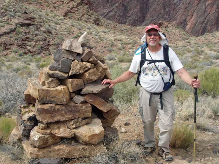
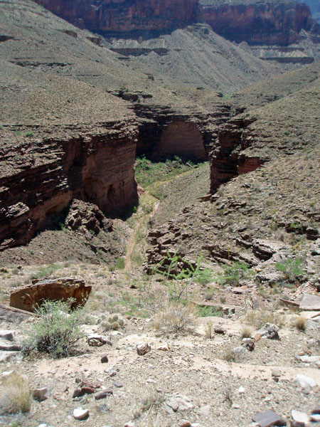
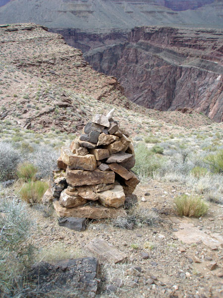
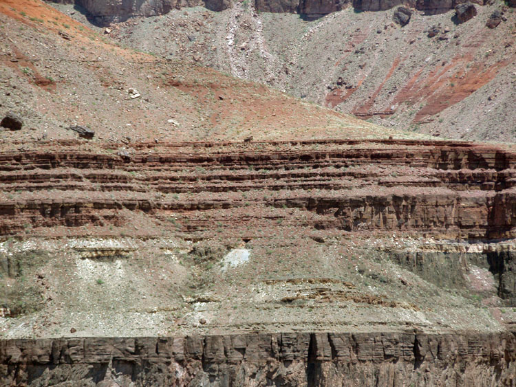
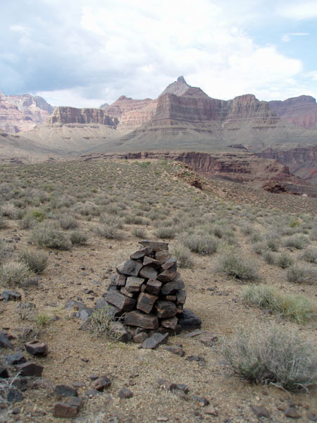
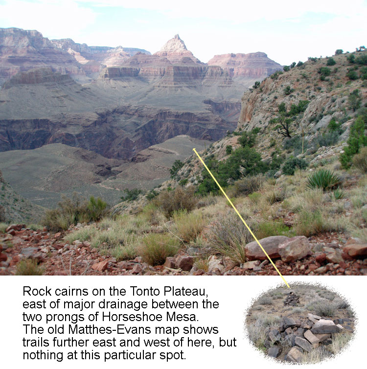
By 3 p.m. we were finally getting some cloud cover. We had seen clouds over the north rim, and rain falling to the west. We had rested up well, and while we were a bit short on water, I was sure that we'd be fine for the hike to our water cache. Up to this point, I had been drinking freely, without concern for my inventory. But, now that I could see that I only had about a half liter left, I would be a bit more stingy, at least until we reached the top of the Redwall. Bill still had the better part of 2 liters, and parted with a half liter of Gookinaid, which I downed before we left our Tapeats ledge. We wandered over to the cairn that marks a trail which descends below the Tapeats, and then contours over into the Hance area before disappearing. It is marked on the old Matthes-Evans map. I found this trail many years ago, and from its end, followed a steep, rocky chute down to the foot of Sockdolager Rapids. The construction had held up well over the years. But, we didn't have the time to follow the trail on this trip. For lack of a better name, I call this the Sockdolager Trail. It doesn't really reach the river, but it does afford fine views. It is quite an odd feeling to tramp along the meager Tonto Trail, then to bushwhack across the plateau, and suddenly end up on this fine, although short, trail. As it turns out, there may have been two large cairns here. Only about 20 feet away from the one in the photos I've posted, is a distinctive pile of very large rocks, probably a couple of feet high. Either the original cairn was rebuilt, or there were two here at one time - to serve as a gateway for this trail I suppose. |
|
|
||
|
Rock cairn that marks the decent of a constructed trail below the Tapeats, contouring above Sockdolager rapids, and ending high above the schist. |
||
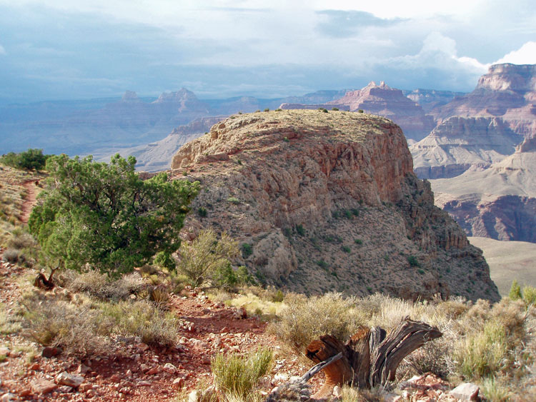
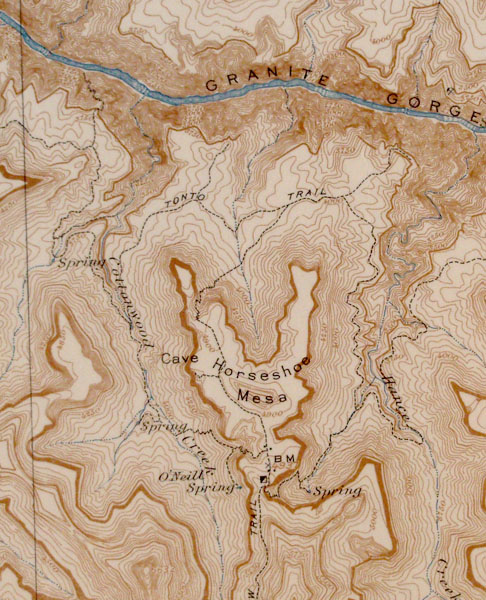
We soon continued on our way, following the Tonto trail to the west
prong of the Horseshoe, where another trail takes one up to the top of
the Redwall. As we were walking, we spied another cairn, and, as
it turns out, another nearby pile that was, at some point a second
cairn. We didn't see any particular signs of a trail here, but
from the top 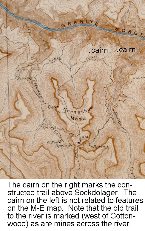 of
the Redwall, it appeared that there was some kind of trail that might
have led out to the edge of the plateau, to a fine overview of the
river. But, it is not on the M-E map (click on the map, to the
left to see a bigger image, and notation for the location of these
cairns). The main cairn isn't as impressive as the one marking the
Sockdolager trail, but it is quite large nonetheless. Quite a
mystery to me what it all means . . . except for another trip out here
sometime! of
the Redwall, it appeared that there was some kind of trail that might
have led out to the edge of the plateau, to a fine overview of the
river. But, it is not on the M-E map (click on the map, to the
left to see a bigger image, and notation for the location of these
cairns). The main cairn isn't as impressive as the one marking the
Sockdolager trail, but it is quite large nonetheless. Quite a
mystery to me what it all means . . . except for another trip out here
sometime!
Despite the long lunch break, and the improved weather conditions - in fact we got a few sprinkles after visiting this second set of cairns - we were a bit slow getting up through the Redwall. From our lunch break, it took an hour and a half to cover this ground, although that does include the time spent at the cairns. We stopped for a half hour atop the Redwall, and decided that we would give a pass on visiting the cave nearby. A good choice, considering that it would be over four and a half hours before we would reach the trailhead! |
|
|
||
|
|
||
| We reached the water cache above the mesa by 5:45 p.m. I had cached a liter bottle of frozen water, fully ensconced in an insulated bag. It was icy cold upon our return, and there was still a bit of ice in it! That went down well with me. We spent a half hour here, and then headed on up the trail. Soon, we bumped into my colleagues, who were headed down to camp for two nights. We reached our upper water cache at nearly 7:30 p.m. and rested up there until about 8:15 p.m. It was getting dark - the clouds obscured an otherwise full moon - and quite cool when we were at rest. We could see that there was rain down in the canyon, and it looked like we might catch a break and end up our hike without getting dumped on. But, alas, such was not to be the case. Barely five minutes from the top, which we reached at 9:40 p.m., we got quite a bit of rain, and we were just too tired to care about pulling out our rain gear. We piled into the truck, dumping our wet packs into the extra cab section. A change into clean shirts, and the heater, soon put us into better, and drier, spirits. Our progress from Horseshoe Mesa was complicated by a rapid deterioration in Bill's strength and stamina. He may have been suffering from a delayed reaction to the heat, and was overcome with nausea in the upper Coconino. [Been there, done that!] But, he trooped along as best as anyone can under such circumstances and we both agreed that it was a successful, and rewarding, hike. |
|
|
||
|
|
Return to Hiking Grand Canyon home page |
|


