|
April 18 |
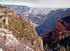
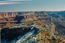
1998 - The view from the old Grandview Hotel. |
|
In 1998 I went up to
the South Rim to find what I could of the site of the old Grandview
Hotel. I found a few reminders of this once prime destination for
Grand Canyon visitors, but best of all was this view from the rim out in
front of where the hotel once stood. |
 |
|
April 17 |
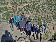
2004 - With MBA students on the Bright Angel. |
|
In 2004 I organized a
hike with faculty, family and four of our MBA students down the Bright
Angel Trail to Plateau Point for a day hike. Here is the photo I
took of the group at the start of our hike. From left to right:
Cara Lynn Foster, Mike Wissert, Hilary, Akhaabi, Ben Ullyot, Adam Matz,
John Haney, Kathy & John Eastwood. A great day! |
 |
|
April 16 |
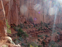
2011 - Bill Ferris on the Nankoweap Trail. |
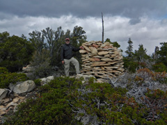
2013 - On top of Saddle Mountain. |
|
In 2011 I drove Bill
Ferris out to the Nankoweap Trail so he could begin a long hike from
there to Phantom Ranch and out. On this first day we arrived at
the lower trailhead and then hiked up to the saddle at the park boundary
where we camped for the night. From there I got this sunset shot
looking down into Nankoweap with the moon overhead. I wrote up a
full account
here.
In 2013 I drove Bill Ferris and Rob Jones out to the
Nankoweap Trail so they could begin a long hike from there to Phantom
Ranch and out (picking up Chris Forsyth along the way in Lava). We
camped at the trailhead the night before and I joined them for the hike
up to the saddle under very dark and threatening skies. We said
our goodbyes there and I hiked up to the top of Saddle Mountain, where I
got this photo of me at the giant cairn there. Great views from up
there but coming back down through all the New Mexico locust was just
awful! |
 |
|
April 15 |

2011 - Sunset from the saddle on the Nankoweap Trail. |
|
In 2011 I drove Bill
Ferris out to the Nankoweap Trail so he could begin a long hike from
there to Phantom Ranch and out. On this first day we arrived at
the lower trailhead and then hiked up to the saddle at the park boundary
where we camped for the night. From there I got this sunset shot
looking down into Nankoweap with the moon overhead. I wrote up a
full account
here. |
 |
|
April 14 |
 |
|
April 13 |
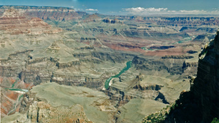
1996 - The view from Zuni Point. |
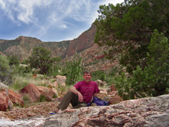
2005 - On the Old Tanner route. |
|
In 1996 I drove up to
the South Rim to do some rim hiking between Grandview and Desert View,
checking on Harvey Butchart's mention of occasional along the edge.
I found a couple of interesting places, but also great views as shown in
this panorama from near Zuni Point. Hance Rapids are visible on
the left.
In 2005 I did a looping day hike down the Tanner Trail and
back up to the rim via the "Old Tanner Trail" which as best as I could
tell was just a bushwhacking route, although I did see a couple of
cairns on the "Esplanade" level. Here is a timed photo of me in
the bay east of Desert View taking a break before heading up the canyon
and to the rim. I parked at Desert View and so had to walk from
there to Lipan Point, and from my exit along a dirt road back. I
wrote up a full account
here.
In 1981 I hiked down the South Kaibab to the Tonto and then into
the middle Pipe Creek via a route that passes by a granary. From
there I hiked back up to the Tonto somewhere to the west through the
broken Tapeats and then over to Indian Garden and back up the Bright
Angel Trail. [No photos.] |
 |
|
April 12 |
 |
|
April 11 |
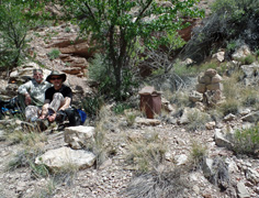
2015 - With John Eastwood at O'Neill Spring. |
|
In 2015 John Eastwood
and I did a day hike down Grandview to check out O'Neill Spring.
Here we are at the spring along with the cairn I made and the old metal
can I found here. The spring was dry, as seems usual these years.
Then we checked out the Tuning Fork cave, but a big jump at the end of a
slope kept us out. [I returned a week later with a rope and
finally got to see inside this cave.] |
 |
|
April 10 |
 |
|
April 9 |
 |
|
April 8 |
 |
|
April 7 |
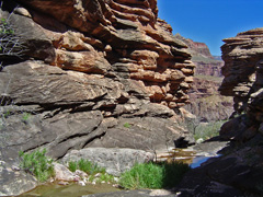
2005 - Ravine west of Plateau Point. |

2012 - Horseshoe Mesa with old cook cabin. |
|
In 2005 I did a day
hike down the Bright Angel Trail and out to a ravine west of Plateau
Point that cuts through the Tapeats cliffs, as shown in the photo.
It was a wet spring and there was actually water flowing down this
little ravine. One of the attractions to me are that there are old
names under some of the overhangs in here, including Ashurst, presumably
the same early miner that partnered up with John Hance back in the day.
In 2012 I did a day hike down the Grandview Trail to
"rediscover" O'Neill Spring, which I had seen full of water in 2000.
But, I've never heard of anyone else ever seeing water there. I
tried to follow the old trail but missed finding the spring on this
trip, but would find it a couple of weeks later (and dry). Here's
a photo of the trail across Horseshoe Mesa with the old miner's cook
cabin walls still standing. |
 |
|
April 6 |
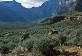
1980 - Cairns mark Cremation Canyon use area. |
|
In 1980 I did a three
day hike to Cremation Canyon. This was my last day and I hiked
from my camp in Cremation back on the Tonto to Indian Garden and up to
the rim on the Bright Angel Trail. Here are two big cairns that
used to mark the boundary of the Cremation use area. |
 |
|
April 5 |
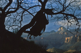
1980 - Pack hanging at Cremation Canyon. |
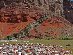
2013 - Diabase dike at Hance Rapids |
|
In 1980 I did a three
day hike to Cremation Canyon. This was my second day and I day
hiked up into the canyon from my camp. Here is a photo from late
in the day with my pack hanging from a tree and Buddha Temple in the
background.
In 2013 I did a day hike down the New Hance Trail to the
river. I camped in the forest near the trailhead to insure that I
could get this done in a day. I was especially interested in the
geology of the area, like this diabase dike at Hance Rapids. I
wrote up a full account
here. |
 |
|
April 4 |
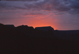
1980 - Sunset from Cremation Canyon. |
|
In 1980 I did a three
day hike to Cremation Canyon. This was my first day and I hiked
down the South Kaibab Trail and over to Cremation on the Tonto, camping
near the trail in the main bed. The only photo I took this day was
of this sunset from my camp. |
 |
|
April 3 |
 |
|
April 2 |
 |
|
April 1 |
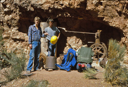
1980 - Sinking Ship from the Old Hance Trail. |
|
In 1980 I joined
Duane Ott (r) and his friend Norman (l) for an overnight hike down the Old Hance
and up the Grandview. This was our second day and on our way up we
visited at one of Pete Berry's old mines below Horseshoe Mesa. Not
only was there a lot of old equipment here but it seemed rather intact. |
 |
|
March 31 |
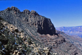
1980 - Sinking Ship from the Old Hance Trail. |
|
In 1980 I joined
Duane Ott and his friend Norman for an overnight hike down the Old Hance
and up the Grandview. This was our first day and we got down to
the Tonto level to camp. Here is a view of the Sinking Ship from
along this "trail." |
 |
|
March 30 |
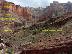
2001 - On the saddle with the Battleship. |
|
In 2013 John Eastwood
and I did a day hike down the New Hance Trail accompanied by notes from
the book, "Hiking the Grand Canyon's Geology" by Abbott and Cook.
It is a very different landscape than most other trails on the South
Rim. Here is John with my annotation of the lower rock layers.
While we hoped to get to the river for this hike, we turned back after
reaching the creekbed. I wrote up a full account
here. |
 |
|
March 29 |
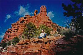
2001 - On the saddle with the Battleship. |
|
In 2001 I did a short
hike with Bob Stabo down the Bright Angel and out on the route to the
Battleship. Here is Bob, with the butte behind him, on the saddle,
which is as far as we went. |
 |
|
March 27 |
 |
|
March 26 |
 |
|
March 25 |
|
In 1999 I did a short hike
down the BA to the 1.5 Mile House with John Eastwood. We were up
in Tusayan for the grand opening of
The Grand Hotel and
on the spur of the moment decided to do this brief hike even though we
had not come prepared, nor especially dressed, for the occasion.
Still, it was the first time I saw the new restroom facilities at the
1.5 Mile House, an improvement that was far too many years in the
making. |
 |
|
March 25 |
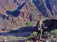
2007 - On the "old miners" trail. |
|
In 2007 I did a six day with Bill Ferris to Clear Creek.
This was our sixth, and final, day. We left the BA campground and
headed out over the silver bridge to catch the so-called "old miners"
trail. It follows a steep route up to the Tonto and you get some
really unique views along the way. Here is Bill on that trail
looking down at the silver bridge and Phantom Ranch behind the ridge.
I wrote up a full account
here. |
 |
|
March 24 |
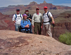
2006 - At Plateau Point with NAU colleagues. |
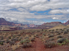
2007 - On the Clear Creek Trail. |
|
In 2006 I led a hike
with some of my colleagues from NAU down the Bright Angel Trail to
Plateau Point. Here are some of us at Plateau Point - David
Albritton, Susan Williams, Joe Anderson, me and John Eastwood.
In 2007 I did a six day with Bill Ferris to Clear Creek.
This was our fifth day and time to start our journey back as we hiked
from our camp in Clear Creek back to the Bright Angel campground.
Here is Bill on the trail with an expansive view of the canyon.
I wrote up a full account
here. |
 |
|
March 23 |
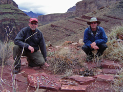
2007 - At the Billopolis ruins site. |
|
In 2007 I did a six day with Bill Ferris to Clear Creek.
This was our fourth day and we woke up to rain at our camp in Clear Creek.
Consequently we stayed close to camp most of the morning and only did a
bit of exploring in the afternoon. But, Bill found a very
interesting ruin site above the creek with loads of pottery shards
laying about. Here we are at what I dubbed as "Billopolis."
I wrote up a full account
here.
In 1981 I did a day hike down the Bright Angel Trail to 2 Mile
Corner and then out and around the Battleship. [No photos.] |
 |
|
March 22 |
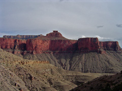
2007 - Thor Temple. |
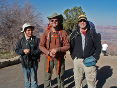
2013 - Atop the Grandview Trail. |
|
In 2007 I did a six day with Bill Ferris to Clear Creek.
This was our third day and we day hiked around Clear Creek from our
camp. We went up the canyon to some ruins and a cave and I was
able to get this rare (at least to me) picture of Thor Temple, with
Wotans Throne in the background. I wrote up a full account
here.
In 2013, Bill Ferris invited me to join him and his son
Matthew on a seven day hike of the Escalante Route from Tanner to
Grandview. Surprisingly, this was my first time over the whole
route. This was our seventh, and final, day and we hiked from
our camp
at Hance Creek up the Grandview Trail to the rim. Here we are at
the trailhead happy to have done such a great hike together and knowing
that we were going to stop at the Cameron Trading Post for Navajo tacos
on the way home!
In 2003 I did a day hike down the Bright Angel Trail to Plateau
Point. [No photos.] |
 |
|
March 21 |
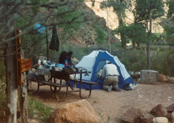
1993 - Neil does some packing at the BA Campground. |
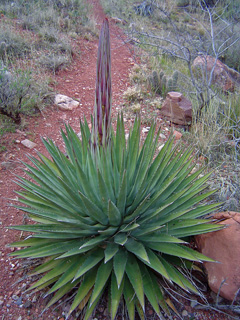
2007 - Agave just getting started. |
2009 - Sunrise at 94 Mile Canyon. |
2013 - On the way to Hance Canyon. |
2015 - Zoroaster ridge in Clear Creek. |
|
In 1993 Neil
Jacobs and I did a ten day hike from Nankoweap to Phantom. This was our
tenth, and final, day. Since we got to the campground late, we
took the very last spot, by the bridge (but, closest to the ranch).
Here is a photo of our spot that morning as we packed up and hiked up
the South Kaibab to the rim.
In 2007 I did a six day with Bill Ferris to Clear Creek.
This was our second day and we hiked from the BA campground to Clear
Creek. We saw quite a few young agaves, like the one shown here,
that were just starting to send up their stalks. I wrote up a full
account
here.
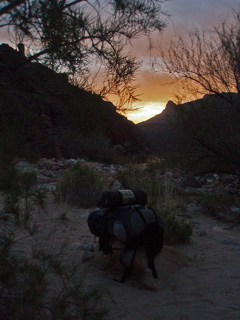
In 2009 Bill Ferris, Chris Forsyth, John Eastwood and I started a nine day hike down Crazy Jug and over to
Phantom Ranch. This was our eighth, and my last, day. We
left from 94 Mile Canyon, shown here at sunrise, with my pack all ready
to go. But, shortly after starting up the ravine that leads to the
Tonto I fell and badly bent my foot (which seemed quite odd given that I
was wearing boots!). It took hours to reach the plateau with
everyone's help. I wasn't getting any better and really could not
even walk. So, Chris activated the 9-1-1 button on his Spot and an
hour later I was on a helicopter headed for the South Rim Village while
Bill, Chris and John continued for another two grueling days (partly due
to being many hours behind schedule due to my accident).
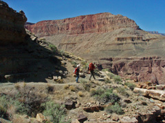
In 2013, Bill Ferris invited me to join him and his son
Matthew on a seven day hike of the Escalante Route from Tanner to
Grandview. Surprisingly, this was my first time over the whole
route. This was our sixth day and we hiked from
our camp
on the Tonto Trail up into Hance Canyon where we camped at the creek.
Here Bill and Matthew chat up their dinner plans as we worked our way
into Hance.
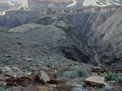
In 2015, Bill Ferris, John Eastwood and I started an eight
day hike with the intent of getting to Asbestos Canyon. This was
our eighth, and final, day. We left our camp on the ridge at
Zoroaster Canyon, shown in the photo. It was a long day and we
hiked along the Clear Creek Trail to Phantom and up the South Kaibab
Trail to the rim. |
 |
|
March 20 |
1984 - Star Trails from Clear Creek. |
1993 - Indian Paintbrush |
2007 - Glowing Zoroaster. |
2008 - Snow-packed Grandview Trail. |
2009 - Chris & 94 Mile Tapeats break. |
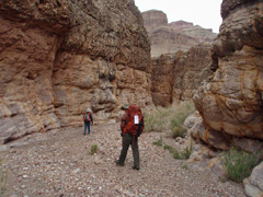
2013 - Hiking down 75 Mile Canyon. |
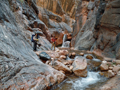
2015 - Horizontal waterfall in CC. |
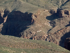
2016 - View north to Clear Creek Trail. |
|
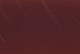
In 1984 I did a hike from Nankoweap to Phantom
(my first) with hiking buddy Duane Ott and Ralph Moore, a backcountry
ranger. This was my twelfth, and final, day. Ralph had gone
ahead three days earlier and Duane had gone on the day before. So,
it was just me hiking to Phantom and then up the South Kaibab to the rim.
But, I got one last chance for a night-time shot of the star trails.
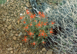
In 1993 Neil
Jacobs and I did a ten day hike from Nankoweap to Phantom. This was our
ninth day and we hiked from our camp in the so-called
"double disappointment" canyon all the way to Phantom Ranch.
We were especially motivated by having dinner reservations. We
arrived just in time (and before we could actually secure a spot in the
campground). Lots of blooming wildflowers at this time of year
including this Indian Paintbrush.
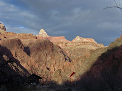
In 2007 I did a six day with Bill Ferris to Clear Creek.
This was our first day and we hiked down the Bright Angel Trail and
stayed at the BA campground. While we had some cloudiness that
would later lead to rain, late in the day Zoroaster was positively
glowing as we arrived at the creek. I wrote up a full account
here.
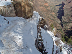
In 2008 I did a day hike down Grandview and into Hance
Canyon, with the idea of trying to get to the river. It was just
too far for me, and I had to turn back from the creek. But, I did
get to discover an old route off the Tapeats to the creek that I had
spied on earlier trips. Lots of snow on the upper part of the
trail as shown in the photo. Traction devices are more than
recommended!
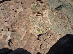
In 2009 Bill Ferris, Chris Forsyth, John Eastwood and I started a nine day hike down Crazy Jug and over to
Phantom Ranch. This was our seventh day and we hiked from our camp
at Crystal Rapids up to the Tonto and over to 94 Mile Canyon where we
camped again at the river. There is a way to get through the
Tapeats into 94 Mile and Chris and I checked it out - he is circled in
the photo below the cliffs. I decided it seemed to iffy and
neither Bill nor John were interested in doing this so Chris climbed
back up and we all contoured back into the canyon before finding a route
to the bed.
In 2013, Bill Ferris invited me to join him and his son
Matthew on a seven day hike of the Escalante Route from Tanner to
Grandview. Surprisingly, this was my first time over the whole
route. This was our fifth day and we hiked from
our camp
at the river beach at Escalante up to 75 Mile, where Bill and Matthew discussed
that evening's dinner plans. Once back at the river we had to go
up the Papago Wall and come down the Papago Slide to get to Hance
Rapids. We continued on from there, now on the beginning of the Tonto
Trail and camped well above the river.
In 2015, Bill Ferris, John Eastwood and I started an eight
day hike with the intent of getting to Asbestos Canyon. This was
our seventh day and we hiked from our camp on the Tonto down to the
river at Clear Creek. The route was very very steep and required
quite a bit of "route finding." Then we hiked up the creek,
climbing past this well-known horizontal waterfall and up an even
steeper route to a ridge terrace below the Tapeats alongside Zoroaster
Canyon.
In 2016 I did a
solo hike for ten days to Vishnu Canyon. This was my tenth, and final, day and I
hiked from the BA campground up the South Kaibab to the rim. Along
the way the light was just right so that I could easily see the Clear
Creek trail across the river, where it climbs up onto the Tonto Plateau. |
 |
|
March 19 |
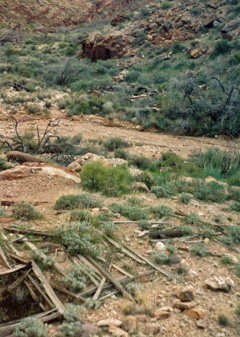
1993 - Remains of Hance's mining camp in Asbestos Canyon. |
1984 - Ruins in Clear Creek Canyon. |
2009 - The descent to Crystal. |
2010 - Trail Crew camp on SK. |
2011 - Sunrise by Whites Butte. |
2013 - At the Escalante hilltop ruin. |
2015 - Shadows at the end of the day. |
2016 - Dinner at Phantom Ranch. |
|
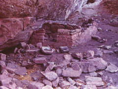
In 1984 I did a hike from Nankoweap to Phantom (my first)
with hiking buddy Duane Ott and Ralph Moore, a backcountry ranger.
This was our eleventh day and Duane and I hiked into
Clear Creek. I camped there and did an afternoon hike up the main
arm to these ruins while Duane continued hiking to Phantom Ranch.
In 1993 Neil
Jacobs and I did a ten day hike from Nankoweap to Phantom. This was our
eighth day and we hiked from our camp in Asbestos to the so-called
"double disappointment" canyon west of Vishnu (which actually had water
flowing!). Before leaving I took this picture of some of the
mining camp remains in Asbestos.
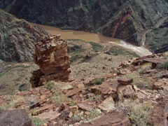
In 2009 Bill Ferris, Chris Forsyth, John Eastwood and I started a nine day hike down Crazy Jug and over to
Phantom Ranch. This was our sixth day and we hiked from our camp
in a little drainage at Tuna to Crystal Rapids. Here is the spot
where our descent into Crystal began, with a nice view of the rapids and
Slate Canyon across the river.
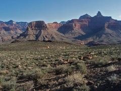
In 2010 Bill Ferris and I started a hike with the intent of
getting to Asbestos Canyon. This was my seventh, and final, day. Following a rockslide on the third
day that ended that quest we had camped at a spring in Vishnu. I
felt strong enough to hike back to Phantom for help which took three
days. Bill was helicoptered out on the sixth day and on this day I
hiked up and out on the South Kaibab Trail, passing by a little tent
city on the Tonto where the trail crew was (apparently) staying for some
extensive work on the trail.
While I had a torn ACL (which I would find out later), as long as I was
heading uphill and could keep my foot level, I was able to hike without
incident. A fuller
account is
here.
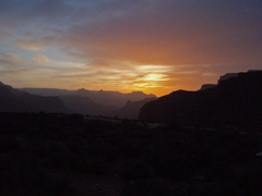
In 2011 Dan Eastwood, John Eastwood and I started down the
So. Bass on a six day hike of the "gems" - my first time over the whole
route. This was our sixth, and final, day and we hiked from
our camp atop the Redwall out via the Hermit Trail. I got this
nice picture of the sunrise that we were treated to when we got up in
the morning. I wrote up a full account of this trip
here.
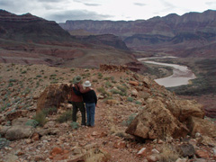
In 2013, Bill Ferris invited me to join him and his son
Matthew on a seven day hike of the Escalante Route from Tanner to
Grandview. Surprisingly, this was my first time over the whole
route. This was our fourth day and we hiked from
our camp
at the river beach at Cardenas to the beach at Escalante. Here Bill and Matthew are
discussing this evening's
dinner plans, with the Cardenas hilltop ruins as a fitting backdrop.
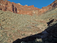
In 2015, Bill Ferris, John Eastwood and I started an eight
day hike with the intent of getting to Asbestos Canyon. This was
our sixth day and we began our hike back from Vishnu. We camped in
this drainage where three times I have found water in potholes. As
we neared this spot below Angels Gate, we got to see our shadows from
the ridge.
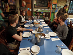
In 2016 I did a
solo hike for ten days to Vishnu Canyon. This was my ninth day and I
hiked from my camp in Clear Creek to the BA campground. I had meal
reservations that night at the ranch and took this picture of my table. |
 |
|
March 18 |
1980 - At 3 Mile House on the BA. |
1993 - Hiking river's edge past Unkar. |
2004 - Phantom Canyon. |
2009 - Bad to the bone! |
2010 - Heli at Phantom Ranch. |
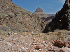
2011 - Heading down Boucher. |
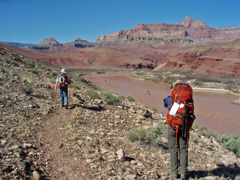
2013 - On the Escalante Route. |
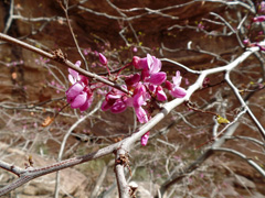
2015 - Redbud in Vishnu. |
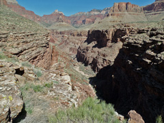
2016 - Main descent into Clear Creek. |
|
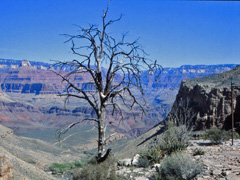
In 1980 I did a five day hike to Clear Creek - my
first! This was the final day and I hiked up the Bright Angel
Trail from the BA campground. I stopped at the overlook behind the
3 Mile House and got this nice canyon shot.
In 1993 Neil
Jacobs and I did a ten day hike from Nankoweap to Phantom. This was our
seventh day and we hiked from our camp at Unkar up to the Tonto level
and then down into Asbestos.
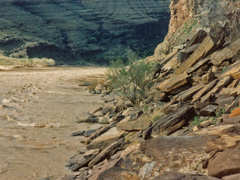
Initially we hiked along the river - in places not very hiker-friendly!
In 2004 I did a three day hike to Phantom Canyon. This
was my last day and I hiked all the way out of the canyon from my camp
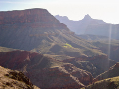
at Phantom Creek. Looking east into the sun early on I got this
cool view with the trees at the spring below Sturdevant Point.
[Brahma and Zoroaster in the background.]
In 2009 Bill Ferris, Chris Forsyth, John Eastwood and I started a nine day hike down Crazy Jug and over to
Phantom Ranch. This was our fifth day and we hiked from our camp
in Monadnock
Amphitheater to a little drainage at Tuna. We came up out of Monadnock
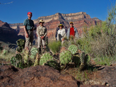
on a route that was not in our notes, but worked well and I got this
picture - one of my favorites - of us after we got up on the Tonto
level.
In 2010 Bill
Ferris and I started a hike with the intent of getting to Asbestos
Canyon. This was our sixth day. Following a rockslide on the third
day that ended that quest we had camped at a spring in Vishnu. I
felt strong enough to hike back to Phantom for help and this was my
third day headed back as I hiked from my camp on the Clear Creek Trail
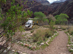
to the ranch. Within a half hour of my checking in with Ranger Bil
Vandergraff this helicopter had been dispatched to pick up Bill.
It was here at Phantom to pick up someone else and I got a chance to
talk with the pilot about Bill's situation (he was quite elated to see
the copter). A fuller
account is
here.
In 2011 Dan Eastwood, John Eastwood and I started down the
So. Bass on a six day hike of the "gems" - my first time over the whole
route. This was our fifth day and we hiked from
Slate to Boucher. Once in Boucher we stashed our packs and headed
down the canyon (as shown in the photo) to the river - our first and
only time on this trip! Later we decided Boucher was too crowded
and after an early dinner we hiked up to the top of the Redwall to camp
for the night. I wrote up a full account of this trip
here.
In 2013, Bill Ferris invited me to join him and his son
Matthew on a seven day hike of the Escalante Route from Tanner to
Grandview. Surprisingly, this was my first time over the whole
route. This was our third day and we hiked from
our camp
at the river over to the beach at Cardenas. Here Bill and Matthew are
hiking along the trail after just having talked about
dinner plans, with the Colorado River as a fitting backdrop.
In 2015, Bill Ferris, John Eastwood and I started an eight
day hike with the intent of getting to Asbestos Canyon. This was
our fifth day. We decided to haul some water up to the Tonto level
to save some weight for the climb out tomorrow. We were back in
camp for lunch and I got this picture of the blooming redbud tree there.
Later in the afternoon John and I hiked up the canyon through the
narrows and out into the open valley.
In 2016 I did a
solo hike for ten days to Vishnu Canyon. This was my eighth day and I
hiked from my camp along the Tonto Plateau to Clear Creek, where I had left a cache of food for my
return. This is a view of the main descent canyon into Clear Creek
looking across the canyon to Deva Temple.
In 1984 I did a hike from Nankoweap to Phantom (my first)
with hiking buddy Duane Ott and Ralph Moore, a backcountry ranger.
This was our tenth day and Duane and I hiked from Asbestos back towards
Clear Creek, camping somewhere along the Tonto Plateau. [No photos
for this day.]
In 1994 I did an eight day trip to Lava Creek in Chuar Canyon.
This was the last day and I hiked from my camp at Kwagunt over to
Nankoweap and all the way out in one very long day. [No photos.] |
 |
|
March 17 |
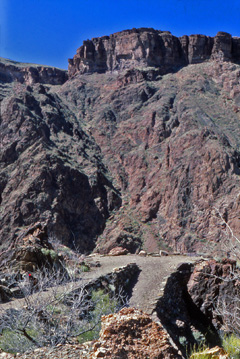
1980 - Phantom Ranch Overlook on the Clear Creek Trail. |
1984 - Hance asbestos mine. |
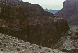
1993 - Lunch break with Angels Window circled. |
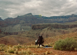
2004 - Haunted Canyon cave/ruin. |
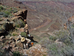
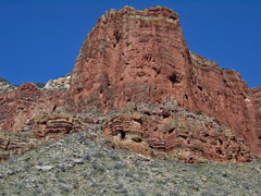
2009 - Climbing up from Hotauta. |
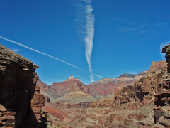
2010 - Deva Temple from Clear Creek. |
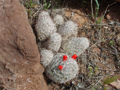
2011 - Cactus on the Tonto. |
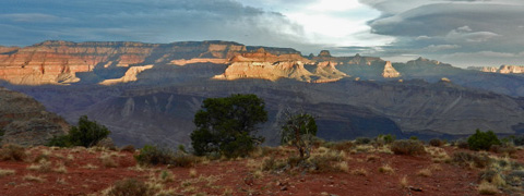
2012 - Sunrise from Redwall Overlook on the Tanner Trail. |
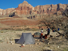
2013 - Camp at the river. |
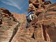
2015 - John descends into Vishnu. |
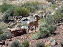
2016 - Bighorn on the Tonto. |
|
In 1980 I did a five day hike to Clear Creek - my
first! This was the fourth day and I hiked back to the BA
campground from Clear Creek. This is a well-constructed portion
close to the end with views down into Bright Angel Canyon.
In 1984 I did a hike from Nankoweap to Phantom (my first)
with hiking buddy Duane Ott and Ralph Moore, a backcountry ranger.
This was our ninth day and Duane and I spent the day in Asbestos doing
some day hiking. Here is one of Hance's asbestos mines, that is
really a tunnel that comes out on the face of this cliff.
In 1993 Neil
Jacobs and I did a ten day hike from Nankoweap to Phantom. This was our
sixth day and we hiked from our camp at Basalt over to Unkar.
Along the way we stopped for lunch and we could barely make out Angels
Window at Cape Royal on the North Rim.
In 2004 I did a three day hike to Phantom Canyon. This
was my second day and I day hiked up the canyon. I especially
wanted to see this cave/ruin up in Haunted Canyon. I got close but
it was too tricky for me to get inside.
In 2009 Bill Ferris, Chris Forsyth, John Eastwood and I started a nine day hike down Crazy Jug and over to
Phantom Ranch. This was our fourth day and we hiked from our camp
on Shinumo Creek along the river to Hotauta Canyon and made the steep
climb up onto the Tonto Plateau which we followed to Monadnock
Amphitheater. Here is John topping out on the Tonto, followed by Bill.
In 2010 Bill
Ferris and I started a hike with the intent of getting to Asbestos
Canyon. This was our sixth day. Following a rockslide on the third
day that ended that quest we had camped at a spring in Vishnu. I
felt strong enough to hike back to Phantom for help and this was my
second day headed back as I hiked from my camp on the Tonto to Clear
Creek (where I thought of this giant X in the sky over Deva Temple as a
good omen). I got through this canyon and about halfway along the
Clear Creek trail before stopping for the night. A fuller
account is
here.
In 2011 Dan Eastwood, John Eastwood and I started down the
So. Bass on a six day hike of the "gems" - my first time over the whole
route. This was our fourth day and we hiked from
Turquoise to Slate. Along the way I couldn't resist taking a
picture of these small cactus that look soft and fuzzy (but aren't!) and
have red fruits. I wrote up a full account of this trip
here.
In 2012 I did a nine day trek to Lava Canyon with Bill
Ferris. This was our ninth, and final, day. We were treated
to this beautiful sunrise at our camp at the Redwall Overlook before
packing up and heading for the rim. I wrote up a full account of this trip
here.
In 2013, Bill Ferris invited me to join him and his son
Matthew on a seven day hike of the Escalante Route from Tanner to
Grandview. Surprisingly, this was my first time over the whole
route. This was our second day and we hiked down the Tanner from
our camp
at the Redwall Overlook to the river close to the start of the Escalante
route/trail. Here Bill and Matthew are talking about
dinner plans at our camp, with Comanche Point as a fitting
backdrop on the rim.
In 2015, Bill Ferris, John Eastwood and I started an eight
day hike with the intent of getting to Asbestos Canyon. This was
our fourth day and we hiked the rest of the way into Vishnu from our
emergency camp at a spring following John's fall. His shoulder was
sore but was able to hike to a nice spot in the bed where we would spend
the next two nights. Here he is in the final descent into Vishnu
by a small waterfall.
In 2016 I did a
solo hike for ten days to Vishnu Canyon. This was my seventh day and I
hiked from my camp in Vishnu back along the Tonto Plateau to my camp
below Angels Gate, where I had left a cache of food and water for my
return. On my way I saw two bighorn sheep in one shallow drainage,
one of whom is pictured here.
In 1994 I did an eight day trip to Lava Creek in Chuar Canyon.
This was the seventh day and I hiked from my camp at Awatubi back
along the Butte Fault route to Kwagunt. [No photos.] |
 |
|
March 16 |
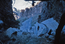
1980 - Chockstones in Clear Creek. |
1984 - At Unkar Rapids. |
1993 - Neil descends into Basalt. |
1996 - End of hike. |
2004 - Bright Angel Creek. |
2008 - On the North Rim. |
2010 - Camped below Angels Gate. |
2011 - Rocks at Jasper Canyon. |
2009 - On the North Bass Trail. |
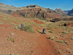
2012 - Packs on the Tanner Trail. |
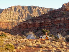
2013 - Camp atop Redwall on Tanner. |
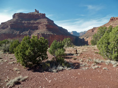
2015 - Angels Gate from Hall Butte. |
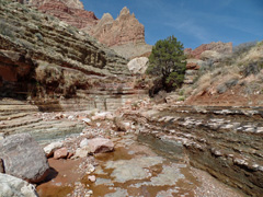
2016 - Up in Vishnu Canyon. |
|
In 1980 I did a five day hike to Clear Creek - my
first! This was the third day and I day hiked up the canyon, past
these big white chockstones (which now seem to be gone for reasons I
can't explain!). I was intending to go up to Cheyava Falls but got
misdirected into the arm that dead ends below Ariel Point.
In 1984 I did a hike from Nankoweap to Phantom (my first)
with hiking buddy Duane Ott and Ralph Moore, a backcountry ranger.
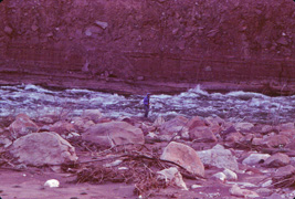
This was our eighth day and Duane and I hiked from Unkar (that's me at
Unkar Rapids) to Asbestos. At Asbestos we met up once again with
Ralph, who was a day ahead of us.
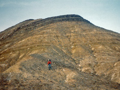
In 1993 Neil
Jacobs and I did a ten day hike from Nankoweap to Phantom. This was our
fifth day and we hiked from our camp at Lava Creek to Basalt.
Although we intended to follow the route I had used in 1984 it looked
like a shorter way would be to stay mostly in front of the Tapeats
towards the river. It was great for a while and then quite awful.
Getting into Basalt proper required contouring along a very steep slope,
shown in the photo with Neil descending from it. We literally were
hiking from little bush to bush to keep our footing over this very
treacherous stretch.
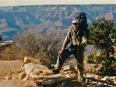
In 1996 I did a solo hike from Nankoweap to Phantom (and out
of course). This was my ninth, and final, day as I hiked to
Phantom and out the South Kaibab Trail, and got someone to snap this
photo of me at the trailhead.
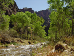
In 2004 I did a three day hike to Phantom Canyon. This
was my first day and I hiked down the South Kaibab to the Bright Angel
Campground and up the route to Utah Flats and over into Phantom Creek in
a long day. Here is a view of the creek from the campground.
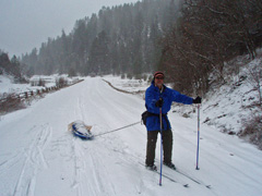
In 2008 I was hoping to hike into Crazy Jug Canyon and hike
all the way to Phantom Ranch and out (over 8 days). But, there was
quite a bit of snow on the rim and John Eastwood, who volunteered to drive me up
and drop me off, convinced me to bring some skis and a sled to haul my
stuff in if we couldn't drive to the trailhead area. That's what
we did, but it still turned out to be too much of a challenge and we
camped in the forest overnight before returning on this day. Here
am I all fitted out with skis and sled as we retraced our route back to
John's truck with the snow falling.
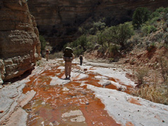
In 2009 Bill Ferris, Chris Forsyth, John Eastwood and I started a nine day hike down Crazy Jug and over to
Phantom Ranch. This was our third day and we hiked from the cabin
on Muav Saddle to a camp site down the North Bass Trail just past Bass'
Shinumo Camp. Here's a nice section where we were walking down the
bed with a bit of water flowing down below the Redwall.
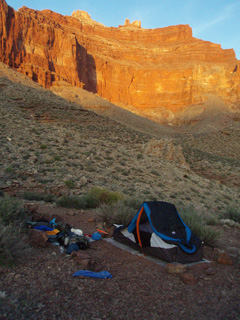
In 2010 Bill
Ferris and I started a hike with the intent of getting to Asbestos
Canyon. This was our fifth day. Following a rockslide on the third
day that ended that quest we were recouping at a spring in Vishnu.
Although I had torn my ACL I felt strong enough to try to hike back to
Phantom to get help for Bill. My leg would buckle often and I
would fall to the ground but if I could keep my foot level I could
manage. This day I hiked out along the Tonto and camped here, in
view of Angels Gate. A fuller
account is
here.
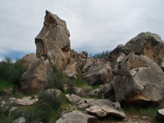
In 2011 Dan Eastwood, John Eastwood and I started down the
So. Bass on a six day hike of the "gems" - my first time over the whole
route. This was our third day and we hiked from
Ruby to Turquoise. At Jasper Canyon there were these interesting
rocks that reminded me of Lord of the Rings - watch out for wargs! I wrote up a full account of this trip
here.
In 2012 I did a nine day trek to Lava Canyon with Bill
Ferris. This was our eighth day and we packed up the kayak and
began shuttling it up the Tanner Trail. One of us would do the
shuttle for a while and then the other would take over. It was a
grind! We camped this night at the Redwall Overlook. I wrote up a full account of this trip
here.
In 2013, Bill Ferris invited me to join him and his son
Matthew on a seven day hike of the Escalante Route from Tanner to
Grandview. Surprisingly, this was my first time over the whole
route. This was our first day and we hiked down the Tanner to camp
at the Redwall Overlook. Here Bill and Matthew are talking about
dinner plans at our camp, with the Desert View Watchtower as a fitting
backdrop on the rim.
In 2015, Bill Ferris, John Eastwood and I started an eight
day hike with the intent of getting to Asbestos Canyon. This was
our third day and we hiked from our camp in the east
arm of Clear Creek to Vishnu. We climbed to the high route behind
Angels Gate and contoured over to Hall Butte and descended. Here
is the view looking back to Angels Gate and the saddle we had come out
on. But, on the descent, John fell on the trail and injured his
shoulder. We continued to the same spring where Bill and I had
recouped at in 2010 - deja vu all over again - and spent the night there
before assessing our situation.
In 2016 I did a
solo hike for ten days to Vishnu Canyon. This was my sixth day and I
day hiked up the canyon, through some neat little narrows and out into
the wide open valley above. A trickle of water was pretty much
constant in the upper bed and it was a very relaxing day before I would
begin my trek back out.
In 1994 I did an eight day trip to Lava Creek in Chuar Canyon.
This was the sixth day and I hiked from my camp at Lava Creek back
along the Butte Fault route to Awatubi. [No photos.] |
 |
|
March 15 |
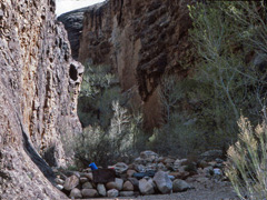
1980 - Camp at Clear Creek. |
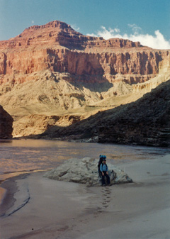
1993 - Headed downstream from the Little Colorado River on our way to
Chuar Valley. |
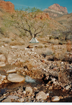
1994 - Camp along Lava Creek in Chuar Valley. |
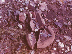
1984 - Artifacts at Unkar. |
1996 - On the Tonto heading to Clear Creek. |
1997 - With Vicki Wallis at the Nankoweap trailhead. |
2003 - Redwall Overlook on Tanner. |
2008 - Stymied by snow on North Rim. |
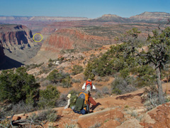
2009 - On the Esplanade. |
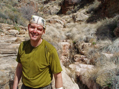
2010 - Bill was banged up but relieved. |
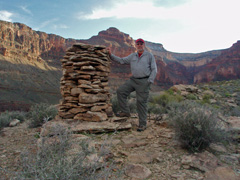
2011 - Old cairn at Ruby Canyon. |
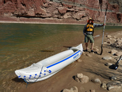
2012 - The inflatable Emma Dean. |
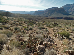
2015 - On the Clear Creek Trail. |
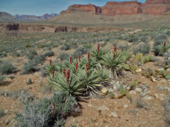
2016 - Yucca in front of Newberry Butte. |
|
In 1980 I did a five day hike to Clear Creek - my
first! This was the second day and I hiked from the BA campground
to Clear Creek and camped right at the junction with the creek.
These rocks provided a bit of shelter for the wind, but also served as
excellent hiking places for the mice.
In 1984 I did a hike from Nankoweap to Phantom (my first)
with hiking buddy Duane Ott and Ralph Moore, a backcountry ranger.
This was our seventh day and Duane and I hiked from Basalt to Unkar (via
the high terrace - is that properly the Tonto?).
We got to Unkar with plenty of time to check out all the great ruins in
this area.
In 1993 Neil
Jacobs and I did a ten day hike from Nankoweap to Phantom. This was our
fourth day and we hiked from our camp above the
Little Colorado to Chuar Valley. Here's a photo Neil took of me
along the beach below the LC before we started our climb up to a higher
level that we had to use. That is Temple Butte behind me.
In 1994 I did an eight day trip to Lava Creek in Chuar Canyon.
This was the fifth day and I day hiked from from my camp alongside the
creek (shown here) up to the Juno Ruins.
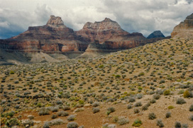
In 1996 I did a solo hike from Nankoweap to Phantom (and out
of course). This was my eighth day and I hiked along the Tonto
Plateau to Clear Creek and camped on that trail about halfway to
Phantom.
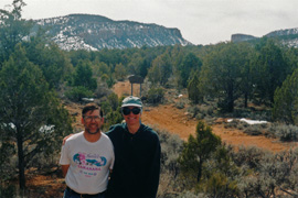
In 1997 I spent more than a week exploring Nankoweap Canyon with Vicki Wallis. This was our
ninth, and last, day. We were camped on the saddle and still had
snow to deal with coming down to the trailhead where her friend Ron
picked us up (and took the photo).
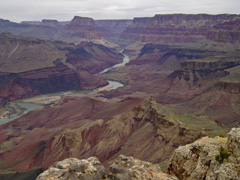
In 2003 Cara Lynn and I did a day hike down the Tanner Trail
to the Redwall Overlook with its wonderful views of the river and the
canyon.
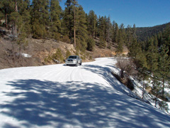
In 2008 I was hoping to hike into Crazy Jug Canyon and hike
all the way to Phantom Ranch and out (over 8 days). But, there was
quite a bit of snow and John Eastwood, who volunteered to drive me up
and drop me off, convinced me to bring some skis and a sled to haul my
stuff in if we couldn't drive to the trailhead area. That's what
we did, but it still turned out to be too much of a challenge and we
camped in the forest overnight before returning the next day.
In 2009 Bill Ferris, Chris Forsyth, John Eastwood and I started a nine day hike down Crazy Jug and over to
Phantom Ranch. This was our second day and we hiked from our camp
near Timp Spring to the old cabin at Muav Saddle. We followed the
Esplanade as much as possible until we were forced to hike up the bed of
Saddle Canyon. I like this photo of everyone scampering down a
little ledge because in the far background (circled in yellow) is
Thunder River.
In 2010 Bill
Ferris and I started a hike with the intent of getting to Asbestos
Canyon. This was our fourth day. We had spent the previous night
just a few yards from where Bill stopped rolling down the slope after
the rockslide I started. We were banged up but not seriously
injured. But, we needed to get to water and assess our situation
further. We could see a small spring below us and spent a couple
of hours working our way to it. That was a huge relief as you can
tell from the look on Bill's face! A fuller
account is
here.
In 2011 Dan Eastwood, John Eastwood and I started down the
So. Bass on a six day hike of the "gems" - my first time over the whole
route. This was our second day and we hiked from Bass Canyon to
Ruby. Before getting to the main bed I took a detour out to the
point where the old map showed a cairn and it wasn't hard to miss. I wrote up a full account of this trip
here.
In 2012 I did a nine day trek to Lava Canyon with Bill
Ferris. This was our seventh day and we loaded up the kayak for a
couple of trips back and forth across the river. All went
perfectly well. We camped near the beach this night. I wrote up a full account of this trip
here.
In 2015, Bill Ferris, John Eastwood and I started an eight
day hike with the intent of getting to Asbestos Canyon. This was
our second day and we hiked from our camp along the Clear Creek Trail
(that's Bill and John on the trail) into the canyon and then up the east
arm of Clear Creek.
In 2016 I did a
solo hike for ten days to Vishnu Canyon. This was my fifth day and I
day hiked down into lower Vishnu Canyon to revisit the old cabin that
remains there. I was quite sure that there was a trail leading
down to it from a ravine right behind it. So, I went up this route
- I can't say that I saw any signs of definitive constructed work - and
then around the front of Newberry Butte. From here it would be
just an hour or so to get to some of Hance's nearby mines, but I didn't
have the time and instead hopped over the Newberry saddle back into
upper Vishnu and to my camp.
In 1981 I did a day hike down the South Kaibab to Cedar Ridge and
then contoured over to below Shoshone Point with the intent of climbing
up to the rim. This was my first attempt at finding that route and
I came up empty. To return I decided to descend down through the
Redwall and then cut across the Tonto back to the South Kaibab,
following it back to the rim. [No photos.] |
 |
|
March 14 |
1980 - Night shot from BA Camp. |
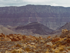
1984 - Chuar Lava Hill. |
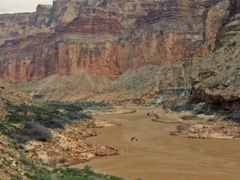
1993 - River party below Kwagunt. |
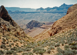
1994 - Entering Chuar Valley. |
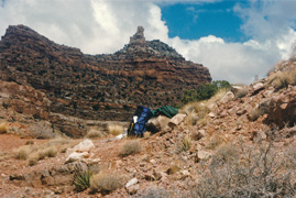
1996 - Freya Castle on route to Unkar. |
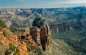
1997 - Marion Point ... with snow. |
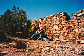
2002 - With Vicki Wallis on Horseshoe Mesa. |
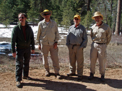
2009 - At the start Crazy Jug hike. |
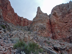
2010 - Hall Butte route into Vishnu. |
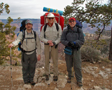
2011 - At the So. Bass trailhead. |
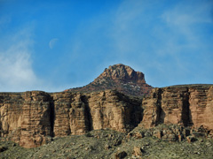
2012 - Moon over Butchart Butte. |
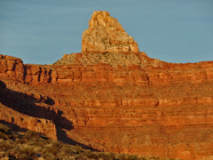
2015 - Zoroaster Temple at sunset. |
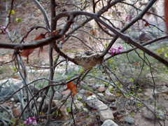
2016 - Hummingbird nest in Vishnu. |
|
In 1980 I did a five day hike to Clear Creek - my
first! This was the first day and I hiked down the BA trail to the
BA Campground, where I got this early evening shot of the cliffs
silhouetted against the dark sky.
In 1984 I did a hike from Nankoweap to Phantom (my first)
with hiking buddy Duane Ott and Ralph Moore, a backcountry ranger.
This was our sixth day and Duane and I hiked up and over into Basalt.
We had thought to follow Harvey's route further upstream, but spied a
break in the Tapeats and were able to use that to get over easily.
As we left we had a nice view of this area including Chuar Lava Hill,
shown in the photo.
In 1993 Neil
Jacobs and I did a ten day hike from Nankoweap to Phantom. This was our
third day and we hiked from our camp at Kwagunt Rapids to near the
Little Colorado, where we camped. Along the way we saw this river
party coming down. Later we saw a research party that camped at
Awatubi and motored up and down the river to the LC. [I think they
were studying the fish.]
In 1994 I did an eight day trip to Lava Creek in Chuar Canyon.
This was the fourth day and I hiked from Awatubi to Chuar Valley. Here
is the descent into Chuar from Carbon.
In 1996 I did a solo hike from Nankoweap to Phantom (and out
of course). This was my seventh day and I hiked over the high
saddle between Unkar and Vishnu. At the saddle I took a break and
got this picture of my pack with Freya Castle in the background.
In 1997 I spent more than a week exploring Nankoweap Canyon with Vicki Wallis. This was our
eighth day and we moved our camp from Tilted Mesa to the saddle.
Vicki's friend Ron was going to pick us up the next day so we didn't
feel like we needed to get all the way to the trailhead this day.
I got this picture of Marion Point proper, still with some snow on it.
In 2002 I did a three day hike to Grapevine Canyon. This was
my last day and I hiked back to the rim via the Grandview Trail on a
very sore and sprained ankle. As long as I could keep my steps
level and flat that was okay, but any rolling of my boot would shoot
pain up my leg. I met up with Vicki Wallis at Horseshoe Mesa and
we hiked out together.
In 2009 Bill Ferris, Chris Forsyth, me and John Eastwood (in
the photo, l. to r.) started a nine day hike down Crazy Jug and over to
Phantom Ranch. Well, eight days for me due to an accident that
resulted in a helicopter ride out. This was our first day and Cara
Lynn & Erik dropped us off on the road leading to Crazy Jug, as far as
we could safely go due to the snow. We camped this night just past
the spring below Timp Point.
In 2010 Bill
Ferris and I started a hike with the intent of getting to Asbestos
Canyon. This was our third day and we hiked up the east arm Clear Creek
to catch the high Redwall route to Vishnu. All went well until
late in the day, coming down from Hall Butte when I knocked a huge rock
loose that resulted in a torn ACL for me and a frightening tumble down
the slope for Bill. Here is the next to last photo I took this
day, showing the general route down. A fuller
account is
here.
In 2011 Dan Eastwood, John Eastwood and I started down the
So. Bass on a six day hike of the "gems" - my first time over the whole
route. Bill Ferris graciously drove us up to the trailhead (and
took the photo). This was our first day and we camped near to the
Tonto Trail junction where we lucked out finding some water in the bed
nearby. I wrote up a full account of this trip
here.
In 2012 I did a nine day trek to Lava Canyon with Bill
Ferris. This was our sixth day and we loaded up our gear and hiked
back up and over to Basalt. In the morning I got this nice shot of
the moon over newly named Butchart Butte. I wrote up a full account of this trip
here.
In 2015, Bill Ferris, John Eastwood and I started an eight
day hike with the intent of getting to Asbestos Canyon. This was
our first day and we could not get a permit for the BA Campground and
had to lug very heavy packs up the Clear Creek Trail to camp on the
Tonto level. We did have a wonderful sunset, as this photo of
Zoroaster attests.
In 2016 I did a
solo hike for ten days to Vishnu Canyon. This was my fourth day and I
finished hiking to Vishnu Canyon. I camped under a popular
overhang in the bed. Here was a hummingbird nest in the redbud
tree that I had seen the previous year! |
 |
|
March 13 |
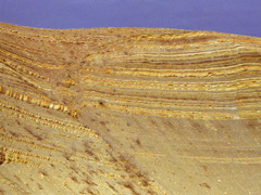
1984 - In Chuar Canyon. |
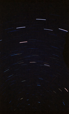
1991 - Star trails from Phantom Creek. |
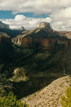
1996 - Siegfried Pyre from the exit ravine in Lava leading to Unkar. |
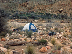
1993 - Camp at Kwagunt Rapids. |
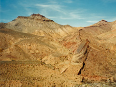
1994 - Nankoweap Mesa & Butte Fault. |
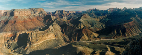
1997 - Panorama of Nankoweap Canyon from above Tilted Mesa. |
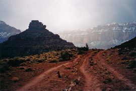
1998 - Ghostly O'Neill Butte on the South Kaibab. |
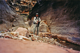
2002 - Exploring in Grapevine Canyon. |
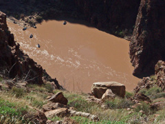
2010 - River runners from the CC Trail. |
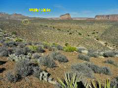
2012 - The head of Basalt Canyon. |
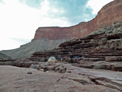
2016 - Water pockets camp on Tonto. |
|
In 1984 I did a hike from Nankoweap to Phantom (my first)
with hiking buddy Duane Ott and Ralph Moore, a backcountry ranger.
This was our fifth day and we spent a layover day in Lava. Duane
and I hiked up the creek a few miles with Ralph, who wanted to camp up
higher in order to get an early start as he had to end up getting out a
day ahead of us.
In 1991 I did a four day hike with Neil Jacobs to Phantom
Creek. This was our last day and we hiked all the way out to the
South Rim from our camp in Phantom Creek. But, overnight I was
able to shoot this long exposure of star trails (and, it appears, a
passing plane).
In 1993 Neil
Jacobs and I did a ten day hike from Nankoweap to Phantom. This was our
second day and we hiked to Kwagunt Rapids where we camped. Just
before reaching the rapids I had placed a small food cache the previous
November to lighten our load a little bit.
In 1994 I did an
eight day trip to Lava Creek in Chuar Canyon. This was the third day and
I hiked over the Butte Fault route from Nankoweap to Awatubi. Here
is the view from the exit in Kwagunt looking back at the fault and at
Nankoweap Butte.
In 1996 I did a solo hike from Nankoweap to Phantom (and out
of course). This was my sixth day and the first one over new
ground for me as I hiked up to the head of Lava and over the high saddle
into Unkar. As I started up, I had this great view looking back to
the north where Siegfried Pyre is quite dominating.
In 1997 I spent more than a week exploring Nankoweap Canyon with Vicki Wallis. This was our
seventh day and we started a two day hike back out. This day we
got up above Tilted Mesa before deciding to camp. From here one
gets a wonderful panoramic view of Nankoweap.
In 1998 I did a five day hike that took me to Vishnu Canyon.
This was my last day and I hiked out to the rim from my camp along the
Clear Creek Trail, via the South Kaibab. The weather turned later
in the day and I got this ghostly photo of O'Neill Butte on the way out.
In 2002 I did a three day hike to Grapevine Canyon. This was
my second day and I day hiked to some nearby inscriptions and then down
into Grapevine as far as I could go. On my way back to camp I had
to get up a steep sloping rock to the Tonto and fell back into the bed,
badly spraining my ankle and leading to an uncomfortable night.
In 2010 Bill
Ferris and I started a hike with the intent of getting to Asbestos
Canyon. This was our second day and we hiked the Clear Creek Trail from
Phantom to the first set of camp sites at Clear Creek. Along the
climb up you get good views of the river and we saw this passing group
of rafters. A fuller
account is
here.
In 2012 I did a nine day trek to Lava Canyon with Bill
Ferris. This was our fifth day and we each went on separate day
hikes. I went up to check out a break in the Tapeats that leads back to
Basalt that Doug Nering had pegged as the probably Walcott route from
1882. Before returning to camp I decided to cache my excess water
at the tree circled here thinking that I would be able to easily find it
on the way out. I did! I wrote up a full account of this trip
here.
In 2016 I did a
solo hike for ten days to Vishnu Canyon. This was my third day and I
hiked along the Tonto Plateau past Clear Creek to a water pocket below
Angels Gate that I have now used three times. I filtered some
water and cached it here for my return in a few days just in case the
pocket dried up. It didn't. Here I am with my camp all set
up on a nice ledge. |
 |
|
March 12 |
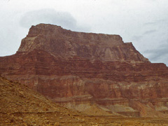
1984 - Chuar Butte. |
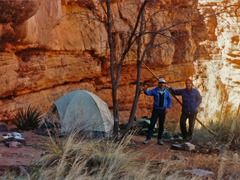
1991 - Phantom Creek camp. |
1996 - Hartman Natural Bridge in the upper end of Lava Canyon. |
1993 - Precarious Nankoweap Trail. |
1994 - Camp at Nankoweap Creek. |
1997 - Nankoweap Rapids. |
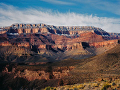
1998 - The South Rim. |
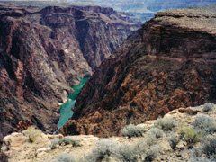
2002 - River on the way to Grapevine. |
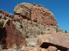
2010 - O'Neill Butte. |
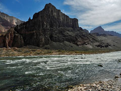
2012 - Lava Rapids. |
2016 - On the Clear Creek Trail. |
|
In 1984 I did a hike from Nankoweap to Phantom (my first)
with hiking buddy Duane Ott and Ralph Moore, a backcountry ranger.
This was our fourth day and we hiked from the Little Colorado confluence
to Lava. We had to leave the river a short ways downstream and it was a
long, grueling day to Lava. We passed through some of the old wreckage
of the 1956 air collision that occurred here at Chuar Butte, shown in
the photo.
In 1991 I did a four day hike with Neil Jacobs to Phantom
Creek. This was our
third day and from our camp at the top of the narrows, shown here, I did
a day hike up the canyon to explore, unsuccessfully, the Redwall route
to Shiva.
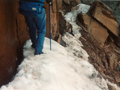
In 1993 Neil
Jacobs and I did a ten day hike from Nankoweap to Phantom. This was our
first day and we were surprised to find quite a lot of snow on the trail
just past Marion Point. We were kicking out a path in the snow drift
about three or four feet above the trail!
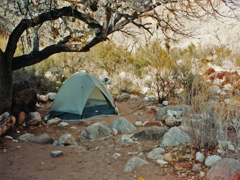
In 1994 I did an
eight day trip to Lava Creek in Chuar Canyon. This was the second day
and I finished hiking down the Nankoweap Trail to camp here beside
Nankoweap Creek.
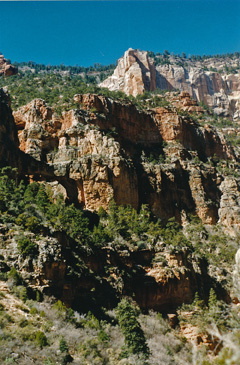
In 1996 I did a solo hike from Nankoweap to Phantom (and out
of course). This was my
fifth day and I did a day hike up Lava to find Hartman Natural Bridge,
shown here on the left side. It is not visible until you are practically
at the bridge and I was just about to give up when I finally spotted it.
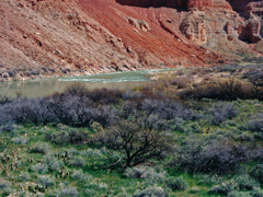
In 1997 I spent more than a week exploring Nankoweap Canyon
with Vicki Wallis. This
was our sixth day and we took a day hike down to Little Nankoweap. Along
the way I got this picture of the river at Nankoweap Rapids.
In 1998 I did a five day hike that took me to Vishnu Canyon.
This was my fourth day and I was heading back along the Tonto when I
snapped this photo of the South Rim. Shoshone Point is a bit left of
center.
In 2002 I did a three day
hike to Grapevine Canyon. This was my first day and I hiked down the
Grandview and over in Grapevine. Between Cottonwood and Grapevine the
trail affords nice views of the river.
In 2010 Bill Ferris and I
started a hike with the intent of getting to Asbestos Canyon. This
was our first day and we hiked down the South Kaibab to the Bright Angel
Campground. This hike would end with a rockfall in Vishnu. A
fuller account is
here.
In 2012 I did a nine day trek to Lava Canyon with Bill Ferris.
This was our fourth day and from our base camp in Lava/Chuar we hiked
down to the river for a day and I got this nice view of the rapids
looking across to Palisades. I wrote up a full account of this trip
here.
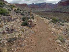
In 2016 I did a solo hike
for ten days to Vishnu Canyon. This was my second day and I hiked from
Phantom to Clear Creek. Along the trail, after it makes a bend into
Clear Creek Canyon proper I passed this cairn? Hmm ... what does it
mean? I don't know. |
 |
|
March 11 |
1984 - Ralph & Duane at the LC. |
1991 - Phantom Ranch. |
1994 - The road to Saddle Mountain. |
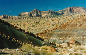
1996 - In Chuar Canyon. |
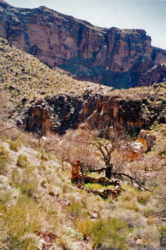
1998 - Old cabin site in Vishnu Canyon, most likely related to Hance's
mines in nearby Asbestos Canyon. |
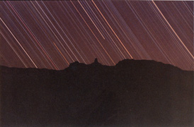
1997 - Star trails over Mt. Hayden. |
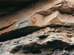
1999 - Pictograph on Big Saddle Trail. |
2012 - Bill Ferris heads up Basalt. |
2016 - On the South Kaibab Trail. |
|
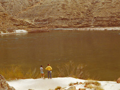
In 1984 I did a hike from Nankoweap to Phantom (my first)
with hiking buddy Duane Ott and Ralph Moore, a backcountry ranger.
This was our third day and we hiked along the river to the Little
Colorado junction where we camped for the night. Here are Duane and
Ralph looking out across the Big C and Little C.
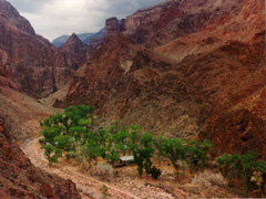
In 1991 I did a four day hike with Neil Jacobs to Phantom
Creek. This was our
second day and we hiked up from the BA Campground to Utah Flats and over
into the creek. Here's a view of Phantom Ranch as we were heading up
this rough trail.
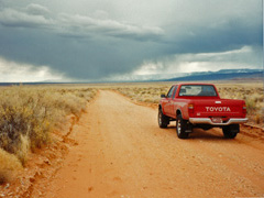
In 1994 I did an
eight day trip to Lava Creek in Chuar Canyon. This was the first day and
I drove up to the Saddle Mountain trailhead and camped this night at
Marion Point.
In 1996 I did a solo hike from Nankoweap to Phantom (and out
of course). This was my
fourth day and I got to Lava Creek in Chuar Canyon, where I would spend
a couple of nights before moving on.
In 1997 I spent more than a week exploring Nankoweap Canyon
with Vicki Wallis. This
was our fifth day and we did a day hike to the Little Nankoweap. But,
overnight I was able to capture this nice photo of the star tracks
behind Mt. Hayden.
In 1998 I did a five day hike that took me to Vishnu Canyon.
This was my third day and I hiked from my camp in Vishnu down into the
lower bed to look for the remains of an old cabin I had seen a few years
earlier from the Tonto level. Almost certainly this is associated with
Hance's mining claims in nearby Asbestos Canyon.
In 1999 I did a six day hike in the Crazy Jug area.
This was my sixth, and final, day as I hiked back up the Big Saddle
Trail to the rim, passing by this neat little pictograph that looks like
a smiley face.
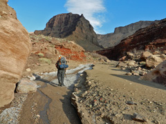
In 2012 I did a nine day trek to Lava Canyon with Bill Ferris.
This was our third day and we hiked up Basalt Canyon, as shown here,
over into Chuar/Lava. I wrote up a full account of this trip
here.
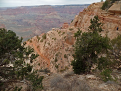
In 2016 I did a solo hike for ten days to Vishnu Canyon. This was
my first day and I hiked down the South Kaibab Trail, shown in the
photo, to the Bright Angel Campground. |
 |
|
March 10 |
1984 - Duane and granaries at Nankoweap. |
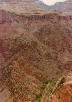
1991 - Looking down on the Bright Angel Campground from the South Kaibab
Trail. This also shows nearly the complete route up to Utah Flats
from the end campsite. |
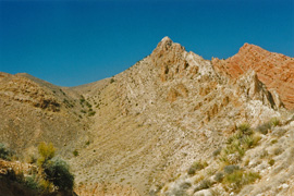
1996 - Awatubi Crest. |
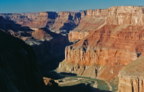
1997 - The river from atop Nankoweap Mesa. |
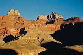
1998 - Zoroaster & Brahma from the Tonto Plateau. |
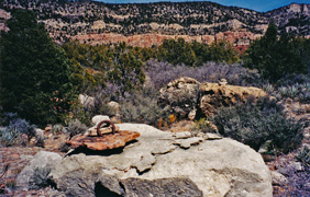
1999 - Old horseshoe on the Esplanade near Crazy Jug. |
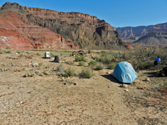
2012 - Camp at Basalt with Bill Ferris. |
|
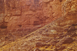
In 1984 I did a hike from Nankoweap to Phantom (my first)
with hiking buddy Duane Ott and Ralph Moore, a backcountry ranger.
This was our second day and we hiked from below the Redwall (on the
trail) to Kwagunt Rapids. Ralph took the Butte Fault route while
Duane and I went down the creek to the river and then down to Kwagunt.
Along the way we stopped for lunch and Duane climbed up to the nearby
granaries.
In 1991 I did a four day hike with Neil Jacobs to Phantom
Creek. This was our first day and we hiked down the South Kaibab
and stayed overnight in the BA Campground. From along the trail
you can get this good view of the campground as well as our route for
tomorrow up to Utah Flats.
In 1996 I did a solo hike from Nankoweap to Phantom (and out
of course). This was my third day and one of my most miserable.
I got sick at Awatubi - as I have now done three times. No doubt
it is from the water I can get there, although you do have to dig for it
in the bed. Consequently I left this camp late and had a tough
time of it. I got as fas as the saddle between 60 Mile and Carbon.
There I actually spent time boiling all my water - that did the trick.
I was much better the next day. Here is a view of the route coming
down from the Awatubi Crest from Malgosa.
In 1997 I spent more than a week exploring Nankoweap Canyon with Vicki Wallis. This was our
fourth day and I did a hike up to the top of Nankoweap Mesa. Here
is a photo I took looking back down on the Nankoweap Rapids area from
the top of the mesa.
In 1998 I did a five day hike that took me to Vishnu Canyon.
This was my second day and I hiked from my camp out in front of The
Howlands Butte to Vishnu Creek. This photo was taken in the early
morning with Zoroaster and Brahma Temples dominating the view to the
west.
In 1999 I did a six day hike in the Crazy Jug area.
This was my fifth day and I day hiked from my camp on the west side of
the canyon along the Esplanade towards Bridger Knoll. I found this
old horseshoe at about the place where John Eastwood and I had come down
from the rim four years earlier via what I call the Dutton Route.
In 2012 I did a nine day trek to Lava Canyon with Bill
Ferris. We capsized in the river while crossing on the first day
and this, our second day, was spent drying out all our belongings and
making the river crossing again, without packs, to convince ourselves
that we would be okay on the journey back.
Here's our camp on a terrace up above the river. I wrote up a full account of this trip
here. |
 |
|
March 9 |
1984 - Nankoweap Canyon. |
1996 - Nankoweap Butte. |
1997 - Camp along Nankoweap Creek. |
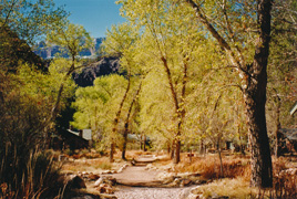
1998 - Phantom Ranch. |
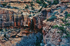
1999 - Temporary waterfall in Crazy Jug Canyon. |
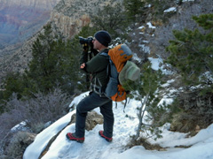
2012 - With Bill Ferris on the Tanner Trail. |
|
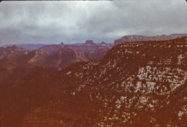
In 1984 I did a hike from Nankoweap to Phantom (my first)
with hiking buddy Duane Ott and Ralph Moore, a backcountry ranger.
This was our first day and we camped on a narrow ledge below the
Redwall. This is the only photo I took this day - of Nankoweap
Canyon from the trail as it winds its way along the Supai layer.
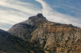
In 1996 I did a solo hike from Nankoweap to Phantom (and out
of course). This was my second day and I hiked from my camp at Nankoweap
Creek to Awatubi, using the Butte Fault route, going up and over many
high saddles. Here is the view of Nankoweap Butte from near the
saddle between Nankoweap and Kwagunt.
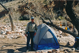
In 1997 I spent more than a week exploring Nankoweap Canyon with Vicki Wallis
and, for the first few days, with John Eastwood and his
daughter Megan. This was our third day and John and Megan hiked
back out while Vicki and I secured our camp so we could take a day hike
down to the Colorado River.
In 1998 I did a five day hike that took me to Vishnu Canyon.
This was my first day and I hiked down the South Kaibab to Phantom
Ranch, shown in the photo. John Eastwood joined until we reached
the Tonto level on the Clear Creek Trail, where we took a break before
he headed back to the rim. I hiked over to Clear Creek and got
back onto the Tonto level east of the canyon before stopping for the
night.
In 1999 I did a six day hike in the Crazy Jug area.
I spent three nights camped near Timp Canyon, on the Esplanade.
This was my fourth day and I moved my camp to the west side of Crazy Jug
in preparation for another day hike the next day. Along the way I
was treated to this temporary waterfall, thanks to the snow we had
gotten a couple of days earlier.
In 2012 I did a nine day trek to Lava Canyon with Bill
Ferris. We hiked down the Tanner Trail - the photo shows Bill
snapping a photo near the top of the trail. We got to the river
and recovered the kayak and supplies we had cached the week before.
All went well until we were mostly across the river when we tipped over
in an eddy. Somehow we managed to get to shore with all our gear.
I wrote up a full account of this trip
here.
In 2005 I did a day hike with Vicki Wallis down the South Kaibab
and over to Cremation and then back up. Everything was amazingly
green, but apparently I did not bring along a camera, so no photos. |
 |
|
March 8 |
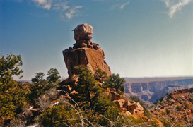
1996 - The battleships at Marion Pt. |
1997 - Snow on Tilted Mesa. |
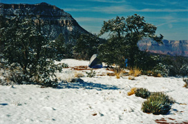
1999 - Overnight snow at Timp Canyon. |
|
In 1996 I did a solo hike from Nankoweap to Phantom (and out
of course). This was my first day and I hiked down to Nankoweap
Creek passing by the rock formations that always remind me of
battleships as I rounded the bend at Marion Point.
In 1997 I spent more than a week exploring Nankoweap Canyon with Vicki Wallis
and, for the first few days, with John Eastwood and his
daughter Megan. This was our second day and Vicki and I got to the
creek and set up camp. On the way it was amazing to see snow at
Tilted Mesa, as shown in the photo.
In 1999 I did a six day hike in the Crazy Jug area.
I spent three nights camped near Timp Canyon, on the Esplanade.
This was my third day and I woke up to find the ground covered in snow.
But the sun was out and it was a pleasant day, with the snow melting
away quickly. I spent the day near camp just poking around and
letting everything dry out. |
 |
|
March 7 |
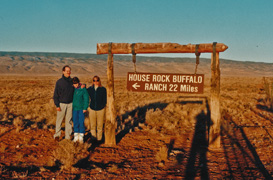
1997 - John, Meg & Vicki on the way to Nankoweap. |
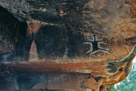
1999 - Pictographs near Stina Canyon. |
|
In 1997 I had planned to do a long hike from Nankoweap to
Phantom with Vicki Wallis. We were joined by John Eastwood and his
daughter Megan, who would give us a ride to the trailhead and spend a
couple of days in Nankoweap with us. Alas, despite how this photo
looks, there was lots of snow on the north side of Saddle Mountain and
we struggled with post holing our way up to the saddle. We camped
at Marion Point and changed our plans - Vicki and I would spend about a
week in Nankoweap and John would get her friend Ron to drive out to pick
us up.
In 1999 I did a six day hike in the Crazy Jug area.
I spent three nights camped near Timp Canyon, on the Esplanade.
This was my second day and I managed a long day hike to the cabin on
Muav Saddle and back, finishing in the dark with snow falling. On
the way up the canyon, somewhere past Stina Canyon I came across this
cool overhang with these unusual pictographs. |
 |
|
March 6 |
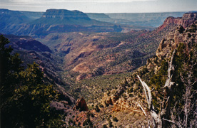
1999 - Crazy Jug Canyon. |
|
In 1999 I did a six day hike in the Crazy Jug area.
There was snow on the road coming in and more fell before I got back
out, and I saw nary a soul the whole time. This was my first day
and I entered via what I call the Big Saddle Trail. Here is the
view from the trail down Crazy Jug Canyon, to Steamboat Mountain in the
background. |
 |
|
March 5 |
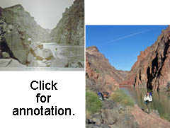
2006 - Matching photos at the foot of the Old Grandview Trail. |
|
In 2006 I did an overnight hike with John Eastwood down the
"Old Grandview" to the river. This was our second day
and we hiked back up to the rim from our camp at the river. I had
brought along copies of old photos of this spot at the river and before
we left I was able to do a good job of matching them up with our views,
as shown in my picture (click on it for annotation). The old photo
comes from Burton Holmes "Travelogues," published in 1910. I wrote
up more on this trip
here. |
 |
|
March 4 |
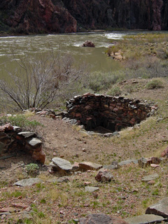
2004 - BA ruins at the river. |
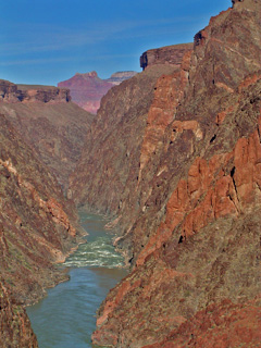
2006 - Isis & Shiva over the river. |
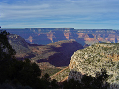
2007 - Huxley Terrace at South Bass. |
|
In 2004 I did a day hike down the South Kaibab to Phantom
Ranch and back the same way with John Haney. At the river the
light was just right to get a photo of some ruins between the black
bridge and Bright Angel Creek that are mentioned in John Wesley Powell's
book about his pathbreaking river trip of 1869 (mostly). From his
book, the August 16 entry includes this passage: "Late in the afternoon
I return and go up a little gulch just above this creek ... and discover
the ruins of two or three old houses, which were originally of stone
laid in mortar."
In 2006 I did an overnight hike with John Eastwood down the
"Old Grandview" to the river. The old trail below the Tapeats is
often hardly more than a barely discernible route. But, along the
way we were treated to some cool and unique views, like this one of Isis
and Shiva as a backdrop to the river at Grapevine Rapids.
In 2007 Cara Lynn and I did a short day hike down the South
Bass Trail to the Esplanade. It was a cool day but with plenty of
sun. Here's the view from up near the top of the trail of Huxley
Terrace (on the Esplanade) stretching out to the right from Mt.
Huethawali. |
 |
|
March 3 |
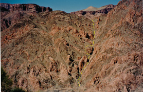
1998 - Ravine route from SK to CC trail. |
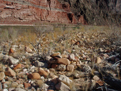
2012 - Kayak cache at the river. |
|
In 1998 I did a day hike down the South Kaibab and once
across the river hiked up a ravine to the Clear Creek Trail up above the
stone bench. I cached some items for a later trip and returned via
the trail through Phantom Ranch.
In 2012 I did a hike down the Tanner Trail with Bill Ferris
to cache my inflatable kayak in preparation for a river crossing we
would make the next week. Here is the spot where I cached it
(along with some of our hiking gear) under the pile of rocks near where
we planned to cross the river. After finishing that we hiked back
up to the rim. |
 |
|
March 2 |
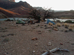
2012 - Kayak cache camp at Tanner. |
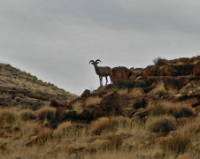
2013 - Bighorns in Soap Creek. |
|
In 2012 I did a hike down the Tanner Trail with Bill Ferris
to cache my inflatable kayak in preparation for a river crossing we
would make the next week. Here is Bill at our camp by the river.
In 2013 I did a day hike down Soap Creek. I had hoped
to get to the river but I was deterred by a spot in the canyon where a
rope had been fixed to get by a giant boulder. On my return, as I
neared the plateau, I happened upon a couple of bighorn sheep. |
 |
|
March 1 |
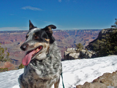
2008 - Scout on the South Rim. |
|
In 2008 I did one of my favorite day hike loops - down the
South Kaibab, across the Tonto and up the Bright Angel. Waiting at
the top for me were Cara Lynn and our dog Scout. |
 |
|
February 28 |
 |
|
February 27 |
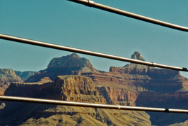
2000 - Hmm... the view from Plateau Pt. |
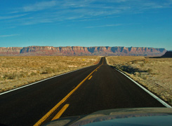
2009 - The Vermilion Cliffs. |
|
In 2000 I did a day hike down the Bright Angel Trail to
Plateau Point just to enjoy the weather. I was the only one at the
point while there and I took some photos like this that I think made for
a nice contrast.
In 2009 I drove up to the North Rim to get to Crazy Jug.
The snow on those roads stymied me from getting any closer than about
five miles from the rim. But, I got this nice shot of the
Vermilion Cliffs while I was on my way up. |
 |
|
February 26 |
 |
|
February 25 |
 |
|
February 24 |
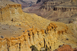
1981 - On the Tanner Trail. |
|
In 1981 I did a hike down the Tanner Trail, camping for two
nights at the river. This was my last day and I hiked back up to
the rim. This photo is from a spot looking back at a section of
trail below the Redwall with the river in the background. |
 |
|
February 23 |
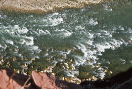
1981 - Unkar Rapids ... from 400 feet above! |
|
In 1981 I did a hike down the Tanner Trail, camping for two
nights at the river. This was my second day and I hiked over to
the tall cliff above Unkar Rapids. At about 400 above the river, I
had to literally crawl out to the edge to take this picture looking down
on the rapids. From here I hiked up the Cardenas drainage and
somehow managed to get to the base of the Redwall and follow a route to
the Escalante-Cardenas saddle and return to camp down the Tanner Trail. |
 |
|
February 22 |
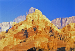
1981 - Comanche Pt. ... beside itself. |
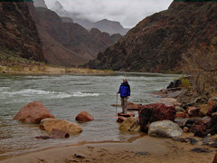
2004 - John at Pipe Creek Rapids. |
|
In 1981 I did a hike down the Tanner Trail, camping for two
nights at the river. This was my first day down. By accident
my film jammed, yet I got this cool picture that is double exposure of
Comanche Pt.
In 2004 John Eastwood and I did a day hike down the Bright
Angel Trail - here is John at the river. It was a cool day, lots
of clouds and with some occasional light rain. We were in search
of the lower portion of a route that would lead up to the Tonto west of
Pipe Creek. On an earlier hike we had come down that route but got
cliffed out a hundred feet above the BA Trail. We came up empty on
this trip, but on the way back we did hike the original Devil's
Corkscrew as we ascended back to Indian Garden. [A few months
later I was able to do this interesting route - see
here.] |
 |
|
February 21 |
 |
|
February 20 |
 |
|
February 19 |
 |
|
February 18 |
 |
|
February 17 |
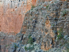
2013 - Chris Atwood climbing down from Tse-An-Kaetan. |
|
In 2013 Chris Atwood and I did a day hike down the South
Kaibab Trail. We were headed into Cremation Canyon and decided to
try for Tse-an-Kaetan, a cave where some ancient split-twig figurines
had been found. We located the cave and I was sure I'd never get
into it. But, after climbing up to it, Chris tied in a long piece
of webbing to an anchor spot and came back down (as shown in the photo)
to borrow my pen so he could sign into the register. With the
webbing as security I made the climb too and got the chance to poke
around in this fantastic cave.
In 1991 I did a three day trek down the Grandview Trail.
I camped for two nights at the little spring in the side canyon to
Cottonwood. This was my last day and I hiked back up the Grandview
Trail. [No photos.] |
 |
|
February 16 |
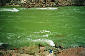
1991 - At the foot of Sockdolager Rapids. |
|
In 1991 I did a three day trek down the Grandview Trail.
I camped for two nights at the little spring in the side canyon to
Cottonwood. This was my second day and I did a day hike down to
the foot of Sockdolager Rapids, shown here with my fanny pack sitting on
a rock. There is an old trail that goes beneath the Tapeats and a
steep rock-filled ravine that leads to this spot north of Horseshoe
Mesa. |
 |
|
February 15 |
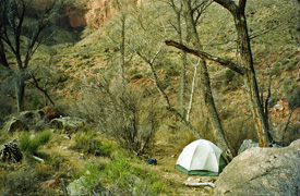
1991 - Camp at Cottonwood Spring. |
|
In 1991 I did a three day trek down the Grandview Trail.
I camped for two nights at the little spring in the side canyon to
Cottonwood, as seen in the photo. I used to camp at this spot
quite often - it is all by itself, next to water (at least, back then)
and away from the trail. As you can see, this is my roomy 3-man
tent; quite the luxury for a solo hike! |
 |
|
February 14 |
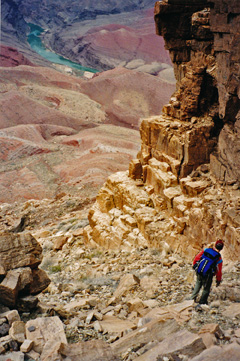
1998 - John Eastwood on route to Cardenas Creek. |
|
In 1998 John Eastwood and I did a day hike down the Tanner
Trail. The rim was snowpacked and it took us quite a bit of time
to locate the trailhead! While above the Redwall we left the trail
and hiked up to the Escalante-Cardenas saddle and then headed north to
an easy route down through the Redwall. From here we had to find a
narrow break in the Tapeats - the photo shows John after we got through
that spot. We got to the river and ate a late lunch as the weather
took a turn. From here we bushwhacked our way over to the lower
stretches of the Tanner Trail and hiked up in the rain which soon turned
to snow, reaching the rim late at night. We were in the midst of a
big storm and the drive back to Flagstaff took many hours.
In 1984 I hiked down the Grandview Trail with Karen Herrera and we
camped for two nights on Horseshoe Mesa. This was our last day and
we hiked back up to the rim. I recall that it had snowed
overnight, but I have no photos for this day. |
 |
|
February 13 |
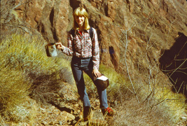
1984 - Karen Herrera with coffee pot on the Old Grandview Trail. |
|
In 1984 I hiked down the Grandview Trail with Karen Herrera and we
camped for two nights on Horseshoe Mesa. This was our second day
and we did a day hike down to Cottonwood Creek and then out on the Tonto
and down the Old Grandview Trail to the river. In the old, but
well-constructed, section through the Tapeats we came across this old
coffee pot. Below this, the "trail" became a barely discernible
route and for years I wasn't sure we had actually followed the right
route to the river. I don't know how we did this trek to the river
and back in a day, in the middle of winter, but, alas, I did not keep
any journal notes to remind me! |
 |
|
February 12 |
|
In 1984 I hiked down the Grandview Trail with Karen Herrera.
We spent two nights camped on Horseshoe Mesa. This was our first
day and we hiked down to a camp site. [For some reason I have no
photos for this day nor do I have any journal notes.] |
 |
|
February 11 |
 |
|
February 10 |
 |
|
February 9 |
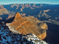
2008 - O'Neill Butte along the South Kaibab Trail. |
|
In 2008 I did a day hike down the South Kaibab Trail to the
river. I literally only crossed the Black Bridge and after a short
rest turned around and came back up to the rim. I was on the trail
at 7:30 am, reached the other side of the bridge at 10:15, took a
fifteen minute break and was back on the rim at 2 p.m. Six and a
half hours for this round trip to the river - not bad!
In 1981 I hiked down to the Bright
Angel Campground where I spent a couple of nights. This was my
last day and I hiked back up to the rim. [No photos.] |
 |
|
February 8 |
|
In 1981 I had hiked down to the Bright
Angel Campground where I would spend a couple of nights. This was my
second day and I hiked up to Utah Flats and over into Phantom Creek.
From there I continued north until I could follow a talus slope down to
the creek and cross over to the North Kaibab Trail and return to my
camp. [No photos.] |
 |
|
February 7 |
|
In 1981 I hiked down to the Bright
Angel Campground where I would spend a couple of nights. [No photos.] |
 |
|
February 6 |
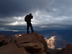
2009 - Bill Ferris on the South Kaibab. |
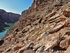
2013 - Sketchy slopes in 6 Mile Draw. |
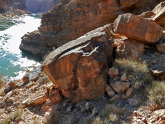
2013 - Downriver from Cathedral. |
|
In 2009 Bill Ferris and I did a day hike down the South
Kaibab to the Colorado River and back the same way. We stopped at
the picnic table near Bright Angel Creek for our turnaround point, not
going all the way to the ranch. It was really dark in the early
morning as you can tell from this photo of Bill snapping some pictures
from Ooh Aah Pt.
In 2013 I was trying to do some loop segments in Marble
Canyon. This day I started down the so-called 6 Mile Draw which
comes out to a sheer cliff over the river. I started following a
steep route on the upriver side, heading for a slope that would take me
to the river. But, I soon gave up over this precarious slope; the
photo is looking back to the draw, to which I returned. A fuller
account is written up
here.
In 2013 I was trying to do some loop segments in Marble
Canyon. In the morning I was stymied in 6 Mile Draw, so in
the afternoon I drove up the road and hiked down Cathedral Wash. I
followed down alongside the river to find a spot referred to as a
"wall." This photo shows my furthest progress. I did not get
past the knob that sticks out into the river and I think the wall is
just beyond this. A fuller account is written up
here. |
 |
|
February 5 |
 |
|
February 4 |
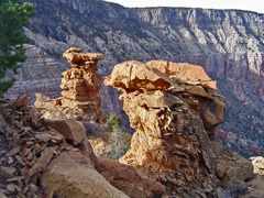
2006 - Toroweap towers on Pt. Huitzil route. |
|
In 2006 I went up the to South Bass area with John & Kathy
Eastwood, Mark Pebler and one of Kathy's astronomy students, Keith.
John, Mark and I got dropped off at the abandoned Pasture Wash Ranger
Station to do a looping hike to the South Bass trailhead via the Pt.
Huitzil route, spending most of our time trekking along the Esplanade.
Great fun. One of the landmarks for navigating this route are
these two squat towers in the Toroweap layer. It was an all day
affair and the three of us had on our headlamps for the final push up
the South Bass. There we found that Mark's vehicle had gotten a
flat and no amount of effort could free one of the lug nuts. So,
the five of us returned to Flagstaff in my Toyota Xtra Cab - talk about
being packed in like sardines! The next day - Super Bowl Sunday -
I drove Mark back up to get his truck (he had to use a patch kit as a
temporary fix). I got back home just in time to see only the very
last play of the big game :-(, between the Steelers and the Seahawks. I wrote up a fuller account of this hike
here. |
 |
|
February 3 |
 |
|
February 2 |
 |
|
February 1 |
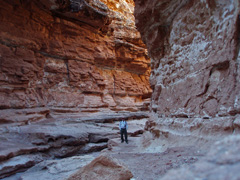
2009 - In the narrows of Cathedral Wash. |
|
In 2009 I decided to scoot up to Marble Canyon and do a hike
I had only read about down Cathedral Wash to the river. Not a soul
around and the fact that you start on the plateau and wend your way into
this narrow canyon rather quickly is very cool. On this day it was
actually cold! And, I made it back home in plenty of time to watch
the Super Bowl. [The one the Cardinals lost :-( unfortunately.]
I wrote up a fuller account of this hike
here. |
 |


