|
September 1 |
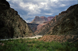

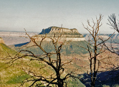
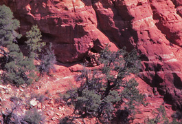
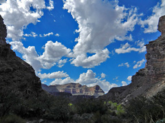
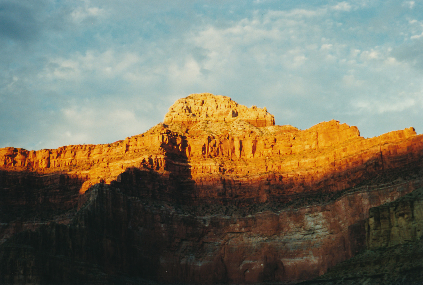
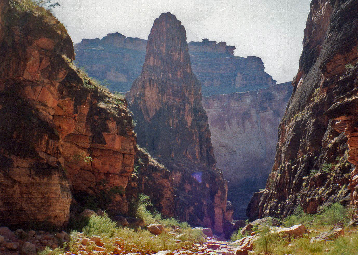
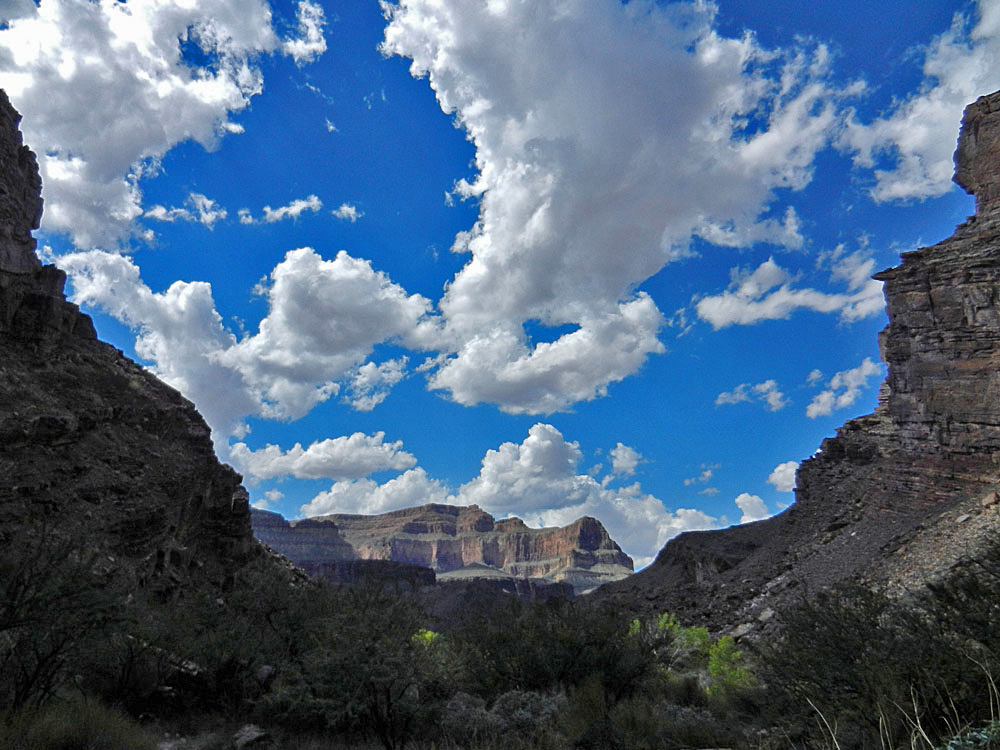
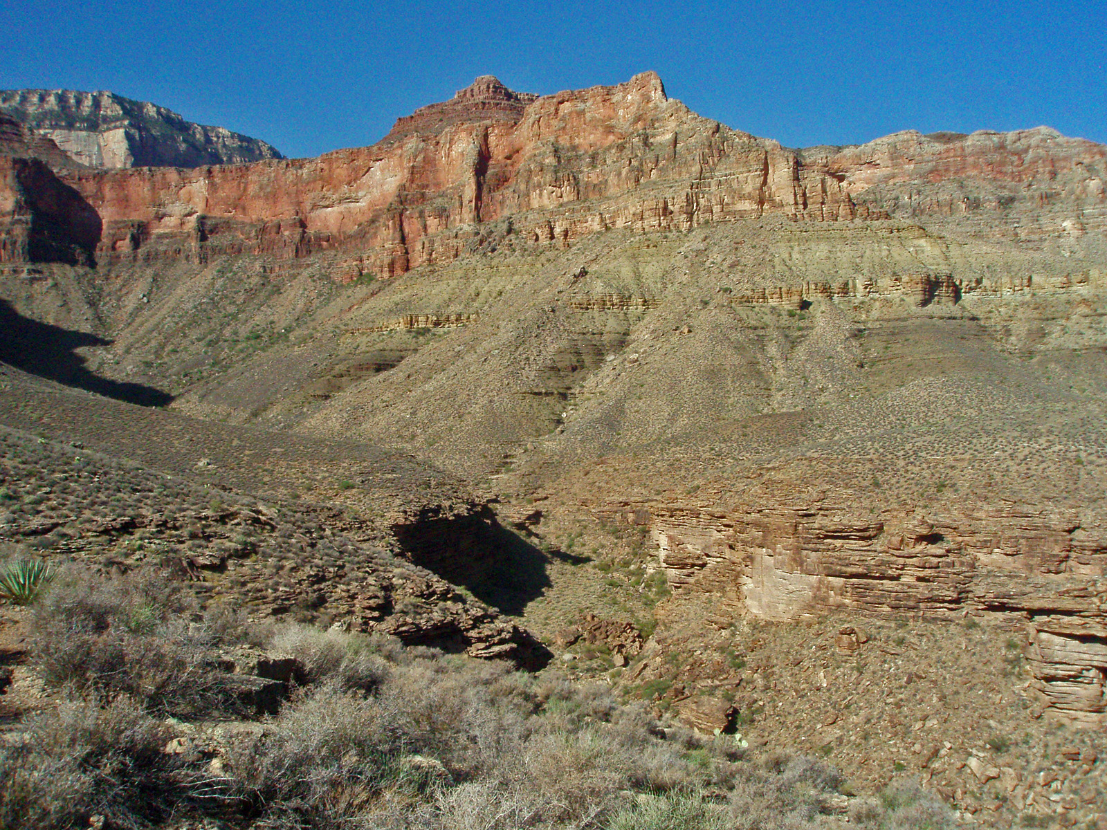
1991 - At Crystal Rapids and later sunset on Mencius Temple. |

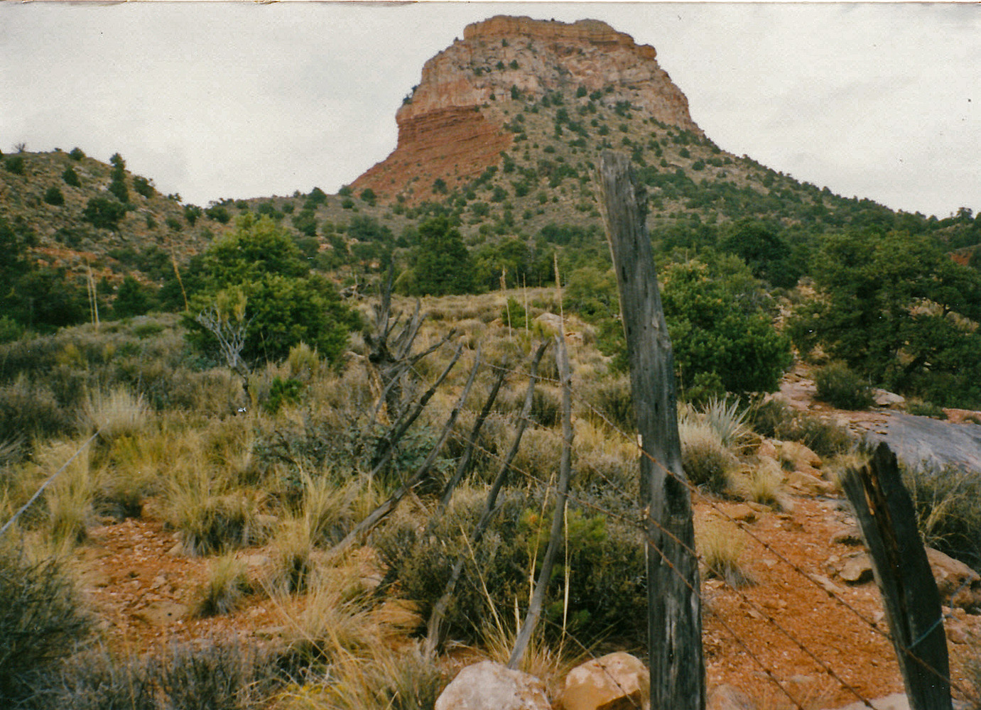
1995 - Fencing in front of Bridger Knoll. |
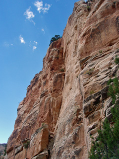
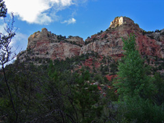
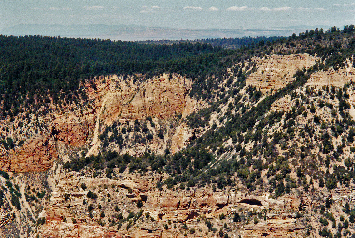
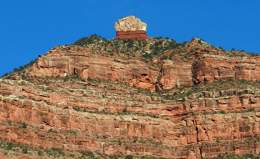
2007 - Coconino cliffs on the Big Saddle Trail. |
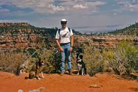
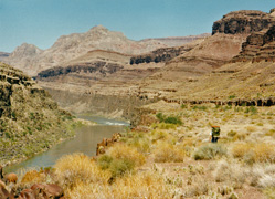
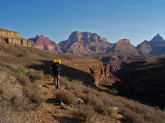
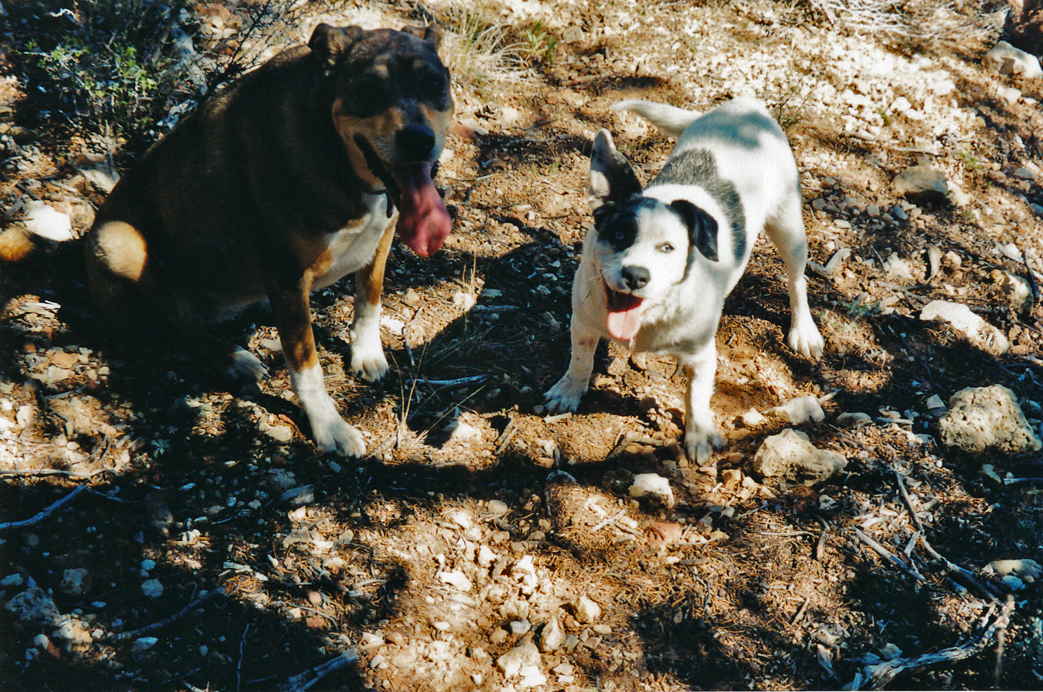
1996 - John with Peppyr & Annie on Nankoweap. |
|
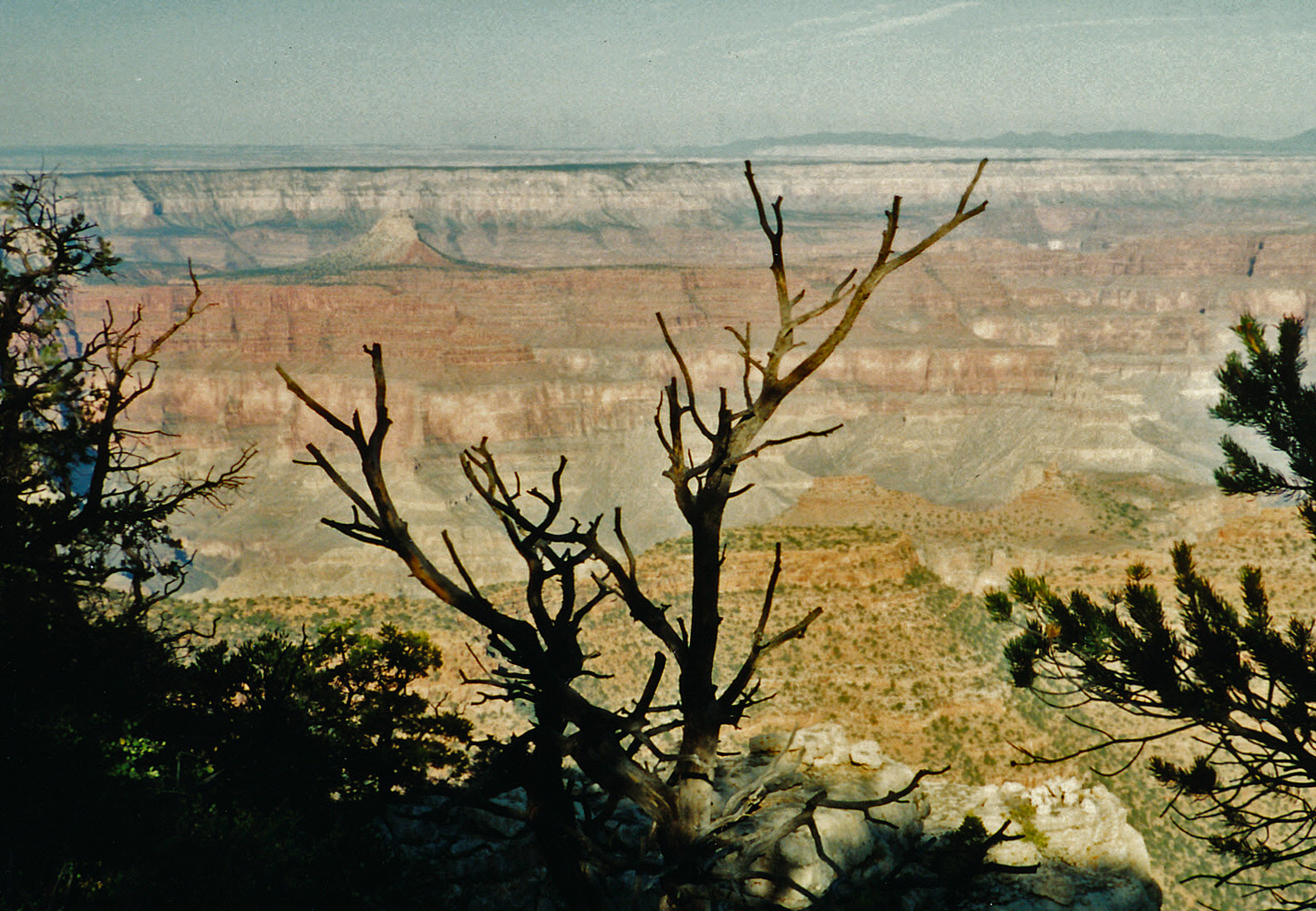
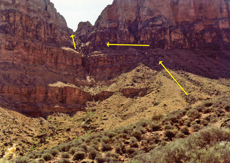
In 1991,
Neil Jacobs and I did a neat looping hike down into Crystal and out near
Pt. Sublime. It was noon on our third day that we reached the
river at Crystal Rapids. It was surprisingly chilly and we pulled
out our stove and had hot oatmeal for lunch before climbing up to the
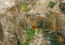
Tonto Plateau to the west. Our third camp was on the Tonto level
at Tuna Creek where we were treated to this sunset view of Mencius
Temple.
In 1995, John Eastwood and I did a hike down what I've come
to call the "Old Dutton Route," to camp at Thunder River on the first
night of a four day trip. Here we had to cross a very old fence
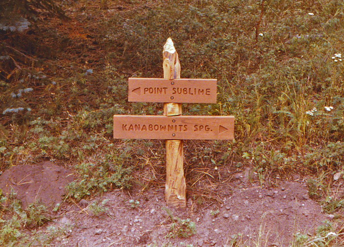
that still stands in the canyon off the south flank of Bridger Knoll
that presumably would keep grazing cattle from wandering too far away.
In 1996, the Eastwoods and I camped at the upper Nankoweap
trailhead. This day John and I hiked down to the lower terrace
with our dogs, Peppyr (mine) and Annie (his). The saddle behind
John is where the trail starts down into the canyon properly.
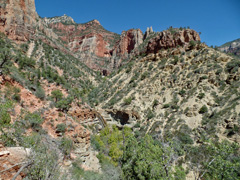
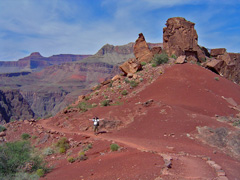
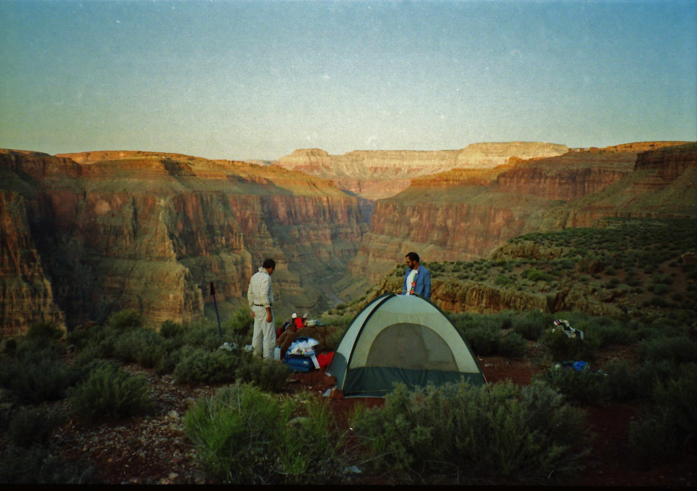
In 2007, Cara Lynn, Erik and I camped at the head of what I call
the Big Saddle Trail near Crazy Jug. This day we took a hike down
the trail to the upper waterfall in the Supai. The old trail
switchbacks through an improbable break in the Coconino cliffs, only
yards wide. At the bottom of that descent the cliffs tower up on
both sides of us. |
 |
|
September 2 |
1991 - Neil on the Flint/Tuna saddle. |
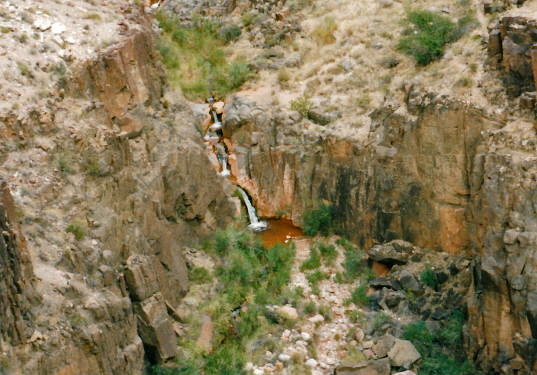
1995 - Cascading falls in Stone Creek. |
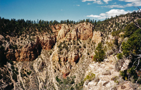
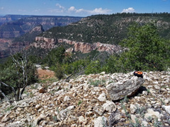
2006 - Muav Saddle & Powell Plateau from Big Saddle. |
2007 - Snake on the Big Saddle Trail. |
|
In 1991,
Neil Jacobs and I did a neat looping hike down into Crystal and out near
Pt. Sublime. We were supposed to get out on this, our fourth day.
We got up to the Flint/Tuna saddle, where I snapped this pic of Neil,
but got hung up in the Kaibab well after dark and gave up at 11 pm, when
we found a spot to lay out our sleeping bags.
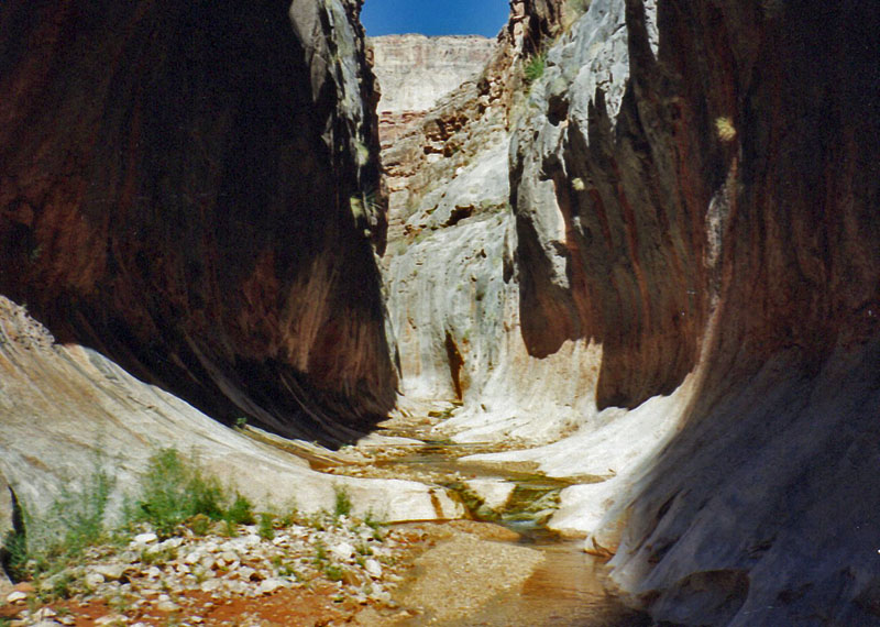
In 1995, John Eastwood and I did a backpacking trip in the
Thunder River area of the canyon. On our second day we followed
the hiker route over to Stone Creek, where we camped, passing over these
cascading falls.
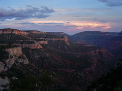
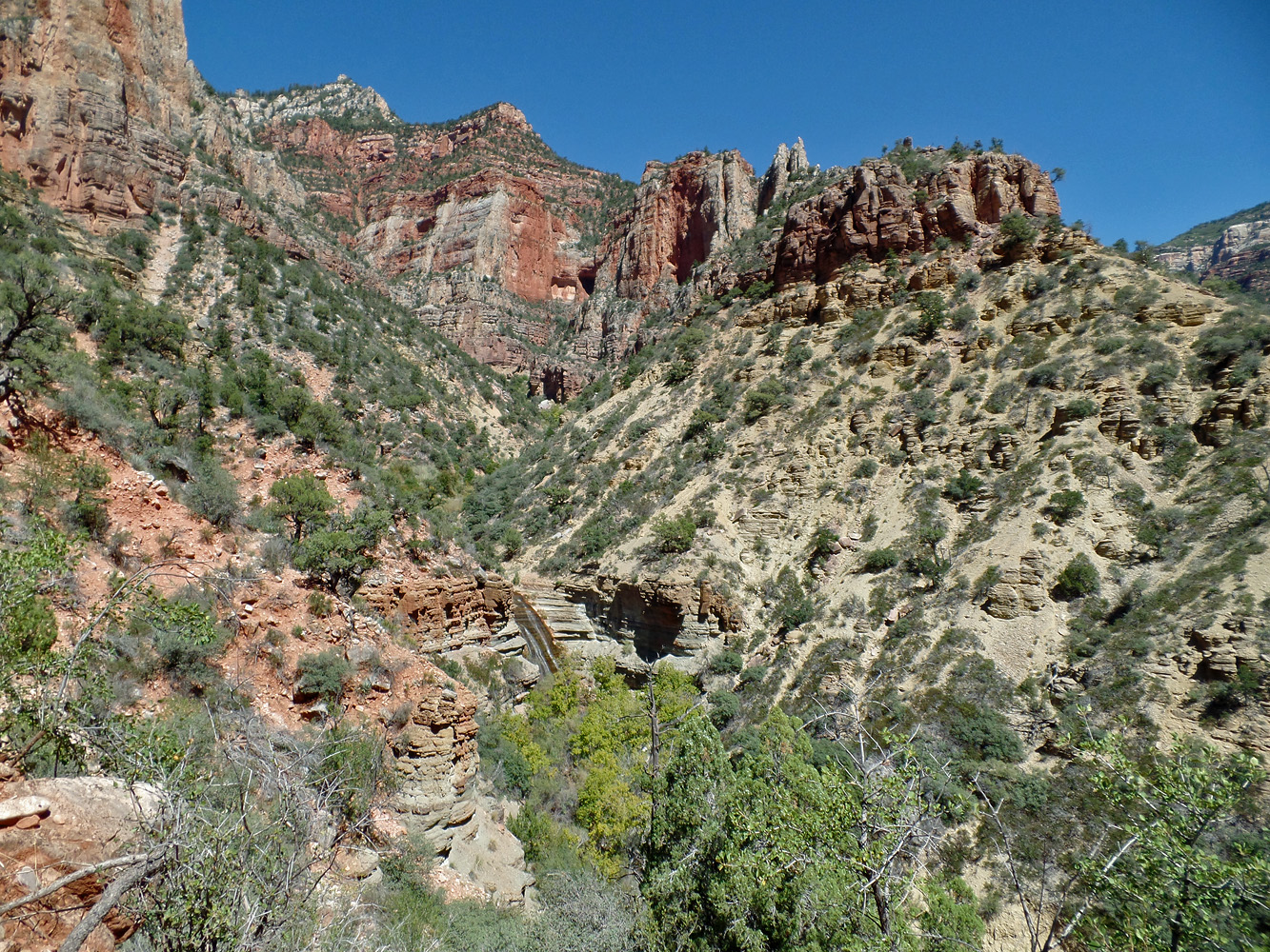
In 2006, Cara Lynn, Erik and I camped at the head of what I
call the Big Saddle Trail near Crazy Jug. This is a view from our
campsite looking toward Muav Saddle and Powell Plateau.
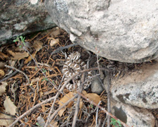
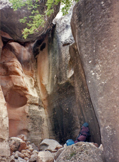
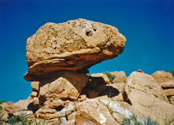
In 2007, Cara Lynn, Erik and I camped at the head of what I call
the Big Saddle Trail near Crazy Jug. Here's a snake we saw, if I
am remembering this correctly, in the Coconino layer. It is not
the well-known Grand Canyon Rattlesnake, and based on what I've found
on-line it seems to be a Hopi Rattlesnake (see
here and
here). |
|
|
|
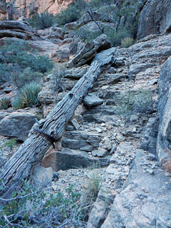
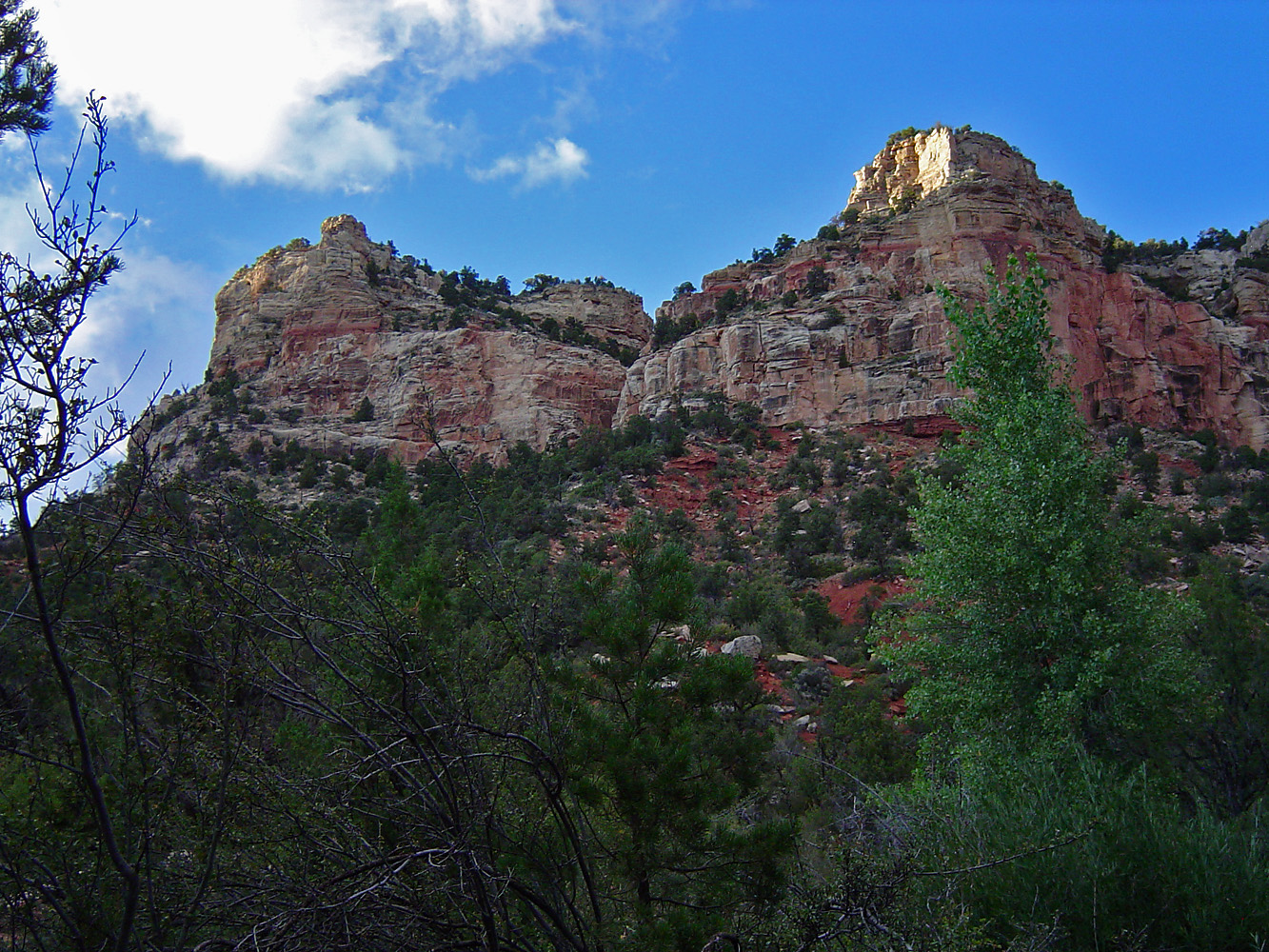
September 3 |
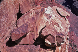
1991 - Mt. Huethawali from Pt. Sublime |
1993 - Steamboat Mountain. |
1995 - Traversing the terrace back to Tapeats. |
2006 - Coconino route at Big Saddle. |
|
In 1991,
Neil Jacobs and I did a neat looping hike down into Crystal and out near
Pt. Sublime. We were supposed to get out the day before but got hung up in the Kaibab
overnight. With the light of this morning we were easily able to
see our way to the top where we were treated to this view of Mt.
Huethawali, which is on the south side of the river.
In 1993, Neil Jacobs, John Eastwood, Brian Maris and I
started a backpacking trip down the North Bass Trail. From the
trailhead you get a nice view of Steamboat Mountain. We got to the
trailhead late the previous night and so got a reasonably early start,
but still we didn't reach the creek as the heat took its toll on me late
in the day.
In 1995, John Eastwood and I did a backpacking trip in the
Thunder River area of the canyon. On our third day we hiked back
to Tapeats Creek (from Stone Creek) on this nice wide terrace. We
had a permit for a Thunder River camp spot, but they were full when we
arrived and so we camped literally on the trail.
In 2006, Cara Lynn, Erik and I camped at the head of what I
call the Big Saddle Trail near Crazy Jug and took day hikes down into
the canyon. This is a view from near the creek/upper waterfall
looking up at where the trail comes through the Coconino. |
|
|
|
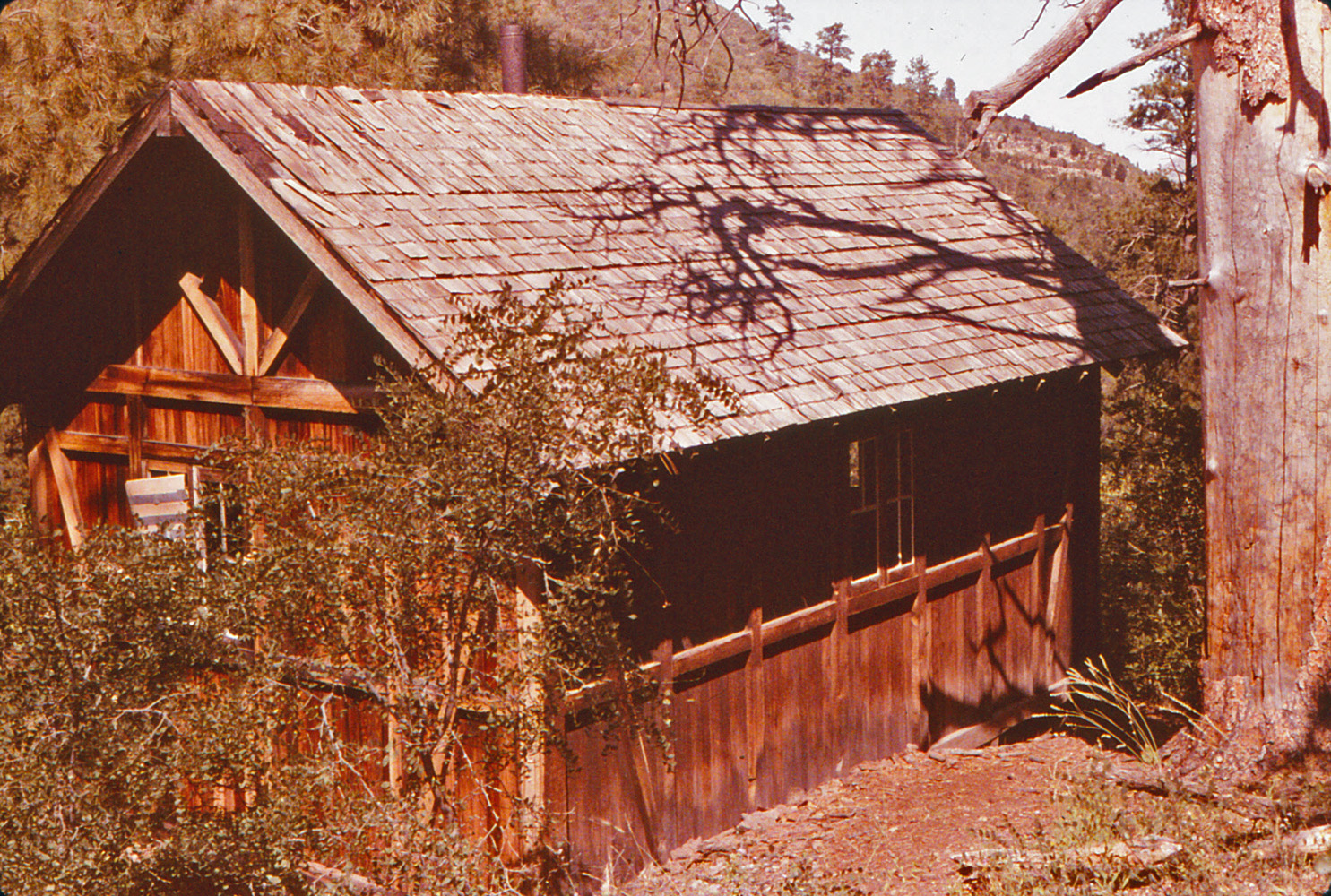
September 4 |
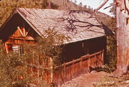
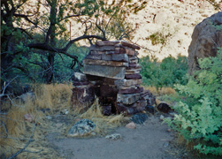
1983 - Cabin on Muav Saddle.. |
1992 - Ghost Rock on the Cranberry route. |
1993 - Posing above White Creek. |
1995 - Thunder River. |
1999 - Dogs atop Big Saddle Trail. |
|
In 1983,
Karen Herrera and I did a day hike from our make-shift camp along the
Swamp Point road to the North Bass and down to Muav Saddle, stopping by
to visit this old cabin.
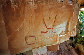
In 1992,
Neil Jacobs, Brian Maris and I did a hike down the old Thunder River
Trail in search for the Cranberry route to Deer Creek. Along the
way we passed the well-known "Ghost Rock" pictograph.
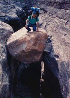
In 1993, Neil Jacobs, John Eastwood, Brian Maris and I
started a backpacking trip down the North Bass Trail. We camped
the previous night in the creekbed above the White Creek drop off due to
my heat exhaustion. I felt much better this day and posed on one
of the stuck boulders near the drop off.
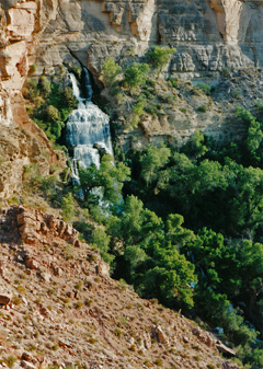
In 1995, John Eastwood and I did a backpacking trip in the
Thunder River area of the canyon. This was our last day as we
hiked up past Thunder River and back to the rim at the Bill Hall Trail.
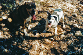
In 1999, I camped at the head of what I
call the Big Saddle Trail near Crazy Jug and took day hikes down into
the canyon. I brought my dogs Peppyr and Rocket with me on this
trip. |
|
|
|
September 5 |

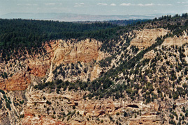
1992 - Neil and Brian at Redwall camp. |
1993 - Chimney at Bass camp in Shinumo. |
1999 - Big Saddle trailhead area. |
|
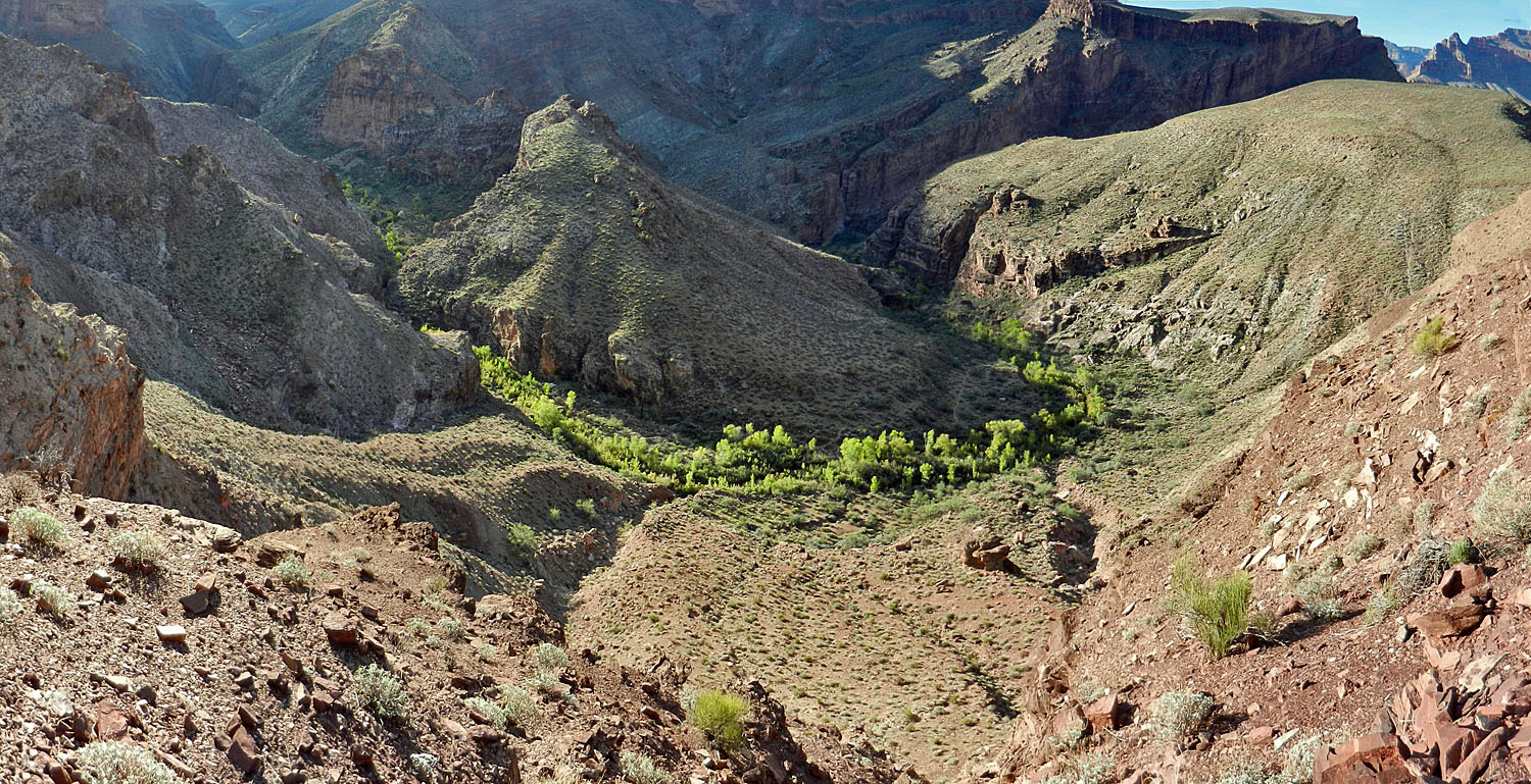
In 1992,
Neil Jacobs, Brian Maris and I did a hike down the old Thunder River
Trail in search for the Cranberry route to Deer Creek. Carrying
packs through the Redwall descent and we camped at a great spot nearby
with wide panoramic views. This day we did a day hike down the
route to Deer Creek and back (bringing back needed water).
In 1993, Neil Jacobs, John Eastwood, Brian Maris and I
started a backpacking trip down the North Bass Trail. We camped
at the White/Shinumo junction. From here we day hiked down to W.W.
Bass' old campsite, where this big chimney still stood, and to the river
beyond this spot.
In 1999, I camped at the head of what I
call the Big Saddle Trail near Crazy Jug and took day hikes down into
the canyon. Here's the view of the trailhead area on the rim from
down on the trail. |
|
|
|
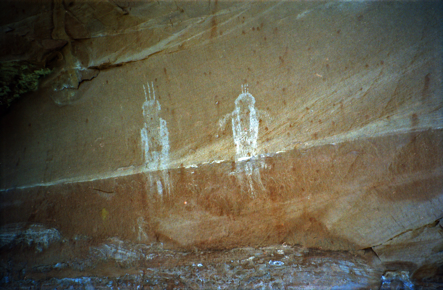
September 6 |
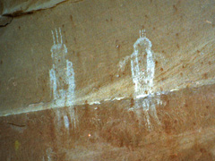
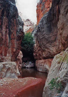
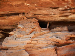
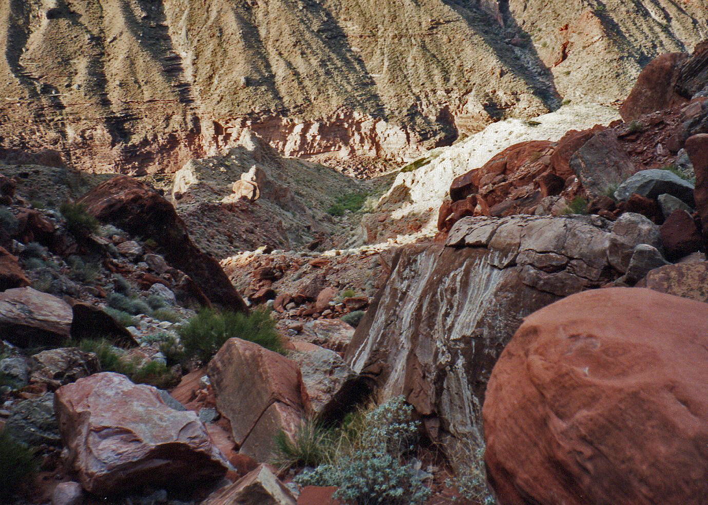
1992 - Pictographs on Cranberry route. |

1993 - Out from the North Bass. |
1999 - Big Saddle trailhead area. |
|
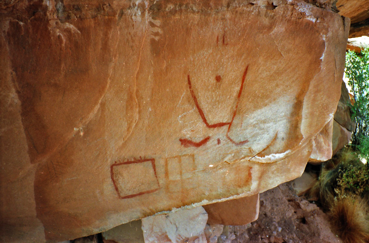
In 1992,
Neil Jacobs, Brian Maris and I did a hike down the old Thunder River
Trail in search for the Cranberry route to Deer Creek. We had
camped for two nights atop the Redwall and this day we hiked out.
Somewhere between the small spring and Ghost Rock we passed by this
interesting pictograph.
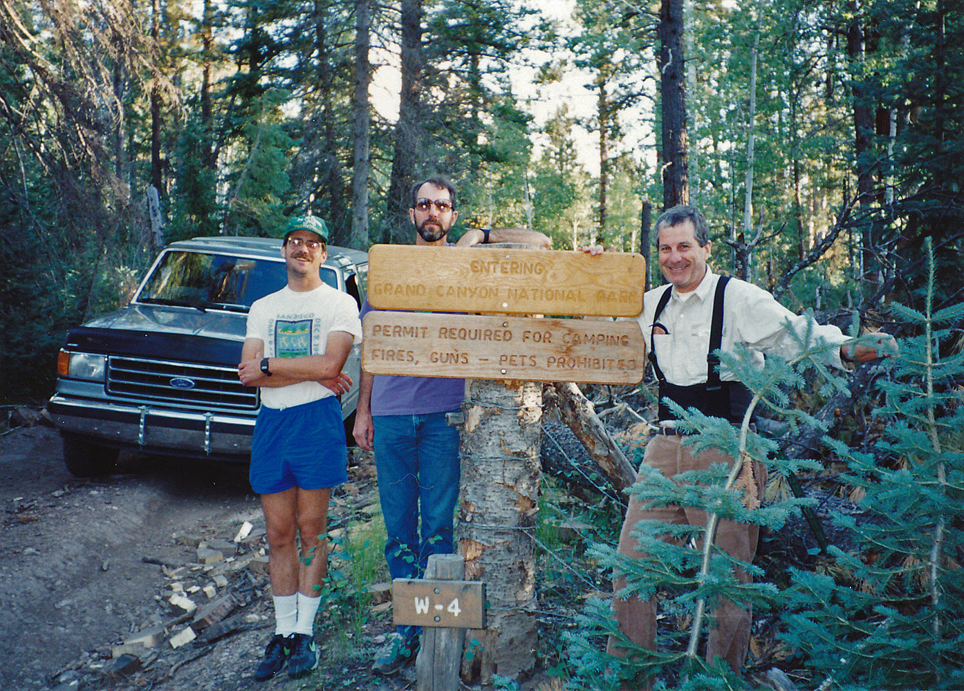
In 1993, John Eastwood, Brian Maris, Neil Jacobs and I did a backpacking trip down the North Bass Trail. We
had camped part way up the previous night and hiked the rest of the way
out today. We stopped at the park boundary on our way out for this
photo.
In 1999, I camped at the head of what I
call the Big Saddle Trail near Crazy Jug and took day hikes down into
the canyon. This day I packed up, but before leaving drove over to
Parissawampitts Pt. to look back at the Big Saddle trailhead area. |
|
|
|
September 7 |
|
|
|
September 8 |
|
|
|
September 9 |
|
|
|
September 10 |
|
|
|
September 11 |
2016 - Muav waterfall on Old BA Trail. |
|
In 2016, I
did a looping day hike from the North Kaibab trailhead over to the Old
BA Trail, down to the Manzanita bridge and back up the North Kaibab.
Hiking along the rim was great - easy stuff and nice and cool with a
5:45 am start. There are brushy areas along the trail down through
the Kaibab, Toroweap and Coconino, but I was able to hold the trail all
the way. [I think if you miss a spot you won't be able to walk for
too long before realizing you need to retrace your steps.] By 11
am I was at the Muav spring and waterfall (shown in the photo) and
thinking I'd be to Manzanita by noon. Alas that was not to be.
The route immediately got hard to follow and I'm sure I was often not on
the old trail. Getting through the next couple of bays was
grueling and I overshot the descent. I reached a point where I
could see down to the creek and see the big rock where you cross - I had
been there this past July. Backtracking was a mess as was trying
to follow next to the creek to get to the crossing point. It was
just after 1 pm when I got across the Bright Angel and took a long
break. It was nearly 2:30 pm before I continued on my way and the
heat soon was getting the best of me. Thankfully the route up from
the Manzanita was all in shade, but I didn't leave here until 4:15 pm.
I was fighting nausea all the way to the rim, which meant I couldn't eat
anything and I could tolerate only a little water from time to time.
I had the trail mostly to myself as night fell and dragged myself out at
10 pm. It was a long day! Once home, I found that I was down
9 pounds!! |
|
|
|
September 12 |
1994 - The first barrier in Indian Hollow. |
2013 - Access interrupted at the North Bass. |
|
In 1994,
I did a looping backpacking trip down Indian Hollow to Kanab Creek, then
down to the river and back up to the rim via the Cranberry route.
Here is my pack at the bottom of the first barrier going down Indian
Hollow. I wrote up a fuller account
here.
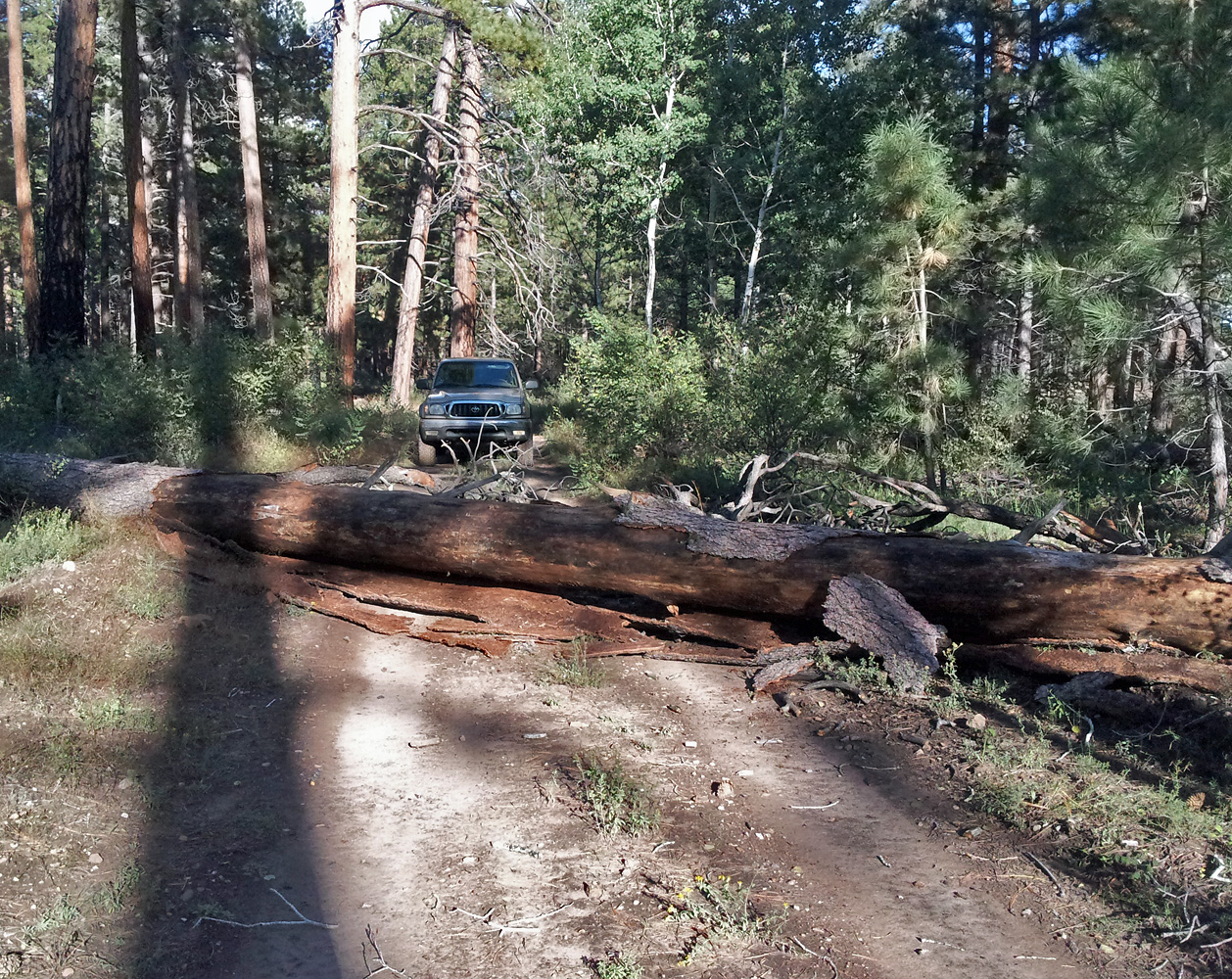
In 2013, I was out on the North Rim to hike down the North
Bass. This day I checked out the road and was greeted with this
obstacle. I was able to hack a way around it and then surprised to
find two vehicles parked at the trailhead! I wrote a fuller
account
here. |
|
|
|
September 13 |
1994 - The "Obstacle Pool" in Indian Hollow. |
1981 - Sinking Ship ruins. |
2013 - Lancelot Pt., where I was headed! |
|
In 1981,
I did a day hike out from the Buggeln Picnic Area around the Sinking
Ship formation to look for some of the ruins out there like this one.
In 1994,
I did a looping backpacking trip down Indian Hollow to Kanab Creek, then
down to the river and back up to the rim via the Cranberry route.
On this second day, I hiked down from the Esplanade to lower Jumpup.
Here is the "Obstacle Pool" that George Steck describes near the end of
Indian Hollow. Barely visible to the right is my rope that I used
to lower my pack where it was dry. I wrote up a fuller account
here.
In 2013, I was out on the North Rim to hike down the North
Bass. This day I wanted to hike out to Lancelot Pt., which
involves hiking through the brush-choked forest. Despite my best
efforts, I ended up at a point to the northeast of the point, which you
can see here in this photo (along with my Spot as I was able to see my
route later). Surprisingly, I had enough cell service here to send
text messages! I wrote a fuller
account
here. |
|
|
|
September 14 |

1994 - The iconic Scotty's Castle. |
2013 - Bass Tomb. |
|
 In 1994,
I did a looping backpacking trip down Indian Hollow to Kanab Creek, then
down to the river and back up to the rim via the Cranberry route.
On this third day, I hiked down from Jumpup Canyon to Kanab Canyon and
down to camp near the so-called Scotty's Castle, shown in the photo.
To the right is Jack Hillers' 1872 photo of the same formation, which
you can access
here. [Click on it for a bigger image.] I wrote up a fuller account
here. In 1994,
I did a looping backpacking trip down Indian Hollow to Kanab Creek, then
down to the river and back up to the rim via the Cranberry route.
On this third day, I hiked down from Jumpup Canyon to Kanab Canyon and
down to camp near the so-called Scotty's Castle, shown in the photo.
To the right is Jack Hillers' 1872 photo of the same formation, which
you can access
here. [Click on it for a bigger image.] I wrote up a fuller account
here. In 2013, I was out on the North Rim to hike down the North
Bass. This day I started my trek down the North Bass Trail.
I had hoped to camp at Shinumo Creek, but the heat took its toll on me
and I camped in the dry bed of White Creek, near a nice little pool of
water, with a great view of Bass Tomb, aka Holy Grail Temple. I wrote a fuller
account
here. |
|
|
|
September 15 |

1994 - In Scotty's Hollow. |
2013 - Granary in White Canyon. |
|
In 1994,
I did a looping backpacking trip down Indian Hollow to Kanab Creek, then
down to the river and back up to the rim via the Cranberry route.
On this fourth day, I did a morning day hike up Scotty's Hollow a bit
(shown in the photo) and then packed up and moved my camp down Kanab to
the area near the Slide of Susurrus. I wrote up a fuller account
here.
In 2013, I was out on the North Rim to hike down the North
Bass. This day I finished my first day goal of getting to Shinumo
Creek to set up camp. That turned out fine as in lower White
Canyon I was able to find Bass' old route out to the north, which hikers
today use to start a long contour into the Merlin area. I was able
to follow a bit of a path and found a large cairn atop the Tapeats.
At this point White is fairly wide and on the south side I found an old
camp, used by the ancient Indians as well as by Bass (in all
likelihood). Near the rock walls outlining some room areas I found
this granary wedged into the cliff. I wrote a fuller
account
here. |
|
|
|
September 16 |
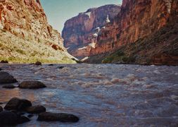
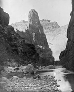
1994 - Kanab Rapids. |

2013 - Comparison photo on North Bass. |
|
In 1994,
I did a looping backpacking trip down Indian Hollow to Kanab Creek, then
down to the river and back up to the rim via the Cranberry route.
On this fifth day, I did a morning day hike up to the Slide of Susurrus and then packed up and moved my camp down
to Kanab Rapids, shown in the photo. I wrote up a fuller account
here.
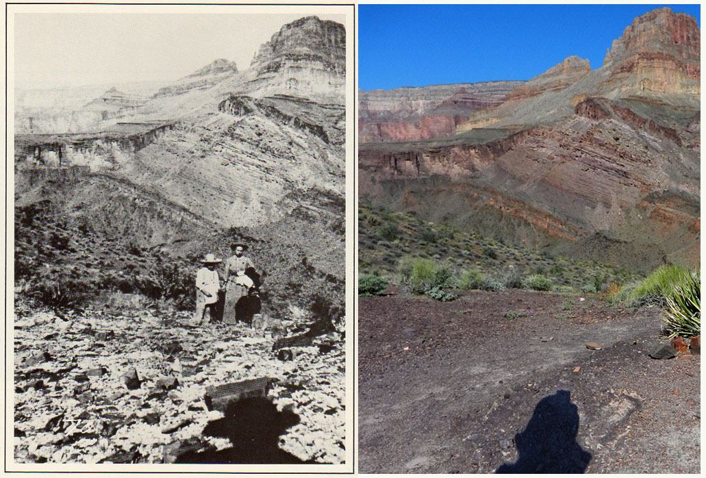
In 2013, I was out on the North Rim to hike down the North
Bass. This day I did a day hike from my camp at the White/Shinumo
junction. I was able to poke around Bass' camp down the creek as
well as go over to the site of his cable tram that crossed the Colorado
River. I had brought along some old pictures and was able to put
together this cool comparison photo - on the left is Bass' picture of
his son and wife and on the right the picture I took, separated by more
than a hundred years. Nailed it! I wrote a fuller
account
here.
In 1983, I did a hike out to Pt. Sublime to see the ruins there.
In the early evening I had someone drop me off at the old, closed, road
near the North Rim entrance station and I camped along that road for the
night. [No photos for this day.] |
|
|
|
September 17 |
1983 - Pt. Sublime ruins. |
1994 - Fishtail Rapids. |
2013 - In Shinumo Amphitheater. |
|
In 1983, I did a hike out to Pt. Sublime to see the
ruins there. I had to walk in on a closed dirt road from the
highway (and back to the lodge) and camped my first night along the
road. This day I arrived at Pt. Sublime in the late morning and
hung out for a bit at the picnic area. The key to finding these
ruins (at least, back then) was to wait for a helicopter tour to fly by,
check out where they were hovering and then make your way back down the
road and through the woods to find the break leading down through the
Kaibab. Well, that worked for me and here is a shot I got of me at
the main ruins site.
In 1994,
I did a looping backpacking trip down Indian Hollow to Kanab Creek, then
down to the river and back up to the rim via the Cranberry route.
On this sixth day I only packed up from Kanab Rapids and hiked to
Fishtail Rapids for my next camp. It was very hot and all I did
was hang out in the shade all day, including what I could create with my
poncho tied up in a tamarisk as shown in the photo. I wrote up a fuller account
here.
In 2013, I was out on the North Rim to hike down the North
Bass. This day I did another day hike from my camp at the White/Shinumo
junction. I went back to Bass' camp and did a more thorough tour
of his garden area and then located the route out that leads to his old
mines in Hakatai Canyon. I had thought to follow this route for
some distance, but it was so hot that I retreated back to a shady spot
along the Shinumo where I spent most of the afternoon. While on my
way down the creek in the late morning I got this great view of the
canyon with a partly cloudy blue sky. I wrote a fuller
account
here. |
|
|
|
September 18 |
1981 - Jicarilla Pt. petroglyphs. |

1983 - On the return from Pt. Sublime. |

1994 - The lower part of Cranberry route. |

2013 - Middle Earth Shinumo Amphitheater. |
|
In 1981, I did a day hike out to Jicarilla Pt. to
see the many petroglyphs down below the Kaibab. You have to get
down at a spot where there was a big dead tree wedged in to help me and
then there were glyphs on both sides of the little sky island here, with
a steep dropoff on each side.
In 1983, I did a hike out to Pt. Sublime to see the
ruins there. On my third day I returned to the lodge by hiking
along the dirt road past this rather new road/trail sign. I'm
pretty sure that at this time all these dirt roads were closed to
traffic, unless you managed to come in from the national forest.
In 1994,
I did a looping backpacking trip down Indian Hollow to Kanab Creek, then
down to the river and back up to the rim via the Cranberry route.
This was my last day. I packed up from
Fishtail Rapids and the steep slope leading up to the Cranberry route
looked so foreboding that I decided to take the real long route out via
Deer Creek. But, when I reached the spring along this river trail
I changed my mind and up I went. What a slog. This shot is
looking back down to the river from about halfway to the top of the
Redwall, where things get easier. I wrote up a fuller account
here.
In 2013, I was out on the North Rim to hike down the North
Bass. It was quite hot during this trip and I decided it would be
wise to allot two days to the hike out. I hiked down from my camp at the White/Shinumo
junction to exit via the bypass trail, which is in great shape but took
me a while to find the previous day. This shot is from near the
top of the bypass before it heads over into White Canyon and you leave
Shinumo for good. Bass' camp is further down stream around the
bend to the right, while my camp was further upstream around the bend to
the left. I wrote a fuller
account
here. |
|
|
|
September 19 |
2013 - In Shinumo Amphitheater. |
|
In 2013, I was out on the North Rim to hike down the North
Bass. This was my last day as I hiked back up to the rim from my
camp below the Redwall. I missed the trail out of the bed in here
and dead-ended at a large pool of water. I backtracked a bit and
then saw a way to climb up to a place where I thought I'd find the
trail. Well, that not only worked, but I found myself on some
older trail, with very clear signs of trail construction as you can tell
from the photo. A few years ago a trail crew was in this canyon
completely rehabilitating the North Bass trail. Either they missed
this section or it was something that Bass abandoned in favor of a
better route. I wrote a fuller
account
here. |
|
|
|
September 20 |
|
|
|
September 21 |
|
|
|
September 22 |
|
|
|
September 23 |
|
|
|
September 24 |
|
|
|
September 25 |

1999 - Sinking Ship. |
2009 - At the Crystal Forest Caves. |
|
In 1999, I did a day hike down the New Hance trail
with Neil Jacobs. As we neared the saddle with Coronado Butte we
had a great view to the west of Sinking Ship (aka the "Three Castles" in
G.W. James' time). We went as far as the top of the Redwall and
then contoured a bit to the west before turning around and heading back.
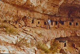
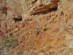
In 2009, Cara Lynn and I did a three day hike down
Grandview and over to the South Kaibab. Even through it was the
end of September it was very hot on this trip. We camped, on this
first day, at Cottonwood Creek. On our way down we stopped and
made an extended visit to the Crystal Forest Caves below the Redwall.
The arrow points to a wooden door at one of the caves up above Cara
Lynn. Cottonwood was bone dry but another group was there and they
graciously gave us enough water so we could get to Grapevine the next
day. I wrote up an article about this hike for the local paper
here. |
|
|
|
September 26 |
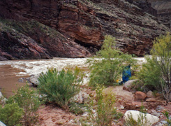
2009 - On the Tonto Trail. |
|
In 2009, Cara Lynn and I did a three day hike down
Grandview and over to the South Kaibab. Even through it was the
end of September it was very hot on this trip. On our second day I
got this nice shot of Cara Lynn hiking along the Tonto Trail in the
early morning with Angels Gate, Wotans Throne and Vishnu Temple in the
background. We would make an extended stop in Grapevine to get
water and wait out the worst of the heat before pushing on and camping
in Boulder Canyon for the night. I wrote up an article about this
hike for the local paper
here. |
|
|
|
September 27 |

2009 - Lonetree Canyon. |
|
In 2009, Cara Lynn and I did a three day hike down
Grandview and over to the South Kaibab. Even through it was the
end of September it was very hot on this trip. On our last day we
hiked through a dry Lonetree Canyon (shown in the photo) although later
I learned that there is a reliable spring just a short ways down the
canyon. The heat drove us into a shady overhang in Cremation
Canyon for over three hours. Even so, we were just totally
exhausted, breaking often on our very slow hike up and out the South
Kaibab - we didn't reach the rim until after 3 a.m. the next morning! I wrote up an article about this
hike for the local paper
here. |
|
|
|
September 28 |
|
|
|
September 29 |
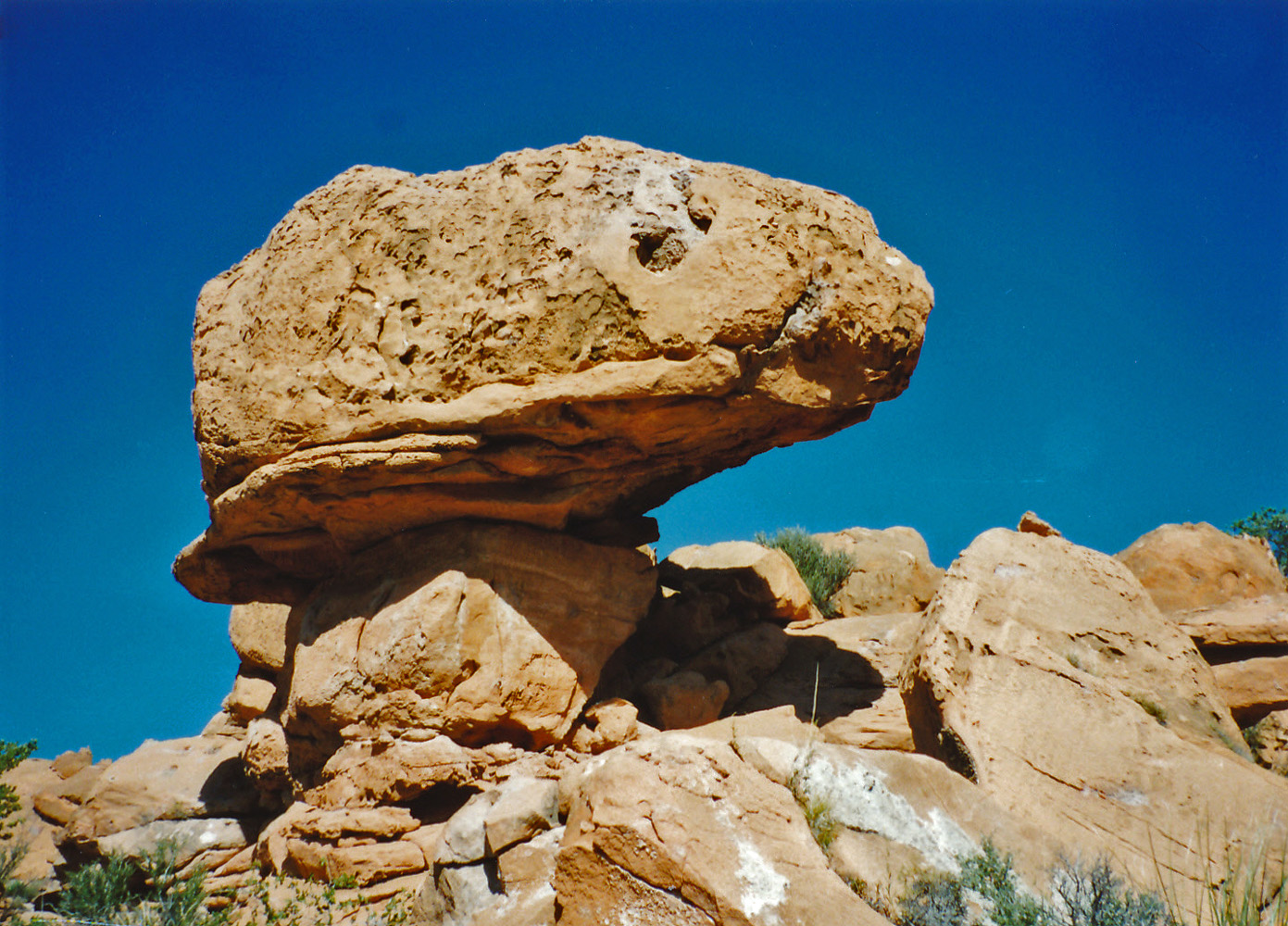
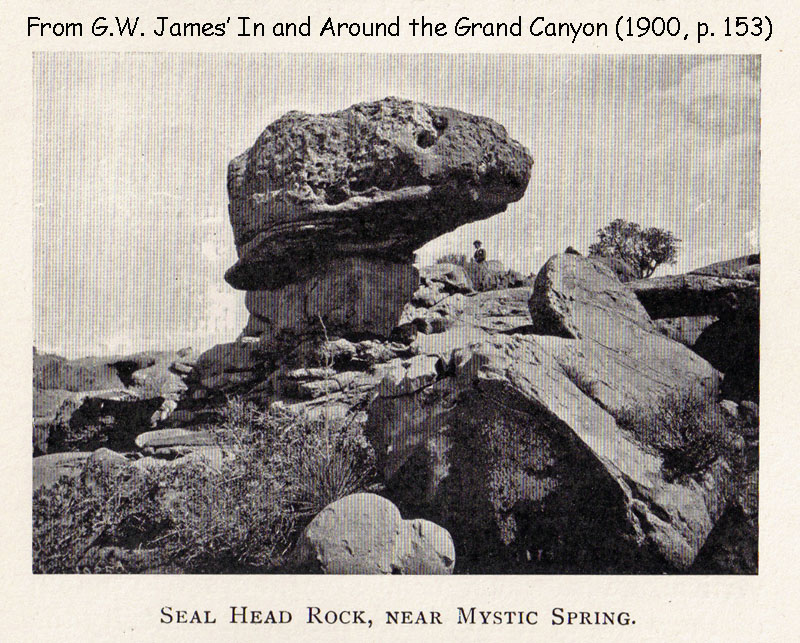
1995 - Seal Head Rock. |
G. W. James, published in 1901. |
|
In 1995, I did backpacking trip down the South Bass
as far as the Esplanade with a few objectives in mind. On the hike
in, I dropped my pack where the faint trail heads west and I did a hike
out to find Mystic Springs, a water source used by Bass in his early
days at the canyon. I had some photos with me from G. W. James'
old book and I was able to find the spring and replicate the photos.
Here is my picture of what James called "Seal Head Rock" taken from
about the same angle as his. [Note that there is someone in the
background of James' photo.] I wrote up a fuller account on this
trip
here. |
|
|
|
September 30 |

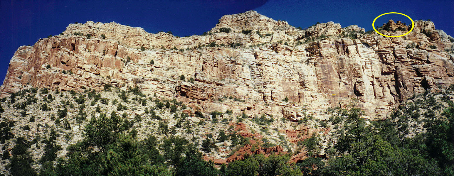
1995 - Panorama of Pt. Huitzil from Esplanade. Twin towers in Toroweap
highlighted. |

1981 - Route to Skeleton
Pt. from Tonto. |
2006 - Erik on the So.
Kaibab Trail |
|
In 1995, I did backpacking trip down the South Bass
as far as the Esplanade with a few objectives in mind. I camped
for two nights on the Esplanade. On this second day I day hiked
over to try and find the route up Pt. Huitzil, armed with notes from
Harvey Butchart. I had earlier been unable to find the route down
from the rim and thought I might have more luck going up. It was
not to be, although later, when I did find the route down, it turns out
that I was very close! One of the markers for this route are two
towers in the Toroweap, circled in the photo. I wrote up a fuller account on this
trip
here.
In 1981, I did a day hike down the South Kaibab with June
Stengel as far as Phantom Ranch. She was going to spend a couple
of days hiking to the North Rim and then hike back. I took the
opportunity to do an interesting route - I followed the "old miner's
trail" from the silver bridge up to the Tonto and then up a bushwhacking
route (shown in the photo) that put me on the South Kaibab near the top
of the Redwall. Great day hike!
In 2006, Erik Drake and I did a rim-to-rim hike, down the
So. Kaibab and up the North Kaibab, with a night at Cottonwood
Campground. We were facilitating a key exchange for a group that
was going to day hike north to south on October 1st. Here is Erik
on the South Kaibab Trail just before Panorama Pt. |
|
|


