|
August 1 |
 |
|
August 2 |
 |
|
August 3 |
 |
|
August 4 |
 |
|
August 5 |
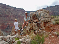
2008 - John & Jim at water cache on the Tanner Trail. |
|
In 2008, I
short day hike with John Eastwood and his friend Jim. John wanted
to cache some water on the Tanner Trail for his daughter Erin's upcoming
canyon backpacking trip. We left some water near the 75 Mile
Canyon saddle and some here, near to where the trail tops out above the
Redwall. Hat tip to Chris Forsyth on this spot, which we had used
in May of 2008. It was a hot day, but the light overcast helped
quite a bit. We even did get some light rain on the way back.
We started down at 6 a.m. and were back to the rim at 3:30 p.m. |
 |
|
August 6 |
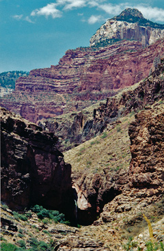
2000 - Passing Ribbon Falls on R2R. |
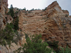
2008 - The Kaibab switchbacks on
the South Kaibab Trail. |
|
In 2000, I
did a rim-to-rim day hike, south to north, with John Eastwood.
[I'm pretty sure it will be the last!] I left home at 4 a.m. and
we were on the trail a few minutes past 6 a.m. We were at Phantom
before 9:30 a.m. and despite it being very hot, this hike was going
well. But, hiking through the "box" wiped me out. We dragged
ourselves into Cottonwood at 2 p.m. and stayed there for an hour and a
half. [The photo is of Ribbon Falls with just a touch of sun
shining on the water.] John was doing well, but I was still
suffering from some heat exhaustion. We were at the Aiken's
residence at 4:15 p.m. and despite there being a light rain I was still
just shuffling along and feeling ill. The trek up the North Kaibab
from here took six more hours and somewhere above the Supai Tunnel my
nausea caught up with me. I felt a lot better then, but our day
was still not done. I had gotten one of my students - Becky
Pallack - to drive over to the North Rim to pick us up and drive us back
to the South Rim so we could pick up my truck. She was
well-rewarded, although I doubt she would have offered to do that again!
I'm pretty sure that we did get back to Flagstaff before sunrise.
In 2008, I did a day hike with colleague Russell Crook down the
South Kaibab to Cedar Ridge. Coming back up you get this great
view of all the switchbacks in the Kaibab limestone. |
 |
|
August 7 |
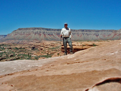
2011 - Atop a "sky island" in Kwagunt Hollow. |
|
In 2011, I
drove up to the North Rim to do a short day hike into Kwagunt Hollow via
the Sowats Trail. My notes read, "Hot! Hot! Hot!" And, so it
was. I got this picture from atop a neat little "sky island" on
the Esplanade where I was poking around. I found trash, perhaps
from an old cowboy camp. I left my home in Flagstaff at 6 a.m.,
was on the trail at 10 a.m., back up to the rim by 4:30 p.m. and back
home at about 9:30 p.m. making it a full day. More on this hike
and photos at my web site
here. |
 |
|
August 8 |
|
In 1983, I did
a R2R2R over the course of 27 hours (north to south to north). I
went up the BA and met up with Sally Sulkoski (?sp) for a little dinner
and a ride out to the SK for the return trek. [I think she was
managing the Yavapai Cafeteria at the time.] I did well until my
return at/about Cottonwood. Somewhere near there I laid down on a
big rock and fell asleep for four hours. Once awake and up, I was
fine the rest of the way to the rim. [No photos.] |
 |
|
August 9 |
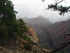
2012 - Thunderstorm on the Grandview. |
|
In 2012, I hiked down the Grandview to check if any water
from our monsoons had filled up O'Neill Spring, which is off the west
side of Horseshoe Mesa (shown in the photo). Alas, bone dry.
I had cached two frozen liter bottles on the way down and they were much
appreciated on the way up as the heat was getting to me. But, up
in the Coconino we finally got some clouds, then rain and then
lightening. One bolt struck very close to two hikers a switchback
ahead of me and it was so loud it knocked me down to my knees. The
three of us huddled together at an inside switchback for about a half
hour while the storm slowly blew away. The full story and more
photos
here.
In 2001, Cara Lynn and I took our first little hike together on a
day trip up to the canyon. While sight-seeing along the East Rim
Drive, we hiked down the Grandview about a half mile. [No photos.] |
 |
|
August 10 |
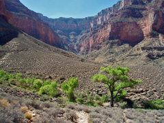
2007 - Cottonwoods beckon at Burro Spring. |
|
In 2007, I
did a hike with Bill Ferris down the South Kaibab, across the Tonto and
up the Bright Angel. We were on the trail at a bit past 6:30 a.m.
and back out at 5:15 p.m. Here we are on the Tonto approaching
Burro Spring. Nice shade here but usually little/no water.
And, Pipe Creek is only about fifteen minutes away. [Afterwards I
wrote up a critical blog and letter to the local paper on our experience
with poor service -
here.] |
 |
|
August 11 |
 |
|
August 12 |
 |
|
August 13 |
 |
|
August 14 |
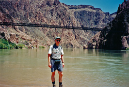
1998 - At the Colorado River near Phantom Ranch. |
|
In 1998, I
took my visiting brother-in-law, Bob Stabo, up to the canyon for a day
hike down the South Kaibab to Phantom Ranch. Here is Bob at the
Boat Beach just after we crossed on the black bridge. It was a hot
day and I was really feeling it on the way back up, especially in the
stretch between O'Neill Butte and Cedar Ridge. My nausea got the
better of me, but not before we actually topped out and were on our way
down the road to our vehicle. |
 |
|
August 15 |
 |
|
August 16 |
 |
|
August 17 |
 |
|
August 18 |
 |
|
August 19 |
 |
|
August 20 |
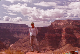
1983 - Atop the descent into Surprise Valley. |
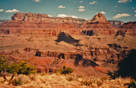
2000 - Wotan's Throne & Vishnu Temple from Ayer Pt. |
|
In 1983, I
did a hike down the Bill Hall Trail to Deer Creek to lay in a cache for
a planned hike I had for later in the fall. I went with Shane, the
son of one of our maintenance guys at the North Rim. He was about
14 and had an odd sense of hiking food - frozen burritos and Cheerios.
But, his dad drove us out to the trailhead and picked us up four days
later. Here I am posing at the top of the descent into Surprise
Valley on our first day.
In 2000, I hiked down the Grandview to check on a route up
to Ayer Point (from Hance Creek). My sister Sue joined me for the
initial mile or so, but otherwise there wasn't anyone around. I
found the route - it's obvious - although there is a series of steps up
through a band in the Redwall that stalled me for a bit. Here is
the view from the point, looking across the river to Wotan's Throne and
Vishnu Temple. As an aside, in G. W. James' book on the canyon
from the early 1900s, he ascribes Ayer's name to what we know of as
Coronado Butte today. And, it was named for Mrs. Ayer, for her
enthusiasm in joining her husband on a trek into the canyon in the
1880s. [He ran a lumber mill in Flagstaff.] |
 |
|
August 21 |
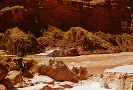
1983 - My pack at Fishtail Rapids. |
|
In 1983, I
did a hike down the Bill Hall Trail to Deer Creek to lay in a cache for
a planned hike I had for later in the fall. On this day I left a
big cache, in a five gallon bucket, in Deer Creek and a mini-cache at
Fishtail Rapids. Here is my pack - an old frame Jansport - laying
on a rock near the rapids.
In 1981, I started a three day trip down Grandview to Cottonwood
Creek with Sally Sulkoski, who was also working on the South Rim at this
time. [Although my records show I have photos, I can't find any.] |
 |
|
August 22 |
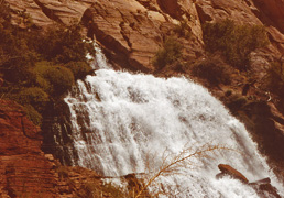
1983 - Near the outlet for Thunder Spring. |
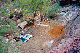
1999 - Afternoon break on Hance Trail. |
|
In 1983, I
did a hike down the Bill Hall Trail to Deer Creek to lay in a cache for
a planned hike I had for later in the fall. On this day Shane and
I hiked over to Thunder River and spent most of the day there before
camping on the Esplanade. I made the climb up to the outlet for
the spring although there is an exposed corner I had to be talked back
around on the way down!
In 1999, I hiked down the Hance Trail to the river. It
was a clear day, but very hot. I cached some icy water atop the
Redwall for my return. But, even before ascending the Redwall I
was suffering from the heat and followed the bed up to this shady spot
where there was a small pool of water at the bottom of an otherwise dry
fall. Even after a couple of hours here I was barely able to climb
the Redwall and ended up spending an unintended night in the ravine that
leads up to the Coronado/rim saddle where I had left my cache.
In 1981, I was on the second day of a three day trip down Grandview
to Cottonwood Creek with Sally Sulkoski, who was also working on the South Rim at this
time. [Although my records show I have photos, I can't find any.] |
 |
|
August 23 |
|
In 1981,
this was the last day of a three day trip down Grandview
to Cottonwood Creek with Sally Sulkoski, who was also working on the South Rim at this
time. [Although my records show I have photos, I can't find any.]
In 1983, I
did a hike down the Bill Hall Trail to Deer Creek to lay in a cache for
a planned hike I had for later in the fall. This was the final day
for Shane and I as we hiked out and met up with his dad for the ride
back to the North Rim. [No photos for this day.]
In 1999, I hiked down the Hance Trail to the river. It
was a clear day, but very hot. Although it was to be a day hike,
the heat knocked me out and I spent the night in the Supai layer.
Early this morning I felt fine and hiked out the last 2-3 miles without
any problems. [No photos for this day.] |
 |
|
August 24 |
1996 - Suzanne & Randall in Hermit Basin. |
2006 - O'Neill Butte on the South Kaibab. |
|
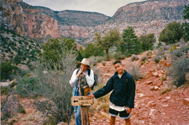
In 1996, I
did a day hike in the Hermit area with my sister Suzanne and Tom
Kelley's son, Randall. We got a late start - a little after 11 am
- and finished up late in the day, at just past 6 pm. We did one
of my favorite loops here - along the old Erimita Mesa road to the
Dripping Springs (or, Silver Bell) trailhead, then down to the springs
and over into Hermit Basin and back to the rim via the Waldron Trail,
coming out pretty close to where we parked. It was a pleasant day,
not too hot, and we even had a bit of rain while at the springs.
Here, Suzanne and Randall are at the trail junction sign for Waldron and
Hermit.
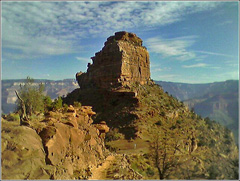
In 2006, I day hiked down the South Kaibab to Phantom Ranch
and back. I was on the trail before 7:30 am, at the ranch from
10:30 to 11:15, and back to the rim at 3:30 pm. Great weather for
this hike - clouds, breezes and relatively cool temps. I snapped
this photo of O'Neill Butte with my phone camera on the way down the
trail. |
 |
|
August 25 |
2001 - With Cara Lynn at PR Canteen. |
2002 - Cara Lynn & Eric at Dripping Spring. |
|
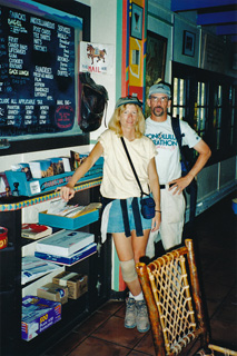
In 2001,
I took Cara Lynn on her first hike down into the canyon, to Phantom
Ranch and back. We got one of the employees to snap the photo of
us in the canteen, by the mail bag and menu board. It was a hot
day and the hike back up was grueling. We started down the South
Kaibab at 6:45 am and were at the Canteen from noon until 2 pm.
Then we hung out at the creek until 3:45 pm. Cara Lynn started up
while I went back to the Canteen to get some ice. I caught up with
her on the long curve below the Tapeats. On the plus side, we had
good moonlight to hike by and topped out at 11 pm!
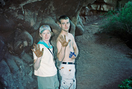
In 2002, Cara Lynn, Erik Drake and I did a
Hermit-Waldron-Dripping Springs-Hermit loop. Here they are at the
spring making some mud handprints. We left Flagstaff at 4 am,
parked at the BA and caught the bus to Hermit's Rest. We started
down the trail at 6:30 am, were back on the rim above Waldron at 8:30 am
and to Boucher's corral at about 10:30 am. We reached Dripping
Springs at noon and stayed until 2:45 pm. We were back at the
Hermit trailhead by 5:30 pm and home three hours later. |
 |
|
August 26 |
 |
|
August 27 |
 |
|
August 28 |
 |
|
August 29 |
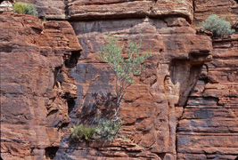
1981 - Tree growing in rock. |
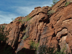
2009 (Oct.) - For comparison; still hanging in there. |
|
In 1981,
I did a very quick overnight hike to Upper Phantom Creek (from the South
Rim). I don't seem to have a journal for this hike, but if memory
serves, it was quite hot and all I did was camp out and return the next
day. But, on the route up to Utah Flats you pass by this tree on
the opposite side of this ravine seemingly growing out of the rock.
I'm sure that everyone who passes by here notes it. And, by way of
comparison, fast forward 28 years and here's a photo I took (Oct. of
2000) showing the same tree, although it doesn't look all that much
bigger! |
 |
|
August 30 |
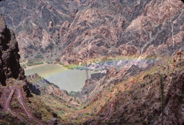
1981 - Rainbow over the black bridge. |
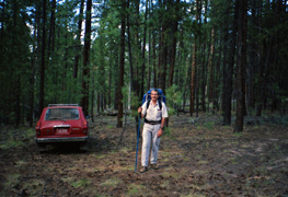
1991 - Heading for Shiva saddle. |
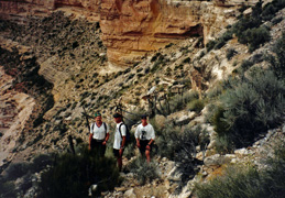
1997 - On the Great Thumb Trail. |
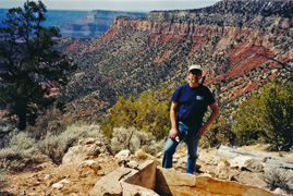
2002 - Trough on the Big Saddle Trail. |
|
In 1981,
I did a very quick overnight hike to Upper Phantom Creek (from the South
Rim). I don't seem to have a journal for this hike, but if memory
serves, it was quite hot and all I did was camp out and return the next
day. But, on this day my return was punctuated by some rain
creating this nice rainbow as I hiked up the South Kaibab.
In 1991, Neil Jacobs and I did a neat looping hike down into
Crystal and out near Pt. Sublime. We got a late start on this, our
first day, reaching the Shiva saddle in the dark. Here, Neil is
ready to go from the place where we parked his car on the Shiva
Expedition road. [My truck was parked near Pt. Sublime.]
In 1997, John Eastwood, Doug Brown and Mathieu Brown
(pictured) and I went up to do a hike down the Great Thumb Trail.
Most of the day was spent in transit, but we did locate the trail and
hike down to the Esplanade. I wrote up a fuller account of this
trip
here.
In 2002, Cara Lynn and I camped at the head of what I call
the Big Saddle Trail near Crazy Jug. This day we took a hike down
the trail, passing this old cement trough, a reminder of days long gone. |
 |
|
August 31 |
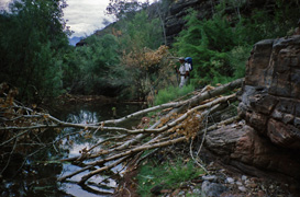
1991 - Beaver pond in Dragon Creek. |
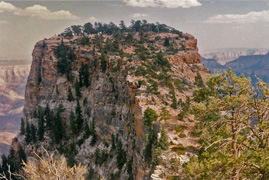
1996 - Unnamed butte above Seiber Pt. |
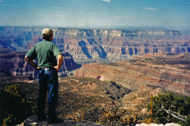
2002 - Overlooking Tapeats Amphitheater. |
|
In 1991, Neil Jacobs and I did a neat looping hike down into
Crystal and out near Pt. Sublime. We camped on the Shiva saddle
our first night and this day we hiked down the ravine into Dragon Creek
where we came across this beaver pond! We didn't see them, but
plenty of freshly gnawed trees were in this area.
In 1996, I dropped off Craig Bain and Doug Brown at the
North Kaibab Trail for them to do a rim-to-rim. I stayed camped at
the Nankoweap trailhead. This day my dog, Peppyr, and I hiked down
the Nankoweap to the broad plateau that led to this fascinating unnamed
butte above Seiber Pt. It's top is in the Coconino layer and the
walking here was sandy! Fantastic views from this spot.
Later this day I met up with John & Kathy Eastwood for another day of
camping and hiking around the rim.
In 2002, Cara Lynn and I camped at the head of what I call
the Big Saddle Trail near Crazy Jug. We did a short hike down the
trail in the morning where we got this nice view looking across the
Tapeats Amphitheater to Great Thumb Mesa. |
 |

