|
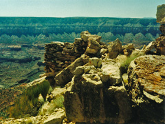
June 1 |
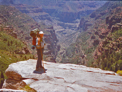
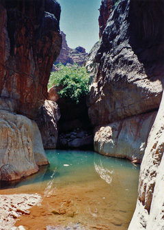
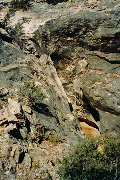
1987 - Deer Springs and Paul waving. |
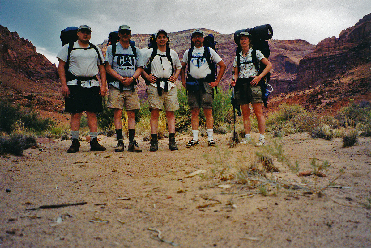
2002 - Ryan, Dick, Dean, Dennis, Cara Lynn. |
|
In 1987,
I did a hike with Paul Eichenberger down the Bill Hall Trail to Deer
Creek. On our third day we visited Deer Springs Falls on our way
to camp on the Esplanade.
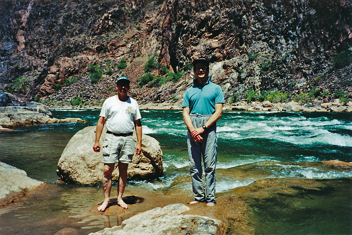
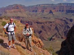
In 2002,
Cara Lynn and I joined Dick Dicenza and his sons, Dean & Ryan, on a
hike down the Paria. This day we finally got out of the water, but
the weather was fine for this more usual backcountry hiking.
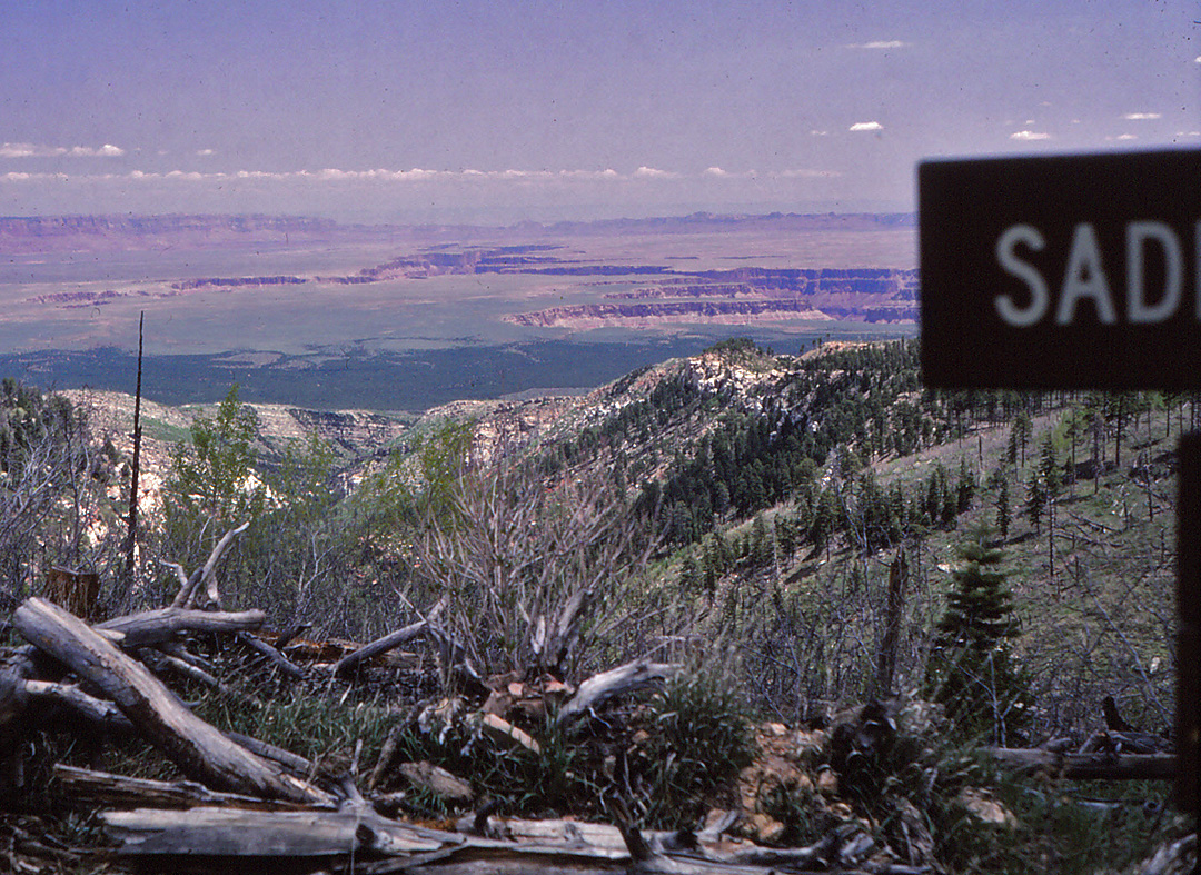
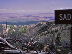
In 2000, I spent a few days with (most of) the Eastwood
family - Megan, John & Kathy - at the Big Saddle camp. This day we
packed up our camp and headed home. [No photos.] |
 |
|
June 2 |

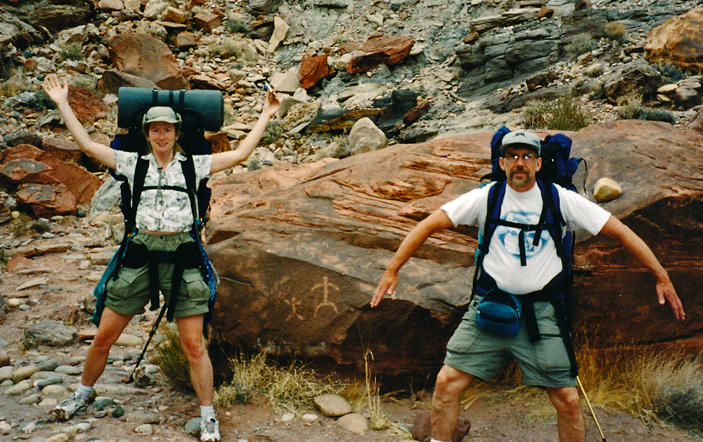
2002 - Acting out petroglyphs with Cara Lynn. |
|
In 2002,
Cara Lynn and I joined Dick Dicenza and his sons, Dean & Ryan, on a
hike down the Paria. On our final day we passed some petroglyphs
as we neared Lees Ferry.
In 1987,
I did a hike with Paul Eichenberger down the Bill Hall Trail to Deer
Creek. We hiked out from the Esplanade this final day of our trek. [No photos.] |
|
|
June 3 |
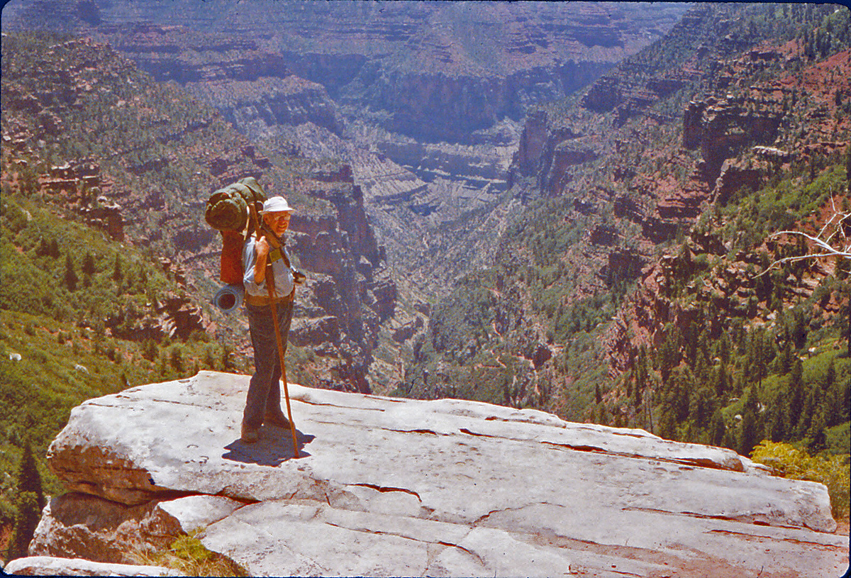
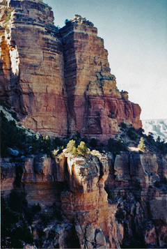
1987 - With my dad on the North Kaibab Trail. |
|
In 1987, I
did a hike with my dad down the North Kaibab Trail to camp overnight at
Cottonwood campground. Here is my Dad on an impromptu viewpoint in
the Coconino overlooking Roaring Spring Canyon. |
|
|
June 4 |
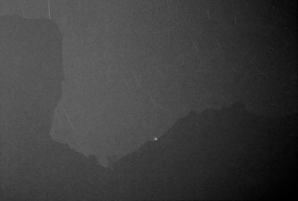
1987 - Night shot from Cottonwood campground. |
|
In 1987, I
did a hike with my Dad down the North Kaibab Trail to camp overnight at
Cottonwood campground. Here is a long exposure I took from our
camp of the stars rotating over the North Rim. The light on the
rim is from the lodge.
In 1981, I did a quick "day" hike down the South Kaibab to Phantom Ranch
and back. I left after work and got back at about 11 p.m. It
was an excuse to visit my sister, Sue, who was then working at Phantom.
[No photos.] |
|
|
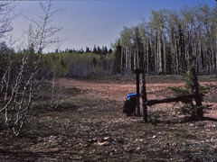
June 5 |
1983 - Along the dirt road to the trailhead. |
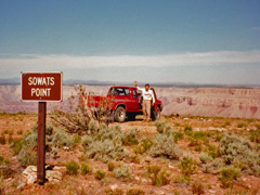
1991 - Neil waves as we check out our route. |
|
In 1983, I
did my first hike down Nankoweap. I had to hike to the trailhead
along the North Rim roads, which were still closed due to downed trees.
My first night I camped along this road.
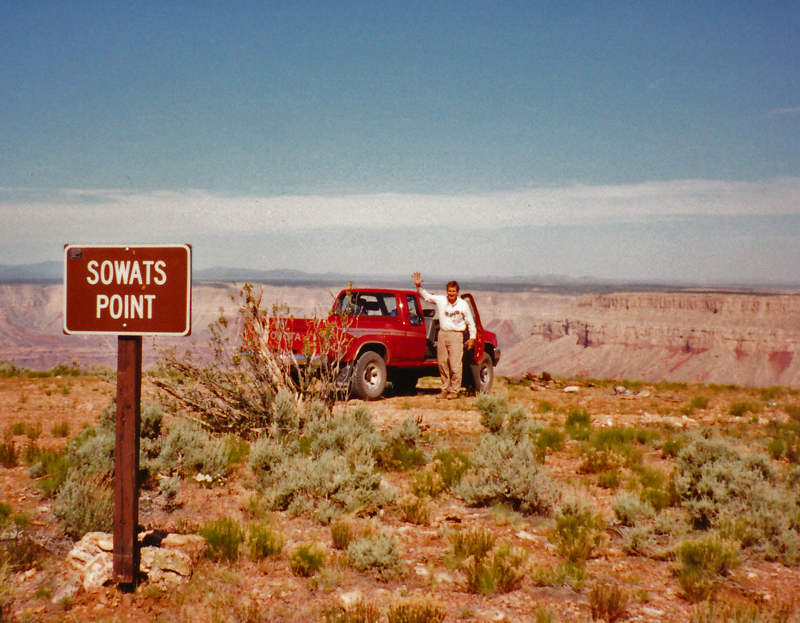
In 1991, I did a hike down into Kanab Canyon via the trail at
Sowats Point with Neil Jacobs. Even in the shaded narrows of
Sowats, Jumpup and Kanab it was brutally hot. |
|
|
June 6 |
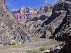
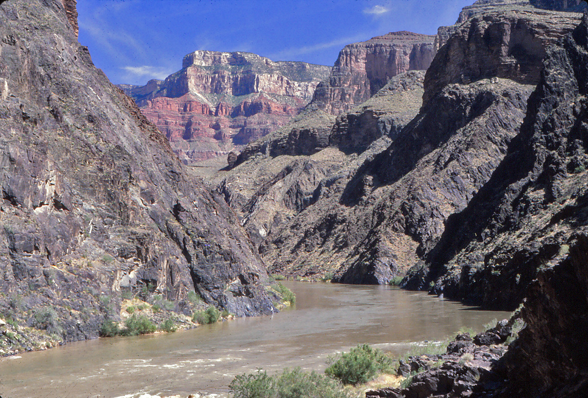
1980 - Colorado River at Boucher Rapids. |
1983 - The view of Marble Platform from the Nankoweap trailhead. |
1991 - At Shower Spring. |
|
In 1980,
I did my first hike down to Boucher. From my camp at the creek I
did a day hike to the river where I took this shot. The next day I
returned to the rim via the Tonto and Hermit trails. Not bad for
two days.
In 1983, I did my first tentative hike down the Nankoweap.
Because all the forest roads were closed (due to downed trees) I was
only able to make Marion Point on my second night. This is the
view from the trailhead looking northerly towards the Echo Cliffs and
Lees Ferry.
In 1991,
I did a hike down into Kanab Canyon with Neil Jacobs. We stopped
at the Shower Spring and ... took a quick shower of course! The
water comes right off all the ferns covering the overhang. |
|
|
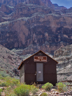
June 7 |
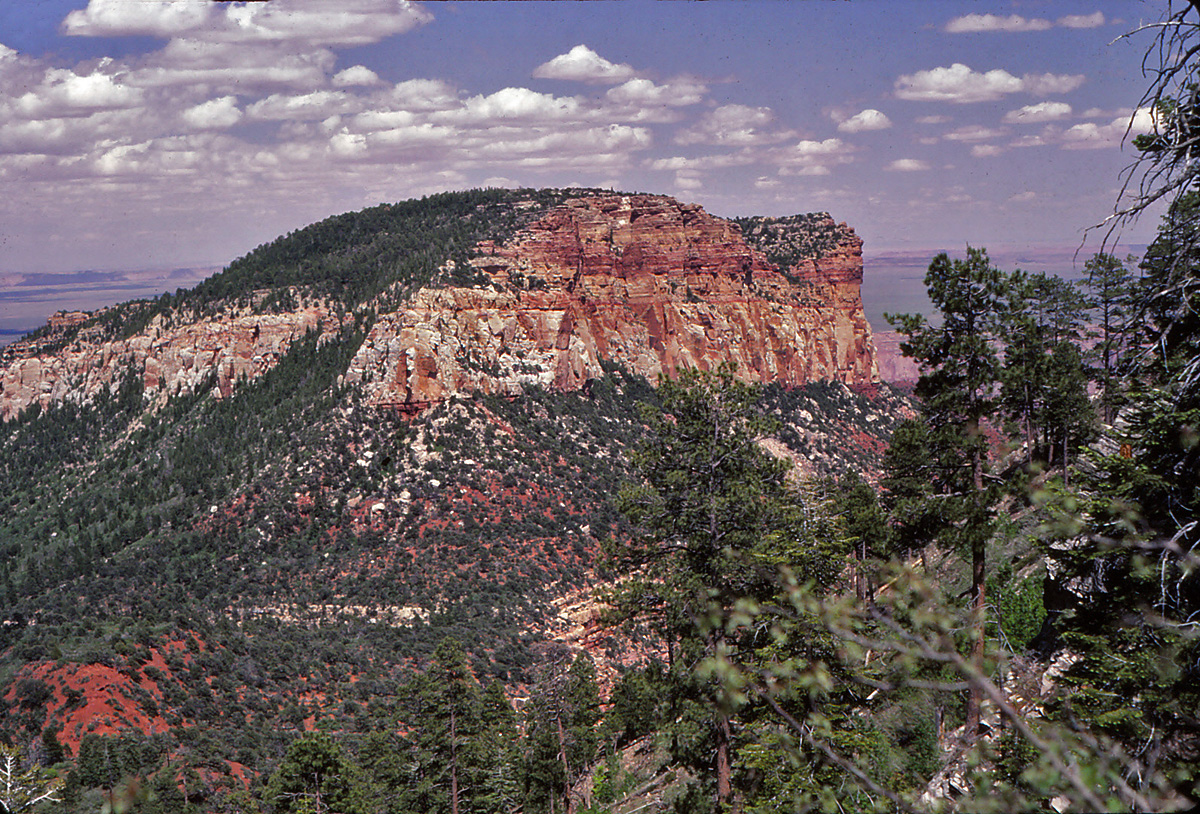
1980 - Hermit Ranger Station. |
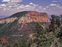
1983 - Saddle Mountain. |
1991 - Scotty's Hollow. |
1993 - Escalante ruins. |

1994 - Starting down Havasu. |
2009 - Jicarilla Pt. petroglyphs. |
|
In 1980,
I did my first hike down to Boucher and overnighted at the creek.
I hiked back out this day, via the Tonto Trail and the Hermit Trail,
taking this picture of the old ranger station along the way.
In 1983, I did my first tentative hike down the Nankoweap.
Because all the forest roads were closed (due to downed trees) I was
only able to make Marion Point on my second night. The third day I
got this
view of Saddle Mountain as I hiked back to the trailhead. From
there I followed the old fire road to Pt. Imperial. Part way back
along that literally just-opened road I snagged a ride the rest of the
way back to the lodge. FWIW, we only got one day off a week
working at the lodge, so my hike started at the end of my last work day
and finished just before the start of my first work day.
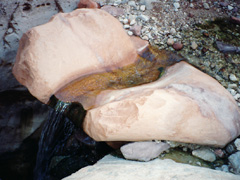
In 1991,
I did a hike down into Kanab Canyon with Neil Jacobs. This day we
just hiked up Scotty's Hollow and enjoyed the pleasant environment.
This really cool pouroff for a small waterfall especially charmed me.
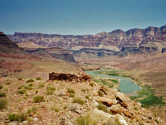
In 1993, I did a day hike down Tanner, over the
Cardenas/Escalante saddle, and down through the Redwall and Tapeats to
these ruins above Escalante Creek.
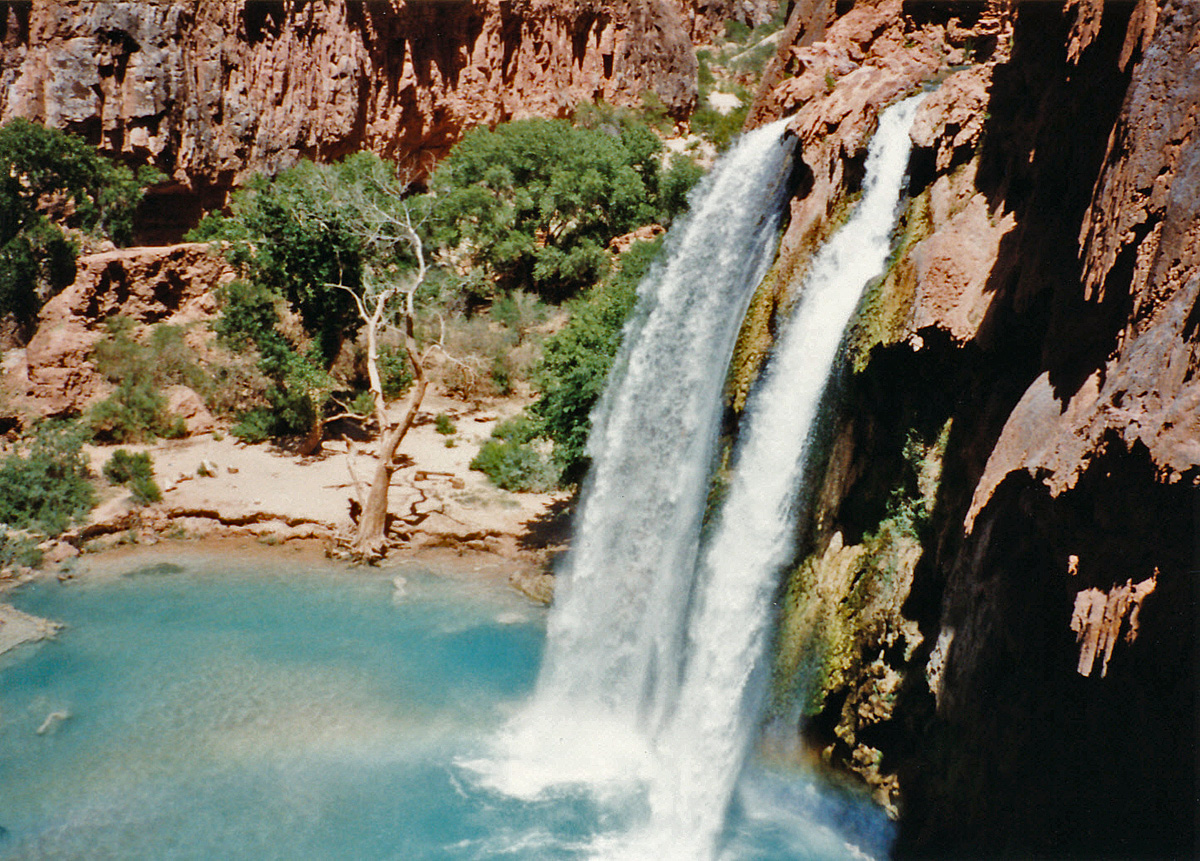
In 1994, I started my first (and only) trip down into
Havasu with my Dad, and the family Eastwood - Megan, Kathy, Erin and
John.
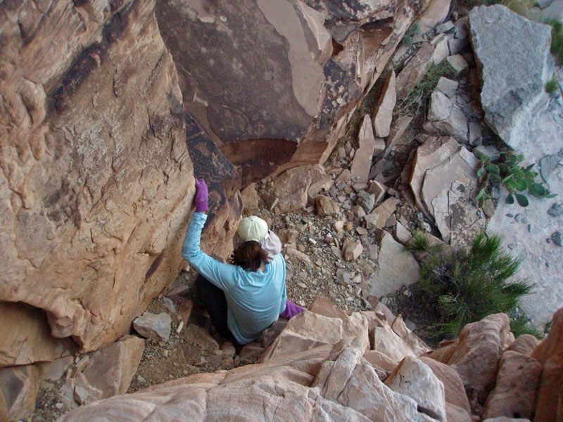
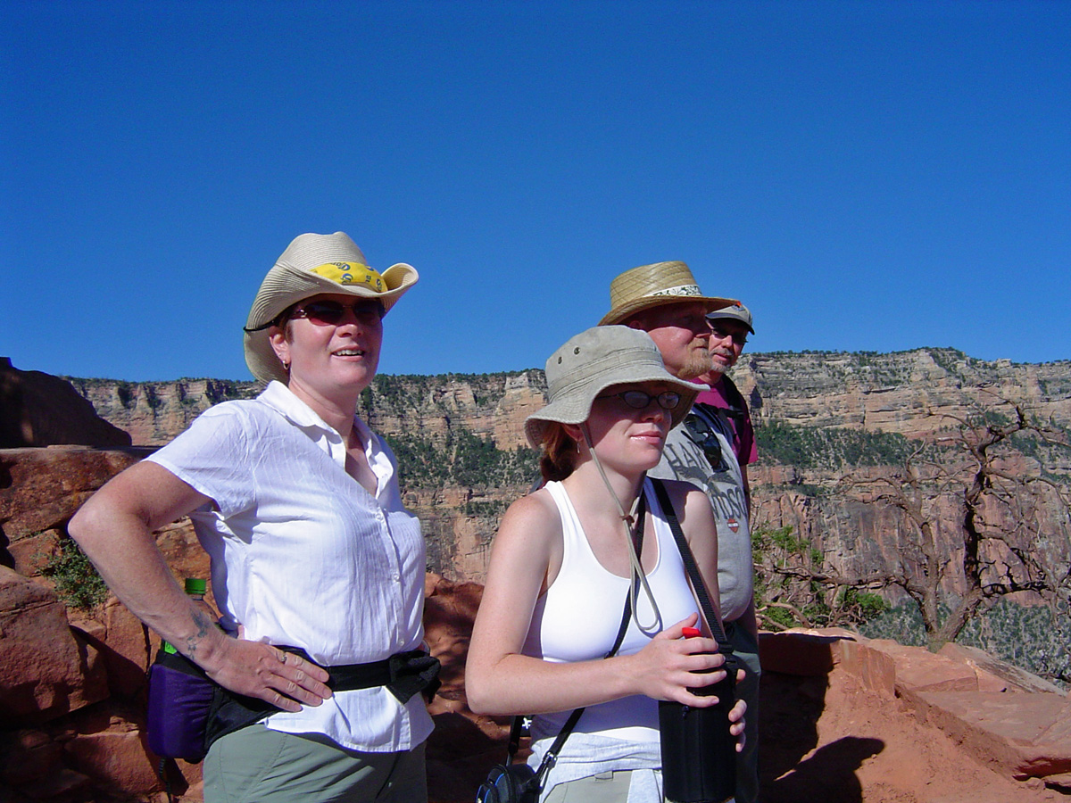
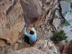
In 2009, Cara Lynn and I returned to the South Rim to
explore the petroglyphs below Jicarilla Pt. Here is Cara Lynn
carefully descending the steep chute on the east side to the lowest
panel that we saw. |
|
|
June 8 |
1991 - Obstacle Pool in Kwagunt Hollow. |
1994 - Beaver Falls on Havasu Creek. |
|
In 1991,
I did a hike down into Kanab Canyon with Neil Jacobs. This was our
last day as we hiked out from Scotty's Castle. We took a detour up
Kwagunt to see the Obstacle Pool described by George Steck. This
spot makes it difficult to come down this canyon although I did so a few
years later.
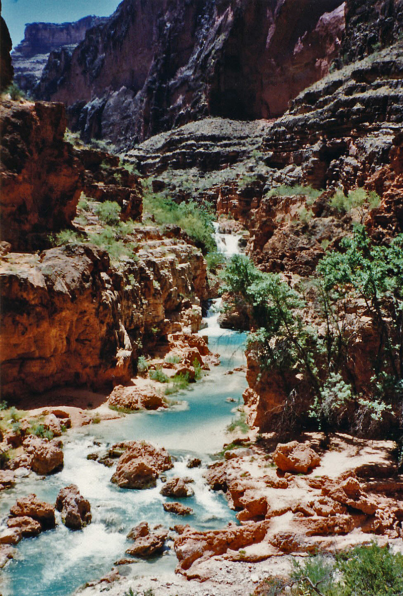
In 1994, I started my first (and only) trip down into
Havasu with my Dad, and the family Eastwood - Megan, Kathy, Erin and
John. On our second day I hiked down as far as Beaver Falls, shown
in the photo. |
|
|
|
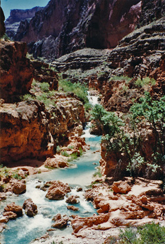
June 9 |
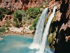
1994 - Havasu Falls. |
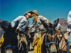
2002 - Horsing around at Plateau Pt. |
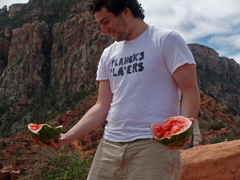
2007 - Watermelon at Cedar Ridge. |
|
In 1994, I
started my first (and only) trip down into Havasu with my Dad, and the
family Eastwood - Megan, Kathy, Erin and John. This was our last
day as we hiked up from the campground below Havasu Falls back to the
rim. BTW, we all carried our own pack down and back up unlike many
(most?) of the other backpackers we saw!
In 2002, on the heels of our trek down the Paria, Cara
Lynn and I took the mule trip to Plateau Point. If you haven't
been, you're out of luck as the Park Service has ended these trips.
[OK, they kissed them goodbye!]
In 2007, I joined John & Kathy Eastwood on a day hike down
to Cedar Ridge with Kathy's summer physics and astronomy students.
One of them brought a watermelon to share, but forgot to bring a knife,
LOL. |
|
|
|
June 10 |
2000 - O'Neill Spring ... with water!! |
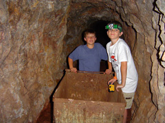
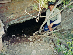
2006 - In the mine below Horseshoe Mesa. |
|
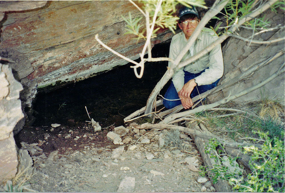
In 2000,
I did a day hike down the Grandview Trail with John Eastwood. We
took the spur trail down to Cottonwood and came back up from the west
prong. One of my main objectives was to find O'Neill Spring, which
is shown on older maps. We did and it had water in it. I
wrote about this site more thoroughly
here.
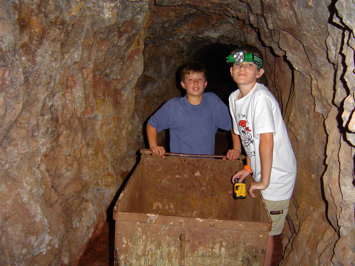
In 2006, I did a day hike down the Grandview Trail with
one of my colleagues, Russell Crook, and his family. Here, his
son, also Russell, and a friend play around with an old ore cart in the
mine shaft. You can't do that any more as the Park Service has put
up metal grates across the entrances of these old mines. |
|
|
|
June 11 |
|
|
|
June 12 |
|
|
|
June 13 |
|
In 1987, I did a
looping day hike from Mather Campground to the South Kaibab Trail, down
to the Tonto, across to Indian Garden and up the Bright Angel. I
kept a journal for this hike, but took no photos! |
|
|
|
June 14 |
1992 - North Canyon. |
2000 - Tanner water pocket. |
2000 - On the Old Grandview. |
|
In 1992, my
Dad and I did some camping and hiking around on the North Rim, including
a car camp at Francois Matthes Point! [You can't do that anymore.]
This day we were camped out near East Rim Viewpoint and did a looping
hike down to North Canyon Spring and out via Crystal Spring.
In 2000, I did two short day hikes on the South Rim.
The first was down the Tanner Trail to find the water pocket that Harvey
Butchart mentions. I'm pretty sure this was it. It is quite
a ways down the main ravine below the trail and just where the cliffs
begin.
In 2000, my other project was to find the old Grandview
trailhead. There is a spot on the regular trail where a wooden
post used to be and that's where the old trail meets up with the "new"
one. After seeing the old trail shown on old maps I was able to
find the trailhead and follow it all the way to the new trail.
It is quite spectacular, especially when it winds along this narrow
ledge below the Kaibab (and Toroweap?). |
|
|
|
June 15 |

2005 - With the family Markwardt (Yvonne, Carol, Greg) and me at on the
South Kaibab Trail. |
|
In 2005,
Cara Lynn's sister and family came for a visit which included a trek
down the South Kaibab to Cedar Ridge. Pictured are Yvonne,
daughter Carol, husband Greg and me in the background. They
returned to the rim while I took advantage of the opportunity to hike
down to the Tonto, then over to Indian Garden and up the Bright Angel
without the hassle of using the transportation system on the rim.
In 1983, I did a night hike to the South Rim from the North Rim, leaving
after work this day. I got in at daybreak and made the trip to
visit the clinic doctor about my sore Achilles tendon! She told me
to wear some low cut boots.
[No photos.] |
|
|
June 16 |
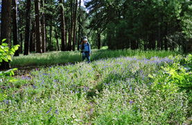
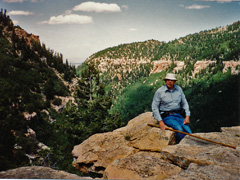
1992 - With my Dad atop Powell Plateau. |
|
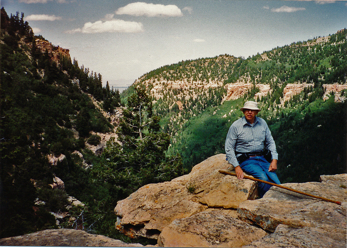
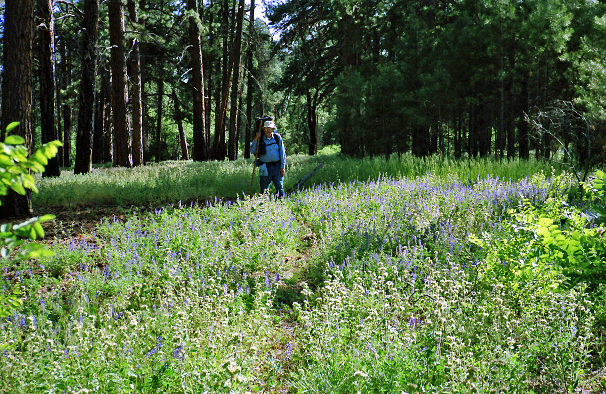
In 1992,
my Dad and I did a lot of camping and hiking on the North Rim.
This day we drove out to Swamp Point, put on our packs and hiked over to
Powell Plateau. We didn't go far, considering as how we had to
carry all the water we would need for this quick overnight trip.
Here is my Dad in a field of lupine as we made our way to a nice camping
spot on the rim. |
|
|
June 17 |
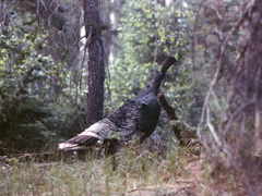
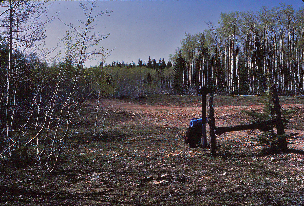
1984 - Turkey near Robbers Roost Spring. |
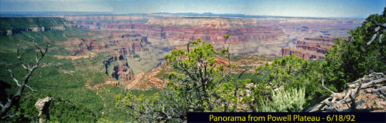
1992 - Panorama from the west side of Powel Plateau. |
|
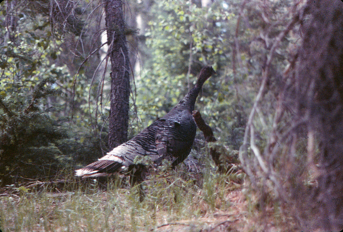
In 1984,
I got this shot of a passing turkey in the woods of the North Rim on a
little day hike I did to find Robbers Roost Spring.
In 1992, my Dad and I did a lot of camping and hiking on
the North Rim. We spent the previous night camped on Powell
Plateau and before hiking back to Swamp Point we hiked out to the
western rim and I took this panorama of three shots.
In 1983, I did a day hike from the South Rim back to the North Rim, where
I was working for the summer.
[No photos.] |
|
|
June 18 |
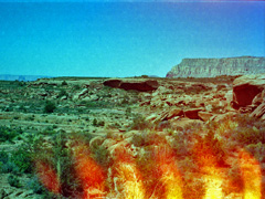
1992 - Ghost Rock on the Espanade. |
|
In 1992, my Dad and I did a lot of camping and hiking on
the North Rim. We spent the previous night camped at the Indian
Hollow Campground. This day I hiked down the Indian Hollow Trail
to look for a pictograph site called "Ghost Rock." It has some
very tall figures in white that I guess you would say look ghostly.
After hunting around for a while I found it in the prominently shaded
overhang in the center of this photo. The fiery spikes at the
bottom of the picture are the result of the film being partly exposed to light.
Alas, the days of film were fraught with calamities! |
|
|
June 19 |

1992 - At Brow Monument, converted to b&w. |
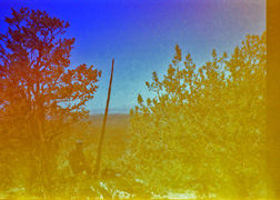
Best correction I could do in color. |
|
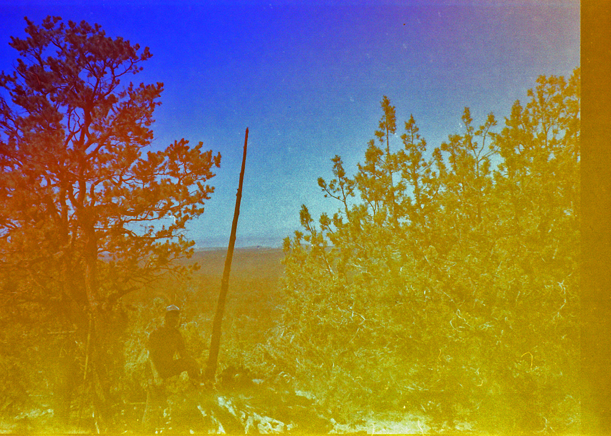
In 1992, my Dad and I did a lot of camping and hiking on
the North Rim and this was our last day. On our way back to
Flagstaff we stopped for a hike to
Brow Monument. There wasn't really a trail yet (like there is
today), but the route had been marked with colored ribbons and we were
able to follow them to the spot. Here, members of Powell's 1872
trip built up a rock pile as a survey marker. I don't know if the
dead tree stuck in the middle is original, but it's possible. This
was my last frame of film and I only got the one shot, later learning
that it was partly wrecked by exposed light. But, Photoshop can do
some amazing things. The b&w version looks pretty good, and even
making corrections on the color version you can see more than I could
when I had the film developed at the time.
To repeat myself - Alas, the days of film were fraught with calamities! |
|
|
|
June 20 |

2000 - On the South Kaibab Trail. |
|
In 2000, I
did a day hike down to the Bright Angel Campground. [No, I didn't
go all the way to Phantom Ranch!!] Down and back via the South
Kaibab Trail. I cached two frozen liter bottles of water just
below the Tonto Trail junction for my return. Absolutely
delightful on this hot June day.
In 1981, I did an overnight hike down the South Bass and out along the
Esplanade to the area below Chemehuevi Spring (from which I got water).
It was very hot!! [No photos.] |
|
|
June 21 |
|
In 1981, I did an
overnight hike down the South Bass and out along the Esplanade to the
area below Chemehuevi Spring. This day I hiked back out. It
was very hot!! [No photos.] |
|
|
|
June 22 |
|
|
|
June 23 - On my
Birthday!! |
1983 - The Colonade with Isis behind. |
1997 - Ruins at Toltec Point. |
|
In 1983,
while working on the North Rim I hiked out on the Widforss Trail to its
end (at the aptly named Widforss Point). From there I bushwhacked
my way further west until I was at the rim across from The Colonade.
In 1997, I drove up to the South Bass Trailhead and hiked along
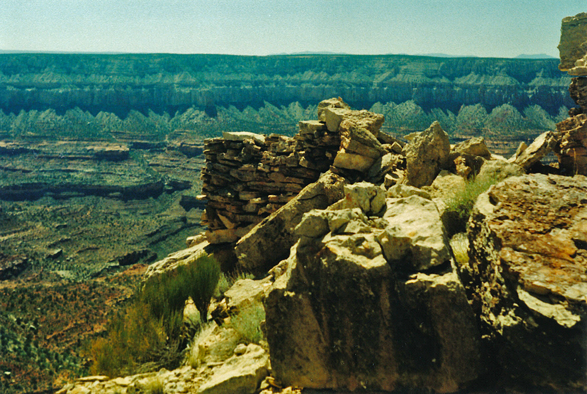
the rim to check on some ruins out at Toltec Point. I found a
couple of places with still-standing walls. |
|
|
|
June 24 |
|
|
|
June 25 |
|
|
|
June 26 |
|
|
|
June 27 |
1983 - On the Widforss Trail. |
|
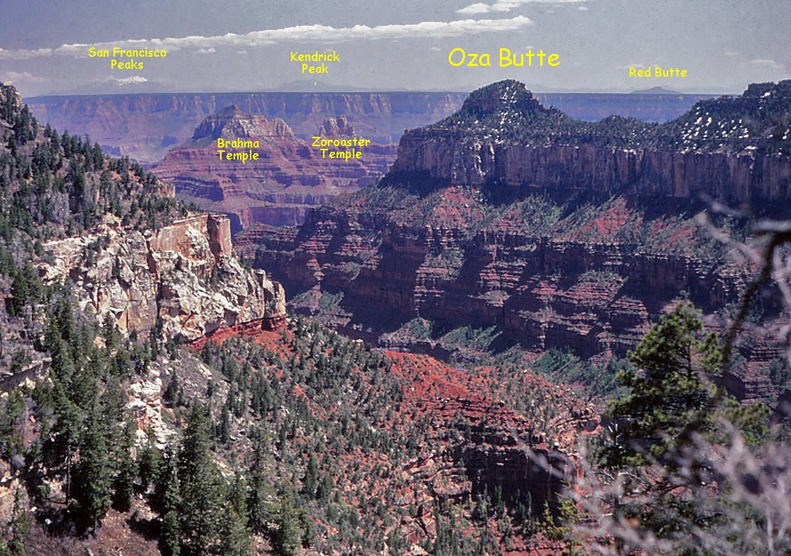
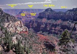
In 1983,
while working on the North Rim, I did a day hike out along the Widforss
Trail and then bushwhacked my way to the top of Oza Butte, shown in the
photo. I remember being surrounded by a constant green haze all
the way there as I brushed against/through the pollinating pine trees. |
|
|
June 28 |
2000 - At Pipe Creek Rapids. |
|
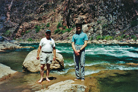
In 2000,
John Eastwood and I did a "quick" day hike down the Bright Angel Trail
to the river. We left the rim at 6:55 a.m. and got back at 6:00
p.m.! Cloud cover during the hike up really helped. As we
returned to Indian Garden in the mid-afternoon we picked a bunch of the
blackberries near there to snack on. Also, on this trip I cached
some frozen water at 2-mile corner. I often find that the water at
the 3-mile house is too warm and this just hit the spot. This must
be my favorite pose at the river here - see May 13. :-)
If I am remembering right, I believe it was a German tourist that took
the picture for me. |
|
|
June 29 |
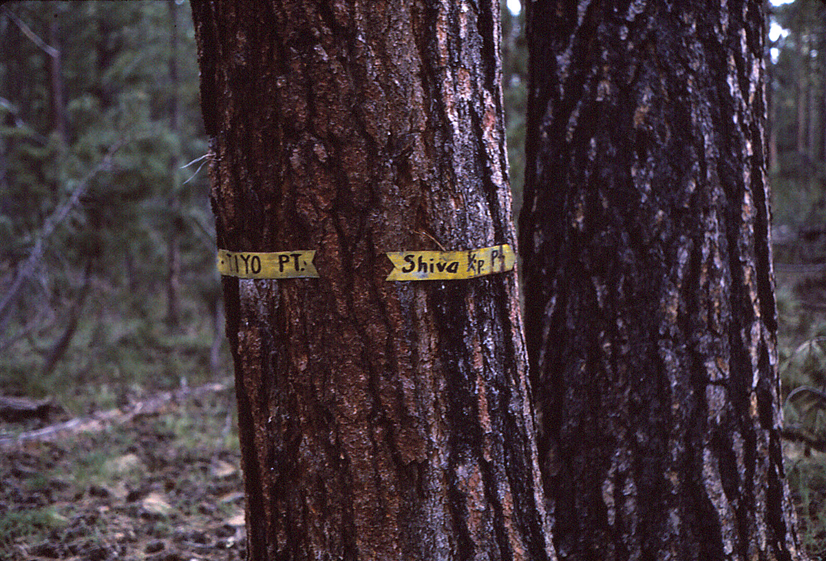
1983 - On my way to Shiva Temple. |
|
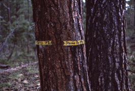
In 1983,
I did a hike out to the rim of the canyon where I camped for two nights
so I could do a day hike to Shiva Temple. In these years the road
through "The Basin" was closed to traffic and I had to walk all the way
from the lodge area. This old marker on a tree directed me on the
right faint track, which gave out well before reaching the rim. My
job at the lodge was six days a week - well, so was everyone else's.
But, I was able to get off work after the day shift, have the rest of
the day off and all the next day. The following day I would go
back to work on the graveyard shift, giving me an entire day for my
hiking. Talk about burning the candle at both ends! |
|
|
June 30 |

1983 - Atop Shiva Temple. |
2006 - On the South Kaibab Trail. |
|
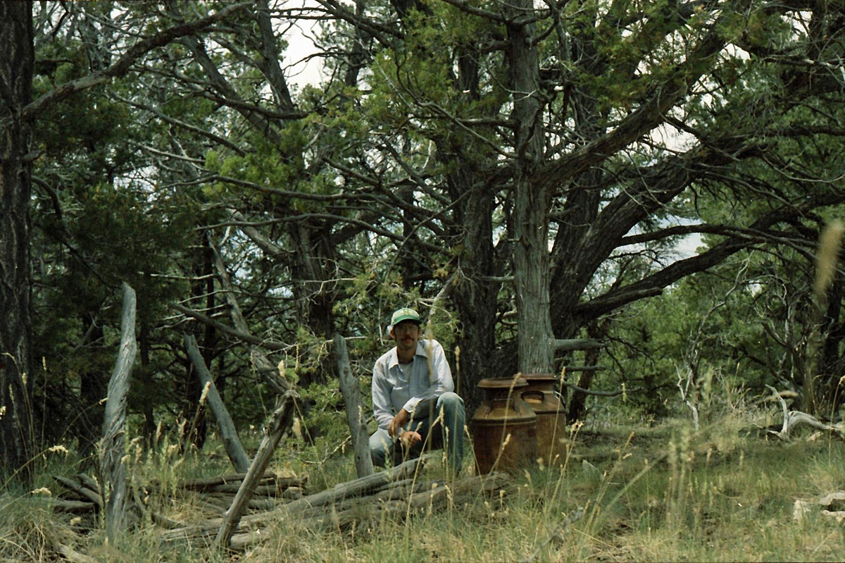
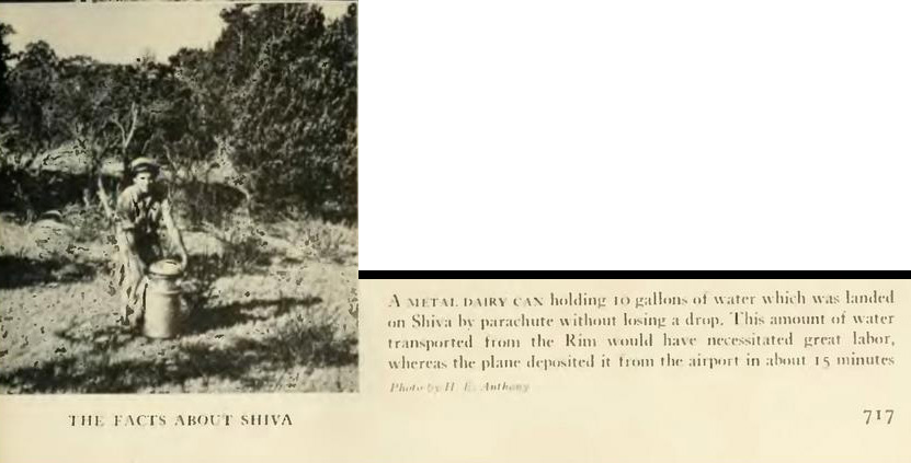
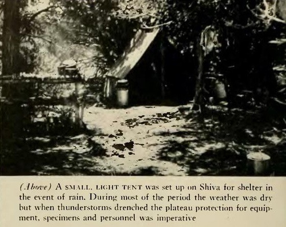
In 1983, I
did a hike out to the rim of the canyon where I camped for two nights so
I could do a day hike to Shiva Temple. This was the day of my hike
over and up to the top of Shiva (and back). Here I am next to two
milk cans that were parachuted down to the
1937 expedition (full of
water). You can see these old cans in these photos from the 1937
expedition (click on them to see a larger image):


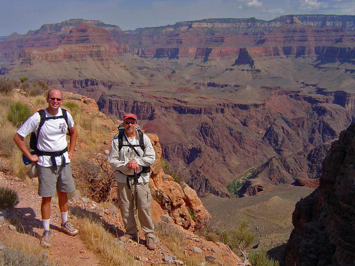
In 2006, I did a day hike down the South Kaibab Trail to Phantom
Ranch with colleague Russell Crook. We parked at the picnic area
off the East Rim Drive and were started down the trail a couple of
minutes after 8 am. We did catch some clouds in the afternoon, but
still didn't reach the rim until just a few minutes before 8 pm. |
|
|