|
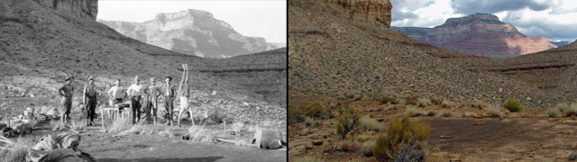
November 1 |
1981 - Apache Point. |
|
In 1981 I made a
hike to Royal Arch after having been here just ten days earlier. This hike lasted four days. I camped
all three nights in Royal Arch Creek and made day hikes from here.
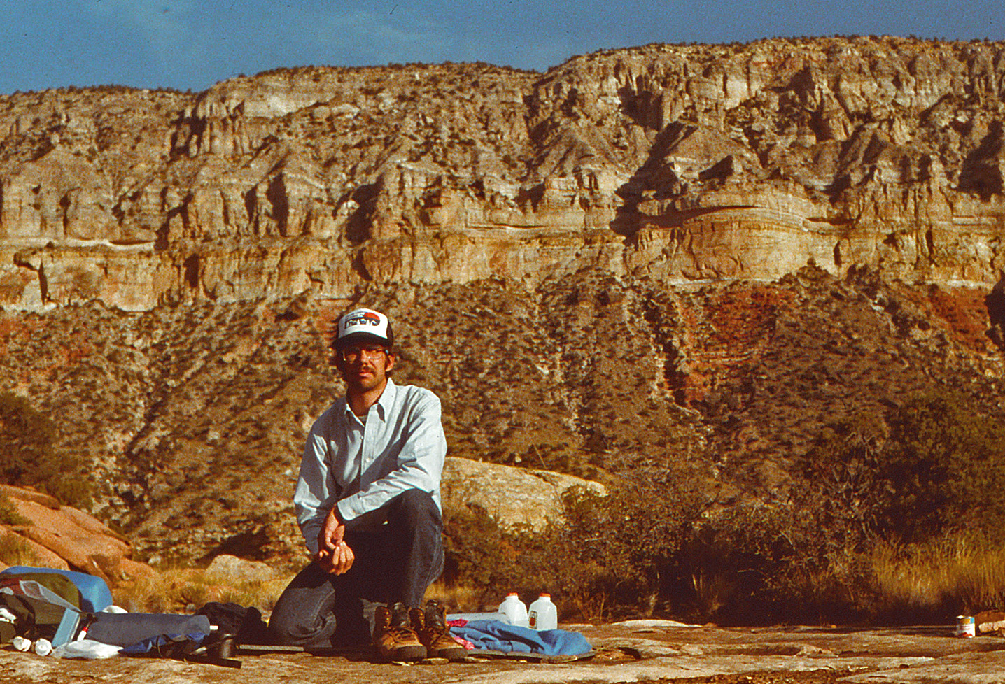
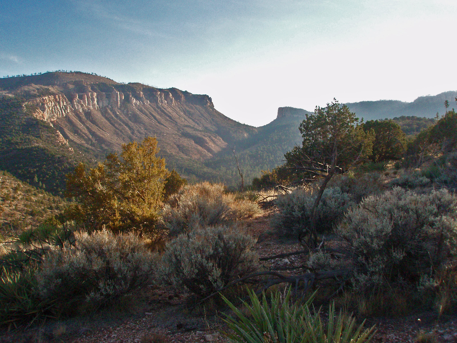
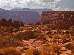
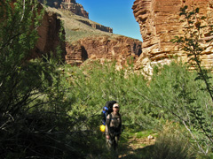
This was my second day and I did a round-trip hike up to Apache Point.
Skittish trail through the Coconino, if memory serves.
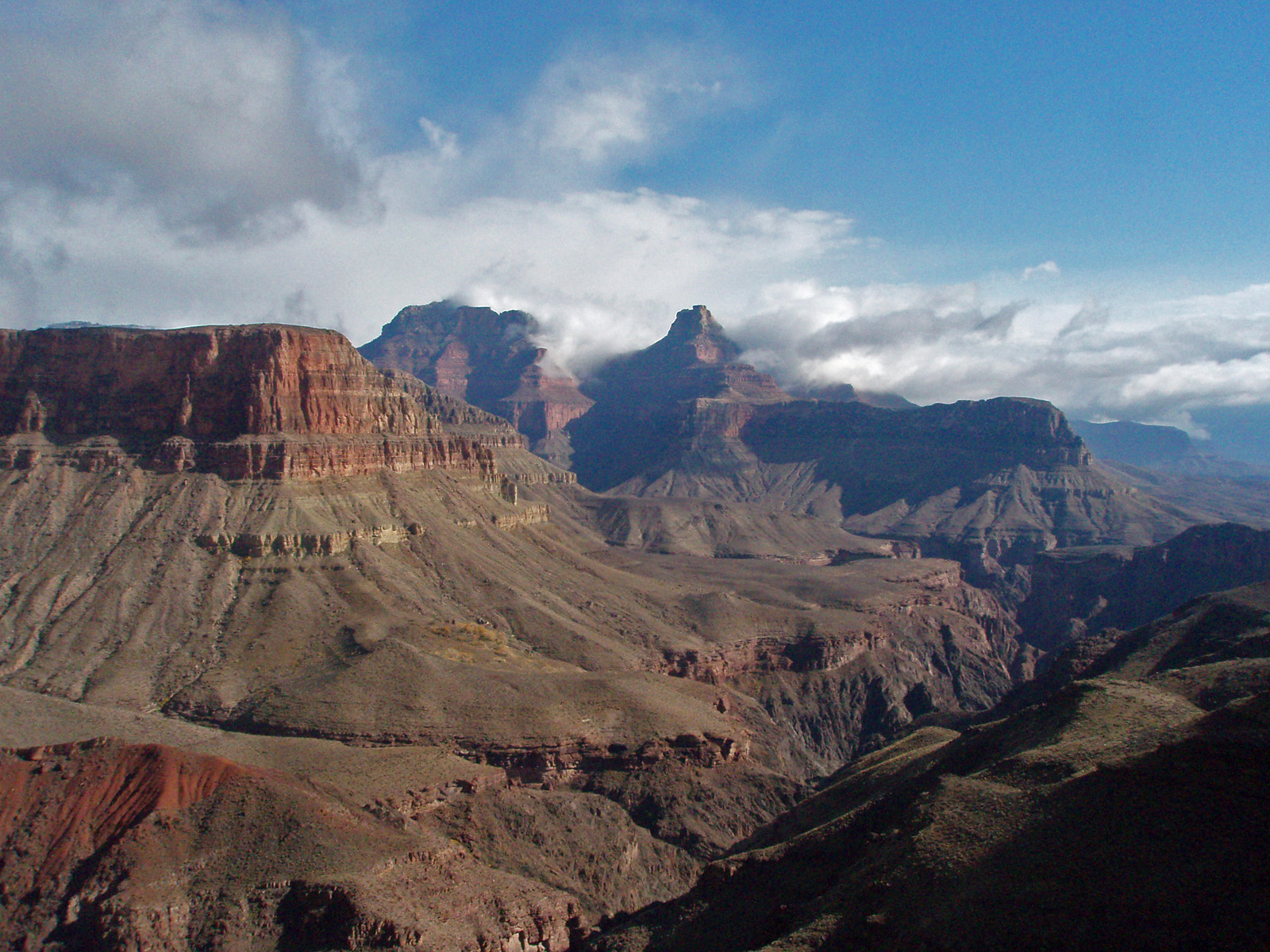
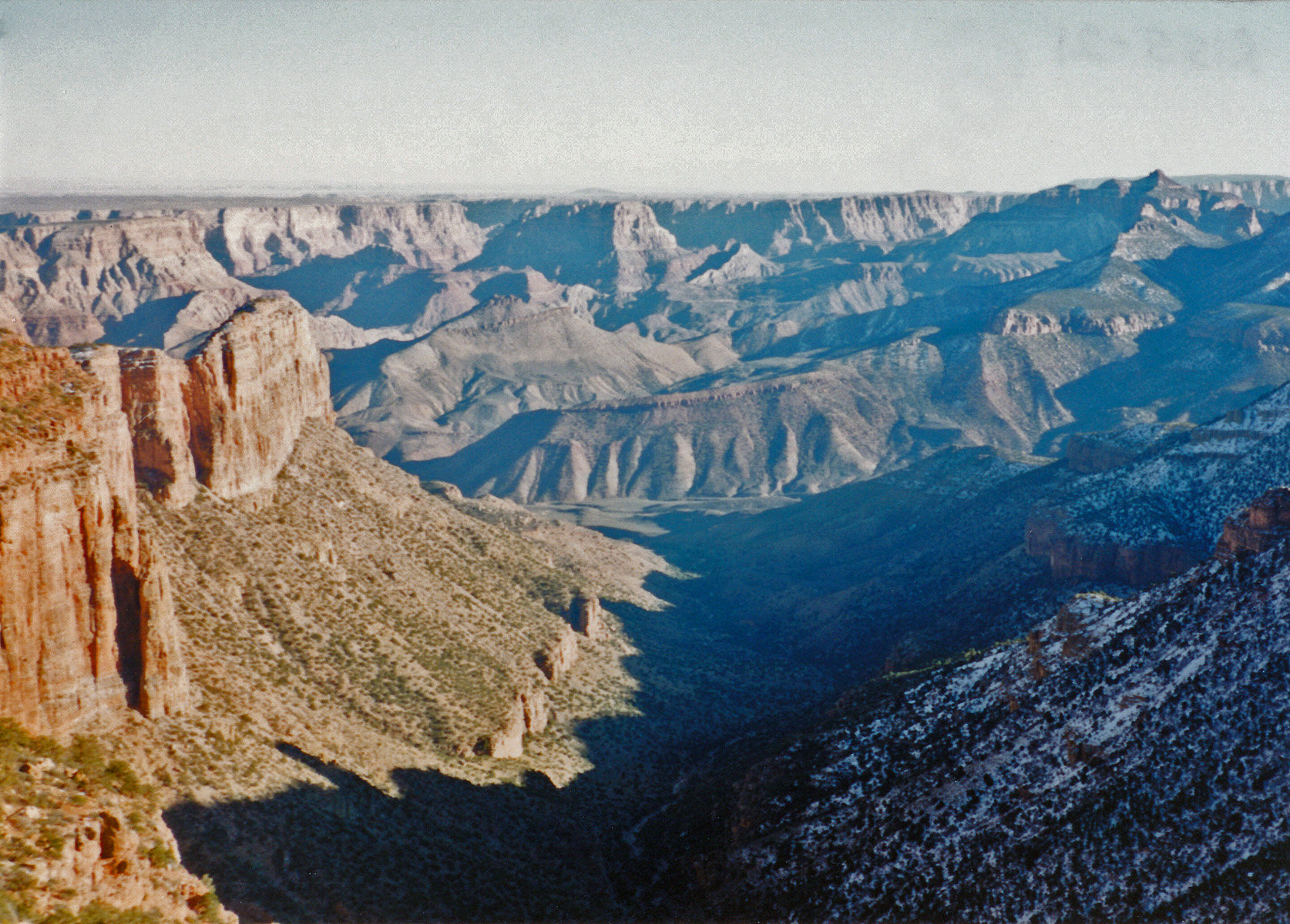
In 2009 I hiked down the Tanner Trail on a four day
hike with the intent to finally be able to hike up to the Little
Colorado River. On my second day and I had a great day hike
to the LC and back. But, overnight I quite violently sick and in
the early morning hours I was alternating between throwing up and having
the runs. That lasted all morning and by noon I was just totally
wasted. Lucky for me I had built an extra day into my schedule so
I did very little this day. I tried to eat a little later in the
afternoon - some oatmeal - and got sick again. Anyway, no photos
from today! I wrote up a full account
here. |
 |
|
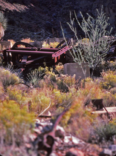
November 2 |
1981 - Royal Arch cairn. |
1983 - Covington House. |
2008 - On the Grandview Trail. |
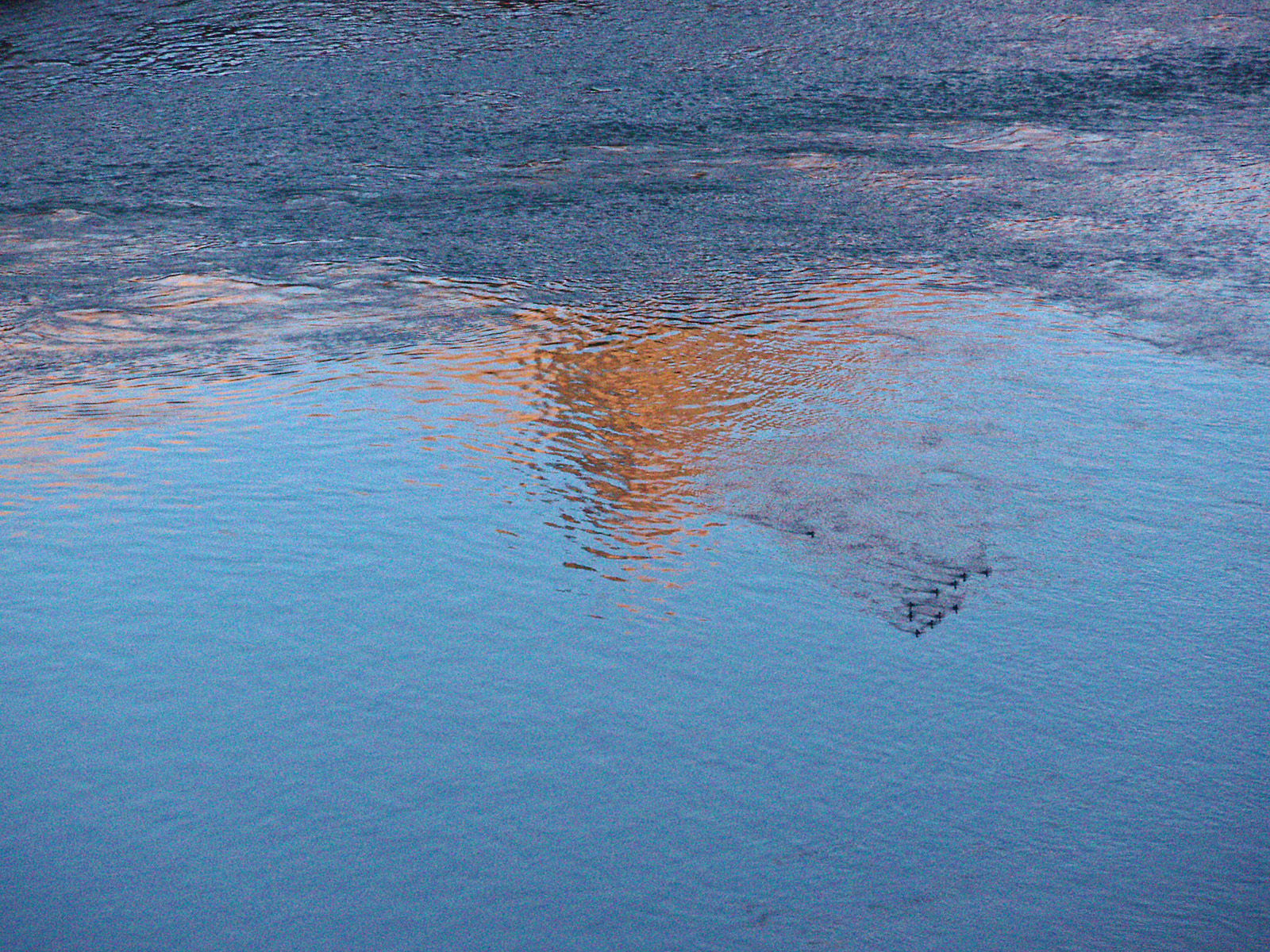
2009 - Ducks in the Colorado River. |
|
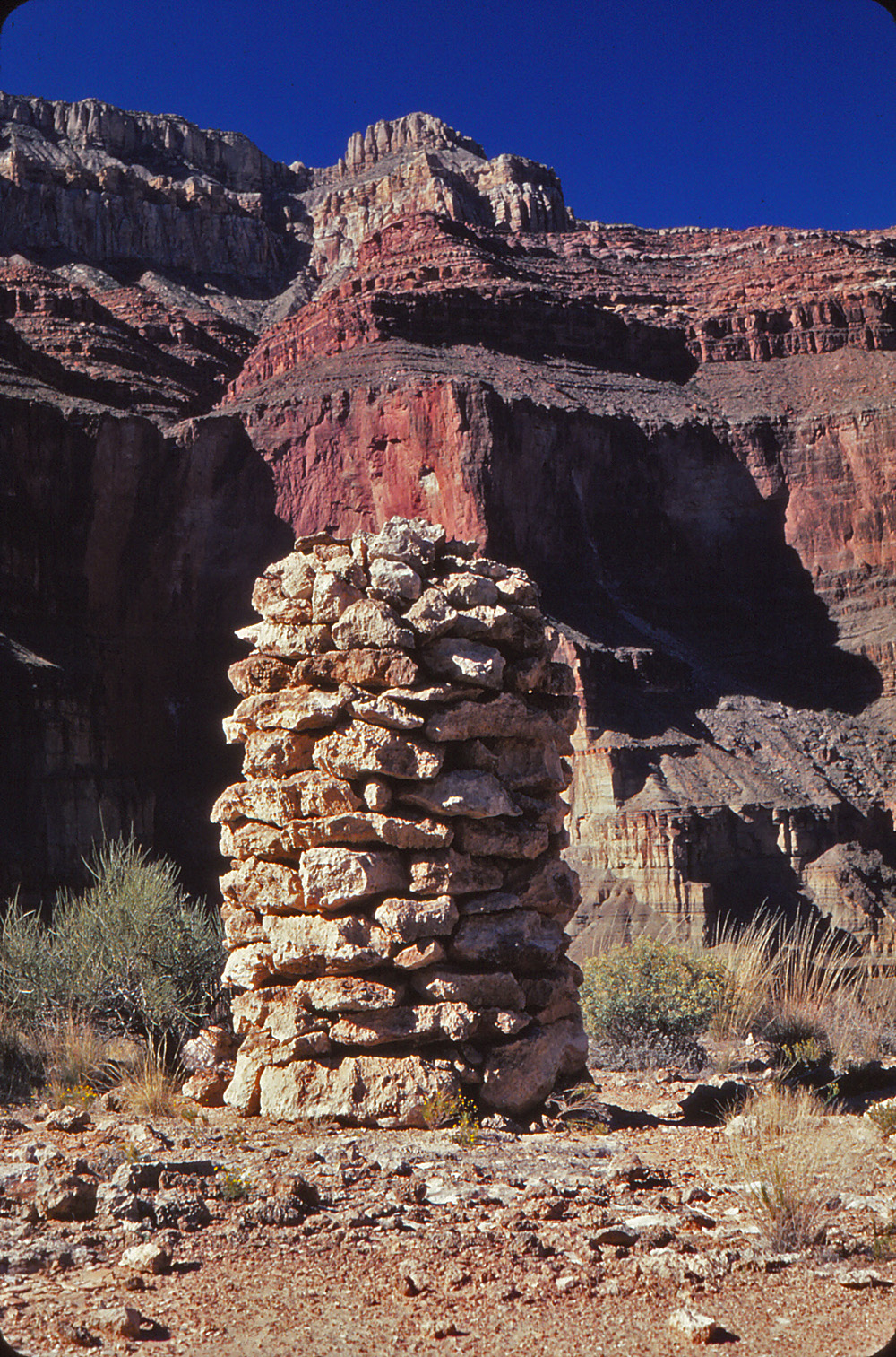
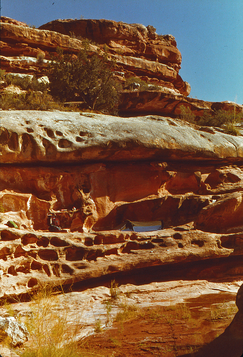
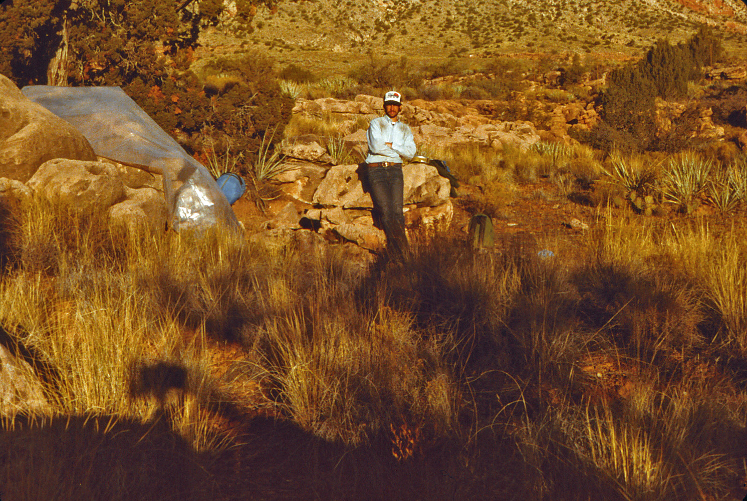
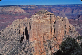
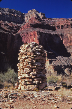
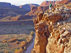
In 1981 I made a
hike to Royal Arch after having been here just ten days earlier. This hike lasted four days. I camped
all three nights in Royal Arch Creek and made day hikes from here.
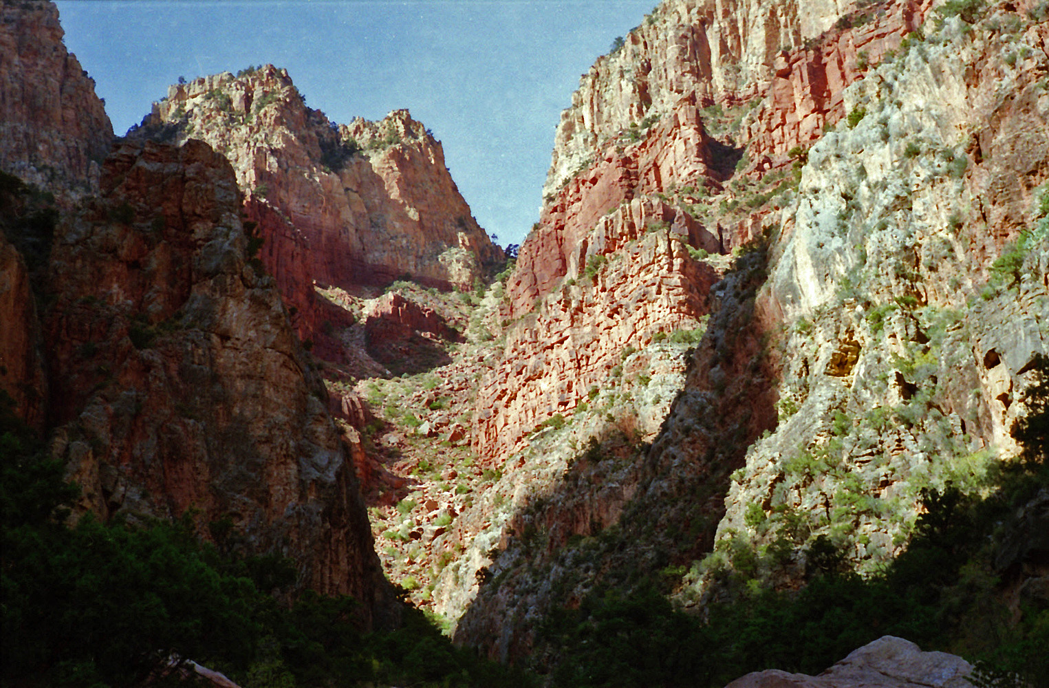
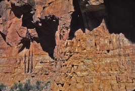
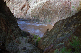
This was my third day and I hiked to the spot on the Royal Arch route
where you need a rope to descend a short cliff in order to access Elves
Chasm and the Colorado River. While there was a rope in place I
did not have the nerve to actually use it. I did get this picture
of a huge cairn along this route, with Apache Pt. in the background.
It has been one of my all time favorites.
In 1983 I started an ambitious 30 day hike from
Toroweap to Phantom Ranch. Alas, my reach exceeded my grasp and
this turned into a ten day round trip hike to Willow Spring instead.
I had only one major food cache, at Deer Creek, and way overestimated
how much I could carry - a 90 lb. pack was really too much! This
was my first day when I got this photo of "Covington House." From
my journal for this day, "My pace is good, but I rest frequently... The
trail is alternately excellent and nonexistent, so I wander a lot."
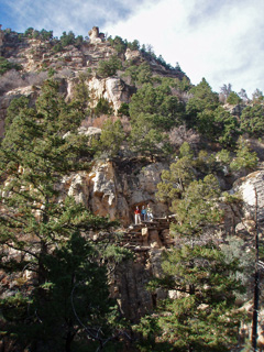
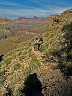
In 2008 I did a day hike down the Grandview to the
Cave of the Domes with John Eastwood, Cara Lynn Foster and Gary Yeh, a
visiting faculty member. This is the first time I can remember
actually seeing the names on the walls in this cave! I got this
nice photo of John, Cara Lynn and Gary on a piece of the trail showing
the extensive cribbing, just before the stone "bridge" across the saddle
with Grapevine.
In 2009 I hiked down the Tanner Trail on a four day
hike with the intent to finally be able to hike up to the Little
Colorado River, which I did on my second day. On my third day I
was violently sick and alternated between throwing up and having
the runs all morning long. Lucky for me this had been an extra day in my schedule so
I did very little. This was my last day and time to hike out.
I had eaten very little the night before and only had a little bit of
water for breakfast this morning. Still I was able to hike all the
way out, only nibbling on a granola bar until I was atop the Redwall.
I tried to eat more here, but threw up again. A grueling day, but
I made it out by 5 pm. I wrote up a full account
here. |
|
|
|
November 3 |
1981 - Ruins on South Bass Trail. |

1983 - Esplanade camp. |

1995 - Route from Coconino Saddle on Grandview. |
|
In 1981 I made a
hike to Royal Arch after having been here just ten days earlier. This hike lasted four days. I camped
all three nights in Royal Arch Creek and made day hikes from here.
This was my last day and I had a very nice hike out, snapping this photo
of some ruins that are near the South Bass Trail about halfway up to the
rim.
In 1983 I started an ambitious 30 day hike from
Toroweap to Phantom Ranch. Alas, my reach exceeded my grasp and
this turned into a ten day round trip hike to Willow Spring instead.
I had only one major food cache, at Deer Creek, and way overestimated
how much I could carry - a 90 lb. pack was really too much! This
was my second day and the only photo I took was just before leaving
camp. I had a dilemma with my stove but was able to clean out the
pump and get it working. A very slow day. From my journal:
"Progress is very slow and I rest often." I ran out of water by
the end of the day. I was constantly on the lookout for a water
pocket and lucked out with a small one in Big Canyon.
In 1995 I began a three day hike down the Grandview to
Hance Creek. This was my first day and I decided to get down into
Hance via the ravine that one can take from a saddle on the Grandview
Trail at a very popular resting stop. All went very well on the
descent except that at the bottom I took off my gloves and set them on a
rock and never saw them again! Here is a view of the descent
ravine. |
|
|
|
November 4 |

1983 - The Dome comes into view. |
1995 - Sockdolager Rapid from Hance Creek. |
|
In 1983 I started an ambitious 30 day hike from
Toroweap to Phantom Ranch. Alas, my reach exceeded my grasp and
this turned into a ten day round trip hike to Willow Spring instead.
I had only one major food cache, at Deer Creek, and way overestimated
how much I could carry - a 90 lb. pack was really too much! This
was my third day and I slowly worked my way along the Esplanade from
Cove Canyon to Stairway Canyon. Along the way, I started getting
great views of the Dome, like the one in the photo. I ran out of
water again by the end of the day, but found a water pocket near where I
stopped. From my journal:
"My footing has been better today, though I did trip a few times
(yesterday I fell twice and twisted my foot 6 or 7 times)."
It was a struggle.
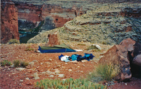
In 1995 I did a three day hike down the Grandview to
Hance Creek. This was my second day and I had one of my all-time
best hiking days. From my camp near the Tonto Trail, I hiked down
Hance Creek all the way to the river. There are three big bypasses
required and the photo shows the river, and the head of Sockdolager
Rapid, from the third bypass. On my return I took a route that
climbs up to the base of the Tapeats to the west and continues out to
the Tonto via the old trail segment up there. I followed the Tonto
Trail back to camp at the end of a long and very satisfying day. |
|
|
|
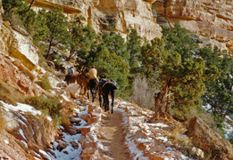
November 5 |

1983 - Crinoid sea lilly fossils. |
1995 - Grandview Trail cobblestones. |
2006 - Bill & Erik as we round Cardenas Butte. |
|
In 1983 I started an ambitious 30 day hike from
Toroweap to Phantom Ranch. Alas, my reach exceeded my grasp and
this turned into a ten day round trip hike to Willow Spring instead.
I had only one major food cache, at Deer Creek, and way overestimated
how much I could carry - a 90 lb. pack was really too much!
This was my fourth day and I passed by some cool looking crinoid sea
lilly fossils, shown in the photo. This
day I finally made it to Willow Spring, where I had intended to be at
the end of day 1!!! From my journal: "The afternoon goes fairly
well - I feel more adjusted to the pack, but it is still very heavy."
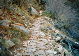
In 1995 I did a three day hike down the Grandview to
Hance Creek. This was my
last day and while hiking back up the Grandview Trail I got a nice
picture of the cobblestone trail.
In 2006, Bill Ferris,
Erik Drake and I headed down the Tanner Trail to the Redwall Overlook
and they agreed to my suggestion that we continue all the way around
Cardenas Butte. Great fun, and I wrote up more
here. |
|
|
|
November 6 |

1983 - My campsite at Willow Spring. |
|
In 1983 I started an ambitious 30 day hike from
Toroweap to Phantom Ranch. Alas, my reach exceeded my grasp and
this turned into a ten day round trip hike to Willow Spring instead.
I had only one major food cache, at Deer Creek, and way overestimated
how much I could carry - a 90 lb. pack was really too much! This
was my fifth day and I stayed at this camp for two more days, just
taking day hikes around the local area. From my journal:
"It is nice not to have to shoulder the pack today. The water
here tastes a bit funny, but mixed with ERG and Tang it is good." |
|
|
|
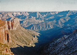
November 7 |
1983 - From the rim above Willow Spring. |
2009 - At the Tanner Trailhead. |
|
In 1983 I started an ambitious 30 day hike from
Toroweap to Phantom Ranch. Alas, my reach exceeded my grasp and
this turned into a ten day round trip hike to Willow Spring instead.
I had only one major food cache, at Deer Creek, and way overestimated
how much I could carry - a 90 lb. pack was really too much! This
was my sixth day and from my Willow Spring camp I did a hike up to the
rim above me, following an actual constructed trail, although at the top
it just faded away. Great views, as shown in the photo, with the
Dome on the right. From my journal:
"The vista is dominated by the Esplanade, usually viewed as serene
and somewhat uniform. But now I see all the canyons, side canyons
and side side canyons that must be contoured, and all the ravines that
must be climbed into and out of, if one is to pass through this area."
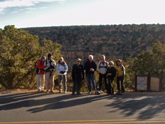
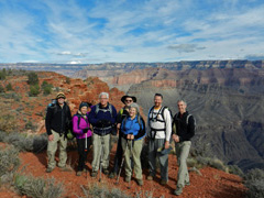
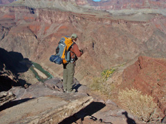
In 2009, our annual faculty hike took us (Meg and John
Eastwood, Cara Lynn Foster, John Haney, TS Amer, Tim Clark, Bev Amer and
Jennie Mitchell) to the Tanner Trail and a hike down to the Redwall
overlook. |
|
|
|
November 8 |
1983 - The Dome in rain clouds. |
|
In 1983 I started an ambitious 30 day hike from
Toroweap to Phantom Ranch. Alas, my reach exceeded my grasp and
this turned into a ten day round trip hike to Willow Spring instead.
I had only one major food cache, at Deer Creek, and way overestimated
how much I could carry - a 90 lb. pack was really too much! This
was my seventh day. I stayed at Willow Spring long enough to make
sure that the ranger would be in at Tuweep when I got back there - his
wife lived on the South Rim and he flew his plane there for his two days
off each week. After six clear days it clouded up last night and
rained off and on until morning. By the end of the day, it was
once again clear. From my journal:
"I am camped at the same place I was at on the third night.
Lots of water still in pockets." |
|
|
|
November 9 |

1981 - Ruins at Garden Creek. |
1983 - A chilly morning on the Esplanade. |
|
In 1981 I did a day hike down the BA, then over the
Tonto and down the ravine west of Plateau Pt. From here I
contoured beneath the Tapeats to Garden Creek and then back up the BA.
It remains one of my all-time favorite hikes. Here is a photo of
the ruins at Garden Creek. Note my old "day pack," which I got
from a military surplus store.
In 1983 I started an ambitious 30 day hike from
Toroweap to Phantom Ranch. Alas, my reach exceeded my grasp and
this turned into a ten day round trip hike to Willow Spring instead.
I had only one major food cache, at Deer Creek, and way overestimated
how much I could carry - a 90 lb. pack was really too much! This
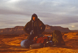
was my eighth day. It turned a bit cooler and here I am all
bundled up in the early morning getting ready to start my day. From my journal:
"The pack still feels very heavy. I rest quite a bit. I
may have been quite mistaken about my ability to carry it even at day 13
or 14 when it should be at its lightest." |
|
|
|
November 10 |
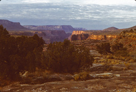
1983 - Looking to Vulcan's Throne. |

2013 - Mt. Huethawali & my shadow. |
|
In 1983 I started an ambitious 30 day hike from
Toroweap to Phantom Ranch. Alas, my reach exceeded my grasp and
this turned into a ten day round trip hike to Willow Spring instead.
I had only one major food cache, at Deer Creek, and way overestimated
how much I could carry - a 90 lb. pack was really too much! This
was my ninth day. Here I can see Vulcan's Throne as I wend my way
along the Esplanade. I reached the road near Tuweep before camping
for my final night. From my journal:
"I got 2 jabs from agaves this morning - one in the upper leg and
one in the side of the foot (ouch!)."
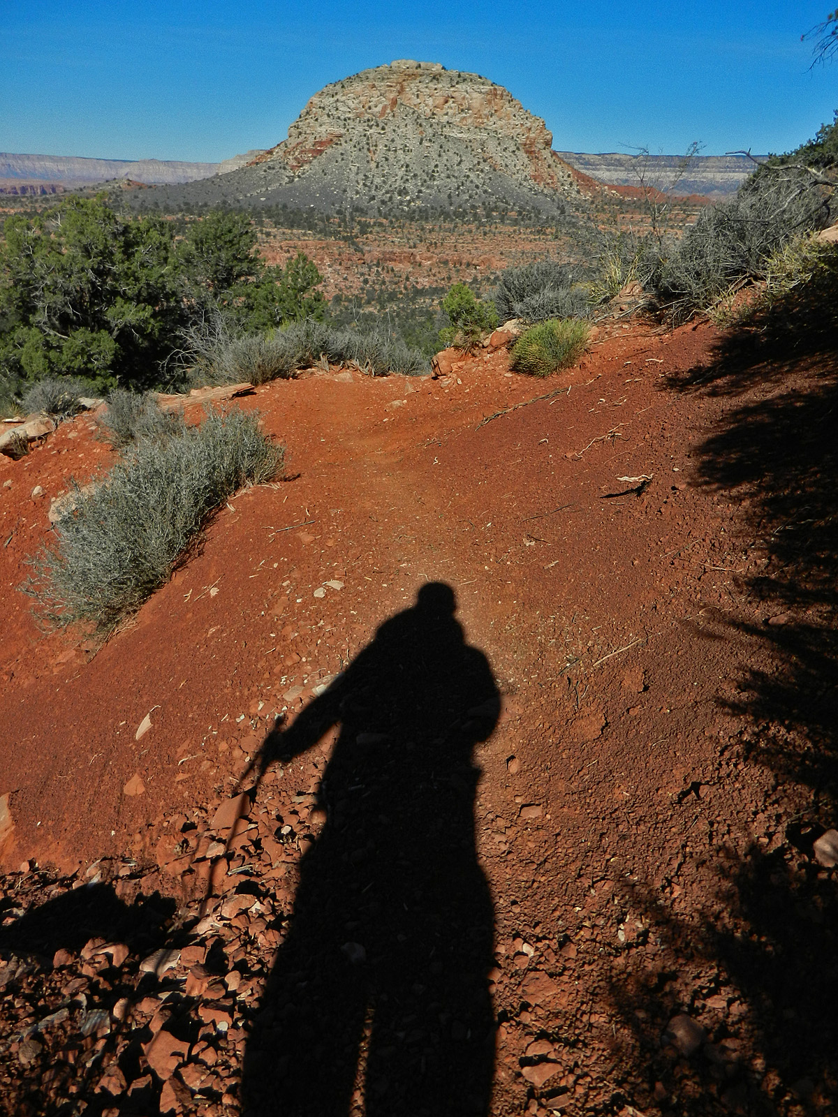
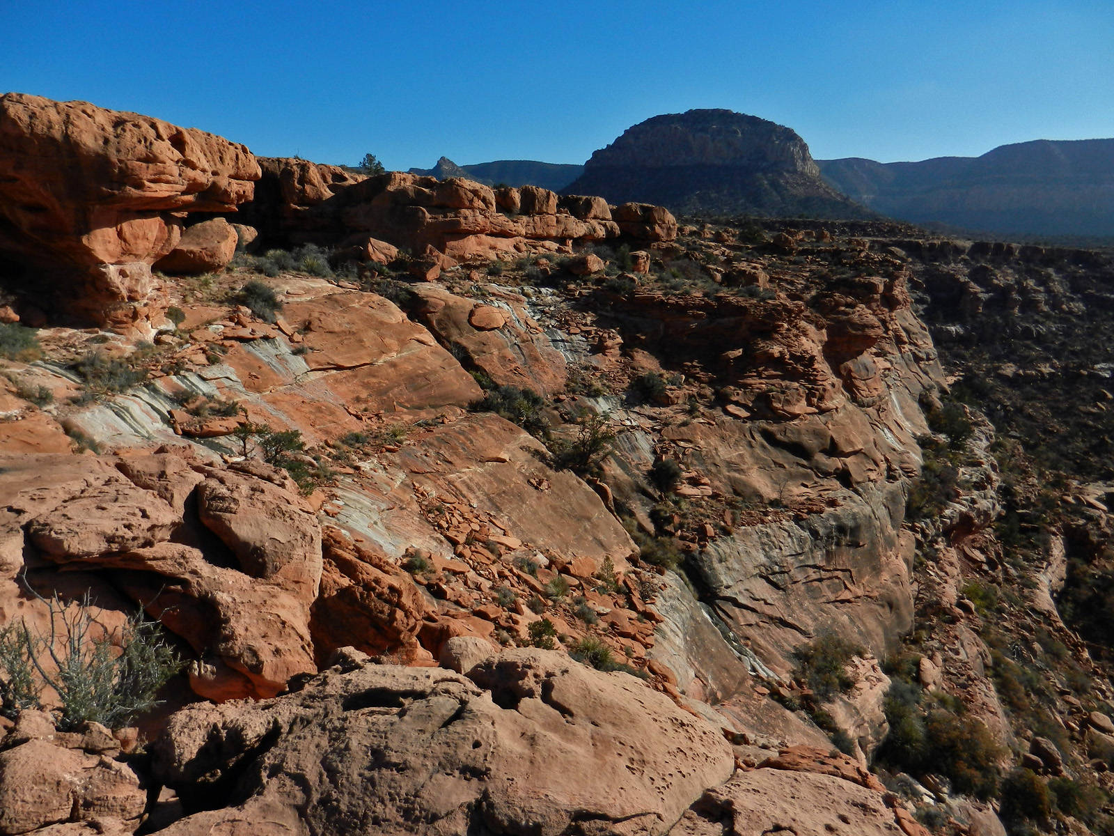
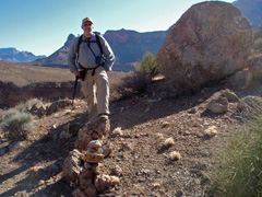
In 2013 I did a nine day hike down the South Bass to explore
that area. This was the first day and I got this shot of Mt.
Huethawali as I was getting down to the Esplanade. A full report
on this hike can be found
here. |
|
|
|
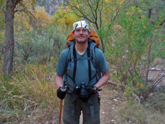
November 11 |

1983 - Last camp on the Tuckup Trail. |
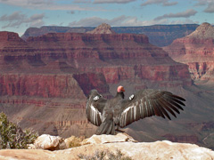
2004 - Hangin' out with condor #19. |
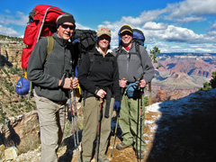
2010 - Ray, Cara Lynn & me starting down the BA. |

2013 - Bass cable car remains. |
|
In 1983 I started an ambitious 30 day hike from
Toroweap to Phantom Ranch. Alas, my reach exceeded my grasp and
this turned into a ten day round trip hike to Willow Spring instead.
I had only one major food cache, at Deer Creek, and way overestimated
how much I could carry - a 90 lb. pack was really too much! This
was my tenth and final day. Here I am at my last camp before
finishing the hike to the ranger station. The ranger was not back
from the South Rim as it was a holiday!!! But, I was able to hitch
a ride back to civilization ... well, back to St. George, Utah, anyway.
In 2004 I did a day hike down the Bright Angel,
intending to go to Plateau Point. But, on my way down, my pants
zipper busted, so I decided to leave the trail at 2 Mile Corner and hike
out to, and around in front of, the Battleship, where I could do some
emergency tailoring. While there, condor #19 landed about twenty
feet away from me and we spent an hour hanging out together!
I wrote a full account of this hike
here.
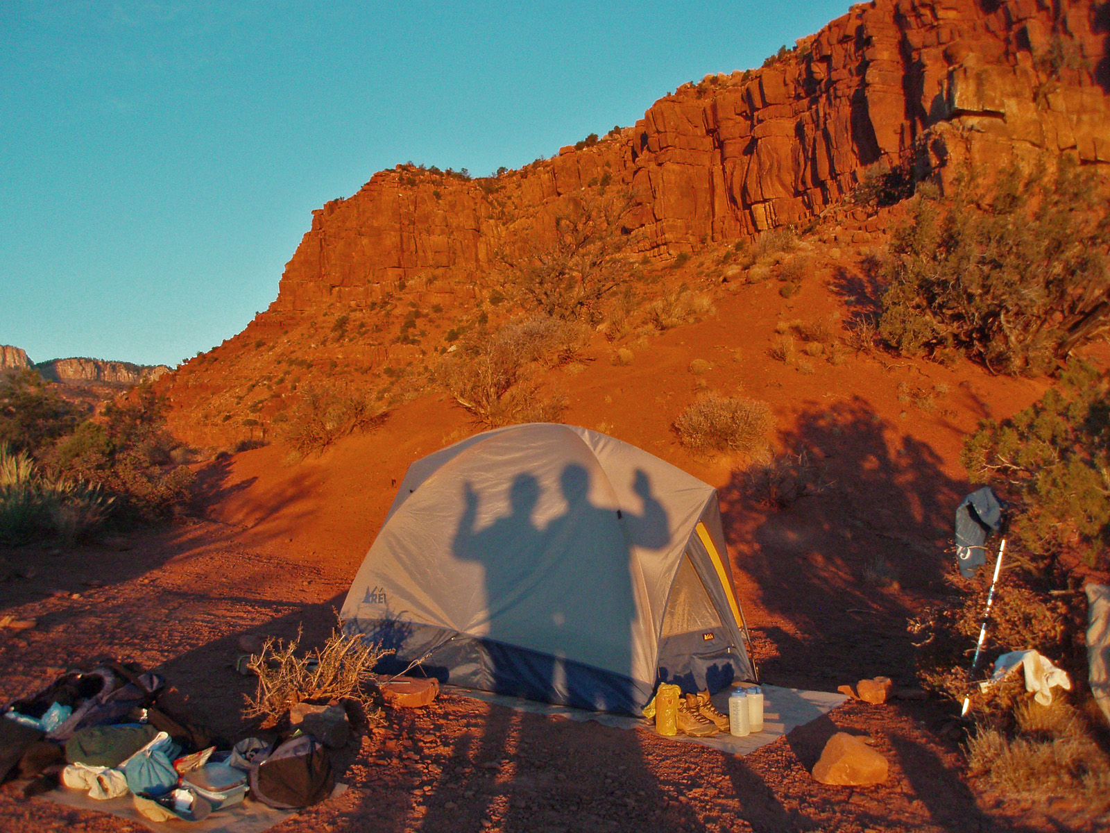
In 2010 I tore my ACL and had it repaired in May.
After quite a bit of PT I was ready to hike again and so started a four
day trek down the BA, across the Tonto and up the Hermit (a route I had
only ever done before as a day hike!). Joining me were Ray
Andrews, whom I met on the shuttle ride back to Flagstaff from the
canyon in March following my ACL tear, and Cara Lynn. Here we are
at the top of the trail about to begin our hike.
In 2013 I did a nine day hike down the South Bass to explore
that area. This was the second day and it was a busy one. I
shuttled water up to the Tonto for a later camp in the morning and in
the afternoon I went in search of Bass' old cable car site, pictured
here. A full report
on this hike can be found
here. |
|
|
|
November 12 |
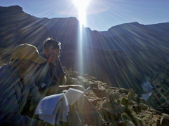
2010 - Ray & I look over notes. |
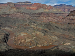
2013 - The river @ Shinumo. |
|
In 2010 I tore my ACL and had it repaired in May.
After quite a bit of PT I was ready to hike again and so started a four
day trek down the BA, across the Tonto and up the Hermit (a route I had
only ever done before as a day hike!). Joining me were Ray
Andrews, whom I met on the shuttle ride back to Flagstaff from the
canyon in March following my ACL tear, and Cara Lynn. This was our
second day as we hiked from Indian Garden to Salt Creek. Along the
way we stopped at a site where, in 1919, a crew was doing a survey for a
trans-canyon aerial tram. At this spot they had rigged up a supply
tram to get their stuff across the river. Cara Lynn took this cool
photo of Ray and I going over my notes to see if we could identify
places from old photos.
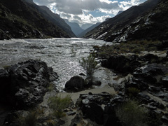
In 2013 I did a nine day hike down the South Bass to explore
that area. This was my third day and I moved my camp from the
river up to the Tapeats below Tyndall Dome. Just a few minutes
from my camp was this fantastic spot where I could look down on the
(muddy) Colorado River and across into part of the Shinumo Amphitheater. A full report
on this hike can be found
here. |
|
|
|
November 13 |
2010 - Cara Lynn at Monument Creek. |
2013 - Tyndall Dome at sunset. |
|
In 2010 I tore my ACL and had it repaired in May.
After quite a bit of PT I was ready to hike again and so started a four
day trek down the BA, across the Tonto and up the Hermit (a route I had
only ever done before as a day hike!). Joining me were Ray
Andrews, whom I met on the shuttle ride back to Flagstaff from the
canyon in March following my ACL tear, and Cara Lynn. This was our
third day as we hiked from Salt Creek to Hermit Creek. The trail
drops into Monument Creek which is quite lush as you can tell from the
photo.
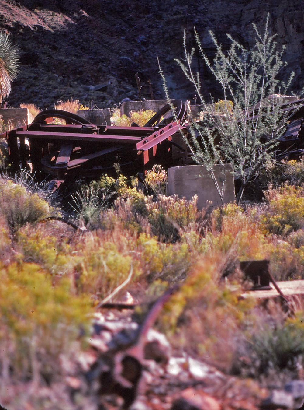
In 2013 I did a nine day hike down the South Bass to explore
that area. This was my fourth day and I day hiked to Bass' mining
operation in the aptly named Copper Canyon. Finding the old trail
into the canyon took some time, but it is one of the coolest I've ever
seen. After exploring around there I returned to my camp and got
this nice sunset shot of Tyndall Dome. A full report
on this hike can be found
here. |
|
|
|
November 14 |
2010 - On the Hermit Trail. |
2013 - Bass cable to Hakatai Canyon. |
|
In 2010 I tore my ACL and had it repaired in May.
After quite a bit of PT I was ready to hike again and so started a four
day trek down the BA, across the Tonto and up the Hermit (a route I had
only ever done before as a day hike!). Joining me were Ray
Andrews, whom I met on the shuttle ride back to Flagstaff from the
canyon in March following my ACL tear, and Cara Lynn. This was our
last day as we hiked from Hermit Creek to Hermit's Rest. Up above
the Cathedral Stair Ray took this photo of Cara Lynn and me on the
trail.
In 2013 I did a nine day hike down the South Bass to explore
that area. This was my fifth day and I day hiked to Bass' cable
crossing to Hakatai Canyon. I was able to follow a reasonable
route down the schist, which was surprisingly grassy, to a built-up
platform where cables still lay. A full report
on this hike can be found
here. |
|
|
|
November 15 |
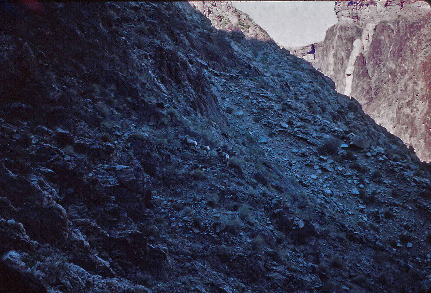
1981 - Bighorns near the river. |

2013 - Camp east of Bass Canyon. |
2014 - On the Grand Scenic Divide. |
|
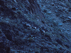
In 1981 I returned to the route through the Tapeats
west of Plateau Point. [I call this BM 3702 for the nearby
marker.] This time I followed a route down the schist all the way to the
river. As I got near I passed by these three bighorns! I was
able to follow a bit above the water all the way to Pipe Creek and then
returned up the B.A. Trail.
In 2013 I did a nine day hike down the South Bass to explore
that area. This was my sixth day and I moved my camp to a high
terrace above the Tonto east of Bass Canyon. Great views from
here! A full report
on this hike can be found
here.
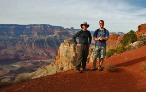
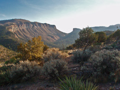
In 2014 I led the faculty hike down the So. Bass and out
along the Grand Scenic Divide, something I had never done before!
Here we all are while on our way back; from left to right, me, Bev & TS
Amer, John & Kathy Eastwood, Paul Wagner and Tim Clark. I wrote up
a bit more on this hike
here. |
|
|
|
November 16 |
2007 - Saddle Mountain. |
2013 - Serpentine Rapids. |
|
In 2007 Cara Lynn and I headed up to the canyon for
four days to hike the Nankoweap Trail. We were commemorating
Charles Walcott's 1882-83 journeys in this area (about which I have
written). Our first day involved the drive up and the hike to the
saddle, seen in the distance in the photo. The sky was smoky as
there were fires burning on the north rim throughout our trip.
In 2013 I did a nine day hike down the South Bass to explore
that area. This was my seventh day and I day hiked down Serpentine
Canyon to the river. Great day. A full report
on this hike can be found
here. |
|
|
|
November 17 |
1981 - Hermit tram remains. |
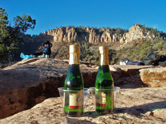
2007 - Nankoweap celebration! |

2013 - The view from Mystic Spring. |
|
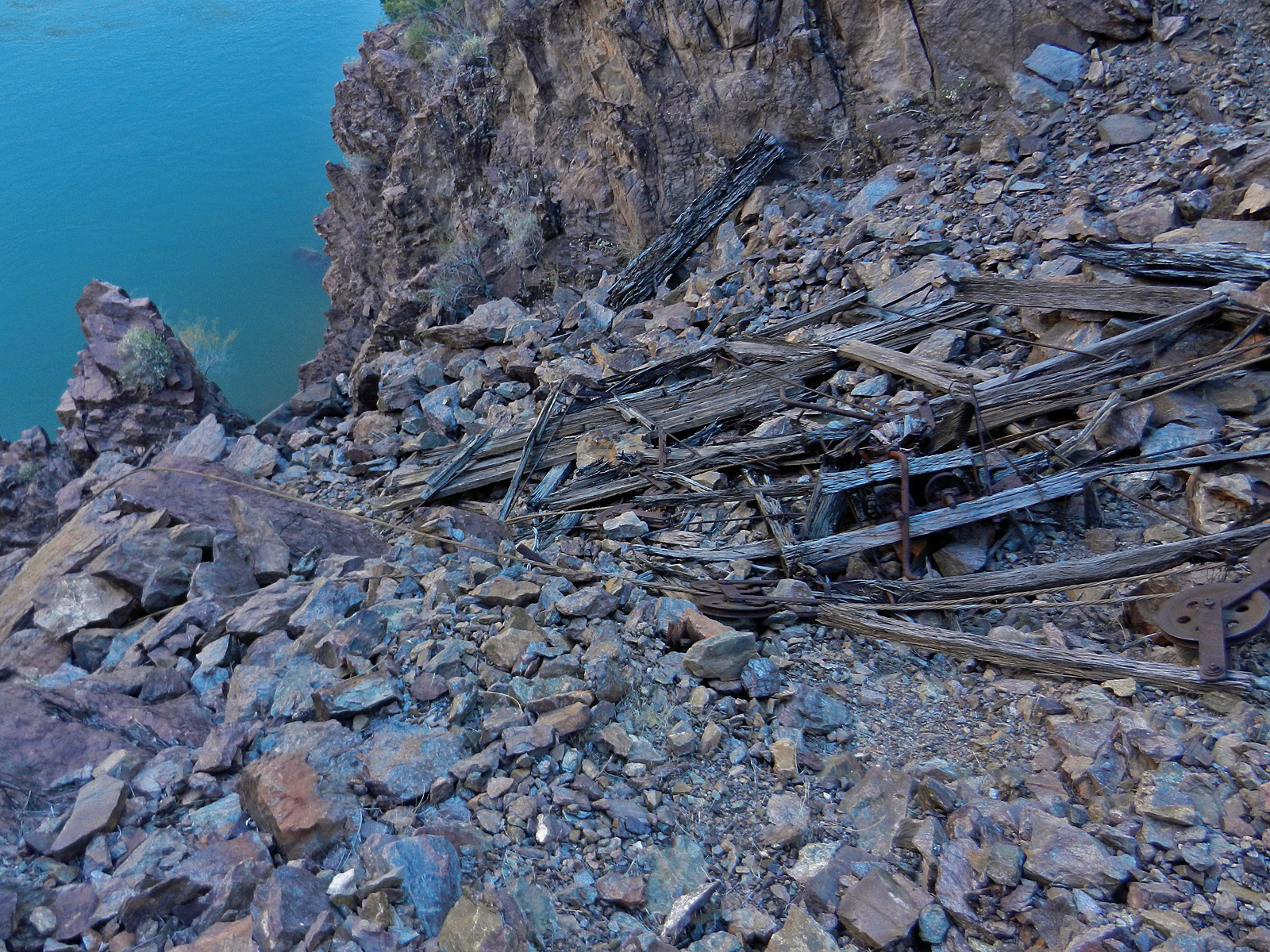
In 1981 I did one of my all-time favorite day hikes
- down the Hermit to the river, along the river to Monument, and back up
to the rim via the Hermit Trail. I estimated this at 20 miles and
I felt great all day. I had lunch at the halfway mark - along the
river across from 94 Mile Creek. Yet, I took only this one photo
all day, of the tram remains near Hermit Camp on the Tonto.
In 2007 Cara Lynn and I headed up to the canyon for
four days to hike the Nankoweap Trail. We were commemorating
Charles Walcott's 1882-83 journeys in this area (about which I have
written). On our second day we hiked down the trail from the saddle
to the creek. This was Walcott's first day in the canyon, in 1882
and we celebrated with a couple of bottles of champagne! [And,
Cara Lynn in her outlaw garb.] Walcott had been charged with
organizing a trail building party but fell ill as the party was leaving
Kanab, so he lagged behind. From his journal, "11/17/82 - Reached
camp at 10 a.m. & found Major Powell & party. Half sick with cold.
Stormy day." Well, the weather was much better for us.
Cheers CDW!!
In 2013 I did a nine day hike down the South Bass to explore
that area. This was my eighth day and I moved my camp from the
high terrace east of Bass Canyon to the Esplanade very near where the
trail starts down. In the upper Supai I met the first hikers (two
of them) I had seen for this whole trip. [I did chat with a river
party at Bass beach, for whom my former student Mathieu Brown was
serving as guide and boatman.] In the afternoon this day I hiked
out in front of Mt. Huethawali to see an old inscription ("Monte Video")
and to revisit Bass' old digs at Mystic Spring. The photo shows
the general view from the spring. A full report
on this hike can be found
here. |
|
|
|
November 18 |
2007 - Cara Lynn at Nankoweap campsite. |
2013 - Grand Scenic Divide. |
|
In 2007 Cara Lynn and I headed up to the canyon for
four days to hike the Nankoweap Trail. We were commemorating
Charles Walcott's 1882-83 journeys in this area (about which I have
written). On our third day we hung around at the creek until the
early afternoon and the packed it in and hiked up the trail to camp
above Tilted Mesa. Here is Cara Lynn at our creek camp. From
Walcott's journal, "11/18/82 - Somewhat better but still unable to work.
Camp moved down the trail 1200 feet." If I am reading this right,
we may have been camped at the same spot exactly 125 years later!
In 2013 I did a nine day hike down the South Bass to explore
that area. This was my last day and I hiked back up to the rim
from my camp on the Esplanade. On the way I got a nice shot of the
Grand Scenic Divide, shown here. I thought I might have time to do
a quick out there on my way out, but I didn't have the enthusiasm to do
so. But, next year I did - see November 15! A full report
on this hike can be found
here. |
|
|
|
November 19 |
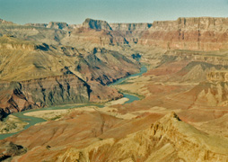
2004 - The view towards Desert View. |

2007 - So long, from above Tilted Mesa. |
|
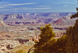
In 2004 I did day hike down the Grandview and out
to the edge of the Tonto, overlooking the river. This is one of my
go-to favorite hikes. The photo is looking up the river and Desert
View is barely visible on the rim.
In 2007 Cara Lynn and I headed up to the canyon for
four days to hike the Nankoweap Trail. We were commemorating
Charles Walcott's 1882-83 journeys in this area (about which I have
written). This was our last day and we hiked up and out from our
camp above Tilted Mesa. One last really cool part of this trip
involved getting up in the middle of the night and see my shadow cast by
the light from Venus! I had been interested in doing this for a
few years but conditions have to be just right - Venus has to be bright
and there must be a new moon (more or less). Too cool. One
final quote from Walcott's journal, for this date in 1882,
"Party all building trail. I am unable
to do anything but sit around." |
|
|
|
November 20 |
|
|
|
November 21 |
|
|
|
November 22 |
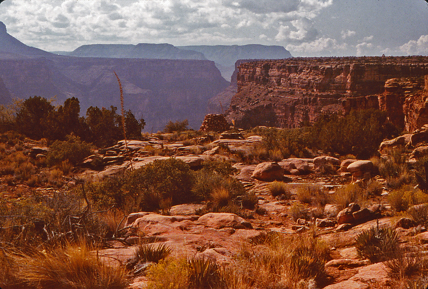
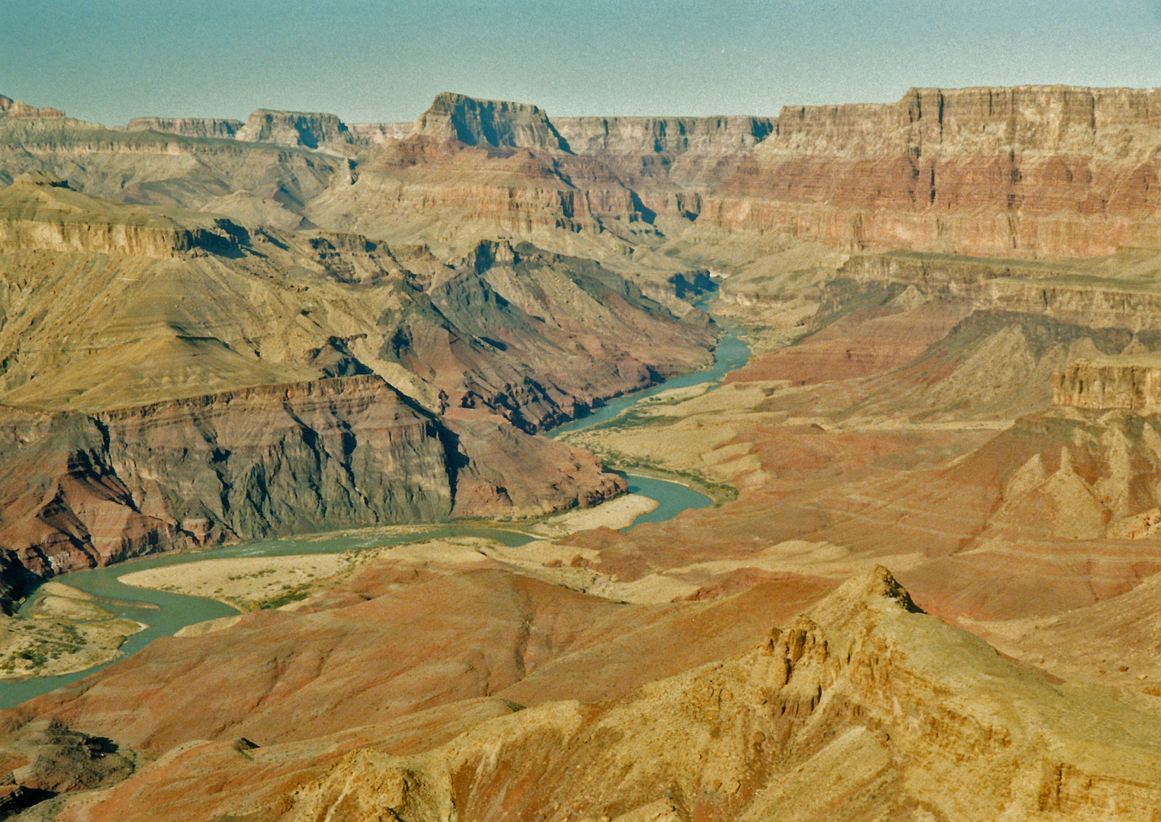
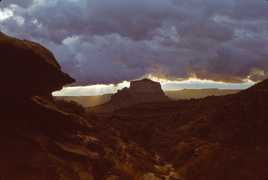
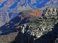
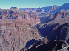
1991 - Looking up river from the Tanner Trail. |
|
In 1991 I hiked down the Tanner with the hope of
doing a day hike from my camp at Palisades to the Little Colorado.
Alas it was not to be. I had to drive up to the backcountry office
to get a permit and I wasn't able to start down the trail until 12:30 in
the afternoon. I was exhausted by the time I reached the river but
continued on and got to a spot
to camp more than a mile from Palisades as darkness fell.
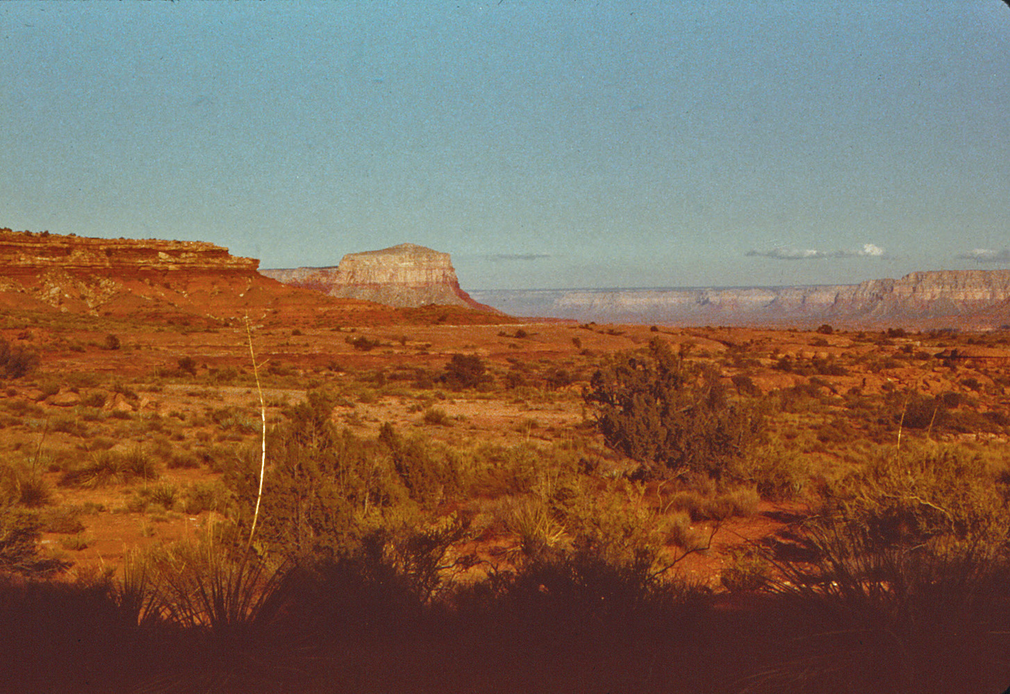
This photo shows where I was heading for this trip. |
|
|
|
November 23 |
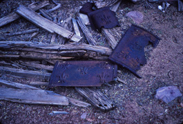
1981 - Camp remains at Hance Rapids. |
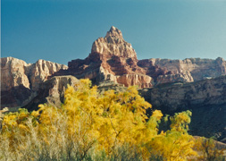
1991 - Comanche Pt. |
|
In 1981 I hiked down the New Hance Trail and
camped at the river. I was able to see some of the remains of
Hance's camp here and the photo shows pieces of an old stove. In
more recent years I've looked for this site and come up empty - I guess
that's what happens after 30+ years! The next day I was planning
on following the Escalante Route to Tanner but got off the route and
ended up on the saddle between Cardenas and Escalante Buttes. I
didn't feel like hiking all the way down to Tanner Rapids to camp so,
instead, I hiked out!
In 1991 I hiked down the Tanner with the hope of
doing a day hike from my camp below Palisades to the Little Colorado.
Alas it was not to be. It was quite cold in the morning and I
didn't have the enthusiasm for the hike to the LC. Instead,
I hung around this area, hiking upriver to look over the old mines and
the camp site there.
Later in the day I got this nice picture of Comanche Pt. |
|
|
|
November 24 |
2004 - Overlooking the Paria from behind Lees Ferry. |
|
In 2004 Cara Lynn and I did some touring around
Glen Canyon Dam, where there was a big water release going on and then
later down to the Lees Ferry area. From the parking area by the
boat launch we hiked up the hills to the northwest and ended up at some
really spectacular cliffs with great views of the area. I guess
you can call this a mini-day hike. Cara Lynn took this picture of
me not quite "over the edge!"
In 1981 I hiked down the New Hance Trail and camped at the river.
This was my second/last day. I was planning on following the
Escalante Route to Tanner but got off the route and ended up on the
saddle between Cardenas and Escalante Buttes. I didn't feel like
hiking all the way down to Tanner Rapids to camp so, instead, I hiked
out! [No photos.]
In 1991 I hiked down the Tanner with the hope of doing a
day hike from my camp at Palisades to the Little Colorado. Alas it
was not to be. I was too exhausted for that hike so I spent the
second day just looking around Palisades. This was my last day and
I hiked back out. [No photos.] |
|
|
|
November 25 |
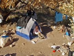
1999 - Camp in South Canyon near Vaseys Paradise. |
2009 - Bill scopes out Bright Angel Campground. |
|
In 1999 I hiked down into South Canyon for the first
time, over the Thanksgiving holiday. Cold but not unpleasant.
This first day I decided to camp atop the Redwall in my little bivy
tent. Great views of the river from here, including of Vaseys
Paradise, the waterfall in the background of the photo.
In 2009 Bill Ferris and I did a hike over
Thanksgiving to Trinity so I could finish a hike we had done (with John
Eastwood and Chris Forsyth) in March where an accident led to me being
airlifted out of Trinity on the eighth day of our nine day trip.
This was our first day, hiking down the South Kaibab to the Bright Angel
Campground and then up to Utah Flats and over to Phantom Creek for our
first camp. Here is Bill at an overlook below the Tapeats checking
out the area. |
|
|
|
November 26 |
1999 - Stanton's Cave. |
2005 - With visiting Chinese Profs at Plateau Pt. |
2009 - Camp at Phantom Creek. |
2011 - Working off Thanksgiving on the Tonto. |
|
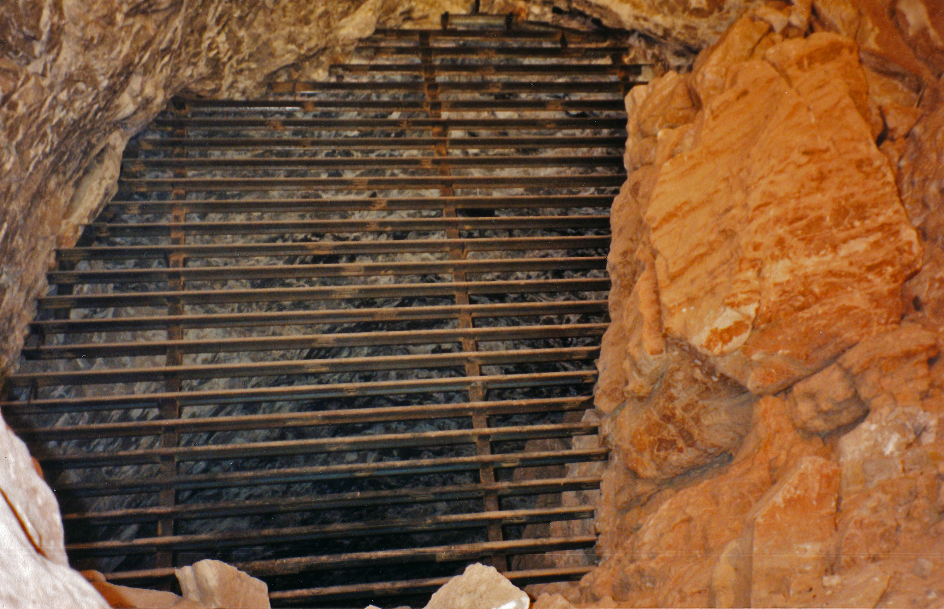
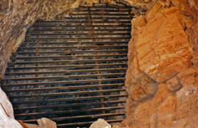
In 1999 I hiked down into South Canyon for the first
time, over the Thanksgiving holiday. Cold but not unpleasant.
This was my second, and last day. I hiked down to the river from
my camp above the Redwall and
explored around a bit, including a visit to "Stanton's Cave," now sealed
up with this iron grate (done just a
couple of years earlier).
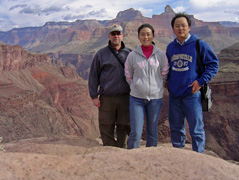
In 2005 I took a couple of our visiting Chinese
professors on a day hike to Plateau Point. Yu Shan (center) had
been sitting in my Money & Banking class all semester, while Zhang
(left) sat in on other classes. At Plateau Pt. we pulled out our
lunches and Zhang pulled out a box of ... brownie mix. He thought
it was actually a box of brownies (well, that's what the picture
shows!). I told him it was a powder and he opened it up and dipped
his finger into it and said, "Powder." Well, we had plenty of food
to share, but that still cracks me up. More on this trip
here.
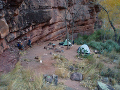
In 2009 Bill Ferris and I did a hike over
Thanksgiving to Trinity so I could finish a hike we had done (with John
Eastwood and Chris Forsyth) in March where an accident led to me being
airlifted out of Trinity on the eighth day of our nine day trip.
This was our second day and we hiked from our Phantom Creek camp (shown
in the photo) over into
Trinity, camping in the bed above the main junction. This was
Thanksgiving day and we had a dinner of freeze-dried chicken, potatoes
and stuffing, gravy, cranberry sauce and berry cobbler. Not your
traditional meal, but tasty none the less. Read more on this trip
here.
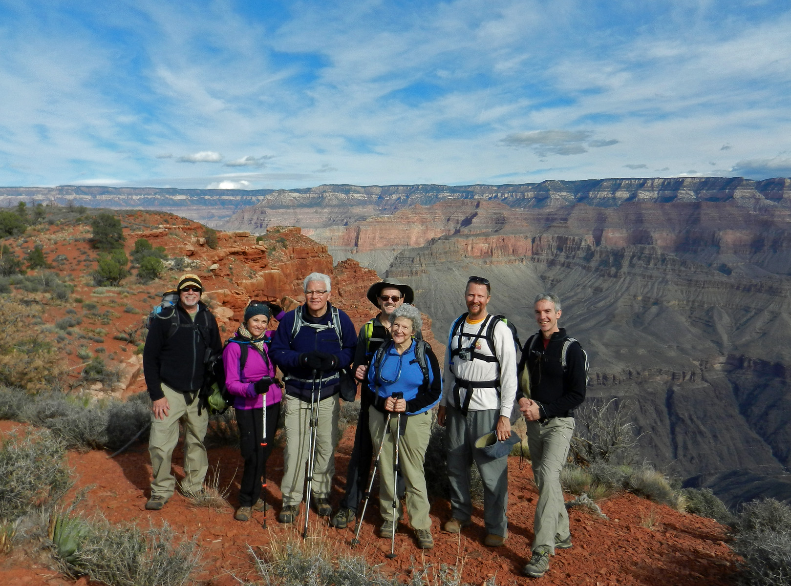
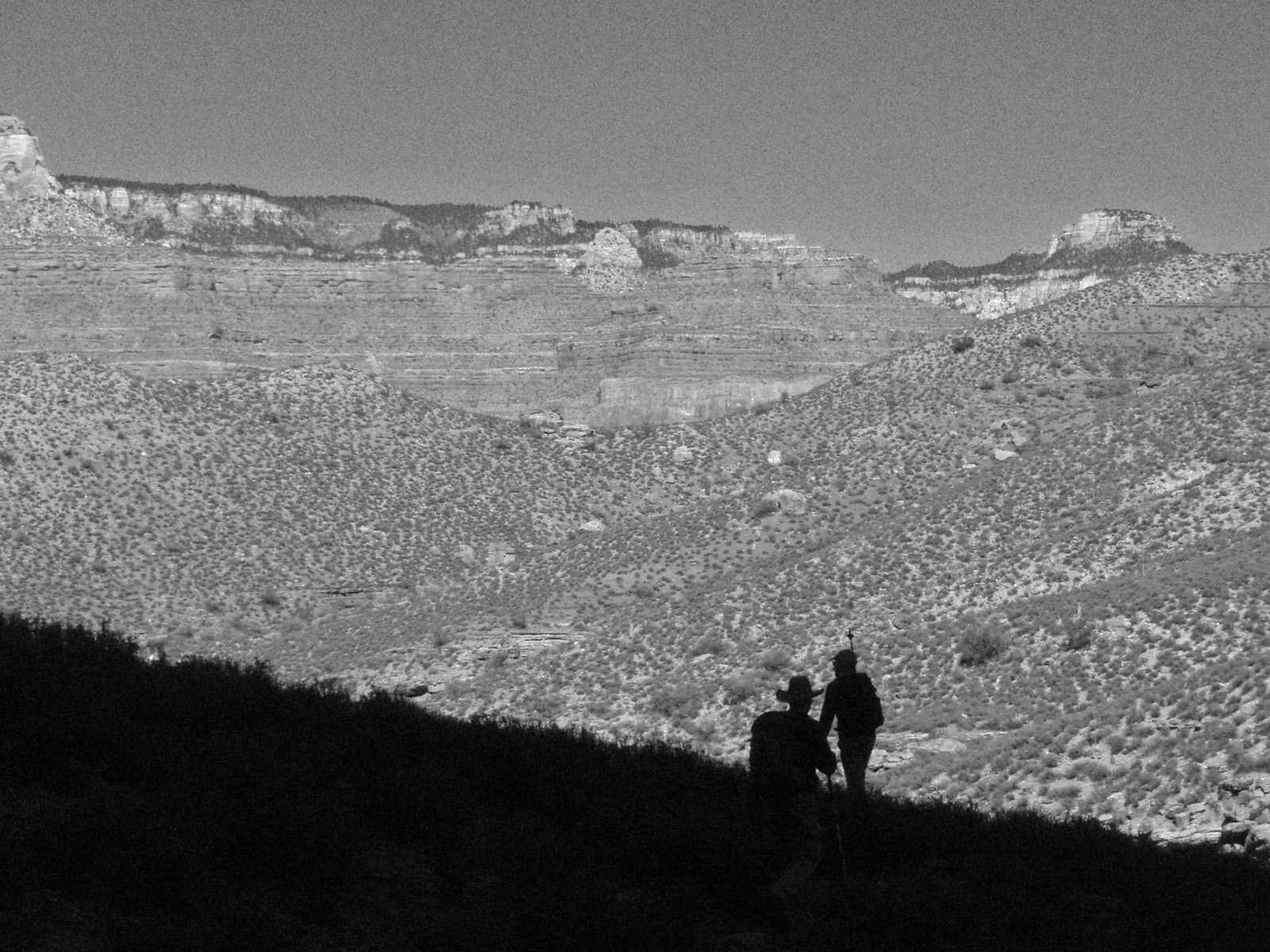
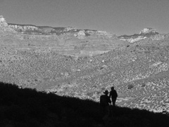
In 2011 Bill Ferris, John Eastwood and I did a
post-Thanksgiving hike down the South Kaibab, across the Tonto and up
the Bright Angel. Kathy Eastwood managed the logistics for us,
dropping us off and picking us up at the Bright Angel Lodge. Here
are Bill and John silhouetted against the canyon along the Tonto which I
thought would look cool in B&W, although the color shot looks good too.
More
here. |
|
|
|
November 27 |
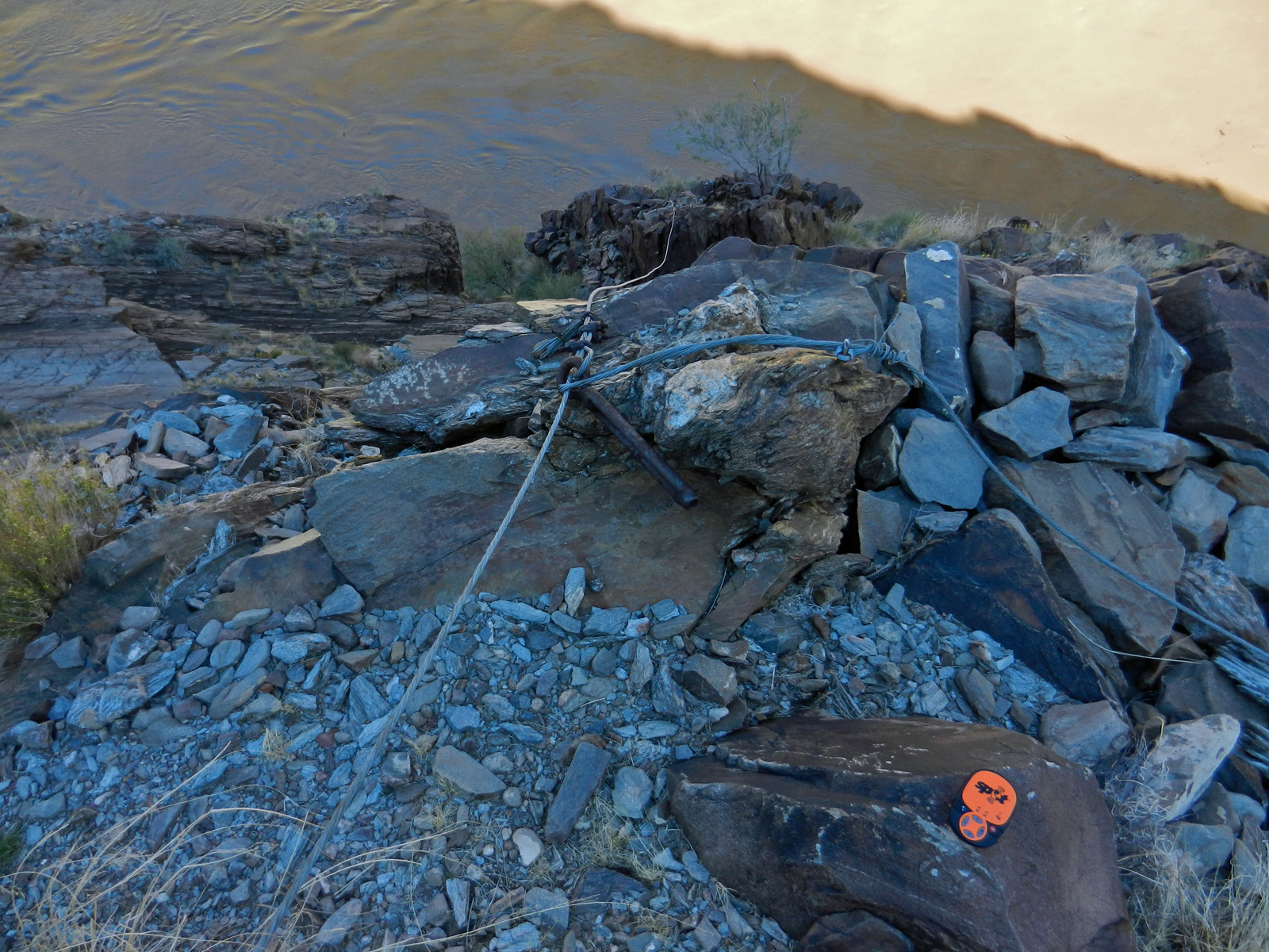
2009 - My helicopter ride pick-up spot. |

2010 - Icy Kolb Seep on the BA Trail. |
|
In 2009 Bill Ferris and I did a hike over
Thanksgiving to Trinity so I could finish a hike we had done (with John
Eastwood and Chris Forsyth) in March where an accident led to me being
airlifted out of Trinity on the eighth day of our nine day trip.
This was our third day and we hiked from our camp back to the spot where
the helicopter picked me up, shown
in the photo, courtesy of Chris' Spot device. Bill and I continued
on down to the river to fill up with water and go over the spot where I
fell. Read more on this trip
here.
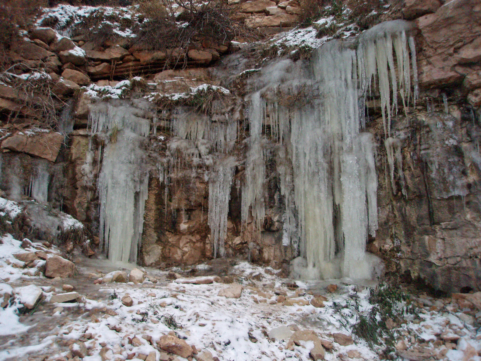
In 2010 Bill Ferris, his neighbor Joe and I did a
post-Thanksgiving hike down the South Kaibab, across the Tonto and up
the Bright Angel. It was a cold hike and we were all bundled up at
Pipe Creek where we stopped for lunch. Icy conditions at the top
of both trails, as shown here at the so-called Kolb Seep, high on the
Bright Angel Trail. |
|
|
|
November 28 |
2009 - Photo of 1919 tram survey crew at their camp and my photo with
the same view. |
|
In 2009 Bill Ferris and I did a hike over
Thanksgiving to Trinity so I could finish a hike we had done (with John
Eastwood and Chris Forsyth) in March where an accident led to me being
airlifted out of Trinity on the eighth day of our nine day trip.
This was our fourth day and we day hiked from our camp to find some
sites from 1919 when a survey crew was camped here. We found a
cache under an overhang and we also determined where their camp was and
I matched up the view from the old photo. Read more on this trip
here. |
|
|
|
November 29 |

2009 - Brahma and Zoroaster Temples shrouded in afternoon clouds. |
|
In 2009 Bill Ferris and I did a hike over
Thanksgiving to Trinity so I could finish a hike we had done (with John
Eastwood and Chris Forsyth) in March where an accident led to me being
airlifted out of Trinity on the eighth day of our nine day trip.
This was our fifth day and we hiked from our Trinity camp back to the
Bright Angel Campground. It was lightly raining in the morning but
cleared up in the afternoon. The clouds still hung around,
offering nice photo opportunities like this one of Zoroaster and Brahma. Read more on this trip
here. |
|
|
|
November 30 |
1990 - Mules on the trail. |
1994 - Snow down low in Nankoweap. |
2009 - Bill Ferris is ready to go. |
2013 - At the ruins in Garden Creek. |
|
In 1990 I hiked down to the Bright Angel Campground
to spend two nights. This was my first day and for a while I was
behind this mule train - a trail crew I think.
In 1994 I hiked down the Nankoweap Trail to spend
four days in the canyon. I had to drive to the South Rim to get a
permit, yet I still managed to get all the way to the creek by 7 p.m.
There was a bit of snow around and this view of Nankoweap (Marion Pt. to
the left) shows snow on the northerly slope of Seiber Pt. going down to
the Tapeats!
In 2009 Bill Ferris and I did a hike over
Thanksgiving to Trinity so I could finish a hike we had done (with John
Eastwood and Chris Forsyth) in March where an accident led to me being
airlifted out of Trinity on the eighth day of our nine day trip.
This was our last day and we hiked from the Bright Angel Campground to
the rim. Here is a classic picture of Bill just as we were leaving
the campground. Read more on this trip
here.
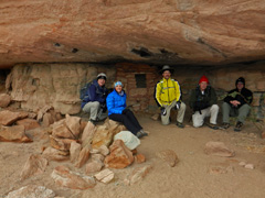
In 2013 I did a
post-Thanksgiving hike with colleagues and family down the Bright Angel
to visit the ruins in Bright Angel Wash and in Garden Creek. The
canyon experienced an inversion either the day before or the day after.
This day we had clouds at the rim and then hiked down beneath them.
Cool all day. At the Garden Creek ruins we posed for a photo, from
left to right - TS and Bev Amer, John Eastwood, Bob Stabo and me.
For a fuller account and more photo see
here. |
|
|